From:
242.40 €Choose the model
| Code | Price | GARMIN Code | Cartography model | Electronic Support | Cut | |
|---|---|---|---|---|---|---|

|
254.50 €
242.40€
PZ
|
Add to cart |
010-13894-00 | GN+/N+ Large Dealer Blank Card, EMEA | Micro SD CARD | large |
|
|
354.50 €
339.40€
PZ
|
Add to cart |
010-13895-00 | GNV+/P+ Large Dealer Blank Card, EMEA | Micro SD CARD | large |
Prices are valid for online shop only
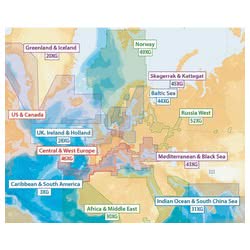
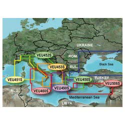
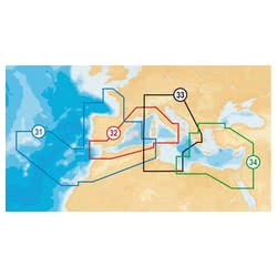
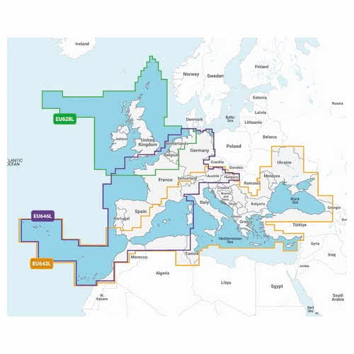
GARMIN Navionics LARGE Charting
Garmin Navionics+ & Navionics+ LARGE
The Large version offers the same quality and completeness as the Regular, but with a much wider geographical coverage, always within the EMEA region (Europe, Middle-East and Africa) — ideal for those navigating on long routes or in various countries. Includes HD bathymetry, auto guidance features, and daily updates. The perfect choice for cruises or professional use where detailed route planning and safety are crucial.
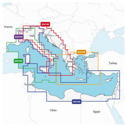
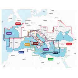
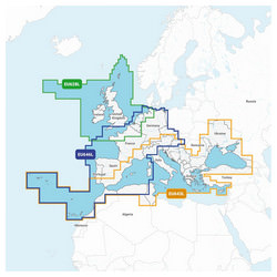
Garmin Navionics Vision+ & Garmin Navionics Vision+ LARGE
They represent the utmost detail of Garmin cartography. Compatible with Garmin chartplotters and third-party devices, they combine extensive coverage with advanced contents and features: satellite images, interactive 3D views, aerial photos, and high-definition relief shading.
Ideal for those who require utmost precision in long navigations, coastal explorations, or regattas in new waters within the EMEA region (Europe, Middle-East and Africa). A superior level of detail and safety, on a large scale.

Prodotti Correlati
90% of the orders are shipped within 24H. Have a look at the availability and shipment time in the product page
We work on boating since 1982. You will find experienced and polite staff
You can choose between Paypal, Credit Card, Postepay and Transfer
We only use packaging from recycled material within our own store
 Italiano
 English