From:
22.64 €Navimap navigation charts are a reliable point of reference for anyone navigating the Italian coastline and beyond. Whether you're an experienced yachtsman, recreational angler, or marine professional, having accurate and up-to-date charting on board is essential for ensuring safe navigation and proper route planning.
Each Navimap chart is created with the utmost attention to detail, accurately depicting bathymetry, maritime signals (buoys, lighthouses, beacons), ports, harbors, restricted areas, and all the elements useful for safe and informed navigation. The quality of the materials used guarantees high resistance to water and tearing, a significant advantage, especially when sailing in adverse weather conditions or operating in challenging marine environments.
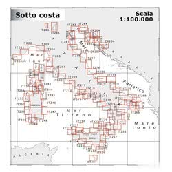
Choosing the right scale is a crucial aspect of nautical chart selection. A larger scale (e.g., 1:25,000 or 1:50,000) offers a greater level of detail, ideal for coastal navigation, exploring bays and inlets, and navigating in ports and channels. A smaller scale (e.g., 1:100,000 or 1:200,000) is better suited for offshore sailing, long-distance route planning, and navigation in deeper waters.
Navimap charts offer significant advantages over navigation apps and GPS systems. Unlike electronic devices, a traditional sea chart doesn't rely on battery power, network coverage, or potential technical malfunctions. In emergency situations or remote areas, a paper chart can make the difference between safe navigation and potential danger. Furthermore, consulting a nautical chart stimulates awareness of the surrounding space, understanding of marine dynamics, and identification of potential hazards, contributing to more responsible and informed navigation.
Complete your onboard equipment with the right navigation instruments and don't forget the safety equipment.
A nautical chart is a graphical representation of a sea area, with indications of bathymetry, hazards, signals, and ports. A pilot book is a publication that complements the chart, providing detailed information on ports, anchorages, recommended routes, local regulations, and available services, often with photographs and more in-depth descriptions.
Nautical charts are updated periodically to reflect changes in the marine environment (new wrecks, changes to signals, dredging, etc.). You can purchase new editions of the charts or download Notices to Mariners (AVVISI) that indicate the changes to be made manually to existing charts. The Italian Naval Hydrographic Institute regularly publishes the AVVISI.
To navigate the Aeolian Islands, you will need the nautical charts that cover that area of the Tyrrhenian Sea. In particular, Navimap charts IT311-IT312 and IT104-IT101 cover the coasts of northern Sicily and the Aeolian Islands, providing useful details for navigation between the islands and along the coast.
The numbers on Navimap nautical charts indicate sea depths (bathymetry) in meters or decimeters, depending on the scale of the chart. This data is essential to avoid groundings and navigate safely, especially in areas with shallow waters or the presence of submerged rocks.
The legend of the Navimap nautical chart is usually printed on one side of the chart itself or available as a separate insert. The legend explains the symbols, abbreviations, and conventions used in the chart, allowing you to correctly interpret the information represented.
Yes, Navimap nautical charts are also suitable for fishing, as they provide detailed information on seabed depths, the presence of shallows and wrecks (which often attract fish), and the location of maritime signals. However, for more specific fishing, it is advisable to supplement the nautical charts with more detailed bathymetric charts or information provided by experienced local fishermen.
90% of the orders are shipped within 24H. Have a look at the availability and shipment time in the product page
We work on boating since 1982. You will find experienced and polite staff
You can choose between Paypal, Credit Card, Postepay and Transfer
We only use packaging from recycled material within our own store
 Italiano
 English