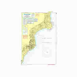
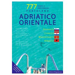
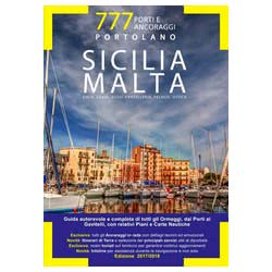
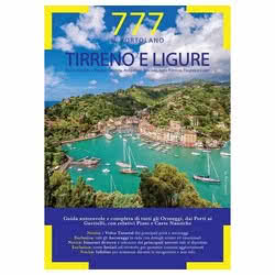
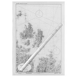
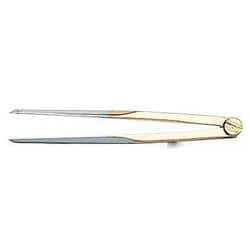
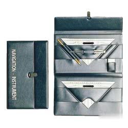
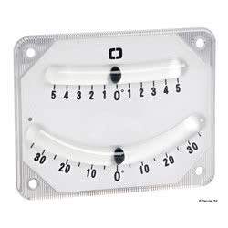
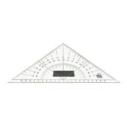
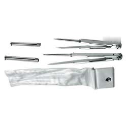
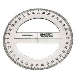
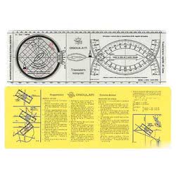
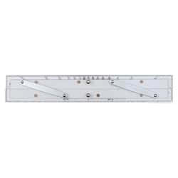
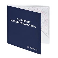
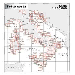
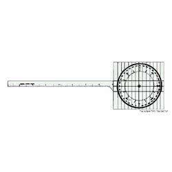
Notice (8): A non well formed numeric value encountered [APP/Controller/CatalogController.php, line 132]Code Context$catProducts = array();$catSeries = array_slice($catSeries, ($page-1) * MyConstants::CATALOG_PAGE_SIZE, MyConstants::CATALOG_PAGE_SIZE);$catArg = 'nautical-charts-and-pilotage-guides-70' $lastCategoryId = '70' $page = '1//////////////////////////////////////////////////////////' $currentBrand = null $category = array( 'Category' => array( 'id' => '70', 'name_it' => 'Carte nautiche e portolani', 'name_eng' => 'Nautical charts and Pilotage guides', 'name_de' => 'Seekarten und Lotsenführer', 'description_it' => null, 'description_eng' => null, 'description_de' => null, 'html_title_it' => 'Carte nautiche e portolani in vendita - Nautica Basile', 'html_meta_it' => 'Carte nautiche e portolani in vendita. Risparmia acquistando online! Spedizioni veloci e tracciabili. Nautica Basile, in barca dal 1983.', 'html_meta_eng' => null, 'html_meta_de' => null, 'html_title_eng' => null, 'html_title_de' => null, 'father' => 'P08000', 'ebay' => null, 'ebay2' => null, 'ebay_uk' => null, 'ebay_uk2' => null, 'ebay_de' => null, 'ebay_de2' => null, 'ebay_us' => null, 'ebay_us2' => null, 'ebay_store' => '1188800619', 'merchant_center' => '3391', 'active' => true, 'created' => '2015-04-23 20:45:27', 'modified' => '2016-01-09 10:13:47', 'brands' => 'Osculati, Magnamare, Istituto Idrografico della Marina', 'description_short_it' => null, 'description_short_eng' => null, 'description_short_de' => null, 'json_ld_schema_it' => null, 'json_ld_schema_eng' => null, 'json_ld_schema_de' => null ), 'Father' => array( 'id' => 'P08000', 'name_it' => 'Elettronica e navigazione', 'name_eng' => 'Electronics and navigation', 'name_de' => 'Elektronik und Navigation', 'description_it' => null, 'description_eng' => null, 'description_de' => null, 'html_title_it' => null, 'html_meta_it' => null, 'html_meta_eng' => null, 'html_meta_de' => null, 'html_title_eng' => null, 'html_title_de' => null, 'father' => null, 'ebay' => '29723', 'ebay2' => '50437', 'ebay_uk' => '29723', 'ebay_uk2' => '15263', 'ebay_de' => '36642', 'ebay_de2' => null, 'ebay_us' => '26444', 'ebay_us2' => '38630', 'ebay_store' => '1', 'merchant_center' => null, 'active' => true, 'created' => '2015-04-23 20:40:38', 'modified' => '2016-03-10 11:37:14', 'brands' => null, 'description_short_it' => null, 'description_short_eng' => null, 'description_short_de' => null, 'json_ld_schema_it' => null, 'json_ld_schema_eng' => null, 'json_ld_schema_de' => null ), 'ActionParams' => 'nautical-charts-and-pilotage-guides-70' ) $destinationCategory = array() $matches = array() $subCategory = null $breadcrumb = array( (int) 0 => array( 'title' => 'Electronics and navigation' ), (int) 1 => array( 'url' => 'https://www.nauticabasile.it/eng/catalog/nautical-charts-and-pilotage-guides-70/', 'title' => 'Nautical charts and Pilotage guides' ) ) $otherCategories = array( (int) 0 => array( 'Category' => array( 'id' => '100216', 'name_it' => 'Antenne GPS e Antifurti GPS', 'name_eng' => null, 'name_de' => null, 'description_it' => null, 'description_eng' => null, 'description_de' => null, 'html_title_it' => null, 'html_meta_it' => null, 'html_meta_eng' => null, 'html_meta_de' => null, 'html_title_eng' => null, 'html_title_de' => null, 'father' => 'P08000', 'ebay' => null, 'ebay2' => null, 'ebay_uk' => null, 'ebay_uk2' => null, 'ebay_de' => null, 'ebay_de2' => null, 'ebay_us' => null, 'ebay_us2' => null, 'ebay_store' => null, 'merchant_center' => null, 'active' => true, 'created' => '2026-01-17 21:23:20', 'modified' => '2026-01-17 21:23:20', 'brands' => 'Glomex', 'description_short_it' => null, 'description_short_eng' => null, 'description_short_de' => null, 'json_ld_schema_it' => null, 'json_ld_schema_eng' => null, 'json_ld_schema_de' => null ), 'ActionParams' => '100216' ), (int) 1 => array( 'Category' => array( 'id' => '26', 'name_it' => 'Binocoli Nautici, Strumenti da Carteggio', 'name_eng' => 'Binoculars, Plotting tools', 'name_de' => 'Ferngläser, Kartenarbeit', 'description_it' => null, 'description_eng' => null, 'description_de' => null, 'html_title_it' => 'Binocoli nautici, carteggio nautico in vendita - Nautica Basile', 'html_meta_it' => 'Binocoli nautici, carteggio nautico. Risparmia acquistando online! Spedizioni veloci e tracciabili. Nautica Basile, in barca dal 1983.', 'html_meta_eng' => null, 'html_meta_de' => null, 'html_title_eng' => null, 'html_title_de' => null, 'father' => 'P08000', 'ebay' => null, 'ebay2' => null, 'ebay_uk' => null, 'ebay_uk2' => null, 'ebay_de' => null, 'ebay_de2' => null, 'ebay_us' => null, 'ebay_us2' => null, 'ebay_store' => '1188800419', 'merchant_center' => '3391', 'active' => true, 'created' => '2015-04-23 20:45:17', 'modified' => '2016-01-09 10:13:13', 'brands' => 'Osculati', 'description_short_it' => null, 'description_short_eng' => null, 'description_short_de' => null, 'json_ld_schema_it' => null, 'json_ld_schema_eng' => null, 'json_ld_schema_de' => null ), 'ActionParams' => 'binoculars-plotting-tools-26' ), (int) 2 => array( 'Category' => array( 'id' => '25', 'name_it' => 'Bussole Nautiche', 'name_eng' => 'Compasses', 'name_de' => 'Kompasse', 'description_it' => null, 'description_eng' => null, 'description_de' => null, 'html_title_it' => 'Bussole nautiche, offerte e prezzi - Nautica Basile', 'html_meta_it' => 'Bussole nautiche, offerte e prezzi. Risparmia acquistando online! Spedizioni veloci e tracciabili. Nautica Basile, in barca dal 1983.', 'html_meta_eng' => null, 'html_meta_de' => null, 'html_title_eng' => null, 'html_title_de' => null, 'father' => 'P08000', 'ebay' => null, 'ebay2' => null, 'ebay_uk' => null, 'ebay_uk2' => null, 'ebay_de' => null, 'ebay_de2' => null, 'ebay_us' => null, 'ebay_us2' => null, 'ebay_store' => '1188800519', 'merchant_center' => '4785', 'active' => true, 'created' => '2015-04-23 20:45:27', 'modified' => '2016-01-09 10:13:36', 'brands' => 'Riviera, Ritchie navigation, Osculati, Vion', 'description_short_it' => null, 'description_short_eng' => null, 'description_short_de' => null, 'json_ld_schema_it' => null, 'json_ld_schema_eng' => null, 'json_ld_schema_de' => null ), 'ActionParams' => 'compasses-25' ), (int) 3 => array( 'Category' => array( 'id' => '29', 'name_it' => 'Ecoscandagli, GPS, Cartografie', 'name_eng' => 'Depth Sounder, GPS, Navigation Charts', 'name_de' => 'Elektronik', 'description_it' => null, 'description_eng' => null, 'description_de' => null, 'html_title_it' => 'Ecoscandagli migliori - GPS per barca in offerta - Nautica Basile', 'html_meta_it' => 'Ecoscandagli migliori - GPS per barca in offerta. Risparmia acquistando online! Spedizioni veloci e tracciabili. Nautica Basile, in barca dal 1983.', 'html_meta_eng' => null, 'html_meta_de' => null, 'html_title_eng' => null, 'html_title_de' => null, 'father' => 'P08000', 'ebay' => null, 'ebay2' => null, 'ebay_uk' => null, 'ebay_uk2' => null, 'ebay_de' => null, 'ebay_de2' => null, 'ebay_us' => null, 'ebay_us2' => null, 'ebay_store' => '1188800819', 'merchant_center' => '340', 'active' => true, 'created' => '2015-04-23 20:40:38', 'modified' => '2016-01-09 10:24:07', 'brands' => 'Raymarine, Garmin, Navionics, Osculati, Lowrance, Veethree instruments, Norcross, Simrad', 'description_short_it' => null, 'description_short_eng' => null, 'description_short_de' => null, 'json_ld_schema_it' => null, 'json_ld_schema_eng' => null, 'json_ld_schema_de' => null ), 'ActionParams' => 'depth-sounder-gps-navigation-charts-29' ), (int) 4 => array( 'Category' => array( 'id' => '27', 'name_it' => 'Strumentazione motore, barca ed impianti', 'name_eng' => 'Engine and Boat instruments and installations', 'name_de' => 'Motorinstrumente und Geräte', 'description_it' => null, 'description_eng' => null, 'description_de' => null, 'html_title_it' => 'Strumentazione motori marini, barca ed impianti | Nautica Basile', 'html_meta_it' => 'Strumentazione motori marini, barca ed impianti. Nautica Basile, in barca dal 1983. Risparmia acquistando online! Spedizioni tracciabili e veloci', 'html_meta_eng' => null, 'html_meta_de' => null, 'html_title_eng' => null, 'html_title_de' => null, 'father' => 'P08000', 'ebay' => null, 'ebay2' => null, 'ebay_uk' => null, 'ebay_uk2' => null, 'ebay_de' => null, 'ebay_de2' => null, 'ebay_us' => null, 'ebay_us2' => null, 'ebay_store' => '1188800719', 'merchant_center' => '340', 'active' => true, 'created' => '2015-04-23 20:40:38', 'modified' => '2016-01-09 10:23:32', 'brands' => 'Osculati, VDO Marine, Gobius', 'description_short_it' => null, 'description_short_eng' => null, 'description_short_de' => null, 'json_ld_schema_it' => null, 'json_ld_schema_eng' => null, 'json_ld_schema_de' => null ), 'ActionParams' => 'engine-and-boat-instruments-and-installations-27' ), (int) 5 => array( 'Category' => array( 'id' => '28', 'name_it' => 'Strumentazione meteorologica e Orologi', 'name_eng' => 'Meteorological instruments and Watches', 'name_de' => 'Meteorologische Messinstrumente', 'description_it' => null, 'description_eng' => null, 'description_de' => null, 'html_title_it' => 'Strumentazione meteorologica barche - Nautica Basile', 'html_meta_it' => 'Strumentazione meteorologica barche. Risparmia acquistando online! Spedizioni veloci e tracciabili. Nautica Basile, in barca dal 1983.', 'html_meta_eng' => null, 'html_meta_de' => null, 'html_title_eng' => null, 'html_title_de' => null, 'father' => 'P08000', 'ebay' => null, 'ebay2' => null, 'ebay_uk' => null, 'ebay_uk2' => null, 'ebay_de' => null, 'ebay_de2' => null, 'ebay_us' => null, 'ebay_us2' => null, 'ebay_store' => '1188801119', 'merchant_center' => '340', 'active' => true, 'created' => '2015-04-23 20:45:08', 'modified' => '2016-01-09 10:24:52', 'brands' => 'Barigo, Vion, Altitude, La Crosse, Skywatch', 'description_short_it' => null, 'description_short_eng' => null, 'description_short_de' => null, 'json_ld_schema_it' => null, 'json_ld_schema_eng' => null, 'json_ld_schema_de' => null ), 'ActionParams' => 'meteorological-instruments-and-watches-28' ), (int) 6 => array( 'Category' => array( 'id' => '08002', 'name_it' => 'Autopiloti Nautici', 'name_eng' => 'Nautical Autopilots', 'name_de' => 'Nautische Autopiloten', 'description_it' => null, 'description_eng' => null, 'description_de' => null, 'html_title_it' => null, 'html_meta_it' => null, 'html_meta_eng' => null, 'html_meta_de' => null, 'html_title_eng' => null, 'html_title_de' => null, 'father' => 'P08000', 'ebay' => null, 'ebay2' => null, 'ebay_uk' => null, 'ebay_uk2' => null, 'ebay_de' => null, 'ebay_de2' => null, 'ebay_us' => null, 'ebay_us2' => null, 'ebay_store' => null, 'merchant_center' => null, 'active' => true, 'created' => '2021-03-03 20:52:01', 'modified' => '2021-03-03 20:52:01', 'brands' => 'Raymarine, Garmin', 'description_short_it' => null, 'description_short_eng' => null, 'description_short_de' => null, 'json_ld_schema_it' => null, 'json_ld_schema_eng' => null, 'json_ld_schema_de' => null ), 'ActionParams' => 'nautical-autopilots-08002' ), (int) 7 => array( 'Category' => array( 'id' => '70', 'name_it' => 'Carte nautiche e portolani', 'name_eng' => 'Nautical charts and Pilotage guides', 'name_de' => 'Seekarten und Lotsenführer', 'description_it' => null, 'description_eng' => null, 'description_de' => null, 'html_title_it' => 'Carte nautiche e portolani in vendita - Nautica Basile', 'html_meta_it' => 'Carte nautiche e portolani in vendita. Risparmia acquistando online! Spedizioni veloci e tracciabili. Nautica Basile, in barca dal 1983.', 'html_meta_eng' => null, 'html_meta_de' => null, 'html_title_eng' => null, 'html_title_de' => null, 'father' => 'P08000', 'ebay' => null, 'ebay2' => null, 'ebay_uk' => null, 'ebay_uk2' => null, 'ebay_de' => null, 'ebay_de2' => null, 'ebay_us' => null, 'ebay_us2' => null, 'ebay_store' => '1188800619', 'merchant_center' => '3391', 'active' => true, 'created' => '2015-04-23 20:45:27', 'modified' => '2016-01-09 10:13:47', 'brands' => 'Osculati, Magnamare, Istituto Idrografico della Marina', 'description_short_it' => null, 'description_short_eng' => null, 'description_short_de' => null, 'json_ld_schema_it' => null, 'json_ld_schema_eng' => null, 'json_ld_schema_de' => null ), 'ActionParams' => 'nautical-charts-and-pilotage-guides-70' ), (int) 8 => array( 'Category' => array( 'id' => '08001', 'name_it' => 'Impianti VHF, Radar, TV e Stereo', 'name_eng' => 'VHF, Radar, TV and Tuner', 'name_de' => 'VHF, Radar, TV und Tuner', 'description_it' => null, 'description_eng' => null, 'description_de' => null, 'html_title_it' => null, 'html_meta_it' => null, 'html_meta_eng' => null, 'html_meta_de' => null, 'html_title_eng' => null, 'html_title_de' => null, 'father' => 'P08000', 'ebay' => null, 'ebay2' => null, 'ebay_uk' => null, 'ebay_uk2' => null, 'ebay_de' => null, 'ebay_de2' => null, 'ebay_us' => null, 'ebay_us2' => null, 'ebay_store' => null, 'merchant_center' => null, 'active' => true, 'created' => '2019-05-04 12:00:54', 'modified' => '2019-05-04 12:01:08', 'brands' => 'Glomex, Osculati, Fusion, Aquatic av, Scout, Cobra marine, Raymarine, Scanstrut, Standard Horizon, Riviera, Boss Marine, Garmin, Sound marine', 'description_short_it' => null, 'description_short_eng' => null, 'description_short_de' => null, 'json_ld_schema_it' => null, 'json_ld_schema_eng' => null, 'json_ld_schema_de' => null ), 'ActionParams' => 'vhf-radar-tv-and-tuner-08001' ) ) $otherCategory = array( 'Category' => array( 'id' => '08001', 'name_it' => 'Impianti VHF, Radar, TV e Stereo', 'name_eng' => 'VHF, Radar, TV and Tuner', 'name_de' => 'VHF, Radar, TV und Tuner', 'description_it' => null, 'description_eng' => null, 'description_de' => null, 'html_title_it' => null, 'html_meta_it' => null, 'html_meta_eng' => null, 'html_meta_de' => null, 'html_title_eng' => null, 'html_title_de' => null, 'father' => 'P08000', 'ebay' => null, 'ebay2' => null, 'ebay_uk' => null, 'ebay_uk2' => null, 'ebay_de' => null, 'ebay_de2' => null, 'ebay_us' => null, 'ebay_us2' => null, 'ebay_store' => null, 'merchant_center' => null, 'active' => true, 'created' => '2019-05-04 12:00:54', 'modified' => '2019-05-04 12:01:08', 'brands' => 'Glomex, Osculati, Fusion, Aquatic av, Scout, Cobra marine, Raymarine, Scanstrut, Standard Horizon, Riviera, Boss Marine, Garmin, Sound marine', 'description_short_it' => null, 'description_short_eng' => null, 'description_short_de' => null, 'json_ld_schema_it' => null, 'json_ld_schema_eng' => null, 'json_ld_schema_de' => null ) ) $index = (int) 3 $subCategories = array( (int) 0 => array( 'Category' => array( 'id' => '08000701', 'name_it' => 'Carte di Navigazione 777 Il Portolano', 'name_eng' => 'Maps 777 Il Portolano', 'name_de' => 'Maps 777 Il Portolano', 'description_it' => '<p>Il Portolano 777 è molto più di una semplice carta nautica. È una guida completa che integra le informazioni cartografiche con <strong>dettagli pratici</strong> per il diportista: segnalamenti, avvisi ai naviganti, zone di divieto e, soprattutto, <strong>consigli sugli ancoraggi</strong>. Un vero e proprio compagno di viaggio per esplorare le coste italiane in sicurezza.</p><br><br><p>A differenza delle app di navigazione, il Portolano 777 non dipende dalla connessione internet e offre una <strong>visione d'insieme immediata</strong>. Ottimo per la pianificazione della rotta a tavolino e come backup affidabile in caso di problemi tecnici. Le edizioni sono aggiornate periodicamente per riflettere i cambiamenti della costa e dei regolamenti marittimi.</p><br><br><h2>Il Consiglio dell'Officina Basile</h2><br><br><ul><br> <li><strong>Aggiornamenti:</strong> Verifica sempre la data di pubblicazione del portolano e confrontala con gli avvisi ai naviganti più recenti.</li><br> <li><strong>Integrazione:</strong> Usa il portolano in combinazione con un plotter cartografico per una navigazione più precisa e sicura.</li><br> <li><strong>Backup:</strong> Anche se usi app di navigazione, porta sempre con te il portolano cartaceo. Le batterie si scaricano, internet sparisce, la carta no.</li><br></ul><br><br><h2>FAQ</h2><br><br><h3>Come si legge un portolano nautico?</h3><br><p>Il portolano utilizza simboli e abbreviazioni standardizzati a livello internazionale. Include informazioni su batimetriche, tipologia dei fondali, pericoli per la navigazione (scogli, relitti), segnalamenti marittimi (boe, fari) e porti. Impara a riconoscere i simboli per interpretare correttamente le informazioni.</p><br><br><h3>Qual è la differenza tra carta nautica e portolano?</h3><br><p>La carta nautica è una rappresentazione grafica della costa e dei fondali, mentre il portolano è una guida che integra la carta con informazioni aggiuntive come descrizioni dei porti, consigli sugli ancoraggi, normative locali e avvisi ai naviganti. Il portolano è un complemento indispensabile alla carta nautica.</p><br><br><h3>Dove trovo le coordinate GPS degli ancoraggi segnati sul Portolano?</h3><br><p>I portolani moderni spesso includono le coordinate GPS degli ancoraggi più sicuri e riparati. In alternativa, puoi ricavare le coordinate direttamente dalla carta nautica utilizzando un righello e un compasso. Ricorda di verificare sempre la posizione effettiva dell'ancoraggio prima di gettare l'ancora.</p><br><br><h3>Quali sono i migliori portolani per la costa adriatica?</h3><br><p>Le edizioni 777 sono considerate tra le più complete e affidabili per la costa adriatica. Controlla sempre che l'edizione sia recente per avere informazioni aggiornate su porti, ancoraggi e segnalamenti.</p><h3>Come si legge un portolano nautico?</h3><p>Il portolano utilizza simboli e abbreviazioni standardizzati a livello internazionale. Include informazioni su batimetriche, tipologia dei fondali, pericoli per la navigazione (scogli, relitti), segnalamenti marittimi (boe, fari) e porti. Impara a riconoscere i simboli per interpretare correttamente le informazioni.</p><h3>Qual è la differenza tra carta nautica e portolano?</h3><p>La carta nautica è una rappresentazione grafica della costa e dei fondali, mentre il portolano è una guida che integra la carta con informazioni aggiuntive come descrizioni dei porti, consigli sugli ancoraggi, normative locali e avvisi ai naviganti. Il portolano è un complemento indispensabile alla carta nautica.</p><h3>Dove trovo le coordinate GPS degli ancoraggi segnati sul Portolano?</h3><p>I portolani moderni spesso includono le coordinate GPS degli ancoraggi più sicuri e riparati. In alternativa, puoi ricavare le coordinate direttamente dalla carta nautica utilizzando un righello e un compasso. Ricorda di verificare sempre la posizione effettiva dell'ancoraggio prima di gettare l'ancora.</p><h3>Quali sono i migliori portolani per la costa adriatica?</h3><p>Le edizioni 777 sono considerate tra le più complete e affidabili per la costa adriatica. Controlla sempre che l'edizione sia recente per avere informazioni aggiornate su porti, ancoraggi e segnalamenti.</p>', 'description_eng' => '<p>The Portolano 777 is far more than just a set of <strong>nautical charts</strong>. It's a comprehensive guide that integrates chart information with practical details crucial for yachtsmen and boaters: navigational aids, Notices to Mariners, restricted zones, and, most importantly, expert <strong>anchorage advice</strong>. Consider it your trusted companion for exploring the Italian coast with confidence.</p><br><br><p>Unlike navigation apps, the Portolano 777 doesn't rely on an internet connection and provides an <strong>immediate overview</strong> of the area. Ideal for pre-voyage route planning and a reliable backup in case of technical difficulties. These editions are periodically updated to reflect changes to the coastline and maritime regulations. Think of them as the best <strong>sea charts</strong> you can get.</p><br><br><h2>Nautica Basile's Advice</h2><br><br><ul><br> <li><strong>Updates:</strong> Always check the publication date of the pilot book and compare it with the most recent Notices to Mariners.</li><br> <li><strong>Integration:</strong> Use the pilot book in conjunction with a chartplotter for more precise and safer navigation.</li><br> <li><strong>Backup:</strong> Even if you use navigation apps, always carry the paper pilot book with you. Batteries die, internet disappears, but the chart endures.</li><br></ul><br><br><h2>FAQ</h2><br><br><h3>How do I read a nautical pilot book?</h3><br><p>The pilot book uses internationally standardized symbols and abbreviations. It includes information on bathymetry, seabed types, navigational hazards (rocks, wrecks), maritime signals (buoys, lighthouses), and ports. Learn to recognize the symbols to correctly interpret the information on these <strong>navigation charts</strong>.</p><br><br><h3>What is the difference between a nautical chart and a pilot book?</h3><br><p>A nautical chart is a graphical representation of the coastline and seabed, while the pilot book is a guide that complements the chart with additional information such as port descriptions, anchorage recommendations, local regulations, and Notices to Mariners. The pilot book is an indispensable supplement to the nautical chart.</p><br><br><h3>Where can I find the GPS coordinates of the anchorages marked on the Portolano?</h3><br><p>Modern pilot books often include GPS coordinates for the safest and most sheltered anchorages. Alternatively, you can derive the coordinates directly from the nautical chart using a ruler and compass. Remember to always verify the actual position of the anchorage before dropping anchor.</p><br><br><h3>Which are the best pilot books for the Adriatic coast?</h3><br><p>The 777 editions are considered among the most comprehensive and reliable for the Adriatic coast. Always check that the edition is recent to have up-to-date information on ports, anchorages, and navigational aids.</p><h3>How do I read a nautical pilot book?</h3><p>The pilot book uses internationally standardized symbols and abbreviations. It includes information on bathymetry, seabed types, navigational hazards (rocks, wrecks), maritime signals (buoys, lighthouses), and ports. Learn to recognize the symbols to correctly interpret the information.</p><h3>What is the difference between a nautical chart and a pilot book?</h3><p>A nautical chart is a graphical representation of the coastline and seabed, while the pilot book is a guide that complements the chart with additional information such as port descriptions, anchorage recommendations, local regulations, and Notices to Mariners. The pilot book is an indispensable supplement to the nautical chart.</p><h3>Where can I find the GPS coordinates of the anchorages marked on the Portolano?</h3><p>Modern pilot books often include GPS coordinates for the safest and most sheltered anchorages. Alternatively, you can derive the coordinates directly from the nautical chart using a ruler and compass. Remember to always verify the actual position of the anchorage before dropping anchor.</p><h3>Which are the best pilot books for the Adriatic coast?</h3><p>The 777 editions are considered among the most comprehensive and reliable for the Adriatic coast. Always check that the edition is recent to have up-to-date information on ports, anchorages, and navigational aids.</p>', 'description_de' => '<p>Der Portolan 777 ist viel mehr als nur eine Seekarte. Er ist ein umfassender Führer, der kartografische Informationen mit <strong>praktischen Details</strong> für den Wassersportler integriert: Seezeichen, Nachrichten für Seefahrer, Sperrzonen und vor allem <strong>Empfehlungen für Ankerplätze</strong>. Ein wahrer Reisebegleiter, um die italienischen Küsten sicher zu erkunden.</p><br><br><p>Im Gegensatz zu Navigations-Apps ist der Portolan 777 nicht von einer Internetverbindung abhängig und bietet eine <strong>sofortige Gesamtübersicht</strong>. Ideal für die Routenplanung am Tisch und als zuverlässiges Backup bei technischen Problemen. Die Ausgaben werden regelmäßig aktualisiert, um Änderungen an der Küste und den Seeverkehrsvorschriften zu berücksichtigen.</p><br><br><h2>Der Tipp von Nautica Basile</h2><br><br><ul><br> <li><strong>Aktualisierungen:</strong> Überprüfen Sie immer das Erscheinungsdatum des Portolans und vergleichen Sie es mit den neuesten Nachrichten für Seefahrer.</li><br> <li><strong>Integration:</strong> Verwenden Sie den Portolan in Kombination mit einem Kartenplotter für eine präzisere und sicherere Navigation.</li><br> <li><strong>Backup:</strong> Auch wenn Sie Navigations-Apps verwenden, führen Sie immer den gedruckten Portolan mit sich. Batterien entladen sich, das Internet verschwindet, die Karte nicht.</li><br></ul><br><br><h2>FAQ</h2><br><br><h3>Wie liest man einen nautischen Portolan?</h3><br><p>Der Portolan verwendet international standardisierte Symbole und Abkürzungen. Er enthält Informationen über Bathymetrie, Art des Meeresbodens, Gefahren für die Navigation (Klippen, Wracks), Seezeichen (Bojen, Leuchtfeuer) und Häfen. Lernen Sie, die Symbole zu erkennen, um die Informationen korrekt zu interpretieren.</p><br><br><h3>Was ist der Unterschied zwischen einer Seekarte und einem Portolan?</h3><br><p>Die Seekarte ist eine grafische Darstellung der Küste und des Meeresbodens, während der Portolan ein Führer ist, der die Karte mit zusätzlichen Informationen wie Hafenbeschreibungen, Ankerplatzempfehlungen, lokalen Vorschriften und Nachrichten für Seefahrer ergänzt. Der Portolan ist eine unverzichtbare Ergänzung zur Seekarte.</p><br><br><h3>Wo finde ich die GPS-Koordinaten der im Portolan markierten Ankerplätze?</h3><br><p>Moderne Portolane enthalten oft die GPS-Koordinaten der sichersten und geschütztesten Ankerplätze. Alternativ können Sie die Koordinaten direkt aus der Seekarte mit einem Lineal und einem Zirkel ableiten. Denken Sie daran, immer die tatsächliche Position des Ankerplatzes zu überprüfen, bevor Sie den Anker werfen.</p><br><br><h3>Welche sind die besten Portolane für die Adriaküste?</h3><br><p>Die Ausgaben 777 gelten als die umfassendsten und zuverlässigsten für die Adriaküste. Überprüfen Sie immer, ob die Ausgabe aktuell ist, um aktuelle Informationen über Häfen, Ankerplätze und Seezeichen zu erhalten.</p><h3>Wie liest man einen nautischen Portolan?</h3><p>Der Portolan verwendet international standardisierte Symbole und Abkürzungen. Er enthält Informationen über Bathymetrie, Art des Meeresbodens, Gefahren für die Navigation (Klippen, Wracks), Seezeichen (Bojen, Leuchtfeuer) und Häfen. Lernen Sie, die Symbole zu erkennen, um die Informationen korrekt zu interpretieren.</p><h3>Was ist der Unterschied zwischen einer Seekarte und einem Portolan?</h3><p>Die Seekarte ist eine grafische Darstellung der Küste und des Meeresbodens, während der Portolan ein Führer ist, der die Karte mit zusätzlichen Informationen wie Hafenbeschreibungen, Ankerplatzempfehlungen, lokalen Vorschriften und Nachrichten für Seefahrer ergänzt. Der Portolan ist eine unverzichtbare Ergänzung zur Seekarte.</p><h3>Wo finde ich die GPS-Koordinaten der im Portolan markierten Ankerplätze?</h3><p>Moderne Portolane enthalten oft die GPS-Koordinaten der sichersten und geschütztesten Ankerplätze. Alternativ können Sie die Koordinaten direkt aus der Seekarte mit einem Lineal und einem Zirkel ableiten. Denken Sie daran, immer die tatsächliche Position des Ankerplatzes zu überprüfen, bevor Sie den Anker werfen.</p><h3>Welche sind die besten Portolane für die Adriaküste?</h3><p>Die Ausgaben 777 gelten als die umfassendsten und zuverlässigsten für die Adriaküste. Überprüfen Sie immer, ob die Ausgabe aktuell ist, um aktuelle Informationen über Häfen, Ankerplätze und Seezeichen zu erhalten.</p>', 'html_title_it' => 'Portolano Nautico: Ancoraggi Sicuri e Navigazione', 'html_meta_it' => 'Portolani 777 per navigazione e ancoraggi sicuri. Dettagli cartografici aggiornati e consigli pratici per pianificare la tua rotta in sicurezza.', 'html_meta_eng' => 'Portolano 777 for safe navigation and anchorages. Updated nautical chart details and practical advice for planning your route with confidence.', 'html_meta_de' => 'Portolane 777 für sichere Navigation und Ankerplätze. Aktualisierte Seekarten Details und praktische Tipps für die sichere Planung Ihrer Route.', 'html_title_eng' => 'Nautical Pilot Book: Safe Anchorages & Navigation', 'html_title_de' => 'Nautischer Portolan: Sichere Ankerplätze und Navigation', 'father' => '70', 'ebay' => null, 'ebay2' => null, 'ebay_uk' => null, 'ebay_uk2' => null, 'ebay_de' => null, 'ebay_de2' => null, 'ebay_us' => null, 'ebay_us2' => null, 'ebay_store' => null, 'merchant_center' => null, 'active' => true, 'created' => '2021-03-03 20:52:00', 'modified' => '2021-03-03 20:52:00', 'brands' => 'Magnamare, Istituto Idrografico della Marina', 'description_short_it' => 'I <strong>Portolani 777</strong> sono il riferimento per la navigazione costiera e l'individuazione di <strong>ancoraggi sicuri</strong>. Questo <strong>portolano</strong>, aggiornato con le ultime informazioni sulle coste italiane, offre <strong>dettagli cartografici</strong> essenziali per una navigazione senza sorprese. Indispensabile a bordo per la <strong>pianificazione della rotta</strong> e la sicurezza in mare.', 'description_short_eng' => '<strong>Portolano 777</strong> charts are the gold standard for coastal navigation and pinpointing <strong>safe anchorages</strong>. This meticulously updated <strong>pilot book</strong>, featuring the latest information on the Italian coastline, offers essential <strong>nautical chart details</strong> for worry-free voyages. A must-have onboard for effective <strong>route planning</strong> and enhanced safety at sea.', 'description_short_de' => 'Die <strong>Portolane 777</strong> sind die Referenz für die Küstennavigation und das Auffinden von <strong>sicheren Ankerplätzen</strong>. Dieser <strong>Portolan</strong>, aktualisiert mit den neuesten Informationen über die italienischen Küsten, bietet essenzielle <strong>kartografische Details</strong> für eine Navigation ohne Überraschungen. Unverzichtbar an Bord für die <strong>Routenplanung</strong> und die Sicherheit auf See.', 'json_ld_schema_it' => '{"@context": "https://schema.org", "@type": "FAQPage", "mainEntity": [{"@type": "Question", "name": "Come si legge un portolano nautico?", "acceptedAnswer": {"@type": "Answer", "text": "Il portolano utilizza simboli e abbreviazioni standardizzati a livello internazionale. Include informazioni su batimetriche, tipologia dei fondali, pericoli per la navigazione (scogli, relitti), segnalamenti marittimi (boe, fari) e porti. Impara a riconoscere i simboli per interpretare correttamente le informazioni."}}, {"@type": "Question", "name": "Qual è la differenza tra carta nautica e portolano?", "acceptedAnswer": {"@type": "Answer", "text": "La carta nautica è una rappresentazione grafica della costa e dei fondali, mentre il portolano è una guida che integra la carta con informazioni aggiuntive come descrizioni dei porti, consigli sugli ancoraggi, normative locali e avvisi ai naviganti. Il portolano è un complemento indispensabile alla carta nautica."}}, {"@type": "Question", "name": "Dove trovo le coordinate GPS degli ancoraggi segnati sul Portolano?", "acceptedAnswer": {"@type": "Answer", "text": "I portolani moderni spesso includono le coordinate GPS degli ancoraggi più sicuri e riparati. In alternativa, puoi ricavare le coordinate direttamente dalla carta nautica utilizzando un righello e un compasso. Ricorda di verificare sempre la posizione effettiva dell'ancoraggio prima di gettare l'ancora."}}, {"@type": "Question", "name": "Quali sono i migliori portolani per la costa adriatica?", "acceptedAnswer": {"@type": "Answer", "text": "Le edizioni 777 sono considerate tra le più complete e affidabili per la costa adriatica. Controlla sempre che l'edizione sia recente per avere informazioni aggiornate su porti, ancoraggi e segnalamenti."}}]}', 'json_ld_schema_eng' => '{"@context": "https://schema.org", "@type": "FAQPage", "mainEntity": [{"@type": "Question", "name": "How do I read a nautical pilot book?", "acceptedAnswer": {"@type": "Answer", "text": "The pilot book uses internationally standardized symbols and abbreviations. It includes information on bathymetry, seabed types, navigational hazards (rocks, wrecks), maritime signals (buoys, lighthouses), and ports. Learn to recognize the symbols to correctly interpret the information."}}, {"@type": "Question", "name": "What is the difference between a nautical chart and a pilot book?", "acceptedAnswer": {"@type": "Answer", "text": "A nautical chart is a graphical representation of the coastline and seabed, while the pilot book is a guide that complements the chart with additional information such as port descriptions, anchorage recommendations, local regulations, and Notices to Mariners. The pilot book is an indispensable supplement to the nautical chart."}}, {"@type": "Question", "name": "Where can I find the GPS coordinates of the anchorages marked on the Portolano?", "acceptedAnswer": {"@type": "Answer", "text": "Modern pilot books often include GPS coordinates for the safest and most sheltered anchorages. Alternatively, you can derive the coordinates directly from the nautical chart using a ruler and compass. Remember to always verify the actual position of the anchorage before dropping anchor."}}, {"@type": "Question", "name": "Which are the best pilot books for the Adriatic coast?", "acceptedAnswer": {"@type": "Answer", "text": "The 777 editions are considered among the most comprehensive and reliable for the Adriatic coast. Always check that the edition is recent to have up-to-date information on ports, anchorages, and navigational aids."}}]}', 'json_ld_schema_de' => '{"@context": "https://schema.org", "@type": "FAQPage", "mainEntity": [{"@type": "Question", "name": "Wie liest man einen nautischen Portolan?", "acceptedAnswer": {"@type": "Answer", "text": "Der Portolan verwendet international standardisierte Symbole und Abkürzungen. Er enthält Informationen über Bathymetrie, Art des Meeresbodens, Gefahren für die Navigation (Klippen, Wracks), Seezeichen (Bojen, Leuchtfeuer) und Häfen. Lernen Sie, die Symbole zu erkennen, um die Informationen korrekt zu interpretieren."}}, {"@type": "Question", "name": "Was ist der Unterschied zwischen einer Seekarte und einem Portolan?", "acceptedAnswer": {"@type": "Answer", "text": "Die Seekarte ist eine grafische Darstellung der Küste und des Meeresbodens, während der Portolan ein Führer ist, der die Karte mit zusätzlichen Informationen wie Hafenbeschreibungen, Ankerplatzempfehlungen, lokalen Vorschriften und Nachrichten für Seefahrer ergänzt. Der Portolan ist eine unverzichtbare Ergänzung zur Seekarte."}}, {"@type": "Question", "name": "Wo finde ich die GPS-Koordinaten der im Portolan markierten Ankerplätze?", "acceptedAnswer": {"@type": "Answer", "text": "Moderne Portolane enthalten oft die GPS-Koordinaten der sichersten und geschütztesten Ankerplätze. Alternativ können Sie die Koordinaten direkt aus der Seekarte mit einem Lineal und einem Zirkel ableiten. Denken Sie daran, immer die tatsächliche Position des Ankerplatzes zu überprüfen, bevor Sie den Anker werfen."}}, {"@type": "Question", "name": "Welche sind die besten Portolane für die Adriaküste?", "acceptedAnswer": {"@type": "Answer", "text": "Die Ausgaben 777 gelten als die umfassendsten und zuverlässigsten für die Adriaküste. Überprüfen Sie immer, ob die Ausgabe aktuell ist, um aktuelle Informationen über Häfen, Ankerplätze und Seezeichen zu erhalten."}}]}' ), 'ActionParams' => 'maps-777-il-portolano-08000701' ), (int) 1 => array( 'Category' => array( 'id' => '19299', 'name_it' => 'Strumenti per carteggio e inclinometro', 'name_eng' => 'Navigation instruments and inclinometer', 'name_de' => 'Kartenarbeit und Klinometer', 'description_it' => '<h2>Strumenti per carteggio: quando l'elettronica non basta</h2><br><p>Anche con il GPS e il plotter cartografico, un set di strumenti per il <strong>carteggio nautico</strong> rimane essenziale a bordo. Un black-out elettrico, un guasto all'antenna o semplicemente la volontà di affinare le proprie capacità di navigazione richiedono l'uso di <strong>compassi</strong>, <strong>goniometri</strong> e <strong>squadrette</strong>.</p><br><p>I nostri <strong>kit di carteggio</strong> includono tutto il necessario per tracciare rotte, rilevamenti e punti nave con precisione. Offriamo sia strumenti singoli che set completi, con custodia protettiva per preservarli dall'umidità e dagli agenti atmosferici. I modelli in <strong>ottone</strong> garantiscono robustezza e durata nel tempo, mentre quelli in <strong>plexiglass</strong> offrono trasparenza e facilità d'uso.</p><br><p>Un <strong>inclinometro</strong>, o clinometro, è uno strumento utile per misurare l'angolo di rollio e beccheggio della barca. Può essere utilizzato per valutare la stabilità dell'imbarcazione e per regolare le vele in modo ottimale, soprattutto su derive e cabinati a vela.</p><br><br><h2>Il Consiglio dell'Officina Basile</h2><br><ul><br> <li>Verifica periodicamente la taratura del tuo compasso di rilevamento.</li><br> <li>Conserva gli strumenti di carteggio in un luogo asciutto e protetto.</li><br> <li>Acquista un set di carte nautiche aggiornate della zona in cui navighi.</li><br> <li>Se hai dubbi sulla scelta degli strumenti, contattaci: sapremo consigliarti il modello più adatto alle tue esigenze.</li><br></ul><br><br><p>Completa il tuo equipaggiamento con un buon binocolo nautico e una bussola di rilevamento. E non dimenticare le carte nautiche!</p><br><br><h3>FAQ - Domande Frequenti</h3><br><br><h3>Qual è la differenza tra un compasso da carteggio e una bussola di rilevamento?</h3><br><p>Il <strong>compasso da carteggio</strong> serve per tracciare cerchi e misurare distanze sulle carte nautiche. La <strong>bussola di rilevamento</strong>, invece, è utilizzata per misurare l'angolo tra la prua della barca e un punto di riferimento (ad esempio, un faro o un'altra imbarcazione). Alcuni modelli di bussola integrano entrambe le funzioni.</p><br><br><h3>Come si usa un goniometro nautico?</h3><br><p>Il <strong>goniometro nautico</strong> si utilizza per misurare gli angoli sulle carte. Si posiziona il centro del goniometro sul punto in cui si vuole misurare l'angolo e si allineano i bracci con i due punti di riferimento. La lettura sulla scala del goniometro indica l'ampiezza dell'angolo.</p><br><br><h3>Cosa devo considerare quando scelgo un inclinometro per la mia barca?</h3><br><p>Quando scegli un <strong>inclinometro</strong>, considera le dimensioni della tua barca, il tipo di navigazione che pratichi e la facilità di lettura dello strumento. Per le barche a vela, è importante scegliere un inclinometro con una scala sufficientemente ampia per misurare gli angoli di rollio e beccheggio in modo preciso. Assicurati che sia resistente all'acqua e alla salsedine.</p><h3>Qual è la differenza tra un compasso da carteggio e una bussola di rilevamento?</h3><p>Il compasso da carteggio serve per tracciare cerchi e misurare distanze sulle carte nautiche. La bussola di rilevamento, invece, è utilizzata per misurare l'angolo tra la prua della barca e un punto di riferimento (ad esempio, un faro o un'altra imbarcazione). Alcuni modelli di bussola integrano entrambe le funzioni.</p><h3>Come si usa un goniometro nautico?</h3><p>Il goniometro nautico si utilizza per misurare gli angoli sulle carte. Si posiziona il centro del goniometro sul punto in cui si vuole misurare l'angolo e si allineano i bracci con i due punti di riferimento. La lettura sulla scala del goniometro indica l'ampiezza dell'angolo.</p><h3>Cosa devo considerare quando scelgo un inclinometro per la mia barca?</h3><p>Quando scegli un inclinometro, considera le dimensioni della tua barca, il tipo di navigazione che pratichi e la facilità di lettura dello strumento. Per le barche a vela, è importante scegliere un inclinometro con una scala sufficientemente ampia per misurare gli angoli di rollio e beccheggio in modo preciso. Assicurati che sia resistente all'acqua e alla salsedine.</p>', 'description_eng' => '<h2>Chart Navigation Tools: When Electronics Aren't Enough</h2><br><p>Even with GPS and chartplotters, a set of <strong>nautical charting</strong> instruments remains crucial onboard. A power outage, antenna failure, or simply the desire to hone your navigation skills demands the use of <strong>compasses</strong>, <strong>protractors</strong>, and <strong>plotting triangles</strong>. Consider also a <strong>digital protractor</strong> for precise angle measurements.</p><br><p>Our <strong>charting kits</strong> include everything you need to plot courses, bearings, and fixes with precision. We offer both individual instruments and complete sets, with a protective case to safeguard them from moisture and the elements. Brass models ensure robustness and longevity, while plexiglass versions offer transparency and ease of use. You might also consider a <strong>digital level</strong> for other onboard tasks.</p><br><p>An <strong>inclinometer</strong>, sometimes called a clinometer, is a valuable tool for measuring a boat's roll and pitch angle. It can be used to assess the vessel's stability and to optimize sail trim, especially on dinghies and sailing cruisers. A <strong>digital inclinometer</strong> can offer even greater precision.</p><br><br><h2>Nautica Basile's Tip</h2><br><ul><br> <li>Periodically check the calibration of your bearing compass.</li><br> <li>Store your charting instruments in a dry, protected place.</li><br> <li>Purchase an up-to-date set of nautical charts for the area you're sailing.</li><br> <li>If you have any questions about choosing the right instruments, contact us: we can advise you on the model that best suits your needs.</li><br></ul><br><br><p>Complete your equipment with a good pair of marine binoculars and a hand bearing compass. And don't forget the nautical charts!</p><br><br><h3>FAQ - Frequently Asked Questions</h3><br><br><h3>What is the difference between a chart compass and a hand bearing compass?</h3><br><p>A <strong>chart compass</strong> is used to draw circles and measure distances on nautical charts. A <strong>hand bearing compass</strong>, on the other hand, is used to measure the angle between the boat's bow and a landmark (e.g., a lighthouse or another vessel). Some compass models integrate both functions.</p><br><br><h3>How do you use a nautical protractor?</h3><br><p>A <strong>nautical protractor</strong> is used to measure angles on charts. Place the center of the protractor on the point where you want to measure the angle and align the arms with the two reference points. The reading on the protractor scale indicates the size of the angle.</p><br><br><h3>What should I consider when choosing an inclinometer for my boat?</h3><br><p>When choosing an <strong>inclinometer</strong>, consider the size of your boat, the type of sailing you do, and the ease of reading the instrument. For sailboats, it's important to choose an inclinometer with a sufficiently large scale to accurately measure roll and pitch angles. Make sure it is resistant to water and saltwater.</p><h3>What is the difference between a chart compass and a hand bearing compass?</h3><p>A chart compass is used to draw circles and measure distances on nautical charts. A hand bearing compass, on the other hand, is used to measure the angle between the boat's bow and a landmark (e.g., a lighthouse or another vessel). Some compass models integrate both functions.</p><h3>How do you use a nautical protractor?</h3><p>A nautical protractor is used to measure angles on charts. Place the center of the protractor on the point where you want to measure the angle and align the arms with the two reference points. The reading on the protractor scale indicates the size of the angle.</p><h3>What should I consider when choosing an inclinometer for my boat?</h3><p>When choosing an inclinometer, consider the size of your boat, the type of sailing you do, and the ease of reading the instrument. For sailboats, it's important to choose an inclinometer with a sufficiently large scale to accurately measure roll and pitch angles. Make sure it is resistant to water and saltwater.</p>', 'description_de' => '(non modificare a meno che non contenga frasi vietate)<h3>Was ist der Unterschied zwischen einem Kurskompass und einem Peilkompass?</h3><p>Der Kurskompass dient zum Zeichnen von Kreisen und Messen von Entfernungen auf Seekarten. Der Peilkompass hingegen wird verwendet, um den Winkel zwischen dem Bug des Bootes und einem Bezugspunkt (z. B. einem Leuchtturm oder einem anderen Boot) zu messen. Einige Kompassmodelle integrieren beide Funktionen.</p><h3>Wie benutzt man einen Navigationswinkel?</h3><p>Der Navigationswinkel wird verwendet, um Winkel auf Karten zu messen. Platzieren Sie die Mitte des Navigationswinkels auf dem Punkt, an dem Sie den Winkel messen möchten, und richten Sie die Arme mit den beiden Bezugspunkten aus. Der Wert auf der Skala des Navigationswinkels gibt die Größe des Winkels an.</p><h3>Was muss ich bei der Auswahl eines digitalen Neigungsmessers für mein Boot beachten?</h3><p>Berücksichtigen Sie bei der Auswahl eines Neigungsmessers die Größe Ihres Bootes, die Art der Navigation, die Sie betreiben, und die Ablesbarkeit des Instruments. Für Segelboote ist es wichtig, einen Neigungsmesser mit einer ausreichend großen Skala zu wählen, um die Roll- und Stampfwinkel präzise zu messen. Stellen Sie sicher, dass er wasser- und salzwasserbeständig ist.</p>', 'html_title_it' => 'Strumenti Carteggio Nautico: Compassi e Goniometri Nautici', 'html_meta_it' => 'Compassi, goniometri e squadrette per carteggio nautico. Traccia rotte precise anche senza GPS. Kit completi e strumenti singoli nautici in ottone e plexiglass.', 'html_meta_eng' => 'Nautical compasses, protractors, and plotting tools for accurate course plotting without GPS. Brass & plexiglass instruments & complete charting kits.', 'html_meta_de' => 'Kompasse, Navigationswinkel und Kursdreiecke für präzise Navigation ohne GPS. Sets und Einzelinstrumente aus Messing & Plexiglas.', 'html_title_eng' => 'Nautical Charting Tools: Compasses & Protractors', 'html_title_de' => 'Nautische Instrumente: Kompasse & Navigationswinkel', 'father' => '70', 'ebay' => null, 'ebay2' => null, 'ebay_uk' => null, 'ebay_uk2' => null, 'ebay_de' => null, 'ebay_de2' => null, 'ebay_us' => null, 'ebay_us2' => null, 'ebay_store' => null, 'merchant_center' => null, 'active' => true, 'created' => '2015-04-23 20:55:11', 'modified' => '2015-04-23 20:55:11', 'brands' => 'Osculati', 'description_short_it' => '<strong>Goniometri</strong>, <strong>squadrette</strong> e <strong>compassi da carteggio nautici</strong>. L'attrezzatura base per la navigazione tradizionale. Strumenti in <strong>plexiglass</strong> o <strong>ottone</strong>, per tracciare rotte precise e rilevamenti affidabili. Kit completi con custodia per proteggerli dalla salsedine e dagli urti. Indispensabili per chi naviga senza elettronica.', 'description_short_eng' => '<strong>Navigational protractors</strong>, <strong>plotting triangles</strong>, and <strong>nautical chart compasses</strong> are essential tools for traditional navigation. Crafted from durable <strong>plexiglass</strong> or classic <strong>brass</strong>, these instruments allow for plotting accurate courses and obtaining reliable bearings. Complete kits are available with protective cases to shield them from saltwater and impacts. These tools are indispensable for sailors who navigate beyond relying solely on electronics, providing a crucial backup and enhancing navigational skills.', 'description_short_de' => '<strong>Navigationswinkel</strong>, <strong>Anlegedreiecke</strong> und <strong>Kursbesteck</strong> sind die Grundausstattung für die traditionelle Navigation. Diese Instrumente aus <strong>Plexiglas</strong> oder <strong>Messing</strong> ermöglichen es, präzise Kurse zu bestimmen und zuverlässige Peilungen durchzuführen. Komplette Sets mit Etui schützen die Instrumente vor Salzwasser und Stößen. Unverzichtbar für jeden Navigator, der unabhängig von elektronischen Hilfsmitteln navigieren möchte. Sie sind essentiell für die sichere Routenplanung und Positionsbestimmung auf See.', 'json_ld_schema_it' => '{"@context": "https://schema.org", "@type": "FAQPage", "mainEntity": [{"@type": "Question", "name": "Qual è la differenza tra un compasso da carteggio e una bussola di rilevamento?", "acceptedAnswer": {"@type": "Answer", "text": "Il compasso da carteggio serve per tracciare cerchi e misurare distanze sulle carte nautiche. La bussola di rilevamento, invece, è utilizzata per misurare l'angolo tra la prua della barca e un punto di riferimento (ad esempio, un faro o un'altra imbarcazione). Alcuni modelli di bussola integrano entrambe le funzioni."}}, {"@type": "Question", "name": "Come si usa un goniometro nautico?", "acceptedAnswer": {"@type": "Answer", "text": "Il goniometro nautico si utilizza per misurare gli angoli sulle carte. Si posiziona il centro del goniometro sul punto in cui si vuole misurare l'angolo e si allineano i bracci con i due punti di riferimento. La lettura sulla scala del goniometro indica l'ampiezza dell'angolo."}}, {"@type": "Question", "name": "Cosa devo considerare quando scelgo un inclinometro per la mia barca?", "acceptedAnswer": {"@type": "Answer", "text": "Quando scegli un inclinometro, considera le dimensioni della tua barca, il tipo di navigazione che pratichi e la facilità di lettura dello strumento. Per le barche a vela, è importante scegliere un inclinometro con una scala sufficientemente ampia per misurare gli angoli di rollio e beccheggio in modo preciso. Assicurati che sia resistente all'acqua e alla salsedine."}}]}', 'json_ld_schema_eng' => '{"@context": "https://schema.org", "@type": "FAQPage", "mainEntity": [{"@type": "Question", "name": "What is the difference between a chart compass and a hand bearing compass?", "acceptedAnswer": {"@type": "Answer", "text": "A chart compass is used to draw circles and measure distances on nautical charts. A hand bearing compass, on the other hand, is used to measure the angle between the boat's bow and a landmark (e.g., a lighthouse or another vessel). Some compass models integrate both functions."}}, {"@type": "Question", "name": "How do you use a nautical protractor?", "acceptedAnswer": {"@type": "Answer", "text": "A nautical protractor is used to measure angles on charts. Place the center of the protractor on the point where you want to measure the angle and align the arms with the two reference points. The reading on the protractor scale indicates the size of the angle."}}, {"@type": "Question", "name": "What should I consider when choosing an inclinometer for my boat?", "acceptedAnswer": {"@type": "Answer", "text": "When choosing an inclinometer, consider the size of your boat, the type of sailing you do, and the ease of reading the instrument. For sailboats, it's important to choose an inclinometer with a sufficiently large scale to accurately measure roll and pitch angles. Make sure it is resistant to water and saltwater."}}]}', 'json_ld_schema_de' => '{"@context": "https://schema.org", "@type": "FAQPage", "mainEntity": [{"@type": "Question", "name": "Was ist der Unterschied zwischen einem Kurskompass und einem Peilkompass?", "acceptedAnswer": {"@type": "Answer", "text": "Der Kurskompass dient zum Zeichnen von Kreisen und Messen von Entfernungen auf Seekarten. Der Peilkompass hingegen wird verwendet, um den Winkel zwischen dem Bug des Bootes und einem Bezugspunkt (z. B. einem Leuchtturm oder einem anderen Boot) zu messen. Einige Kompassmodelle integrieren beide Funktionen."}}, {"@type": "Question", "name": "Wie benutzt man einen Navigationswinkel?", "acceptedAnswer": {"@type": "Answer", "text": "Der Navigationswinkel wird verwendet, um Winkel auf Karten zu messen. Platzieren Sie die Mitte des Navigationswinkels auf dem Punkt, an dem Sie den Winkel messen möchten, und richten Sie die Arme mit den beiden Bezugspunkten aus. Der Wert auf der Skala des Navigationswinkels gibt die Größe des Winkels an."}}, {"@type": "Question", "name": "Was muss ich bei der Auswahl eines digitalen Neigungsmessers für mein Boot beachten?", "acceptedAnswer": {"@type": "Answer", "text": "Berücksichtigen Sie bei der Auswahl eines Neigungsmessers die Größe Ihres Bootes, die Art der Navigation, die Sie betreiben, und die Ablesbarkeit des Instruments. Für Segelboote ist es wichtig, einen Neigungsmesser mit einer ausreichend großen Skala zu wählen, um die Roll- und Stampfwinkel präzise zu messen. Stellen Sie sicher, dass er wasser- und salzwasserbeständig ist."}}]}' ), 'ActionParams' => 'navigation-instruments-and-inclinometer-19299' ), (int) 2 => array( 'Category' => array( 'id' => '29996', 'name_it' => 'Carte di Navigazione NAVIMAP', 'name_eng' => 'NAVIMAP CHARTS', 'name_de' => 'NAVIMAP-KARTEN', 'description_it' => '<p>Le carte di navigazione <strong>Navimap</strong> sono un punto di riferimento affidabile per chiunque navighi lungo le coste italiane e non solo. Che siate diportisti esperti, pescatori amatoriali o professionisti del mare, avere a bordo una cartografia precisa e aggiornata è fondamentale per garantire la sicurezza della navigazione e una corretta pianificazione delle rotte.</p><br><br><p>Ogni carta <strong>Navimap</strong> è realizzata con la massima attenzione ai dettagli, riportando con precisione batimetrie, segnalamenti marittimi (boe, fari, mede), porti, approdi, zone di divieto e tutti gli elementi utili per una navigazione sicura e consapevole. La qualità dei materiali utilizzati garantisce un'elevata <strong>resistenza all'acqua e agli strappi</strong>, un vantaggio non trascurabile soprattutto quando si naviga in condizioni meteo avverse o si opera in ambienti marini impegnativi.</p><br><br><p>La scelta della <strong>scala giusta</strong> è un aspetto cruciale nella selezione della carta nautica. Una scala più ampia (ad esempio, 1:25.000 o 1:50.000) offre un livello di dettaglio maggiore, ideale per la navigazione costiera, l'esplorazione di baie e insenature e la navigazione in porti e canali. Una scala più piccola (ad esempio, 1:100.000 o 1:200.000) è più adatta per la navigazione d'altura, la pianificazione di rotte a lunga distanza e la navigazione in acque più profonde.</p><br><br><h2>Perché preferire le carte Navimap?</h2><br><br><p>Le carte Navimap offrono vantaggi significativi rispetto alle app di navigazione e ai sistemi GPS. A differenza dei dispositivi elettronici, una carta nautica tradizionale non dipende dalla batteria, dalla copertura di rete o da eventuali malfunzionamenti tecnici. In situazioni di emergenza o in aree remote, una carta cartacea può fare la differenza tra una navigazione sicura e un potenziale pericolo. Inoltre, la consultazione di una carta nautica stimola la consapevolezza dello spazio circostante, la comprensione delle dinamiche marine e l'identificazione di potenziali insidie, contribuendo a una navigazione più responsabile e informata.</p><br><br><h2>Il Consiglio dell'Officina Basile</h2><br><br><ul><br> <li>Verifica sempre attentamente la data di pubblicazione della carta e assicurati che sia la versione più aggiornata disponibile.</li><br> <li>Proteggi la tua carta dall'umidità, dalla salsedine e dai raggi UV per preservarne la leggibilità e prolungarne la durata nel tempo.</li><br> <li>Abbina l'utilizzo della carta nautica a un buon binocolo, a un compasso di rilevamento e ad altri strumenti di navigazione tradizionali per una navigazione completa e affidabile.</li><br> <li>Se utilizzi un plotter cartografico o un sistema di navigazione elettronico, assicurati di avere le carte digitali aggiornate e compatibili con il tuo dispositivo.</li><br></ul><br><br><p>Completa la tua dotazione di bordo con gli <a href="/accessori-nautici/strumenti-di-navigazione/bussola-nautica">strumenti di navigazione</a> giusti e non dimenticare i <a href="/sicurezza-e-salvataggio/dotazioni-di-sicurezza">dispositivi di sicurezza</a>.</p><br><br><h3>FAQ - Domande Frequenti</h3><br><br><h3>Qual è la differenza tra una carta nautica e un portolano?</h3><br><p>La carta nautica è una rappresentazione grafica della zona di mare, con indicazioni su batimetrie, pericoli, segnalamenti e porti. Il portolano è una pubblicazione che integra la carta, fornendo informazioni dettagliate su porti, ancoraggi, rotte consigliate, normative locali e servizi disponibili, spesso con fotografie e descrizioni più approfondite.</p><br><br><h3>Come posso mantenere aggiornate le mie carte nautiche?</h3><br><p>Le carte nautiche vengono aggiornate periodicamente per riflettere i cambiamenti nell'ambiente marino (nuovi relitti, modifiche ai segnalamenti, dragaggi, ecc.). Puoi acquistare le nuove edizioni delle carte oppure scaricare gli avvisi ai naviganti (AVVISI) che segnalano le modifiche da apportare manualmente alle carte esistenti. L'Istituto Idrografico della Marina Militare Italiana pubblica regolarmente gli AVVISI.</p><br><br><h3>Quale carta nautica mi serve per navigare alle isole Eolie?</h3><br><p>Per navigare alle isole Eolie, ti serviranno le carte nautiche che coprono quella zona del Mar Tirreno. In particolare, le carte Navimap IT311-IT312 e IT104-IT101 coprono le coste della Sicilia settentrionale e le isole Eolie, fornendo dettagli utili per la navigazione tra le isole e lungo la costa.</p><br><br><h3>Cosa indicano i numeri presenti sulle carte nautiche Navimap?</h3><br><p>I numeri presenti sulle carte nautiche Navimap indicano le profondità del mare (batimetrie) in metri o decimetri, a seconda della scala della carta. Questi dati sono fondamentali per evitare incagli e navigare in sicurezza, soprattutto in zone con bassi fondali o presenza di scogli affioranti.</p><br><br><h3>Dove posso trovare la legenda della carta nautica Navimap?</h3><br><p>La legenda della carta nautica Navimap è solitamente stampata su un lato della carta stessa o disponibile come inserto separato. La legenda spiega i simboli, le abbreviazioni e le convenzioni utilizzate nella carta, consentendo di interpretare correttamente le informazioni rappresentate.</p><br><br><h3>Le carte nautiche Navimap sono adatte alla pesca?</h3><br><p>Sì, le carte nautiche Navimap sono adatte anche alla pesca, in quanto forniscono informazioni dettagliate sui fondali, sulla presenza di secche e relitti (che spesso attraggono i pesci) e sulla posizione dei segnalamenti marittimi. Tuttavia, per una pesca più specifica, è consigliabile integrare le carte nautiche con carte batimetriche più dettagliate o con informazioni fornite da pescatori esperti della zona.</p><h3>Qual è la differenza tra una carta nautica e un portolano?</h3><p>La carta nautica è una rappresentazione grafica della zona di mare, con indicazioni su batimetrie, pericoli, segnalamenti e porti. Il portolano è una pubblicazione che integra la carta, fornendo informazioni dettagliate su porti, ancoraggi, rotte consigliate, normative locali e servizi disponibili, spesso con fotografie e descrizioni più approfondite.</p><h3>Come posso mantenere aggiornate le mie carte nautiche?</h3><p>Le carte nautiche vengono aggiornate periodicamente per riflettere i cambiamenti nell'ambiente marino (nuovi relitti, modifiche ai segnalamenti, dragaggi, ecc.). Puoi acquistare le nuove edizioni delle carte oppure scaricare gli avvisi ai naviganti (AVVISI) che segnalano le modifiche da apportare manualmente alle carte esistenti. L'Istituto Idrografico della Marina Militare Italiana pubblica regolarmente gli AVVISI.</p><h3>Quale carta nautica mi serve per navigare alle isole Eolie?</h3><p>Per navigare alle isole Eolie, ti serviranno le carte nautiche che coprono quella zona del Mar Tirreno. In particolare, le carte Navimap IT311-IT312 e IT104-IT101 coprono le coste della Sicilia settentrionale e le isole Eolie, fornendo dettagli utili per la navigazione tra le isole e lungo la costa.</p><h3>Cosa indicano i numeri presenti sulle carte nautiche Navimap?</h3><p>I numeri presenti sulle carte nautiche Navimap indicano le profondità del mare (batimetrie) in metri o decimetri, a seconda della scala della carta. Questi dati sono fondamentali per evitare incagli e navigare in sicurezza, soprattutto in zone con bassi fondali o presenza di scogli affioranti.</p><h3>Dove posso trovare la legenda della carta nautica Navimap?</h3><p>La legenda della carta nautica Navimap è solitamente stampata su un lato della carta stessa o disponibile come inserto separato. La legenda spiega i simboli, le abbreviazioni e le convenzioni utilizzate nella carta, consentendo di interpretare correttamente le informazioni rappresentate.</p><h3>Le carte nautiche Navimap sono adatte alla pesca?</h3><p>Sì, le carte nautiche Navimap sono adatte anche alla pesca, in quanto forniscono informazioni dettagliate sui fondali, sulla presenza di secche e relitti (che spesso attraggono i pesci) e sulla posizione dei segnalamenti marittimi. Tuttavia, per una pesca più specifica, è consigliabile integrare le carte nautiche con carte batimetriche più dettagliate o con informazioni fornite da pescatori esperti della zona.</p>', 'description_eng' => '<p><strong>Navimap navigation charts</strong> are a reliable point of reference for anyone navigating the Italian coastline and beyond. Whether you're an experienced yachtsman, recreational angler, or marine professional, having accurate and up-to-date charting on board is essential for ensuring safe navigation and proper route planning.</p><br><br><p>Each <strong>Navimap</strong> chart is created with the utmost attention to detail, accurately depicting bathymetry, maritime signals (buoys, lighthouses, beacons), ports, harbors, restricted areas, and all the elements useful for safe and informed navigation. The quality of the materials used guarantees high <strong>resistance to water and tearing</strong>, a significant advantage, especially when sailing in adverse weather conditions or operating in challenging marine environments.</p><br><br><p>Choosing the <strong>right scale</strong> is a crucial aspect of nautical chart selection. A larger scale (e.g., 1:25,000 or 1:50,000) offers a greater level of detail, ideal for coastal navigation, exploring bays and inlets, and navigating in ports and channels. A smaller scale (e.g., 1:100,000 or 1:200,000) is better suited for offshore sailing, long-distance route planning, and navigation in deeper waters.</p><br><br><h2>Why Choose Navimap Charts?</h2><br><br><p>Navimap charts offer significant advantages over navigation apps and GPS systems. Unlike electronic devices, a traditional sea chart doesn't rely on battery power, network coverage, or potential technical malfunctions. In emergency situations or remote areas, a paper chart can make the difference between safe navigation and potential danger. Furthermore, consulting a nautical chart stimulates awareness of the surrounding space, understanding of marine dynamics, and identification of potential hazards, contributing to more responsible and informed navigation.</p><br><br><h2>Tip from Nautica Basile</h2><br><br><ul><br> <li>Always carefully check the publication date of the chart and ensure it is the most up-to-date version available.</li><br> <li>Protect your chart from moisture, salt spray, and UV rays to preserve its readability and prolong its lifespan.</li><br> <li>Combine the use of the navigation chart with good binoculars, a hand bearing compass, and other traditional navigation instruments for complete and reliable navigation.</li><br> <li>If you use a chartplotter or electronic navigation system, make sure you have updated digital charts that are compatible with your device.</li><br></ul><br><br><p>Complete your onboard equipment with the right <a href="/accessori-nautici/strumenti-di-navigazione/bussola-nautica">navigation instruments</a> and don't forget the <a href="/sicurezza-e-salvataggio/dotazioni-di-sicurezza">safety equipment</a>.</p><br><br><h3>FAQ - Frequently Asked Questions</h3><br><br><h3>What is the difference between a nautical chart and a pilot book?</h3><br><p>A nautical chart is a graphical representation of a sea area, with indications of bathymetry, hazards, signals, and ports. A pilot book is a publication that complements the chart, providing detailed information on ports, anchorages, recommended routes, local regulations, and available services, often with photographs and more in-depth descriptions.</p><br><br><h3>How can I keep my nautical charts up to date?</h3><br><p>Nautical charts are updated periodically to reflect changes in the marine environment (new wrecks, changes to signals, dredging, etc.). You can purchase new editions of the charts or download Notices to Mariners (AVVISI) that indicate the changes to be made manually to existing charts. The Italian Naval Hydrographic Institute regularly publishes the AVVISI.</p><br><br><h3>Which nautical chart do I need to navigate the Aeolian Islands?</h3><br><p>To navigate the Aeolian Islands, you will need the nautical charts that cover that area of the Tyrrhenian Sea. In particular, Navimap charts IT311-IT312 and IT104-IT101 cover the coasts of northern Sicily and the Aeolian Islands, providing useful details for navigation between the islands and along the coast.</p><br><br><h3>What do the numbers on Navimap nautical charts indicate?</h3><br><p>The numbers on Navimap nautical charts indicate sea depths (bathymetry) in meters or decimeters, depending on the scale of the chart. This data is essential to avoid groundings and navigate safely, especially in areas with shallow waters or the presence of submerged rocks.</p><br><br><h3>Where can I find the legend for the Navimap nautical chart?</h3><br><p>The legend of the Navimap nautical chart is usually printed on one side of the chart itself or available as a separate insert. The legend explains the symbols, abbreviations, and conventions used in the chart, allowing you to correctly interpret the information represented.</p><br><br><h3>Are Navimap nautical charts suitable for fishing?</h3><br><p>Yes, Navimap nautical charts are also suitable for fishing, as they provide detailed information on seabed depths, the presence of shallows and wrecks (which often attract fish), and the location of maritime signals. However, for more specific fishing, it is advisable to supplement the nautical charts with more detailed bathymetric charts or information provided by experienced local fishermen.</p><h3>What is the difference between a nautical chart and a pilot book?</h3><p>A nautical chart is a graphical representation of a sea area, with indications of bathymetry, hazards, signals, and ports. A pilot book is a publication that complements the chart, providing detailed information on ports, anchorages, recommended routes, local regulations, and available services, often with photographs and more in-depth descriptions.</p><h3>How can I keep my nautical charts up to date?</h3><p>Nautical charts are updated periodically to reflect changes in the marine environment (new wrecks, changes to signals, dredging, etc.). You can purchase new editions of the charts or download Notices to Mariners (AVVISI) that indicate the changes to be made manually to existing charts. The Italian Naval Hydrographic Institute regularly publishes the AVVISI.</p><h3>Which nautical chart do I need to navigate the Aeolian Islands?</h3><p>To navigate the Aeolian Islands, you will need the nautical charts that cover that area of the Tyrrhenian Sea. In particular, Navimap charts IT311-IT312 and IT104-IT101 cover the coasts of northern Sicily and the Aeolian Islands, providing useful details for navigation between the islands and along the coast.</p><h3>What do the numbers on Navimap nautical charts indicate?</h3><p>The numbers on Navimap nautical charts indicate sea depths (bathymetry) in meters or decimeters, depending on the scale of the chart. This data is essential to avoid groundings and navigate safely, especially in areas with shallow waters or the presence of submerged rocks.</p><h3>Where can I find the legend for the Navimap nautical chart?</h3><p>The legend of the Navimap nautical chart is usually printed on one side of the chart itself or available as a separate insert. The legend explains the symbols, abbreviations, and conventions used in the chart, allowing you to correctly interpret the information represented.</p><h3>Are Navimap nautical charts suitable for fishing?</h3><p>Yes, Navimap nautical charts are also suitable for fishing, as they provide detailed information on seabed depths, the presence of shallows and wrecks (which often attract fish), and the location of maritime signals. However, for more specific fishing, it is advisable to supplement the nautical charts with more detailed bathymetric charts or information provided by experienced local fishermen.</p>', 'description_de' => '<p>Die <strong>Navigationskarten von Navimap</strong> sind ein zuverlässiger Anhaltspunkt für alle, die entlang der italienischen Küsten und darüber hinaus unterwegs sind. Ob erfahrene Segler, Hobbyfischer oder Profis auf See eine präzise und aktuelle Kartografie an Bord ist unerlässlich, um die Sicherheit der Navigation und eine korrekte Routenplanung zu gewährleisten.</p><br><br><p>Jede <strong>Navimap</strong> Karte wird mit größter Liebe zum Detail erstellt und zeigt präzise Bathymetrie, Seezeichen (Bojen, Leuchtfeuer, Seezeichen), Häfen, Anlegestellen, Sperrgebiete und alle Elemente, die für eine sichere und bewusste Navigation nützlich sind. Die Qualität der verwendeten Materialien garantiert eine hohe <strong>Wasser- und Reißfestigkeit</strong>, ein nicht zu unterschätzender Vorteil, insbesondere bei Navigation unter widrigen Wetterbedingungen oder in anspruchsvollen Meeresumgebungen.</p><br><br><p>Die Wahl des <strong>richtigen Maßstabs</strong> ist ein entscheidender Aspekt bei der Auswahl der Seekarte. Ein größerer Maßstab (z. B. 1:25.000 oder 1:50.000) bietet einen höheren Detaillierungsgrad, ideal für die Küstennavigation, die Erkundung von Buchten und Einschnitten sowie die Navigation in Häfen und Kanälen. Ein kleinerer Maßstab (z. B. 1:100.000 oder 1:200.000) eignet sich besser für die Hochseeschifffahrt, die Planung von Langstreckenrouten und die Navigation in tieferen Gewässern.</p><br><br><h2>Warum Navimap Seekarten bevorzugen?</h2><br><br><p>Navimap Seekarten bieten erhebliche Vorteile gegenüber Navigations-Apps und GPS-Systemen. Im Gegensatz zu elektronischen Geräten ist eine traditionelle Seekarte nicht von Batterien, Netzabdeckung oder technischen Störungen abhängig. In Notsituationen oder in abgelegenen Gebieten kann eine Papierkarte den Unterschied zwischen einer sicheren Navigation und einer potenziellen Gefahr ausmachen. Darüber hinaus fördert die Konsultation einer Seekarte das Bewusstsein für den umgebenden Raum, das Verständnis der Meeresdynamik und die Identifizierung potenzieller Gefahren, was zu einer verantwortungsvolleren und informierteren Navigation beiträgt.</p><br><br><h2>Der Rat von Nautica Basile</h2><br><br><ul><br> <li>Überprüfen Sie immer sorgfältig das Veröffentlichungsdatum der Karte und stellen Sie sicher, dass es sich um die aktuellste verfügbare Version handelt.</li><br> <li>Schützen Sie Ihre Karte vor Feuchtigkeit, Salz und UV-Strahlen, um ihre Lesbarkeit zu erhalten und ihre Lebensdauer zu verlängern.</li><br> <li>Kombinieren Sie die Verwendung der Seekarte mit einem guten Fernglas, einem Peilkompass und anderen traditionellen Navigationsinstrumenten für eine vollständige und zuverlässige Navigation.</li><br> <li>Wenn Sie einen Kartenplotter oder ein elektronisches Navigationssystem verwenden, stellen Sie sicher, dass Sie über aktuelle und mit Ihrem Gerät kompatible digitale Karten verfügen.</li><br></ul><br><br><p>Ergänzen Sie Ihre Bordausrüstung mit den richtigen <a href="/accessori-nautici/strumenti-di-navigazione/bussola-nautica">Navigationsinstrumenten</a> und vergessen Sie nicht die <a href="/sicurezza-e-salvataggio/dotazioni-di-sicurezza">Sicherheitsausrüstung</a>.</p><br><br><h3>FAQ - Häufig gestellte Fragen</h3><br><br><h3>Was ist der Unterschied zwischen einer Seekarte und einem Seehandbuch?</h3><br><p>Die Seekarte ist eine grafische Darstellung des Seegebiets mit Angaben zu Bathymetrie, Gefahren, Seezeichen und Häfen. Das Seehandbuch ist eine Publikation, die die Karte ergänzt und detaillierte Informationen über Häfen, Ankerplätze, empfohlene Routen, lokale Vorschriften und verfügbare Dienstleistungen enthält, oft mit Fotos und ausführlicheren Beschreibungen.</p><br><br><h3>Wie kann ich meine Seekarten auf dem neuesten Stand halten?</h3><br><p>Seekarten werden regelmäßig aktualisiert, um Veränderungen in der Meeresumwelt widerzuspiegeln (neue Wracks, Änderungen an Seezeichen, Ausbaggerungen usw.). Sie können die neuen Ausgaben der Karten kaufen oder die Nachrichten für Seefahrer (NfS) herunterladen, die Änderungen melden, die manuell an den vorhandenen Karten vorgenommen werden müssen. Das Bundesamt für Seeschifffahrt und Hydrographie (BSH) veröffentlicht regelmäßig die NfS.</p><br><br><h3>Welche Seekarte benötige ich, um zu den Äolischen Inseln zu segeln?</h3><br><p>Um zu den Äolischen Inseln zu segeln, benötigen Sie die Seekarten, die dieses Gebiet des Tyrrhenischen Meeres abdecken. Insbesondere die Karten Navimap IT311-IT312 und IT104-IT101 decken die Küsten Nord-Siziliens und die Äolischen Inseln ab und bieten nützliche Details für die Navigation zwischen den Inseln und entlang der Küste.</p><br><br><h3>Was bedeuten die Zahlen auf den Navimap Seekarten?</h3><br><p>Die Zahlen auf den Navimap Seekarten geben die Meerestiefen (Bathymetrie) in Metern oder Dezimetern an, je nach Maßstab der Karte. Diese Daten sind unerlässlich, um Auflaufen zu vermeiden und sicher zu navigieren, insbesondere in Gebieten mit flachem Wasser oder vorhandenen Felsen.</p><br><br><h3>Wo finde ich die Legende der Navimap Seekarte?</h3><br><p>Die Legende der Navimap Seekarte ist normalerweise auf einer Seite der Karte selbst aufgedruckt oder als separate Beilage erhältlich. Die Legende erklärt die Symbole, Abkürzungen und Konventionen, die in der Karte verwendet werden, und ermöglicht es, die dargestellten Informationen korrekt zu interpretieren.</p><br><br><h3>Sind die Navimap Seekarten für die Fischerei geeignet?</h3><br><p>Ja, die Navimap Seekarten sind auch für die Fischerei geeignet, da sie detaillierte Informationen über den Meeresboden, das Vorhandensein von Untiefen und Wracks (die oft Fische anziehen) und die Position der Seezeichen liefern. Für eine spezifischere Fischerei ist es jedoch ratsam, die Seekarten mit detaillierteren bathymetrischen Karten oder mit Informationen von erfahrenen Fischern aus der Region zu ergänzen.</p><h3>Was ist der Unterschied zwischen einer Seekarte und einem Seehandbuch?</h3><p>Die Seekarte ist eine grafische Darstellung des Seegebiets mit Angaben zu Bathymetrie, Gefahren, Seezeichen und Häfen. Das Seehandbuch ist eine Publikation, die die Karte ergänzt und detaillierte Informationen über Häfen, Ankerplätze, empfohlene Routen, lokale Vorschriften und verfügbare Dienstleistungen enthält, oft mit Fotos und ausführlicheren Beschreibungen.</p><h3>Wie kann ich meine Seekarten auf dem neuesten Stand halten?</h3><p>Seekarten werden regelmäßig aktualisiert, um Veränderungen in der Meeresumwelt widerzuspiegeln (neue Wracks, Änderungen an Seezeichen, Ausbaggerungen usw.). Sie können die neuen Ausgaben der Karten kaufen oder die Nachrichten für Seefahrer (NfS) herunterladen, die Änderungen melden, die manuell an den vorhandenen Karten vorgenommen werden müssen. Das Bundesamt für Seeschifffahrt und Hydrographie (BSH) veröffentlicht regelmäßig die NfS.</p><h3>Welche Seekarte benötige ich, um zu den Äolischen Inseln zu segeln?</h3><p>Um zu den Äolischen Inseln zu segeln, benötigen Sie die Seekarten, die dieses Gebiet des Tyrrhenischen Meeres abdecken. Insbesondere die Karten Navimap IT311-IT312 und IT104-IT101 decken die Küsten Nord-Siziliens und die Äolischen Inseln ab und bieten nützliche Details für die Navigation zwischen den Inseln und entlang der Küste.</p><h3>Was bedeuten die Zahlen auf den Navimap Seekarten?</h3><p>Die Zahlen auf den Navimap Seekarten geben die Meerestiefen (Bathymetrie) in Metern oder Dezimetern an, je nach Maßstab der Karte. Diese Daten sind unerlässlich, um Auflaufen zu vermeiden und sicher zu navigieren, insbesondere in Gebieten mit flachem Wasser oder vorhandenen Felsen.</p><h3>Wo finde ich die Legende der Navimap Seekarte?</h3><p>Die Legende der Navimap Seekarte ist normalerweise auf einer Seite der Karte selbst aufgedruckt oder als separate Beilage erhältlich. Die Legende erklärt die Symbole, Abkürzungen und Konventionen, die in der Karte verwendet werden, und ermöglicht es, die dargestellten Informationen korrekt zu interpretieren.</p><h3>Sind die Navimap Seekarten für die Fischerei geeignet?</h3><p>Ja, die Navimap Seekarten sind auch für die Fischerei geeignet, da sie detaillierte Informationen über den Meeresboden, das Vorhandensein von Untiefen und Wracks (die oft Fische anziehen) und die Position der Seezeichen liefern. Für eine spezifischere Fischerei ist es jedoch ratsam, die Seekarten mit detaillierteren bathymetrischen Karten oder mit Informationen von erfahrenen Fischern aus der Region zu ergänzen.</p>', 'html_title_it' => 'Carte Nautiche Navimap | Nautica Basile', 'html_meta_it' => 'Carte nautiche Navimap per navigazione costiera sicura: batimetrie dettagliate, segnalamenti e porti italiani. Resistenti all'acqua. Acquista online.', 'html_meta_eng' => 'Navimap nautical charts for safe and precise coastal navigation. Detailed bathymetry, signals, and Italian ports. Water-resistant. Buy online at Nautica Basile.', 'html_meta_de' => 'Navimap Seekarten für sichere Küstennavigation. Detaillierte Bathymetrie, Seezeichen & italienische Häfen. Wasserfest online kaufen!', 'html_title_eng' => 'Navimap Nautical Charts: Buy Online | Nautica Basile', 'html_title_de' => 'Navimap Seekarten Online Kaufen | Nautica Basile', 'father' => '70', 'ebay' => null, 'ebay2' => null, 'ebay_uk' => null, 'ebay_uk2' => null, 'ebay_de' => null, 'ebay_de2' => null, 'ebay_us' => null, 'ebay_us2' => null, 'ebay_store' => null, 'merchant_center' => null, 'active' => true, 'created' => '2015-04-23 20:55:12', 'modified' => '2015-04-23 20:55:12', 'brands' => 'Osculati', 'description_short_it' => 'Le <strong>carte nautiche Navimap</strong> sono strumenti essenziali per una navigazione costiera sicura e precisa in acque italiane. Offrono un dettaglio accurato dei fondali, dei punti di riferimento costieri e dei segnalamenti marittimi. Grazie agli <strong>aggiornamenti costanti</strong> e alla stampa su <strong>materiale resistente</strong> all'acqua salata, le carte Navimap sono adatte alla pianificazione di rotte, alla navigazione costiera e alla pesca professionale o amatoriale. È fondamentale consultare attentamente le <strong>scale di riferimento</strong> per selezionare la carta più appropriata in base alle esigenze di navigazione e alle caratteristiche dell'imbarcazione.', 'description_short_eng' => '<strong>Navimap nautical charts</strong> are an essential tool for safe and precise navigation along the Italian coast. They offer accurate detail of seabed depths, coastal landmarks, and maritime signals. With <strong>constant updates</strong> and printing on <strong>durable, saltwater-resistant material</strong>, Navimap charts are ideal for coastal cruising, route planning, and fishing. Carefully consult the <strong>reference scales</strong> to choose the chart best suited to your navigation needs and boat type.', 'description_short_de' => 'Die <strong>Seekarten von Navimap</strong> sind ein unverzichtbares Hilfsmittel für die sichere und präzise Navigation entlang der italienischen Küsten. Sie bieten detaillierte Informationen über die Beschaffenheit des Meeresbodens, Küstenmerkmale und Seezeichen. Diese Karten sind besonders nützlich für die Planung von Routen und das Auffinden von Fischgründen. Dank der <strong>laufenden Aktualisierungen</strong> und des Drucks auf <strong>salzwasserbeständigem Material</strong> sind die Navimap Karten ideal für die Küstennavigation. Achten Sie auf die <strong>Referenzmaßstäbe</strong>, um die passende Karte für Ihre Navigationsbedürfnisse und Ihr Boot auszuwählen.', 'json_ld_schema_it' => '{"@context": "https://schema.org", "@type": "FAQPage", "mainEntity": [{"@type": "Question", "name": "Qual è la differenza tra una carta nautica e un portolano?", "acceptedAnswer": {"@type": "Answer", "text": "La carta nautica è una rappresentazione grafica della zona di mare, con indicazioni su batimetrie, pericoli, segnalamenti e porti. Il portolano è una pubblicazione che integra la carta, fornendo informazioni dettagliate su porti, ancoraggi, rotte consigliate, normative locali e servizi disponibili, spesso con fotografie e descrizioni più approfondite."}}, {"@type": "Question", "name": "Come posso mantenere aggiornate le mie carte nautiche?", "acceptedAnswer": {"@type": "Answer", "text": "Le carte nautiche vengono aggiornate periodicamente per riflettere i cambiamenti nell'ambiente marino (nuovi relitti, modifiche ai segnalamenti, dragaggi, ecc.). Puoi acquistare le nuove edizioni delle carte oppure scaricare gli avvisi ai naviganti (AVVISI) che segnalano le modifiche da apportare manualmente alle carte esistenti. L'Istituto Idrografico della Marina Militare Italiana pubblica regolarmente gli AVVISI."}}, {"@type": "Question", "name": "Quale carta nautica mi serve per navigare alle isole Eolie?", "acceptedAnswer": {"@type": "Answer", "text": "Per navigare alle isole Eolie, ti serviranno le carte nautiche che coprono quella zona del Mar Tirreno. In particolare, le carte Navimap IT311-IT312 e IT104-IT101 coprono le coste della Sicilia settentrionale e le isole Eolie, fornendo dettagli utili per la navigazione tra le isole e lungo la costa."}}, {"@type": "Question", "name": "Cosa indicano i numeri presenti sulle carte nautiche Navimap?", "acceptedAnswer": {"@type": "Answer", "text": "I numeri presenti sulle carte nautiche Navimap indicano le profondità del mare (batimetrie) in metri o decimetri, a seconda della scala della carta. Questi dati sono fondamentali per evitare incagli e navigare in sicurezza, soprattutto in zone con bassi fondali o presenza di scogli affioranti."}}, {"@type": "Question", "name": "Dove posso trovare la legenda della carta nautica Navimap?", "acceptedAnswer": {"@type": "Answer", "text": "La legenda della carta nautica Navimap è solitamente stampata su un lato della carta stessa o disponibile come inserto separato. La legenda spiega i simboli, le abbreviazioni e le convenzioni utilizzate nella carta, consentendo di interpretare correttamente le informazioni rappresentate."}}, {"@type": "Question", "name": "Le carte nautiche Navimap sono adatte alla pesca?", "acceptedAnswer": {"@type": "Answer", "text": "Sì, le carte nautiche Navimap sono adatte anche alla pesca, in quanto forniscono informazioni dettagliate sui fondali, sulla presenza di secche e relitti (che spesso attraggono i pesci) e sulla posizione dei segnalamenti marittimi. Tuttavia, per una pesca più specifica, è consigliabile integrare le carte nautiche con carte batimetriche più dettagliate o con informazioni fornite da pescatori esperti della zona."}}]}', 'json_ld_schema_eng' => '{"@context": "https://schema.org", "@type": "FAQPage", "mainEntity": [{"@type": "Question", "name": "What is the difference between a nautical chart and a pilot book?", "acceptedAnswer": {"@type": "Answer", "text": "A nautical chart is a graphical representation of a sea area, with indications of bathymetry, hazards, signals, and ports. A pilot book is a publication that complements the chart, providing detailed information on ports, anchorages, recommended routes, local regulations, and available services, often with photographs and more in-depth descriptions."}}, {"@type": "Question", "name": "How can I keep my nautical charts up to date?", "acceptedAnswer": {"@type": "Answer", "text": "Nautical charts are updated periodically to reflect changes in the marine environment (new wrecks, changes to signals, dredging, etc.). You can purchase new editions of the charts or download Notices to Mariners (AVVISI) that indicate the changes to be made manually to existing charts. The Italian Naval Hydrographic Institute regularly publishes the AVVISI."}}, {"@type": "Question", "name": "Which nautical chart do I need to navigate the Aeolian Islands?", "acceptedAnswer": {"@type": "Answer", "text": "To navigate the Aeolian Islands, you will need the nautical charts that cover that area of the Tyrrhenian Sea. In particular, Navimap charts IT311-IT312 and IT104-IT101 cover the coasts of northern Sicily and the Aeolian Islands, providing useful details for navigation between the islands and along the coast."}}, {"@type": "Question", "name": "What do the numbers on Navimap nautical charts indicate?", "acceptedAnswer": {"@type": "Answer", "text": "The numbers on Navimap nautical charts indicate sea depths (bathymetry) in meters or decimeters, depending on the scale of the chart. This data is essential to avoid groundings and navigate safely, especially in areas with shallow waters or the presence of submerged rocks."}}, {"@type": "Question", "name": "Where can I find the legend for the Navimap nautical chart?", "acceptedAnswer": {"@type": "Answer", "text": "The legend of the Navimap nautical chart is usually printed on one side of the chart itself or available as a separate insert. The legend explains the symbols, abbreviations, and conventions used in the chart, allowing you to correctly interpret the information represented."}}, {"@type": "Question", "name": "Are Navimap nautical charts suitable for fishing?", "acceptedAnswer": {"@type": "Answer", "text": "Yes, Navimap nautical charts are also suitable for fishing, as they provide detailed information on seabed depths, the presence of shallows and wrecks (which often attract fish), and the location of maritime signals. However, for more specific fishing, it is advisable to supplement the nautical charts with more detailed bathymetric charts or information provided by experienced local fishermen."}}]}', 'json_ld_schema_de' => '{"@context": "https://schema.org", "@type": "FAQPage", "mainEntity": [{"@type": "Question", "name": "Was ist der Unterschied zwischen einer Seekarte und einem Seehandbuch?", "acceptedAnswer": {"@type": "Answer", "text": "Die Seekarte ist eine grafische Darstellung des Seegebiets mit Angaben zu Bathymetrie, Gefahren, Seezeichen und Häfen. Das Seehandbuch ist eine Publikation, die die Karte ergänzt und detaillierte Informationen über Häfen, Ankerplätze, empfohlene Routen, lokale Vorschriften und verfügbare Dienstleistungen enthält, oft mit Fotos und ausführlicheren Beschreibungen."}}, {"@type": "Question", "name": "Wie kann ich meine Seekarten auf dem neuesten Stand halten?", "acceptedAnswer": {"@type": "Answer", "text": "Seekarten werden regelmäßig aktualisiert, um Veränderungen in der Meeresumwelt widerzuspiegeln (neue Wracks, Änderungen an Seezeichen, Ausbaggerungen usw.). Sie können die neuen Ausgaben der Karten kaufen oder die Nachrichten für Seefahrer (NfS) herunterladen, die Änderungen melden, die manuell an den vorhandenen Karten vorgenommen werden müssen. Das Bundesamt für Seeschifffahrt und Hydrographie (BSH) veröffentlicht regelmäßig die NfS."}}, {"@type": "Question", "name": "Welche Seekarte benötige ich, um zu den Äolischen Inseln zu segeln?", "acceptedAnswer": {"@type": "Answer", "text": "Um zu den Äolischen Inseln zu segeln, benötigen Sie die Seekarten, die dieses Gebiet des Tyrrhenischen Meeres abdecken. Insbesondere die Karten Navimap IT311-IT312 und IT104-IT101 decken die Küsten Nord-Siziliens und die Äolischen Inseln ab und bieten nützliche Details für die Navigation zwischen den Inseln und entlang der Küste."}}, {"@type": "Question", "name": "Was bedeuten die Zahlen auf den Navimap Seekarten?", "acceptedAnswer": {"@type": "Answer", "text": "Die Zahlen auf den Navimap Seekarten geben die Meerestiefen (Bathymetrie) in Metern oder Dezimetern an, je nach Maßstab der Karte. Diese Daten sind unerlässlich, um Auflaufen zu vermeiden und sicher zu navigieren, insbesondere in Gebieten mit flachem Wasser oder vorhandenen Felsen."}}, {"@type": "Question", "name": "Wo finde ich die Legende der Navimap Seekarte?", "acceptedAnswer": {"@type": "Answer", "text": "Die Legende der Navimap Seekarte ist normalerweise auf einer Seite der Karte selbst aufgedruckt oder als separate Beilage erhältlich. Die Legende erklärt die Symbole, Abkürzungen und Konventionen, die in der Karte verwendet werden, und ermöglicht es, die dargestellten Informationen korrekt zu interpretieren."}}, {"@type": "Question", "name": "Sind die Navimap Seekarten für die Fischerei geeignet?", "acceptedAnswer": {"@type": "Answer", "text": "Ja, die Navimap Seekarten sind auch für die Fischerei geeignet, da sie detaillierte Informationen über den Meeresboden, das Vorhandensein von Untiefen und Wracks (die oft Fische anziehen) und die Position der Seezeichen liefern. Für eine spezifischere Fischerei ist es jedoch ratsam, die Seekarten mit detaillierteren bathymetrischen Karten oder mit Informationen von erfahrenen Fischern aus der Region zu ergänzen."}}]}' ), 'ActionParams' => 'navimap-charts-29996' ), (int) 3 => array( 'Category' => array( 'id' => '29233', 'name_it' => 'Materiale promozionale OSCULATI', 'name_eng' => 'OSCULATI promotional material', 'name_de' => 'OSCULATI-Werbematerial', 'description_it' => 'Il materiale promozionale Osculati è una risorsa preziosa per chiunque operi o nutra una passione per il mondo della nautica. Nautica Basile ti propone una gamma completa di strumenti per rimanere sempre aggiornato sulle ultime tendenze e innovazioni del settore, oltre a offrirti elementi decorativi di grande impatto visivo.<br><br>I <strong>cataloghi Osculati</strong> rappresentano una guida completa e dettagliata a tutti i prodotti offerti dal brand. All'interno, troverai informazioni tecniche precise, codici articolo, dimensioni, materiali e caratteristiche prestazionali di ogni singolo componente. Un vero e proprio manuale per la scelta del prodotto più adatto alle tue esigenze e per l'assistenza post-vendita. Ideali per cantieri navali, rivenditori e appassionati esigenti.<br><br>I <strong>poster Osculati</strong> non sono solo un elemento decorativo, ma anche un utile strumento di lavoro. Molti poster riportano schemi tecnici di impianti elettrici, idraulici, motori e altri sistemi presenti a bordo delle imbarcazioni. Perfetti per avere sempre a portata di mano le informazioni necessarie per la manutenzione ordinaria e straordinaria della tua imbarcazione. Scegli tra diverse dimensioni e soggetti per trovare il poster più adatto al tuo spazio.<br><br>Oltre a cataloghi e poster, potresti trovare anche altri gadget promozionali, come adesivi, portachiavi o calendari, perfetti per personalizzare il tuo ambiente di lavoro o la tua imbarcazione con il logo Osculati.<br><br><h2>Il Consiglio di Nautica Basile</h2><br><br><ul><br> <li>Ampia selezione di materiale promozionale Osculati.</li><br> <li>Spedizione rapida e sicura in tutta Italia.</li><br> <li>Assistenza tecnica pre e post vendita da parte del nostro team di esperti.</li><br> <li>Solo prodotti originali Osculati, garanzia di qualità e affidabilità.</li><br></ul><br><br><p>Se sei un professionista del settore, non esitare a contattarci per richiedere il catalogo cartaceo Osculati. Un valido strumento per il tuo lavoro quotidiano. Esplora anche le nostre categorie di <a href="/strumenti-di-navigazione">strumenti di navigazione</a> per completare la tua dotazione di bordo.</p><br><br><h3>Come posso richiedere il catalogo cartaceo Osculati?</h3><br><p>Contattaci direttamente via telefono o email. Saremo lieti di inviarti gratuitamente l'ultima edizione del catalogo Osculati, fino ad esaurimento scorte.</p><br><br><h3>I poster sono resistenti all'acqua?</h3><br><p>I poster sono realizzati su carta di alta qualità per una resa ottimale dei colori e dei dettagli, ma non sono impermeabili. Si consiglia di incorniciarli o plastificarli per proteggerli dall'umidità e prolungarne la durata.</p><br><br><h3>Quali informazioni posso trovare nei cataloghi Osculati?</h3><br><p>Nei cataloghi Osculati troverai informazioni tecniche dettagliate su tutti i prodotti, inclusi codici articolo, dimensioni, materiali, caratteristiche prestazionali, schemi di montaggio e istruzioni per l'uso.</p><br><br><h3>Il materiale promozionale è sempre aggiornato?</h3><br><p>Ci impegniamo a fornire materiale promozionale sempre aggiornato con le ultime novità e i nuovi prodotti Osculati. Controlla regolarmente il nostro sito o contattaci per ricevere le ultime edizioni.</p><h3>Come posso richiedere il catalogo cartaceo Osculati?</h3><p>Contattaci direttamente via telefono o email. Saremo lieti di inviarti gratuitamente l'ultima edizione del catalogo Osculati, fino ad esaurimento scorte.</p><h3>I poster sono resistenti all'acqua?</h3><p>I poster sono realizzati su carta di alta qualità per una resa ottimale dei colori e dei dettagli, ma non sono impermeabili. Si consiglia di incorniciarli o plastificarli per proteggerli dall'umidità e prolungarne la durata.</p><h3>Quali informazioni posso trovare nei cataloghi Osculati?</h3><p>Nei cataloghi Osculati troverai informazioni tecniche dettagliate su tutti i prodotti, inclusi codici articolo, dimensioni, materiali, caratteristiche prestazionali, schemi di montaggio e istruzioni per l'uso.</p><h3>Il materiale promozionale è sempre aggiornato?</h3><p>Ci impegniamo a fornire materiale promozionale sempre aggiornato con le ultime novità e i nuovi prodotti Osculati. Controlla regolarmente il nostro sito o contattaci per ricevere le ultime edizioni.</p>', 'description_eng' => '<h3>How can I request the Osculati paper catalog?</h3><p>Contact us directly by phone or email. We will be happy to send you the latest edition of the Osculati catalog free of charge, while supplies last.</p><h3>Are the posters water resistant?</h3><p>The posters are made on high-quality paper for optimal color rendering and detail, but they are not waterproof. It is recommended to frame or laminate them to protect them from moisture and prolong their life.</p><h3>What information can I find in the Osculati catalogs?</h3><p>In the Osculati catalogs you will find detailed technical information on all products, including part numbers, dimensions, materials, performance characteristics, assembly diagrams and instructions for use.</p><h3>Is the promotional material always up to date?</h3><p>We are committed to providing promotional material that is always up-to-date with the latest Osculati news and new products. Check our site regularly or contact us to receive the latest editions.</p>', 'description_de' => '(non modificare a meno che non contenga frasi vietate)<h3>Wie kann ich den Osculati Papierkatalog anfordern?</h3><p>Kontaktieren Sie uns direkt per Telefon oder E-Mail. Wir senden Ihnen gerne kostenlos die neueste Ausgabe des Osculati Katalogs zu, solange der Vorrat reicht.</p><h3>Sind die Poster wasserfest?</h3><p>Die Poster werden auf hochwertigem Papier hergestellt, um eine optimale Farbwiedergabe und Detailgenauigkeit zu gewährleisten, sind aber nicht wasserdicht. Es wird empfohlen, sie zu rahmen oder zu laminieren, um sie vor Feuchtigkeit zu schützen und ihre Lebensdauer zu verlängern.</p><h3>Welche Informationen finde ich in den Osculati Katalogen?</h3><p>In den Osculati Katalogen finden Sie detaillierte technische Informationen zu allen Produkten, einschließlich Artikelnummern, Abmessungen, Materialien, Leistungsmerkmale, Montagepläne und Gebrauchsanweisungen.</p><h3>Ist das Werbematerial immer auf dem neuesten Stand?</h3><p>Wir sind bestrebt, stets aktuelles Werbematerial mit den neuesten Nachrichten und neuen Osculati Produkten bereitzustellen. Überprüfen Sie regelmäßig unsere Website oder kontaktieren Sie uns, um die neuesten Ausgaben zu erhalten.</p>', 'html_title_it' => 'Materiale Promozionale Osculati | Nautica Basile', 'html_meta_it' => 'Materiale promozionale Osculati su Nautica Basile: cataloghi, poster e gadget per professionisti e appassionati. Aggiornamenti e schemi tecnici.', 'html_meta_eng' => 'Osculati promotional material at Nautica Basile: catalogs, posters, nautical gadgets for pros & enthusiasts. Tech diagrams & fast shipping.', 'html_meta_de' => 'Osculati Werbematerial bei Nautica Basile: Kataloge, Poster & nautische Gadgets für Profis. Aktuelle Infos, technische Zeichnungen & schneller Versand.', 'html_title_eng' => 'Osculati Promotional Material | Nautica Basile', 'html_title_de' => 'Osculati Werbematerial | Nautica Basile', 'father' => '70', 'ebay' => null, 'ebay2' => null, 'ebay_uk' => null, 'ebay_uk2' => null, 'ebay_de' => null, 'ebay_de2' => null, 'ebay_us' => null, 'ebay_us2' => null, 'ebay_store' => null, 'merchant_center' => null, 'active' => true, 'created' => '2015-04-23 20:55:12', 'modified' => '2015-04-23 20:55:12', 'brands' => 'Osculati', 'description_short_it' => 'Immergiti nel mondo <strong>Osculati</strong> con il nostro materiale promozionale esclusivo. Nautica Basile offre una selezione di poster informativi, cataloghi dettagliati e gadget per professionisti del settore nautico e appassionati. Esplora le ultime novità, le offerte speciali e gli schemi tecnici per la tua attività o la manutenzione della tua imbarcazione. Arreda il tuo ufficio, negozio o cabina con un tocco di stile nautico e resta aggiornato sulle soluzioni Osculati.', 'description_short_eng' => 'Dive into the world of <strong>Osculati</strong> with our exclusive promotional materials. Nautica Basile offers a curated selection of informative posters, detailed catalogs, and other nautical gadgets designed for marine industry professionals and boating enthusiasts alike. Find the latest innovations, special offers, and essential technical diagrams for your business or boat maintenance. Decorate your office, shop, or cabin with a touch of nautical style and show your passion for the sea.', 'description_short_de' => 'Mit dem exklusiven Werbematerial von <strong>Osculati</strong> erhalten Sie wertvolle Informationen. Nautica Basile bietet informative Poster, detaillierte Kataloge und nautische Gadgets für Schifffahrtsexperten und Liebhaber. Finden Sie aktuelle Produkte, Angebote und technische Zeichnungen für Ihr Geschäft oder die Bootswartung. Verschönern Sie Büro, Geschäft oder Kabine mit nautischem Flair. Nutzen Sie das Material zur Information und Inspiration rund um Osculati Produkte.', 'json_ld_schema_it' => '{"@context": "https://schema.org", "@type": "FAQPage", "mainEntity": [{"@type": "Question", "name": "Come posso richiedere il catalogo cartaceo Osculati?", "acceptedAnswer": {"@type": "Answer", "text": "Contattaci direttamente via telefono o email. Saremo lieti di inviarti gratuitamente l'ultima edizione del catalogo Osculati, fino ad esaurimento scorte."}}, {"@type": "Question", "name": "I poster sono resistenti all'acqua?", "acceptedAnswer": {"@type": "Answer", "text": "I poster sono realizzati su carta di alta qualità per una resa ottimale dei colori e dei dettagli, ma non sono impermeabili. Si consiglia di incorniciarli o plastificarli per proteggerli dall'umidità e prolungarne la durata."}}, {"@type": "Question", "name": "Quali informazioni posso trovare nei cataloghi Osculati?", "acceptedAnswer": {"@type": "Answer", "text": "Nei cataloghi Osculati troverai informazioni tecniche dettagliate su tutti i prodotti, inclusi codici articolo, dimensioni, materiali, caratteristiche prestazionali, schemi di montaggio e istruzioni per l'uso."}}, {"@type": "Question", "name": "Il materiale promozionale è sempre aggiornato?", "acceptedAnswer": {"@type": "Answer", "text": "Ci impegniamo a fornire materiale promozionale sempre aggiornato con le ultime novità e i nuovi prodotti Osculati. Controlla regolarmente il nostro sito o contattaci per ricevere le ultime edizioni."}}]}', 'json_ld_schema_eng' => '{"@context": "https://schema.org", "@type": "FAQPage", "mainEntity": [{"@type": "Question", "name": "How can I request the Osculati paper catalog?", "acceptedAnswer": {"@type": "Answer", "text": "Contact us directly by phone or email. We will be happy to send you the latest edition of the Osculati catalog free of charge, while supplies last."}}, {"@type": "Question", "name": "Are the posters water resistant?", "acceptedAnswer": {"@type": "Answer", "text": "The posters are made on high-quality paper for optimal color rendering and detail, but they are not waterproof. It is recommended to frame or laminate them to protect them from moisture and prolong their life."}}, {"@type": "Question", "name": "What information can I find in the Osculati catalogs?", "acceptedAnswer": {"@type": "Answer", "text": "In the Osculati catalogs you will find detailed technical information on all products, including part numbers, dimensions, materials, performance characteristics, assembly diagrams and instructions for use."}}, {"@type": "Question", "name": "Is the promotional material always up to date?", "acceptedAnswer": {"@type": "Answer", "text": "We are committed to providing promotional material that is always up-to-date with the latest Osculati news and new products. Check our site regularly or contact us to receive the latest editions."}}]}', 'json_ld_schema_de' => '{"@context": "https://schema.org", "@type": "FAQPage", "mainEntity": [{"@type": "Question", "name": "Wie kann ich den Osculati Papierkatalog anfordern?", "acceptedAnswer": {"@type": "Answer", "text": "Kontaktieren Sie uns direkt per Telefon oder E-Mail. Wir senden Ihnen gerne kostenlos die neueste Ausgabe des Osculati Katalogs zu, solange der Vorrat reicht."}}, {"@type": "Question", "name": "Sind die Poster wasserfest?", "acceptedAnswer": {"@type": "Answer", "text": "Die Poster werden auf hochwertigem Papier hergestellt, um eine optimale Farbwiedergabe und Detailgenauigkeit zu gewährleisten, sind aber nicht wasserdicht. Es wird empfohlen, sie zu rahmen oder zu laminieren, um sie vor Feuchtigkeit zu schützen und ihre Lebensdauer zu verlängern."}}, {"@type": "Question", "name": "Welche Informationen finde ich in den Osculati Katalogen?", "acceptedAnswer": {"@type": "Answer", "text": "In den Osculati Katalogen finden Sie detaillierte technische Informationen zu allen Produkten, einschließlich Artikelnummern, Abmessungen, Materialien, Leistungsmerkmale, Montagepläne und Gebrauchsanweisungen."}}, {"@type": "Question", "name": "Ist das Werbematerial immer auf dem neuesten Stand?", "acceptedAnswer": {"@type": "Answer", "text": "Wir sind bestrebt, stets aktuelles Werbematerial mit den neuesten Nachrichten und neuen Osculati Produkten bereitzustellen. Überprüfen Sie regelmäßig unsere Website oder kontaktieren Sie uns, um die neuesten Ausgaben zu erhalten."}}]}' ), 'ActionParams' => 'osculati-promotional-material-29233' ) ) $subCategoryIds = array( (int) 0 => '08000701', (int) 1 => (int) 19299, (int) 2 => (int) 29996, (int) 3 => (int) 29233 ) $otherSubCategory = array( 'Category' => array( 'id' => '29233', 'name_it' => 'Materiale promozionale OSCULATI', 'name_eng' => 'OSCULATI promotional material', 'name_de' => 'OSCULATI-Werbematerial', 'description_it' => 'Il materiale promozionale Osculati è una risorsa preziosa per chiunque operi o nutra una passione per il mondo della nautica. Nautica Basile ti propone una gamma completa di strumenti per rimanere sempre aggiornato sulle ultime tendenze e innovazioni del settore, oltre a offrirti elementi decorativi di grande impatto visivo.<br><br>I <strong>cataloghi Osculati</strong> rappresentano una guida completa e dettagliata a tutti i prodotti offerti dal brand. All'interno, troverai informazioni tecniche precise, codici articolo, dimensioni, materiali e caratteristiche prestazionali di ogni singolo componente. Un vero e proprio manuale per la scelta del prodotto più adatto alle tue esigenze e per l'assistenza post-vendita. Ideali per cantieri navali, rivenditori e appassionati esigenti.<br><br>I <strong>poster Osculati</strong> non sono solo un elemento decorativo, ma anche un utile strumento di lavoro. Molti poster riportano schemi tecnici di impianti elettrici, idraulici, motori e altri sistemi presenti a bordo delle imbarcazioni. Perfetti per avere sempre a portata di mano le informazioni necessarie per la manutenzione ordinaria e straordinaria della tua imbarcazione. Scegli tra diverse dimensioni e soggetti per trovare il poster più adatto al tuo spazio.<br><br>Oltre a cataloghi e poster, potresti trovare anche altri gadget promozionali, come adesivi, portachiavi o calendari, perfetti per personalizzare il tuo ambiente di lavoro o la tua imbarcazione con il logo Osculati.<br><br><h2>Il Consiglio di Nautica Basile</h2><br><br><ul><br> <li>Ampia selezione di materiale promozionale Osculati.</li><br> <li>Spedizione rapida e sicura in tutta Italia.</li><br> <li>Assistenza tecnica pre e post vendita da parte del nostro team di esperti.</li><br> <li>Solo prodotti originali Osculati, garanzia di qualità e affidabilità.</li><br></ul><br><br><p>Se sei un professionista del settore, non esitare a contattarci per richiedere il catalogo cartaceo Osculati. Un valido strumento per il tuo lavoro quotidiano. Esplora anche le nostre categorie di <a href="/strumenti-di-navigazione">strumenti di navigazione</a> per completare la tua dotazione di bordo.</p><br><br><h3>Come posso richiedere il catalogo cartaceo Osculati?</h3><br><p>Contattaci direttamente via telefono o email. Saremo lieti di inviarti gratuitamente l'ultima edizione del catalogo Osculati, fino ad esaurimento scorte.</p><br><br><h3>I poster sono resistenti all'acqua?</h3><br><p>I poster sono realizzati su carta di alta qualità per una resa ottimale dei colori e dei dettagli, ma non sono impermeabili. Si consiglia di incorniciarli o plastificarli per proteggerli dall'umidità e prolungarne la durata.</p><br><br><h3>Quali informazioni posso trovare nei cataloghi Osculati?</h3><br><p>Nei cataloghi Osculati troverai informazioni tecniche dettagliate su tutti i prodotti, inclusi codici articolo, dimensioni, materiali, caratteristiche prestazionali, schemi di montaggio e istruzioni per l'uso.</p><br><br><h3>Il materiale promozionale è sempre aggiornato?</h3><br><p>Ci impegniamo a fornire materiale promozionale sempre aggiornato con le ultime novità e i nuovi prodotti Osculati. Controlla regolarmente il nostro sito o contattaci per ricevere le ultime edizioni.</p><h3>Come posso richiedere il catalogo cartaceo Osculati?</h3><p>Contattaci direttamente via telefono o email. Saremo lieti di inviarti gratuitamente l'ultima edizione del catalogo Osculati, fino ad esaurimento scorte.</p><h3>I poster sono resistenti all'acqua?</h3><p>I poster sono realizzati su carta di alta qualità per una resa ottimale dei colori e dei dettagli, ma non sono impermeabili. Si consiglia di incorniciarli o plastificarli per proteggerli dall'umidità e prolungarne la durata.</p><h3>Quali informazioni posso trovare nei cataloghi Osculati?</h3><p>Nei cataloghi Osculati troverai informazioni tecniche dettagliate su tutti i prodotti, inclusi codici articolo, dimensioni, materiali, caratteristiche prestazionali, schemi di montaggio e istruzioni per l'uso.</p><h3>Il materiale promozionale è sempre aggiornato?</h3><p>Ci impegniamo a fornire materiale promozionale sempre aggiornato con le ultime novità e i nuovi prodotti Osculati. Controlla regolarmente il nostro sito o contattaci per ricevere le ultime edizioni.</p>', 'description_eng' => '<h3>How can I request the Osculati paper catalog?</h3><p>Contact us directly by phone or email. We will be happy to send you the latest edition of the Osculati catalog free of charge, while supplies last.</p><h3>Are the posters water resistant?</h3><p>The posters are made on high-quality paper for optimal color rendering and detail, but they are not waterproof. It is recommended to frame or laminate them to protect them from moisture and prolong their life.</p><h3>What information can I find in the Osculati catalogs?</h3><p>In the Osculati catalogs you will find detailed technical information on all products, including part numbers, dimensions, materials, performance characteristics, assembly diagrams and instructions for use.</p><h3>Is the promotional material always up to date?</h3><p>We are committed to providing promotional material that is always up-to-date with the latest Osculati news and new products. Check our site regularly or contact us to receive the latest editions.</p>', 'description_de' => '(non modificare a meno che non contenga frasi vietate)<h3>Wie kann ich den Osculati Papierkatalog anfordern?</h3><p>Kontaktieren Sie uns direkt per Telefon oder E-Mail. Wir senden Ihnen gerne kostenlos die neueste Ausgabe des Osculati Katalogs zu, solange der Vorrat reicht.</p><h3>Sind die Poster wasserfest?</h3><p>Die Poster werden auf hochwertigem Papier hergestellt, um eine optimale Farbwiedergabe und Detailgenauigkeit zu gewährleisten, sind aber nicht wasserdicht. Es wird empfohlen, sie zu rahmen oder zu laminieren, um sie vor Feuchtigkeit zu schützen und ihre Lebensdauer zu verlängern.</p><h3>Welche Informationen finde ich in den Osculati Katalogen?</h3><p>In den Osculati Katalogen finden Sie detaillierte technische Informationen zu allen Produkten, einschließlich Artikelnummern, Abmessungen, Materialien, Leistungsmerkmale, Montagepläne und Gebrauchsanweisungen.</p><h3>Ist das Werbematerial immer auf dem neuesten Stand?</h3><p>Wir sind bestrebt, stets aktuelles Werbematerial mit den neuesten Nachrichten und neuen Osculati Produkten bereitzustellen. Überprüfen Sie regelmäßig unsere Website oder kontaktieren Sie uns, um die neuesten Ausgaben zu erhalten.</p>', 'html_title_it' => 'Materiale Promozionale Osculati | Nautica Basile', 'html_meta_it' => 'Materiale promozionale Osculati su Nautica Basile: cataloghi, poster e gadget per professionisti e appassionati. Aggiornamenti e schemi tecnici.', 'html_meta_eng' => 'Osculati promotional material at Nautica Basile: catalogs, posters, nautical gadgets for pros & enthusiasts. Tech diagrams & fast shipping.', 'html_meta_de' => 'Osculati Werbematerial bei Nautica Basile: Kataloge, Poster & nautische Gadgets für Profis. Aktuelle Infos, technische Zeichnungen & schneller Versand.', 'html_title_eng' => 'Osculati Promotional Material | Nautica Basile', 'html_title_de' => 'Osculati Werbematerial | Nautica Basile', 'father' => '70', 'ebay' => null, 'ebay2' => null, 'ebay_uk' => null, 'ebay_uk2' => null, 'ebay_de' => null, 'ebay_de2' => null, 'ebay_us' => null, 'ebay_us2' => null, 'ebay_store' => null, 'merchant_center' => null, 'active' => true, 'created' => '2015-04-23 20:55:12', 'modified' => '2015-04-23 20:55:12', 'brands' => 'Osculati', 'description_short_it' => 'Immergiti nel mondo <strong>Osculati</strong> con il nostro materiale promozionale esclusivo. Nautica Basile offre una selezione di poster informativi, cataloghi dettagliati e gadget per professionisti del settore nautico e appassionati. Esplora le ultime novità, le offerte speciali e gli schemi tecnici per la tua attività o la manutenzione della tua imbarcazione. Arreda il tuo ufficio, negozio o cabina con un tocco di stile nautico e resta aggiornato sulle soluzioni Osculati.', 'description_short_eng' => 'Dive into the world of <strong>Osculati</strong> with our exclusive promotional materials. Nautica Basile offers a curated selection of informative posters, detailed catalogs, and other nautical gadgets designed for marine industry professionals and boating enthusiasts alike. Find the latest innovations, special offers, and essential technical diagrams for your business or boat maintenance. Decorate your office, shop, or cabin with a touch of nautical style and show your passion for the sea.', 'description_short_de' => 'Mit dem exklusiven Werbematerial von <strong>Osculati</strong> erhalten Sie wertvolle Informationen. Nautica Basile bietet informative Poster, detaillierte Kataloge und nautische Gadgets für Schifffahrtsexperten und Liebhaber. Finden Sie aktuelle Produkte, Angebote und technische Zeichnungen für Ihr Geschäft oder die Bootswartung. Verschönern Sie Büro, Geschäft oder Kabine mit nautischem Flair. Nutzen Sie das Material zur Information und Inspiration rund um Osculati Produkte.', 'json_ld_schema_it' => '{"@context": "https://schema.org", "@type": "FAQPage", "mainEntity": [{"@type": "Question", "name": "Come posso richiedere il catalogo cartaceo Osculati?", "acceptedAnswer": {"@type": "Answer", "text": "Contattaci direttamente via telefono o email. Saremo lieti di inviarti gratuitamente l'ultima edizione del catalogo Osculati, fino ad esaurimento scorte."}}, {"@type": "Question", "name": "I poster sono resistenti all'acqua?", "acceptedAnswer": {"@type": "Answer", "text": "I poster sono realizzati su carta di alta qualità per una resa ottimale dei colori e dei dettagli, ma non sono impermeabili. Si consiglia di incorniciarli o plastificarli per proteggerli dall'umidità e prolungarne la durata."}}, {"@type": "Question", "name": "Quali informazioni posso trovare nei cataloghi Osculati?", "acceptedAnswer": {"@type": "Answer", "text": "Nei cataloghi Osculati troverai informazioni tecniche dettagliate su tutti i prodotti, inclusi codici articolo, dimensioni, materiali, caratteristiche prestazionali, schemi di montaggio e istruzioni per l'uso."}}, {"@type": "Question", "name": "Il materiale promozionale è sempre aggiornato?", "acceptedAnswer": {"@type": "Answer", "text": "Ci impegniamo a fornire materiale promozionale sempre aggiornato con le ultime novità e i nuovi prodotti Osculati. Controlla regolarmente il nostro sito o contattaci per ricevere le ultime edizioni."}}]}', 'json_ld_schema_eng' => '{"@context": "https://schema.org", "@type": "FAQPage", "mainEntity": [{"@type": "Question", "name": "How can I request the Osculati paper catalog?", "acceptedAnswer": {"@type": "Answer", "text": "Contact us directly by phone or email. We will be happy to send you the latest edition of the Osculati catalog free of charge, while supplies last."}}, {"@type": "Question", "name": "Are the posters water resistant?", "acceptedAnswer": {"@type": "Answer", "text": "The posters are made on high-quality paper for optimal color rendering and detail, but they are not waterproof. It is recommended to frame or laminate them to protect them from moisture and prolong their life."}}, {"@type": "Question", "name": "What information can I find in the Osculati catalogs?", "acceptedAnswer": {"@type": "Answer", "text": "In the Osculati catalogs you will find detailed technical information on all products, including part numbers, dimensions, materials, performance characteristics, assembly diagrams and instructions for use."}}, {"@type": "Question", "name": "Is the promotional material always up to date?", "acceptedAnswer": {"@type": "Answer", "text": "We are committed to providing promotional material that is always up-to-date with the latest Osculati news and new products. Check our site regularly or contact us to receive the latest editions."}}]}', 'json_ld_schema_de' => '{"@context": "https://schema.org", "@type": "FAQPage", "mainEntity": [{"@type": "Question", "name": "Wie kann ich den Osculati Papierkatalog anfordern?", "acceptedAnswer": {"@type": "Answer", "text": "Kontaktieren Sie uns direkt per Telefon oder E-Mail. Wir senden Ihnen gerne kostenlos die neueste Ausgabe des Osculati Katalogs zu, solange der Vorrat reicht."}}, {"@type": "Question", "name": "Sind die Poster wasserfest?", "acceptedAnswer": {"@type": "Answer", "text": "Die Poster werden auf hochwertigem Papier hergestellt, um eine optimale Farbwiedergabe und Detailgenauigkeit zu gewährleisten, sind aber nicht wasserdicht. Es wird empfohlen, sie zu rahmen oder zu laminieren, um sie vor Feuchtigkeit zu schützen und ihre Lebensdauer zu verlängern."}}, {"@type": "Question", "name": "Welche Informationen finde ich in den Osculati Katalogen?", "acceptedAnswer": {"@type": "Answer", "text": "In den Osculati Katalogen finden Sie detaillierte technische Informationen zu allen Produkten, einschließlich Artikelnummern, Abmessungen, Materialien, Leistungsmerkmale, Montagepläne und Gebrauchsanweisungen."}}, {"@type": "Question", "name": "Ist das Werbematerial immer auf dem neuesten Stand?", "acceptedAnswer": {"@type": "Answer", "text": "Wir sind bestrebt, stets aktuelles Werbematerial mit den neuesten Nachrichten und neuen Osculati Produkten bereitzustellen. Überprüfen Sie regelmäßig unsere Website oder kontaktieren Sie uns, um die neuesten Ausgaben zu erhalten."}}]}' ) ) $catProducts = array() $productsConditions = array( 'OR' => array( 'Product.category_id IN' => array( (int) 0 => '08000701', (int) 1 => (int) 19299, (int) 2 => (int) 29996, (int) 3 => (int) 29233 ), 'Product.category_id2 IN' => array( (int) 0 => '08000701', (int) 1 => (int) 19299, (int) 2 => (int) 29996, (int) 3 => (int) 29233 ) ) ) $seriesCondition = array( 'OR' => array( 'Serie.upper_category_id' => '70', 'Serie.upper_category_id2' => '70' ), 'Serie.active' => (int) 1 ) $totProducts = (int) 7 $catSeries = array( (int) 0 => array( 'Serie' => array( 'id' => '1880', 'name_it' => 'Compasso nautico', 'name_eng' => 'Navigation compasses', 'name_de' => 'Zirkel für Kartenarbeit', 'summary_it' => 'Compasso ottone', 'summary_eng' => 'Divider mirror polished brass', 'summary_de' => 'Zirkel aus Messing hochglanzpoliert', 'description_it' => 'Punte dure e lucidate a specchio. Sono ben rifinite e funzionali, completi di custodia di plastica.', 'description_eng' => 'Hard mirror polished steel points; excellent finish, practical; supplied with plastic case holder.', 'description_de' => 'Harte, hochglanzpolierte Spitzen. Gut gearbeitet und sehr funktionell. Einschließlich Schutzhülle aus Kunststoff.', 'html_title_it' => null, 'html_meta_it' => null, 'html_meta_eng' => null, 'html_meta_de' => null, 'html_title_eng' => null, 'html_title_de' => null, 'category_id' => '19299', 'category_id2' => null, 'upper_category_id2' => null, 'upper_category_id' => '70', 'photo' => '26.141.60', 'attributes_it' => 'Tipo::;::Lunghezza mm::;::Materiale', 'attributes_eng' => 'Type::;::Length mm::;::Material', 'attributes_de' => 'Typ::;::Länge mm::;::Material', 'active' => true, 'start_price' => '21.5570', 'end_price' => '28.0330', 'supplier_name' => 'Osculati', 'created' => '2015-04-23 20:55:18', 'modified' => '2015-04-23 20:55:18', 'attribute_variants' => null, 'description_bottom_de' => null, 'description_bottom_eng' => null, 'description_bottom_it' => null, 'brands' => 'Osculati' ) ), (int) 1 => array( 'Serie' => array( 'id' => '1881', 'name_it' => 'Kit di carteggio', 'name_eng' => 'Charting kit', 'name_de' => 'Navigations-Zeichenset', 'summary_it' => 'Kit carteggio con custodia', 'summary_eng' => 'Plotting kit with case', 'summary_de' => 'Navigationsset im Schutzetui', 'description_it' => 'Contenuto in una custodia che salvaguardia l’integrità della strumentazione.<br/>Contenuto:<br/>- 2 squadre 26.142.40;<br/>- 1 compasso 26.141.60;<br/>- matita e gomma.<br/>Per uso presso le scuole nautiche può essere personalizzato con logo della scuola (quantità minima 50 pezzi).', 'description_eng' => 'Supplied in a protective case.<br/>Content:<br/>- 2 rulers 26.142.40;<br/>- 1 compass 26.141.60;<br/>- pencil and eraser.<br/>Suitable for nautical schools, it can be customized with the school logo (minimum quantity 50 pieces).', 'description_de' => 'In Schutzetui für die vollständige Aufbewahrung der Ausrüstung.<br/>Inhalt:<br/>- 2 Kursdreiecke 26.142.40;<br/>- 1 Zirkel 26.141.60;<br/>- Bleistift und Radiergummi.<br/>Für Schulungszwecke kann es mit dem Logo der jeweiligen Nautik-Schule versehen werden. (Mindestmenge für Logoaufdruck 50 Stck.)', 'html_title_it' => null, 'html_meta_it' => null, 'html_meta_eng' => null, 'html_meta_de' => null, 'html_title_eng' => null, 'html_title_de' => null, 'category_id' => '19299', 'category_id2' => null, 'upper_category_id2' => null, 'upper_category_id' => '70', 'photo' => '26.142.45', 'attributes_it' => null, 'attributes_eng' => null, 'attributes_de' => null, 'active' => true, 'start_price' => '54.3440', 'end_price' => '54.3440', 'supplier_name' => 'Osculati', 'created' => '2015-04-23 20:55:18', 'modified' => '2015-04-23 20:55:18', 'attribute_variants' => null, 'description_bottom_de' => null, 'description_bottom_eng' => null, 'description_bottom_it' => null, 'brands' => 'Osculati' ) ), (int) 2 => array( 'Serie' => array( 'id' => '1884', 'name_it' => 'Inclinometro', 'name_eng' => 'Inclinometer', 'name_de' => 'Präzionsinklinometer mit doppelta Wasserwage', 'summary_it' => null, 'summary_eng' => 'Double bubble inclinometer', 'summary_de' => 'Inklinometer doppelter Wasserwaage', 'description_it' => 'Di alta precisione, grazie alla doppia bolla.', 'description_eng' => 'High precision double bubble inclinometer', 'description_de' => 'Präzisionsinklinometer mit doppelter Wasserwaage.', 'html_title_it' => null, 'html_meta_it' => null, 'html_meta_eng' => null, 'html_meta_de' => null, 'html_title_eng' => null, 'html_title_de' => null, 'category_id' => '19299', 'category_id2' => null, 'upper_category_id2' => null, 'upper_category_id' => '70', 'photo' => '26.700.86-new12', 'attributes_it' => 'Scale::;::misure::;::Fissaggio', 'attributes_eng' => 'Scales::;::misure::;::Fixing', 'attributes_de' => 'Skalen::;::misure::;::Befestigung', 'active' => true, 'start_price' => '8.1150', 'end_price' => '13.4420', 'supplier_name' => 'Osculati', 'created' => '2015-04-23 20:55:18', 'modified' => '2015-04-23 20:55:18', 'attribute_variants' => null, 'description_bottom_de' => null, 'description_bottom_eng' => null, 'description_bottom_it' => null, 'brands' => 'Osculati' ) ), (int) 3 => array( 'Serie' => array( 'id' => '14943', 'name_it' => 'Squadra nautica in plexiglass', 'name_eng' => 'Plexiglass triangular protractor', 'name_de' => 'Kursdreieck aus Plexiglas', 'summary_it' => 'Squadretta plexiglass con logo', 'summary_eng' => 'Protractor plexiglass', 'summary_de' => 'Kursdreieck aus Plexiglass', 'description_it' => '', 'description_eng' => null, 'description_de' => null, 'html_title_it' => null, 'html_meta_it' => null, 'html_meta_eng' => null, 'html_meta_de' => null, 'html_title_eng' => null, 'html_title_de' => null, 'category_id' => '19299', 'category_id2' => null, 'upper_category_id2' => null, 'upper_category_id' => '70', 'photo' => '26.142.40', 'attributes_it' => 'Descrizione', 'attributes_eng' => 'Description', 'attributes_de' => 'Beschreibung', 'active' => true, 'start_price' => '6.0080', 'end_price' => '6.0080', 'supplier_name' => 'Osculati', 'created' => '2015-04-23 20:55:18', 'modified' => '2015-04-23 20:55:18', 'attribute_variants' => null, 'description_bottom_de' => null, 'description_bottom_eng' => null, 'description_bottom_it' => null, 'brands' => 'Osculati' ) ), (int) 4 => array( 'Serie' => array( 'id' => '14949', 'name_it' => 'Compasso per carteggio di alta qualità', 'name_eng' => 'Genuine German WEREIN plotting dividers', 'name_de' => 'Hochwertige Zirkel für Kartenarbeit', 'summary_it' => 'Compasso ottone cromato', 'summary_eng' => 'Plotting divider chromed brass', 'summary_de' => 'Zirkel aus Messing verchromt', 'description_it' => 'In ottone cromato, completi di salvapunte e custodia.', 'description_eng' => 'Made of <strong>chromed brass</strong>; supplied with casing and tips protector.', 'description_de' => 'Aus verchromtem Messing. Einschließlich gepolsterte Schutzhülle.', 'html_title_it' => null, 'html_meta_it' => null, 'html_meta_eng' => null, 'html_meta_de' => null, 'html_title_eng' => null, 'html_title_de' => null, 'category_id' => '19299', 'category_id2' => null, 'upper_category_id2' => null, 'upper_category_id' => '70', 'photo' => '26.142.60-61a', 'attributes_it' => 'Tipo::;::Lunghezza mm', 'attributes_eng' => 'Type::;::Length mm', 'attributes_de' => 'Typ::;::Länge mm', 'active' => true, 'start_price' => '29.3440', 'end_price' => '32.4590', 'supplier_name' => 'Osculati', 'created' => '2015-04-23 20:55:18', 'modified' => '2015-04-23 20:55:18', 'attribute_variants' => null, 'description_bottom_de' => null, 'description_bottom_eng' => null, 'description_bottom_it' => null, 'brands' => 'Osculati' ) ), (int) 5 => array( 'Serie' => array( 'id' => '14952', 'name_it' => 'Goniometro', 'name_eng' => 'Goniometer', 'name_de' => null, 'summary_it' => 'Goniometro plexiglass', 'summary_eng' => 'Goniometre plexiglass', 'summary_de' => 'Winkelmesser aus Plexiglass', 'description_it' => 'Circolare trasparente a 360° in <strong>plexiglass</strong>.', 'description_eng' => 'Circular transparent goniometer 360° made of <strong>plexiglass</strong>.', 'description_de' => 'Vollkreisgradmesser 360° aus <strong>Plexiglass</strong>.', 'html_title_it' => null, 'html_meta_it' => null, 'html_meta_eng' => null, 'html_meta_de' => null, 'html_title_eng' => null, 'html_title_de' => null, 'category_id' => '19299', 'category_id2' => null, 'upper_category_id2' => null, 'upper_category_id' => '70', 'photo' => '26.142.30', 'attributes_it' => 'Ø', 'attributes_eng' => 'Ø', 'attributes_de' => 'Ø', 'active' => true, 'start_price' => '1.4820', 'end_price' => '1.4820', 'supplier_name' => 'Osculati', 'created' => '2015-04-23 20:55:18', 'modified' => '2015-04-23 20:55:18', 'attribute_variants' => null, 'description_bottom_de' => null, 'description_bottom_eng' => null, 'description_bottom_it' => null, 'brands' => 'Osculati' ) ), (int) 6 => array( 'Serie' => array( 'id' => '14955', 'name_it' => 'Regolo-rapportatore Tracciatore Integrale', 'name_eng' => 'Parallel rule INTEGRAL PLOTTER', 'name_de' => 'Regel-Reporter Integralzeichner', 'summary_it' => 'Regolo tracciatore integrale', 'summary_eng' => null, 'summary_de' => 'Navigationslineal', 'description_it' => 'Racchiude in un solo strumento sia il rapportatore Bretone, che il rapportatore rapido sistema “Jean CRAS”. Completo di custodia e di istruzioni. Permette di misurare distanze, correggere declinazioni, trasportare un punto rilevato, tracciare il rilevamento vero di un rilevamento costiero, rotte in base alla graduazione della bussola ecc.', 'description_eng' => 'All fitted in <strong>just one</strong> device, the Bretone protractor and the Jean CRAS quick system protractor; includes casing and instructions; suitable for measuring distances, adjust variations, transport a fixing point, plot a coast route, bearing according to the compass graduation, etc...', 'description_de' => 'Kombiniert in <strong>einem</strong> Instrument die Funktionen des Bretone-Winkelgradmessers mit denen des "Jean CRAS-Winkelmeßschnellsystems". Mit Schutzhülle und Bedienungsanleitung. Es ermöglicht das Messen von Entfernungen, das Korriegieren von Abweichungen, das Übertragen eines gepeilten Punktes, das Zeichnen der tatsächlichen Peilung einer Künstenpeilung sowie von Kursen auf der Grundlage der Graduierung des Kompasses usw.', 'html_title_it' => null, 'html_meta_it' => null, 'html_meta_eng' => null, 'html_meta_de' => null, 'html_title_eng' => null, 'html_title_de' => null, 'category_id' => '19299', 'category_id2' => null, 'upper_category_id2' => null, 'upper_category_id' => '70', 'photo' => '26.142.85', 'attributes_it' => 'Lunghezza mm', 'attributes_eng' => 'Length mm', 'attributes_de' => 'Länge mm', 'active' => true, 'start_price' => '27.9510', 'end_price' => '27.9510', 'supplier_name' => 'Osculati', 'created' => '2015-04-23 20:55:18', 'modified' => '2015-04-23 20:55:18', 'attribute_variants' => null, 'description_bottom_de' => null, 'description_bottom_eng' => null, 'description_bottom_it' => null, 'brands' => 'Osculati' ) ), (int) 7 => array( 'Serie' => array( 'id' => '14958', 'name_it' => 'Righe nautiche Micron a parallelogramma', 'name_eng' => 'Parallel ruler MICRON', 'name_de' => 'MICRON Navigationslineale für Parallelverschiebung', 'summary_it' => 'Righe parallele', 'summary_eng' => 'Micron parallel ruler', 'summary_de' => null, 'description_it' => 'In <strong>plexiglass trasparente</strong>. Modello di ottima finitura e di alta precisione.', 'description_eng' => 'Made of <strong>transparent plexiglass</strong>; high accuracy, fine finish.', 'description_de' => 'Aus <strong>transparentem Plexiglas</strong>. Sehr gute Verarbeitung und äußerste Präzision.', 'html_title_it' => null, 'html_meta_it' => null, 'html_meta_eng' => null, 'html_meta_de' => null, 'html_title_eng' => null, 'html_title_de' => null, 'category_id' => '19299', 'category_id2' => null, 'upper_category_id2' => null, 'upper_category_id' => '70', 'photo' => '26.142.70-72', 'attributes_it' => 'Lunghezza cm', 'attributes_eng' => 'Length cm', 'attributes_de' => 'Länge cm', 'active' => true, 'start_price' => '15.4100', 'end_price' => '19.9180', 'supplier_name' => 'Osculati', 'created' => '2015-04-23 20:55:18', 'modified' => '2015-04-23 20:55:18', 'attribute_variants' => null, 'description_bottom_de' => null, 'description_bottom_eng' => null, 'description_bottom_it' => null, 'brands' => 'Osculati' ) ), (int) 8 => array( 'Serie' => array( 'id' => '29359', 'name_it' => 'Kit carteggio Scuola', 'name_eng' => 'Scuola charting kit', 'name_de' => 'Navigations-Zeichenset für Schulungszwecke', 'summary_it' => null, 'summary_eng' => null, 'summary_de' => null, 'description_it' => 'Versione economica. Composto da 2 squadre, compasso a punte fisse, matita Graphos + gomma in elegante custodia.', 'description_eng' => 'Cheap version. It includes 2 square sets, dividers, Graphos pencil + eraser in elegant case.', 'description_de' => 'Preiswerte Ausführung in elegantem Schutzetui. Set besteht aus: 2 Kursdreiecke, Zirkel, Bleistift und Radiergummi.', 'html_title_it' => null, 'html_meta_it' => null, 'html_meta_eng' => null, 'html_meta_de' => null, 'html_title_eng' => null, 'html_title_de' => null, 'category_id' => '19299', 'category_id2' => null, 'upper_category_id2' => null, 'upper_category_id' => '70', 'photo' => '26.142.44-new2014', 'attributes_it' => 'misure chiuso mm', 'attributes_eng' => 'misure closed mm', 'attributes_de' => 'misure geschlossen mm', 'active' => true, 'start_price' => '23.7700', 'end_price' => '23.7700', 'supplier_name' => 'Osculati', 'created' => '2015-04-23 20:55:18', 'modified' => '2015-04-23 20:55:18', 'attribute_variants' => null, 'description_bottom_de' => null, 'description_bottom_eng' => null, 'description_bottom_it' => null, 'brands' => 'Osculati' ) ), (int) 9 => array( 'Serie' => array( 'id' => '30010', 'name_it' => 'Cartografia costiera 1:100.000 NAVIMAP navigazione costiera', 'name_eng' => 'NAVIMAP Coastal Charts 1:100.000', 'name_de' => null, 'summary_it' => 'Carta Navimap FR207-FR208', 'summary_eng' => 'Navimap marine chart', 'summary_de' => 'Navimap Seekarte ', 'description_it' => 'Formato 47,7 x 69,7 cm. Le carte sono composte da LATO 1 + LATO 2.', 'description_eng' => '47.7x69.7-cm size. The charts are made up of SIDE 1 & SIDE 2', 'description_de' => null, 'html_title_it' => null, 'html_meta_it' => null, 'html_meta_eng' => null, 'html_meta_de' => null, 'html_title_eng' => null, 'html_title_de' => null, 'category_id' => '29996', 'category_id2' => null, 'upper_category_id2' => null, 'upper_category_id' => '70', 'photo' => 'visione-sotto-costa-navimap', 'attributes_it' => 'Carta - LATO 1::;::Zona rappresentata - LATO 1::;::Carta - LATO 2::;::Zona rappresentata - LATO 2::;::Scala', 'attributes_eng' => 'Map - SIDE 1::;::Area - Side 1::;::Map - SIDE 2::;::Area - SIDE 2::;::Scale', 'attributes_de' => 'Karte - SEITE 1::;::Bereich - SEITE 1::;::Karte - SEITE 2::;::Bereich - SEITE 2::;::Maßstab', 'active' => true, 'start_price' => '18.5590', 'end_price' => '18.5590', 'supplier_name' => 'Osculati-FC', 'created' => '2015-04-23 20:55:29', 'modified' => '2015-04-23 20:55:29', 'attribute_variants' => null, 'description_bottom_de' => null, 'description_bottom_eng' => null, 'description_bottom_it' => null, 'brands' => 'Osculati' ) ), (int) 10 => array( 'Serie' => array( 'id' => '37704', 'name_it' => 'Naviregle tracciatore polare', 'name_eng' => 'Naviregle route polar', 'name_de' => null, 'summary_it' => null, 'summary_eng' => 'Naviregle route polar tracer', 'summary_de' => 'Kursübertager Naviregle', 'description_it' => '', 'description_eng' => null, 'description_de' => null, 'html_title_it' => null, 'html_meta_it' => null, 'html_meta_eng' => null, 'html_meta_de' => null, 'html_title_eng' => null, 'html_title_de' => null, 'category_id' => '19299', 'category_id2' => null, 'upper_category_id2' => null, 'upper_category_id' => '70', 'photo' => '26.143.00', 'attributes_it' => '', 'attributes_eng' => null, 'attributes_de' => null, 'active' => true, 'start_price' => '9.0380', 'end_price' => '9.0380', 'supplier_name' => 'Osculati', 'created' => '2021-03-07 20:30:46', 'modified' => '2021-03-07 20:30:46', 'attribute_variants' => null, 'description_bottom_de' => null, 'description_bottom_eng' => null, 'description_bottom_it' => null, 'brands' => 'Osculati' ) ) ) $totSeries = (int) 11 $totItems = (int) 18 $totPages = (float) 2CatalogController::renderCategories() - APP/Controller/CatalogController.php, line 132 CatalogController::index() - APP/Controller/CatalogController.php, line 11 ReflectionMethod::invokeArgs() - [internal], line ?? Controller::invokeAction() - CORE/Cake/Controller/Controller.php, line 499 Dispatcher::_invoke() - CORE/Cake/Routing/Dispatcher.php, line 193 Dispatcher::dispatch() - CORE/Cake/Routing/Dispatcher.php, line 167 [main] - APP/webroot/index.php, line 118
Notice (8): A non well formed numeric value encountered [APP/Controller/CatalogController.php, line 138]Code Context$catProducts = $this->Product->find('all', array('conditions' => $productsConditions, 'order' => 'Product.id ASC', 'recursive' => -1));$catProductsOffset = ($page-1) * MyConstants::CATALOG_PAGE_SIZE - $totSeries;$catArg = 'nautical-charts-and-pilotage-guides-70' $lastCategoryId = '70' $page = '1//////////////////////////////////////////////////////////' $currentBrand = null $category = array( 'Category' => array( 'id' => '70', 'name_it' => 'Carte nautiche e portolani', 'name_eng' => 'Nautical charts and Pilotage guides', 'name_de' => 'Seekarten und Lotsenführer', 'description_it' => null, 'description_eng' => null, 'description_de' => null, 'html_title_it' => 'Carte nautiche e portolani in vendita - Nautica Basile', 'html_meta_it' => 'Carte nautiche e portolani in vendita. Risparmia acquistando online! Spedizioni veloci e tracciabili. Nautica Basile, in barca dal 1983.', 'html_meta_eng' => null, 'html_meta_de' => null, 'html_title_eng' => null, 'html_title_de' => null, 'father' => 'P08000', 'ebay' => null, 'ebay2' => null, 'ebay_uk' => null, 'ebay_uk2' => null, 'ebay_de' => null, 'ebay_de2' => null, 'ebay_us' => null, 'ebay_us2' => null, 'ebay_store' => '1188800619', 'merchant_center' => '3391', 'active' => true, 'created' => '2015-04-23 20:45:27', 'modified' => '2016-01-09 10:13:47', 'brands' => 'Osculati, Magnamare, Istituto Idrografico della Marina', 'description_short_it' => null, 'description_short_eng' => null, 'description_short_de' => null, 'json_ld_schema_it' => null, 'json_ld_schema_eng' => null, 'json_ld_schema_de' => null ), 'Father' => array( 'id' => 'P08000', 'name_it' => 'Elettronica e navigazione', 'name_eng' => 'Electronics and navigation', 'name_de' => 'Elektronik und Navigation', 'description_it' => null, 'description_eng' => null, 'description_de' => null, 'html_title_it' => null, 'html_meta_it' => null, 'html_meta_eng' => null, 'html_meta_de' => null, 'html_title_eng' => null, 'html_title_de' => null, 'father' => null, 'ebay' => '29723', 'ebay2' => '50437', 'ebay_uk' => '29723', 'ebay_uk2' => '15263', 'ebay_de' => '36642', 'ebay_de2' => null, 'ebay_us' => '26444', 'ebay_us2' => '38630', 'ebay_store' => '1', 'merchant_center' => null, 'active' => true, 'created' => '2015-04-23 20:40:38', 'modified' => '2016-03-10 11:37:14', 'brands' => null, 'description_short_it' => null, 'description_short_eng' => null, 'description_short_de' => null, 'json_ld_schema_it' => null, 'json_ld_schema_eng' => null, 'json_ld_schema_de' => null ), 'ActionParams' => 'nautical-charts-and-pilotage-guides-70' ) $destinationCategory = array() $matches = array() $subCategory = null $breadcrumb = array( (int) 0 => array( 'title' => 'Electronics and navigation' ), (int) 1 => array( 'url' => 'https://www.nauticabasile.it/eng/catalog/nautical-charts-and-pilotage-guides-70/', 'title' => 'Nautical charts and Pilotage guides' ) ) $otherCategories = array( (int) 0 => array( 'Category' => array( 'id' => '100216', 'name_it' => 'Antenne GPS e Antifurti GPS', 'name_eng' => null, 'name_de' => null, 'description_it' => null, 'description_eng' => null, 'description_de' => null, 'html_title_it' => null, 'html_meta_it' => null, 'html_meta_eng' => null, 'html_meta_de' => null, 'html_title_eng' => null, 'html_title_de' => null, 'father' => 'P08000', 'ebay' => null, 'ebay2' => null, 'ebay_uk' => null, 'ebay_uk2' => null, 'ebay_de' => null, 'ebay_de2' => null, 'ebay_us' => null, 'ebay_us2' => null, 'ebay_store' => null, 'merchant_center' => null, 'active' => true, 'created' => '2026-01-17 21:23:20', 'modified' => '2026-01-17 21:23:20', 'brands' => 'Glomex', 'description_short_it' => null, 'description_short_eng' => null, 'description_short_de' => null, 'json_ld_schema_it' => null, 'json_ld_schema_eng' => null, 'json_ld_schema_de' => null ), 'ActionParams' => '100216' ), (int) 1 => array( 'Category' => array( 'id' => '26', 'name_it' => 'Binocoli Nautici, Strumenti da Carteggio', 'name_eng' => 'Binoculars, Plotting tools', 'name_de' => 'Ferngläser, Kartenarbeit', 'description_it' => null, 'description_eng' => null, 'description_de' => null, 'html_title_it' => 'Binocoli nautici, carteggio nautico in vendita - Nautica Basile', 'html_meta_it' => 'Binocoli nautici, carteggio nautico. Risparmia acquistando online! Spedizioni veloci e tracciabili. Nautica Basile, in barca dal 1983.', 'html_meta_eng' => null, 'html_meta_de' => null, 'html_title_eng' => null, 'html_title_de' => null, 'father' => 'P08000', 'ebay' => null, 'ebay2' => null, 'ebay_uk' => null, 'ebay_uk2' => null, 'ebay_de' => null, 'ebay_de2' => null, 'ebay_us' => null, 'ebay_us2' => null, 'ebay_store' => '1188800419', 'merchant_center' => '3391', 'active' => true, 'created' => '2015-04-23 20:45:17', 'modified' => '2016-01-09 10:13:13', 'brands' => 'Osculati', 'description_short_it' => null, 'description_short_eng' => null, 'description_short_de' => null, 'json_ld_schema_it' => null, 'json_ld_schema_eng' => null, 'json_ld_schema_de' => null ), 'ActionParams' => 'binoculars-plotting-tools-26' ), (int) 2 => array( 'Category' => array( 'id' => '25', 'name_it' => 'Bussole Nautiche', 'name_eng' => 'Compasses', 'name_de' => 'Kompasse', 'description_it' => null, 'description_eng' => null, 'description_de' => null, 'html_title_it' => 'Bussole nautiche, offerte e prezzi - Nautica Basile', 'html_meta_it' => 'Bussole nautiche, offerte e prezzi. Risparmia acquistando online! Spedizioni veloci e tracciabili. Nautica Basile, in barca dal 1983.', 'html_meta_eng' => null, 'html_meta_de' => null, 'html_title_eng' => null, 'html_title_de' => null, 'father' => 'P08000', 'ebay' => null, 'ebay2' => null, 'ebay_uk' => null, 'ebay_uk2' => null, 'ebay_de' => null, 'ebay_de2' => null, 'ebay_us' => null, 'ebay_us2' => null, 'ebay_store' => '1188800519', 'merchant_center' => '4785', 'active' => true, 'created' => '2015-04-23 20:45:27', 'modified' => '2016-01-09 10:13:36', 'brands' => 'Riviera, Ritchie navigation, Osculati, Vion', 'description_short_it' => null, 'description_short_eng' => null, 'description_short_de' => null, 'json_ld_schema_it' => null, 'json_ld_schema_eng' => null, 'json_ld_schema_de' => null ), 'ActionParams' => 'compasses-25' ), (int) 3 => array( 'Category' => array( 'id' => '29', 'name_it' => 'Ecoscandagli, GPS, Cartografie', 'name_eng' => 'Depth Sounder, GPS, Navigation Charts', 'name_de' => 'Elektronik', 'description_it' => null, 'description_eng' => null, 'description_de' => null, 'html_title_it' => 'Ecoscandagli migliori - GPS per barca in offerta - Nautica Basile', 'html_meta_it' => 'Ecoscandagli migliori - GPS per barca in offerta. Risparmia acquistando online! Spedizioni veloci e tracciabili. Nautica Basile, in barca dal 1983.', 'html_meta_eng' => null, 'html_meta_de' => null, 'html_title_eng' => null, 'html_title_de' => null, 'father' => 'P08000', 'ebay' => null, 'ebay2' => null, 'ebay_uk' => null, 'ebay_uk2' => null, 'ebay_de' => null, 'ebay_de2' => null, 'ebay_us' => null, 'ebay_us2' => null, 'ebay_store' => '1188800819', 'merchant_center' => '340', 'active' => true, 'created' => '2015-04-23 20:40:38', 'modified' => '2016-01-09 10:24:07', 'brands' => 'Raymarine, Garmin, Navionics, Osculati, Lowrance, Veethree instruments, Norcross, Simrad', 'description_short_it' => null, 'description_short_eng' => null, 'description_short_de' => null, 'json_ld_schema_it' => null, 'json_ld_schema_eng' => null, 'json_ld_schema_de' => null ), 'ActionParams' => 'depth-sounder-gps-navigation-charts-29' ), (int) 4 => array( 'Category' => array( 'id' => '27', 'name_it' => 'Strumentazione motore, barca ed impianti', 'name_eng' => 'Engine and Boat instruments and installations', 'name_de' => 'Motorinstrumente und Geräte', 'description_it' => null, 'description_eng' => null, 'description_de' => null, 'html_title_it' => 'Strumentazione motori marini, barca ed impianti | Nautica Basile', 'html_meta_it' => 'Strumentazione motori marini, barca ed impianti. Nautica Basile, in barca dal 1983. Risparmia acquistando online! Spedizioni tracciabili e veloci', 'html_meta_eng' => null, 'html_meta_de' => null, 'html_title_eng' => null, 'html_title_de' => null, 'father' => 'P08000', 'ebay' => null, 'ebay2' => null, 'ebay_uk' => null, 'ebay_uk2' => null, 'ebay_de' => null, 'ebay_de2' => null, 'ebay_us' => null, 'ebay_us2' => null, 'ebay_store' => '1188800719', 'merchant_center' => '340', 'active' => true, 'created' => '2015-04-23 20:40:38', 'modified' => '2016-01-09 10:23:32', 'brands' => 'Osculati, VDO Marine, Gobius', 'description_short_it' => null, 'description_short_eng' => null, 'description_short_de' => null, 'json_ld_schema_it' => null, 'json_ld_schema_eng' => null, 'json_ld_schema_de' => null ), 'ActionParams' => 'engine-and-boat-instruments-and-installations-27' ), (int) 5 => array( 'Category' => array( 'id' => '28', 'name_it' => 'Strumentazione meteorologica e Orologi', 'name_eng' => 'Meteorological instruments and Watches', 'name_de' => 'Meteorologische Messinstrumente', 'description_it' => null, 'description_eng' => null, 'description_de' => null, 'html_title_it' => 'Strumentazione meteorologica barche - Nautica Basile', 'html_meta_it' => 'Strumentazione meteorologica barche. Risparmia acquistando online! Spedizioni veloci e tracciabili. Nautica Basile, in barca dal 1983.', 'html_meta_eng' => null, 'html_meta_de' => null, 'html_title_eng' => null, 'html_title_de' => null, 'father' => 'P08000', 'ebay' => null, 'ebay2' => null, 'ebay_uk' => null, 'ebay_uk2' => null, 'ebay_de' => null, 'ebay_de2' => null, 'ebay_us' => null, 'ebay_us2' => null, 'ebay_store' => '1188801119', 'merchant_center' => '340', 'active' => true, 'created' => '2015-04-23 20:45:08', 'modified' => '2016-01-09 10:24:52', 'brands' => 'Barigo, Vion, Altitude, La Crosse, Skywatch', 'description_short_it' => null, 'description_short_eng' => null, 'description_short_de' => null, 'json_ld_schema_it' => null, 'json_ld_schema_eng' => null, 'json_ld_schema_de' => null ), 'ActionParams' => 'meteorological-instruments-and-watches-28' ), (int) 6 => array( 'Category' => array( 'id' => '08002', 'name_it' => 'Autopiloti Nautici', 'name_eng' => 'Nautical Autopilots', 'name_de' => 'Nautische Autopiloten', 'description_it' => null, 'description_eng' => null, 'description_de' => null, 'html_title_it' => null, 'html_meta_it' => null, 'html_meta_eng' => null, 'html_meta_de' => null, 'html_title_eng' => null, 'html_title_de' => null, 'father' => 'P08000', 'ebay' => null, 'ebay2' => null, 'ebay_uk' => null, 'ebay_uk2' => null, 'ebay_de' => null, 'ebay_de2' => null, 'ebay_us' => null, 'ebay_us2' => null, 'ebay_store' => null, 'merchant_center' => null, 'active' => true, 'created' => '2021-03-03 20:52:01', 'modified' => '2021-03-03 20:52:01', 'brands' => 'Raymarine, Garmin', 'description_short_it' => null, 'description_short_eng' => null, 'description_short_de' => null, 'json_ld_schema_it' => null, 'json_ld_schema_eng' => null, 'json_ld_schema_de' => null ), 'ActionParams' => 'nautical-autopilots-08002' ), (int) 7 => array( 'Category' => array( 'id' => '70', 'name_it' => 'Carte nautiche e portolani', 'name_eng' => 'Nautical charts and Pilotage guides', 'name_de' => 'Seekarten und Lotsenführer', 'description_it' => null, 'description_eng' => null, 'description_de' => null, 'html_title_it' => 'Carte nautiche e portolani in vendita - Nautica Basile', 'html_meta_it' => 'Carte nautiche e portolani in vendita. Risparmia acquistando online! Spedizioni veloci e tracciabili. Nautica Basile, in barca dal 1983.', 'html_meta_eng' => null, 'html_meta_de' => null, 'html_title_eng' => null, 'html_title_de' => null, 'father' => 'P08000', 'ebay' => null, 'ebay2' => null, 'ebay_uk' => null, 'ebay_uk2' => null, 'ebay_de' => null, 'ebay_de2' => null, 'ebay_us' => null, 'ebay_us2' => null, 'ebay_store' => '1188800619', 'merchant_center' => '3391', 'active' => true, 'created' => '2015-04-23 20:45:27', 'modified' => '2016-01-09 10:13:47', 'brands' => 'Osculati, Magnamare, Istituto Idrografico della Marina', 'description_short_it' => null, 'description_short_eng' => null, 'description_short_de' => null, 'json_ld_schema_it' => null, 'json_ld_schema_eng' => null, 'json_ld_schema_de' => null ), 'ActionParams' => 'nautical-charts-and-pilotage-guides-70' ), (int) 8 => array( 'Category' => array( 'id' => '08001', 'name_it' => 'Impianti VHF, Radar, TV e Stereo', 'name_eng' => 'VHF, Radar, TV and Tuner', 'name_de' => 'VHF, Radar, TV und Tuner', 'description_it' => null, 'description_eng' => null, 'description_de' => null, 'html_title_it' => null, 'html_meta_it' => null, 'html_meta_eng' => null, 'html_meta_de' => null, 'html_title_eng' => null, 'html_title_de' => null, 'father' => 'P08000', 'ebay' => null, 'ebay2' => null, 'ebay_uk' => null, 'ebay_uk2' => null, 'ebay_de' => null, 'ebay_de2' => null, 'ebay_us' => null, 'ebay_us2' => null, 'ebay_store' => null, 'merchant_center' => null, 'active' => true, 'created' => '2019-05-04 12:00:54', 'modified' => '2019-05-04 12:01:08', 'brands' => 'Glomex, Osculati, Fusion, Aquatic av, Scout, Cobra marine, Raymarine, Scanstrut, Standard Horizon, Riviera, Boss Marine, Garmin, Sound marine', 'description_short_it' => null, 'description_short_eng' => null, 'description_short_de' => null, 'json_ld_schema_it' => null, 'json_ld_schema_eng' => null, 'json_ld_schema_de' => null ), 'ActionParams' => 'vhf-radar-tv-and-tuner-08001' ) ) $otherCategory = array( 'Category' => array( 'id' => '08001', 'name_it' => 'Impianti VHF, Radar, TV e Stereo', 'name_eng' => 'VHF, Radar, TV and Tuner', 'name_de' => 'VHF, Radar, TV und Tuner', 'description_it' => null, 'description_eng' => null, 'description_de' => null, 'html_title_it' => null, 'html_meta_it' => null, 'html_meta_eng' => null, 'html_meta_de' => null, 'html_title_eng' => null, 'html_title_de' => null, 'father' => 'P08000', 'ebay' => null, 'ebay2' => null, 'ebay_uk' => null, 'ebay_uk2' => null, 'ebay_de' => null, 'ebay_de2' => null, 'ebay_us' => null, 'ebay_us2' => null, 'ebay_store' => null, 'merchant_center' => null, 'active' => true, 'created' => '2019-05-04 12:00:54', 'modified' => '2019-05-04 12:01:08', 'brands' => 'Glomex, Osculati, Fusion, Aquatic av, Scout, Cobra marine, Raymarine, Scanstrut, Standard Horizon, Riviera, Boss Marine, Garmin, Sound marine', 'description_short_it' => null, 'description_short_eng' => null, 'description_short_de' => null, 'json_ld_schema_it' => null, 'json_ld_schema_eng' => null, 'json_ld_schema_de' => null ) ) $index = (int) 3 $subCategories = array( (int) 0 => array( 'Category' => array( 'id' => '08000701', 'name_it' => 'Carte di Navigazione 777 Il Portolano', 'name_eng' => 'Maps 777 Il Portolano', 'name_de' => 'Maps 777 Il Portolano', 'description_it' => '<p>Il Portolano 777 è molto più di una semplice carta nautica. È una guida completa che integra le informazioni cartografiche con <strong>dettagli pratici</strong> per il diportista: segnalamenti, avvisi ai naviganti, zone di divieto e, soprattutto, <strong>consigli sugli ancoraggi</strong>. Un vero e proprio compagno di viaggio per esplorare le coste italiane in sicurezza.</p><br><br><p>A differenza delle app di navigazione, il Portolano 777 non dipende dalla connessione internet e offre una <strong>visione d'insieme immediata</strong>. Ottimo per la pianificazione della rotta a tavolino e come backup affidabile in caso di problemi tecnici. Le edizioni sono aggiornate periodicamente per riflettere i cambiamenti della costa e dei regolamenti marittimi.</p><br><br><h2>Il Consiglio dell'Officina Basile</h2><br><br><ul><br> <li><strong>Aggiornamenti:</strong> Verifica sempre la data di pubblicazione del portolano e confrontala con gli avvisi ai naviganti più recenti.</li><br> <li><strong>Integrazione:</strong> Usa il portolano in combinazione con un plotter cartografico per una navigazione più precisa e sicura.</li><br> <li><strong>Backup:</strong> Anche se usi app di navigazione, porta sempre con te il portolano cartaceo. Le batterie si scaricano, internet sparisce, la carta no.</li><br></ul><br><br><h2>FAQ</h2><br><br><h3>Come si legge un portolano nautico?</h3><br><p>Il portolano utilizza simboli e abbreviazioni standardizzati a livello internazionale. Include informazioni su batimetriche, tipologia dei fondali, pericoli per la navigazione (scogli, relitti), segnalamenti marittimi (boe, fari) e porti. Impara a riconoscere i simboli per interpretare correttamente le informazioni.</p><br><br><h3>Qual è la differenza tra carta nautica e portolano?</h3><br><p>La carta nautica è una rappresentazione grafica della costa e dei fondali, mentre il portolano è una guida che integra la carta con informazioni aggiuntive come descrizioni dei porti, consigli sugli ancoraggi, normative locali e avvisi ai naviganti. Il portolano è un complemento indispensabile alla carta nautica.</p><br><br><h3>Dove trovo le coordinate GPS degli ancoraggi segnati sul Portolano?</h3><br><p>I portolani moderni spesso includono le coordinate GPS degli ancoraggi più sicuri e riparati. In alternativa, puoi ricavare le coordinate direttamente dalla carta nautica utilizzando un righello e un compasso. Ricorda di verificare sempre la posizione effettiva dell'ancoraggio prima di gettare l'ancora.</p><br><br><h3>Quali sono i migliori portolani per la costa adriatica?</h3><br><p>Le edizioni 777 sono considerate tra le più complete e affidabili per la costa adriatica. Controlla sempre che l'edizione sia recente per avere informazioni aggiornate su porti, ancoraggi e segnalamenti.</p><h3>Come si legge un portolano nautico?</h3><p>Il portolano utilizza simboli e abbreviazioni standardizzati a livello internazionale. Include informazioni su batimetriche, tipologia dei fondali, pericoli per la navigazione (scogli, relitti), segnalamenti marittimi (boe, fari) e porti. Impara a riconoscere i simboli per interpretare correttamente le informazioni.</p><h3>Qual è la differenza tra carta nautica e portolano?</h3><p>La carta nautica è una rappresentazione grafica della costa e dei fondali, mentre il portolano è una guida che integra la carta con informazioni aggiuntive come descrizioni dei porti, consigli sugli ancoraggi, normative locali e avvisi ai naviganti. Il portolano è un complemento indispensabile alla carta nautica.</p><h3>Dove trovo le coordinate GPS degli ancoraggi segnati sul Portolano?</h3><p>I portolani moderni spesso includono le coordinate GPS degli ancoraggi più sicuri e riparati. In alternativa, puoi ricavare le coordinate direttamente dalla carta nautica utilizzando un righello e un compasso. Ricorda di verificare sempre la posizione effettiva dell'ancoraggio prima di gettare l'ancora.</p><h3>Quali sono i migliori portolani per la costa adriatica?</h3><p>Le edizioni 777 sono considerate tra le più complete e affidabili per la costa adriatica. Controlla sempre che l'edizione sia recente per avere informazioni aggiornate su porti, ancoraggi e segnalamenti.</p>', 'description_eng' => '<p>The Portolano 777 is far more than just a set of <strong>nautical charts</strong>. It's a comprehensive guide that integrates chart information with practical details crucial for yachtsmen and boaters: navigational aids, Notices to Mariners, restricted zones, and, most importantly, expert <strong>anchorage advice</strong>. Consider it your trusted companion for exploring the Italian coast with confidence.</p><br><br><p>Unlike navigation apps, the Portolano 777 doesn't rely on an internet connection and provides an <strong>immediate overview</strong> of the area. Ideal for pre-voyage route planning and a reliable backup in case of technical difficulties. These editions are periodically updated to reflect changes to the coastline and maritime regulations. Think of them as the best <strong>sea charts</strong> you can get.</p><br><br><h2>Nautica Basile's Advice</h2><br><br><ul><br> <li><strong>Updates:</strong> Always check the publication date of the pilot book and compare it with the most recent Notices to Mariners.</li><br> <li><strong>Integration:</strong> Use the pilot book in conjunction with a chartplotter for more precise and safer navigation.</li><br> <li><strong>Backup:</strong> Even if you use navigation apps, always carry the paper pilot book with you. Batteries die, internet disappears, but the chart endures.</li><br></ul><br><br><h2>FAQ</h2><br><br><h3>How do I read a nautical pilot book?</h3><br><p>The pilot book uses internationally standardized symbols and abbreviations. It includes information on bathymetry, seabed types, navigational hazards (rocks, wrecks), maritime signals (buoys, lighthouses), and ports. Learn to recognize the symbols to correctly interpret the information on these <strong>navigation charts</strong>.</p><br><br><h3>What is the difference between a nautical chart and a pilot book?</h3><br><p>A nautical chart is a graphical representation of the coastline and seabed, while the pilot book is a guide that complements the chart with additional information such as port descriptions, anchorage recommendations, local regulations, and Notices to Mariners. The pilot book is an indispensable supplement to the nautical chart.</p><br><br><h3>Where can I find the GPS coordinates of the anchorages marked on the Portolano?</h3><br><p>Modern pilot books often include GPS coordinates for the safest and most sheltered anchorages. Alternatively, you can derive the coordinates directly from the nautical chart using a ruler and compass. Remember to always verify the actual position of the anchorage before dropping anchor.</p><br><br><h3>Which are the best pilot books for the Adriatic coast?</h3><br><p>The 777 editions are considered among the most comprehensive and reliable for the Adriatic coast. Always check that the edition is recent to have up-to-date information on ports, anchorages, and navigational aids.</p><h3>How do I read a nautical pilot book?</h3><p>The pilot book uses internationally standardized symbols and abbreviations. It includes information on bathymetry, seabed types, navigational hazards (rocks, wrecks), maritime signals (buoys, lighthouses), and ports. Learn to recognize the symbols to correctly interpret the information.</p><h3>What is the difference between a nautical chart and a pilot book?</h3><p>A nautical chart is a graphical representation of the coastline and seabed, while the pilot book is a guide that complements the chart with additional information such as port descriptions, anchorage recommendations, local regulations, and Notices to Mariners. The pilot book is an indispensable supplement to the nautical chart.</p><h3>Where can I find the GPS coordinates of the anchorages marked on the Portolano?</h3><p>Modern pilot books often include GPS coordinates for the safest and most sheltered anchorages. Alternatively, you can derive the coordinates directly from the nautical chart using a ruler and compass. Remember to always verify the actual position of the anchorage before dropping anchor.</p><h3>Which are the best pilot books for the Adriatic coast?</h3><p>The 777 editions are considered among the most comprehensive and reliable for the Adriatic coast. Always check that the edition is recent to have up-to-date information on ports, anchorages, and navigational aids.</p>', 'description_de' => '<p>Der Portolan 777 ist viel mehr als nur eine Seekarte. Er ist ein umfassender Führer, der kartografische Informationen mit <strong>praktischen Details</strong> für den Wassersportler integriert: Seezeichen, Nachrichten für Seefahrer, Sperrzonen und vor allem <strong>Empfehlungen für Ankerplätze</strong>. Ein wahrer Reisebegleiter, um die italienischen Küsten sicher zu erkunden.</p><br><br><p>Im Gegensatz zu Navigations-Apps ist der Portolan 777 nicht von einer Internetverbindung abhängig und bietet eine <strong>sofortige Gesamtübersicht</strong>. Ideal für die Routenplanung am Tisch und als zuverlässiges Backup bei technischen Problemen. Die Ausgaben werden regelmäßig aktualisiert, um Änderungen an der Küste und den Seeverkehrsvorschriften zu berücksichtigen.</p><br><br><h2>Der Tipp von Nautica Basile</h2><br><br><ul><br> <li><strong>Aktualisierungen:</strong> Überprüfen Sie immer das Erscheinungsdatum des Portolans und vergleichen Sie es mit den neuesten Nachrichten für Seefahrer.</li><br> <li><strong>Integration:</strong> Verwenden Sie den Portolan in Kombination mit einem Kartenplotter für eine präzisere und sicherere Navigation.</li><br> <li><strong>Backup:</strong> Auch wenn Sie Navigations-Apps verwenden, führen Sie immer den gedruckten Portolan mit sich. Batterien entladen sich, das Internet verschwindet, die Karte nicht.</li><br></ul><br><br><h2>FAQ</h2><br><br><h3>Wie liest man einen nautischen Portolan?</h3><br><p>Der Portolan verwendet international standardisierte Symbole und Abkürzungen. Er enthält Informationen über Bathymetrie, Art des Meeresbodens, Gefahren für die Navigation (Klippen, Wracks), Seezeichen (Bojen, Leuchtfeuer) und Häfen. Lernen Sie, die Symbole zu erkennen, um die Informationen korrekt zu interpretieren.</p><br><br><h3>Was ist der Unterschied zwischen einer Seekarte und einem Portolan?</h3><br><p>Die Seekarte ist eine grafische Darstellung der Küste und des Meeresbodens, während der Portolan ein Führer ist, der die Karte mit zusätzlichen Informationen wie Hafenbeschreibungen, Ankerplatzempfehlungen, lokalen Vorschriften und Nachrichten für Seefahrer ergänzt. Der Portolan ist eine unverzichtbare Ergänzung zur Seekarte.</p><br><br><h3>Wo finde ich die GPS-Koordinaten der im Portolan markierten Ankerplätze?</h3><br><p>Moderne Portolane enthalten oft die GPS-Koordinaten der sichersten und geschütztesten Ankerplätze. Alternativ können Sie die Koordinaten direkt aus der Seekarte mit einem Lineal und einem Zirkel ableiten. Denken Sie daran, immer die tatsächliche Position des Ankerplatzes zu überprüfen, bevor Sie den Anker werfen.</p><br><br><h3>Welche sind die besten Portolane für die Adriaküste?</h3><br><p>Die Ausgaben 777 gelten als die umfassendsten und zuverlässigsten für die Adriaküste. Überprüfen Sie immer, ob die Ausgabe aktuell ist, um aktuelle Informationen über Häfen, Ankerplätze und Seezeichen zu erhalten.</p><h3>Wie liest man einen nautischen Portolan?</h3><p>Der Portolan verwendet international standardisierte Symbole und Abkürzungen. Er enthält Informationen über Bathymetrie, Art des Meeresbodens, Gefahren für die Navigation (Klippen, Wracks), Seezeichen (Bojen, Leuchtfeuer) und Häfen. Lernen Sie, die Symbole zu erkennen, um die Informationen korrekt zu interpretieren.</p><h3>Was ist der Unterschied zwischen einer Seekarte und einem Portolan?</h3><p>Die Seekarte ist eine grafische Darstellung der Küste und des Meeresbodens, während der Portolan ein Führer ist, der die Karte mit zusätzlichen Informationen wie Hafenbeschreibungen, Ankerplatzempfehlungen, lokalen Vorschriften und Nachrichten für Seefahrer ergänzt. Der Portolan ist eine unverzichtbare Ergänzung zur Seekarte.</p><h3>Wo finde ich die GPS-Koordinaten der im Portolan markierten Ankerplätze?</h3><p>Moderne Portolane enthalten oft die GPS-Koordinaten der sichersten und geschütztesten Ankerplätze. Alternativ können Sie die Koordinaten direkt aus der Seekarte mit einem Lineal und einem Zirkel ableiten. Denken Sie daran, immer die tatsächliche Position des Ankerplatzes zu überprüfen, bevor Sie den Anker werfen.</p><h3>Welche sind die besten Portolane für die Adriaküste?</h3><p>Die Ausgaben 777 gelten als die umfassendsten und zuverlässigsten für die Adriaküste. Überprüfen Sie immer, ob die Ausgabe aktuell ist, um aktuelle Informationen über Häfen, Ankerplätze und Seezeichen zu erhalten.</p>', 'html_title_it' => 'Portolano Nautico: Ancoraggi Sicuri e Navigazione', 'html_meta_it' => 'Portolani 777 per navigazione e ancoraggi sicuri. Dettagli cartografici aggiornati e consigli pratici per pianificare la tua rotta in sicurezza.', 'html_meta_eng' => 'Portolano 777 for safe navigation and anchorages. Updated nautical chart details and practical advice for planning your route with confidence.', 'html_meta_de' => 'Portolane 777 für sichere Navigation und Ankerplätze. Aktualisierte Seekarten Details und praktische Tipps für die sichere Planung Ihrer Route.', 'html_title_eng' => 'Nautical Pilot Book: Safe Anchorages & Navigation', 'html_title_de' => 'Nautischer Portolan: Sichere Ankerplätze und Navigation', 'father' => '70', 'ebay' => null, 'ebay2' => null, 'ebay_uk' => null, 'ebay_uk2' => null, 'ebay_de' => null, 'ebay_de2' => null, 'ebay_us' => null, 'ebay_us2' => null, 'ebay_store' => null, 'merchant_center' => null, 'active' => true, 'created' => '2021-03-03 20:52:00', 'modified' => '2021-03-03 20:52:00', 'brands' => 'Magnamare, Istituto Idrografico della Marina', 'description_short_it' => 'I <strong>Portolani 777</strong> sono il riferimento per la navigazione costiera e l'individuazione di <strong>ancoraggi sicuri</strong>. Questo <strong>portolano</strong>, aggiornato con le ultime informazioni sulle coste italiane, offre <strong>dettagli cartografici</strong> essenziali per una navigazione senza sorprese. Indispensabile a bordo per la <strong>pianificazione della rotta</strong> e la sicurezza in mare.', 'description_short_eng' => '<strong>Portolano 777</strong> charts are the gold standard for coastal navigation and pinpointing <strong>safe anchorages</strong>. This meticulously updated <strong>pilot book</strong>, featuring the latest information on the Italian coastline, offers essential <strong>nautical chart details</strong> for worry-free voyages. A must-have onboard for effective <strong>route planning</strong> and enhanced safety at sea.', 'description_short_de' => 'Die <strong>Portolane 777</strong> sind die Referenz für die Küstennavigation und das Auffinden von <strong>sicheren Ankerplätzen</strong>. Dieser <strong>Portolan</strong>, aktualisiert mit den neuesten Informationen über die italienischen Küsten, bietet essenzielle <strong>kartografische Details</strong> für eine Navigation ohne Überraschungen. Unverzichtbar an Bord für die <strong>Routenplanung</strong> und die Sicherheit auf See.', 'json_ld_schema_it' => '{"@context": "https://schema.org", "@type": "FAQPage", "mainEntity": [{"@type": "Question", "name": "Come si legge un portolano nautico?", "acceptedAnswer": {"@type": "Answer", "text": "Il portolano utilizza simboli e abbreviazioni standardizzati a livello internazionale. Include informazioni su batimetriche, tipologia dei fondali, pericoli per la navigazione (scogli, relitti), segnalamenti marittimi (boe, fari) e porti. Impara a riconoscere i simboli per interpretare correttamente le informazioni."}}, {"@type": "Question", "name": "Qual è la differenza tra carta nautica e portolano?", "acceptedAnswer": {"@type": "Answer", "text": "La carta nautica è una rappresentazione grafica della costa e dei fondali, mentre il portolano è una guida che integra la carta con informazioni aggiuntive come descrizioni dei porti, consigli sugli ancoraggi, normative locali e avvisi ai naviganti. Il portolano è un complemento indispensabile alla carta nautica."}}, {"@type": "Question", "name": "Dove trovo le coordinate GPS degli ancoraggi segnati sul Portolano?", "acceptedAnswer": {"@type": "Answer", "text": "I portolani moderni spesso includono le coordinate GPS degli ancoraggi più sicuri e riparati. In alternativa, puoi ricavare le coordinate direttamente dalla carta nautica utilizzando un righello e un compasso. Ricorda di verificare sempre la posizione effettiva dell'ancoraggio prima di gettare l'ancora."}}, {"@type": "Question", "name": "Quali sono i migliori portolani per la costa adriatica?", "acceptedAnswer": {"@type": "Answer", "text": "Le edizioni 777 sono considerate tra le più complete e affidabili per la costa adriatica. Controlla sempre che l'edizione sia recente per avere informazioni aggiornate su porti, ancoraggi e segnalamenti."}}]}', 'json_ld_schema_eng' => '{"@context": "https://schema.org", "@type": "FAQPage", "mainEntity": [{"@type": "Question", "name": "How do I read a nautical pilot book?", "acceptedAnswer": {"@type": "Answer", "text": "The pilot book uses internationally standardized symbols and abbreviations. It includes information on bathymetry, seabed types, navigational hazards (rocks, wrecks), maritime signals (buoys, lighthouses), and ports. Learn to recognize the symbols to correctly interpret the information."}}, {"@type": "Question", "name": "What is the difference between a nautical chart and a pilot book?", "acceptedAnswer": {"@type": "Answer", "text": "A nautical chart is a graphical representation of the coastline and seabed, while the pilot book is a guide that complements the chart with additional information such as port descriptions, anchorage recommendations, local regulations, and Notices to Mariners. The pilot book is an indispensable supplement to the nautical chart."}}, {"@type": "Question", "name": "Where can I find the GPS coordinates of the anchorages marked on the Portolano?", "acceptedAnswer": {"@type": "Answer", "text": "Modern pilot books often include GPS coordinates for the safest and most sheltered anchorages. Alternatively, you can derive the coordinates directly from the nautical chart using a ruler and compass. Remember to always verify the actual position of the anchorage before dropping anchor."}}, {"@type": "Question", "name": "Which are the best pilot books for the Adriatic coast?", "acceptedAnswer": {"@type": "Answer", "text": "The 777 editions are considered among the most comprehensive and reliable for the Adriatic coast. Always check that the edition is recent to have up-to-date information on ports, anchorages, and navigational aids."}}]}', 'json_ld_schema_de' => '{"@context": "https://schema.org", "@type": "FAQPage", "mainEntity": [{"@type": "Question", "name": "Wie liest man einen nautischen Portolan?", "acceptedAnswer": {"@type": "Answer", "text": "Der Portolan verwendet international standardisierte Symbole und Abkürzungen. Er enthält Informationen über Bathymetrie, Art des Meeresbodens, Gefahren für die Navigation (Klippen, Wracks), Seezeichen (Bojen, Leuchtfeuer) und Häfen. Lernen Sie, die Symbole zu erkennen, um die Informationen korrekt zu interpretieren."}}, {"@type": "Question", "name": "Was ist der Unterschied zwischen einer Seekarte und einem Portolan?", "acceptedAnswer": {"@type": "Answer", "text": "Die Seekarte ist eine grafische Darstellung der Küste und des Meeresbodens, während der Portolan ein Führer ist, der die Karte mit zusätzlichen Informationen wie Hafenbeschreibungen, Ankerplatzempfehlungen, lokalen Vorschriften und Nachrichten für Seefahrer ergänzt. Der Portolan ist eine unverzichtbare Ergänzung zur Seekarte."}}, {"@type": "Question", "name": "Wo finde ich die GPS-Koordinaten der im Portolan markierten Ankerplätze?", "acceptedAnswer": {"@type": "Answer", "text": "Moderne Portolane enthalten oft die GPS-Koordinaten der sichersten und geschütztesten Ankerplätze. Alternativ können Sie die Koordinaten direkt aus der Seekarte mit einem Lineal und einem Zirkel ableiten. Denken Sie daran, immer die tatsächliche Position des Ankerplatzes zu überprüfen, bevor Sie den Anker werfen."}}, {"@type": "Question", "name": "Welche sind die besten Portolane für die Adriaküste?", "acceptedAnswer": {"@type": "Answer", "text": "Die Ausgaben 777 gelten als die umfassendsten und zuverlässigsten für die Adriaküste. Überprüfen Sie immer, ob die Ausgabe aktuell ist, um aktuelle Informationen über Häfen, Ankerplätze und Seezeichen zu erhalten."}}]}' ), 'ActionParams' => 'maps-777-il-portolano-08000701' ), (int) 1 => array( 'Category' => array( 'id' => '19299', 'name_it' => 'Strumenti per carteggio e inclinometro', 'name_eng' => 'Navigation instruments and inclinometer', 'name_de' => 'Kartenarbeit und Klinometer', 'description_it' => '<h2>Strumenti per carteggio: quando l'elettronica non basta</h2><br><p>Anche con il GPS e il plotter cartografico, un set di strumenti per il <strong>carteggio nautico</strong> rimane essenziale a bordo. Un black-out elettrico, un guasto all'antenna o semplicemente la volontà di affinare le proprie capacità di navigazione richiedono l'uso di <strong>compassi</strong>, <strong>goniometri</strong> e <strong>squadrette</strong>.</p><br><p>I nostri <strong>kit di carteggio</strong> includono tutto il necessario per tracciare rotte, rilevamenti e punti nave con precisione. Offriamo sia strumenti singoli che set completi, con custodia protettiva per preservarli dall'umidità e dagli agenti atmosferici. I modelli in <strong>ottone</strong> garantiscono robustezza e durata nel tempo, mentre quelli in <strong>plexiglass</strong> offrono trasparenza e facilità d'uso.</p><br><p>Un <strong>inclinometro</strong>, o clinometro, è uno strumento utile per misurare l'angolo di rollio e beccheggio della barca. Può essere utilizzato per valutare la stabilità dell'imbarcazione e per regolare le vele in modo ottimale, soprattutto su derive e cabinati a vela.</p><br><br><h2>Il Consiglio dell'Officina Basile</h2><br><ul><br> <li>Verifica periodicamente la taratura del tuo compasso di rilevamento.</li><br> <li>Conserva gli strumenti di carteggio in un luogo asciutto e protetto.</li><br> <li>Acquista un set di carte nautiche aggiornate della zona in cui navighi.</li><br> <li>Se hai dubbi sulla scelta degli strumenti, contattaci: sapremo consigliarti il modello più adatto alle tue esigenze.</li><br></ul><br><br><p>Completa il tuo equipaggiamento con un buon binocolo nautico e una bussola di rilevamento. E non dimenticare le carte nautiche!</p><br><br><h3>FAQ - Domande Frequenti</h3><br><br><h3>Qual è la differenza tra un compasso da carteggio e una bussola di rilevamento?</h3><br><p>Il <strong>compasso da carteggio</strong> serve per tracciare cerchi e misurare distanze sulle carte nautiche. La <strong>bussola di rilevamento</strong>, invece, è utilizzata per misurare l'angolo tra la prua della barca e un punto di riferimento (ad esempio, un faro o un'altra imbarcazione). Alcuni modelli di bussola integrano entrambe le funzioni.</p><br><br><h3>Come si usa un goniometro nautico?</h3><br><p>Il <strong>goniometro nautico</strong> si utilizza per misurare gli angoli sulle carte. Si posiziona il centro del goniometro sul punto in cui si vuole misurare l'angolo e si allineano i bracci con i due punti di riferimento. La lettura sulla scala del goniometro indica l'ampiezza dell'angolo.</p><br><br><h3>Cosa devo considerare quando scelgo un inclinometro per la mia barca?</h3><br><p>Quando scegli un <strong>inclinometro</strong>, considera le dimensioni della tua barca, il tipo di navigazione che pratichi e la facilità di lettura dello strumento. Per le barche a vela, è importante scegliere un inclinometro con una scala sufficientemente ampia per misurare gli angoli di rollio e beccheggio in modo preciso. Assicurati che sia resistente all'acqua e alla salsedine.</p><h3>Qual è la differenza tra un compasso da carteggio e una bussola di rilevamento?</h3><p>Il compasso da carteggio serve per tracciare cerchi e misurare distanze sulle carte nautiche. La bussola di rilevamento, invece, è utilizzata per misurare l'angolo tra la prua della barca e un punto di riferimento (ad esempio, un faro o un'altra imbarcazione). Alcuni modelli di bussola integrano entrambe le funzioni.</p><h3>Come si usa un goniometro nautico?</h3><p>Il goniometro nautico si utilizza per misurare gli angoli sulle carte. Si posiziona il centro del goniometro sul punto in cui si vuole misurare l'angolo e si allineano i bracci con i due punti di riferimento. La lettura sulla scala del goniometro indica l'ampiezza dell'angolo.</p><h3>Cosa devo considerare quando scelgo un inclinometro per la mia barca?</h3><p>Quando scegli un inclinometro, considera le dimensioni della tua barca, il tipo di navigazione che pratichi e la facilità di lettura dello strumento. Per le barche a vela, è importante scegliere un inclinometro con una scala sufficientemente ampia per misurare gli angoli di rollio e beccheggio in modo preciso. Assicurati che sia resistente all'acqua e alla salsedine.</p>', 'description_eng' => '<h2>Chart Navigation Tools: When Electronics Aren't Enough</h2><br><p>Even with GPS and chartplotters, a set of <strong>nautical charting</strong> instruments remains crucial onboard. A power outage, antenna failure, or simply the desire to hone your navigation skills demands the use of <strong>compasses</strong>, <strong>protractors</strong>, and <strong>plotting triangles</strong>. Consider also a <strong>digital protractor</strong> for precise angle measurements.</p><br><p>Our <strong>charting kits</strong> include everything you need to plot courses, bearings, and fixes with precision. We offer both individual instruments and complete sets, with a protective case to safeguard them from moisture and the elements. Brass models ensure robustness and longevity, while plexiglass versions offer transparency and ease of use. You might also consider a <strong>digital level</strong> for other onboard tasks.</p><br><p>An <strong>inclinometer</strong>, sometimes called a clinometer, is a valuable tool for measuring a boat's roll and pitch angle. It can be used to assess the vessel's stability and to optimize sail trim, especially on dinghies and sailing cruisers. A <strong>digital inclinometer</strong> can offer even greater precision.</p><br><br><h2>Nautica Basile's Tip</h2><br><ul><br> <li>Periodically check the calibration of your bearing compass.</li><br> <li>Store your charting instruments in a dry, protected place.</li><br> <li>Purchase an up-to-date set of nautical charts for the area you're sailing.</li><br> <li>If you have any questions about choosing the right instruments, contact us: we can advise you on the model that best suits your needs.</li><br></ul><br><br><p>Complete your equipment with a good pair of marine binoculars and a hand bearing compass. And don't forget the nautical charts!</p><br><br><h3>FAQ - Frequently Asked Questions</h3><br><br><h3>What is the difference between a chart compass and a hand bearing compass?</h3><br><p>A <strong>chart compass</strong> is used to draw circles and measure distances on nautical charts. A <strong>hand bearing compass</strong>, on the other hand, is used to measure the angle between the boat's bow and a landmark (e.g., a lighthouse or another vessel). Some compass models integrate both functions.</p><br><br><h3>How do you use a nautical protractor?</h3><br><p>A <strong>nautical protractor</strong> is used to measure angles on charts. Place the center of the protractor on the point where you want to measure the angle and align the arms with the two reference points. The reading on the protractor scale indicates the size of the angle.</p><br><br><h3>What should I consider when choosing an inclinometer for my boat?</h3><br><p>When choosing an <strong>inclinometer</strong>, consider the size of your boat, the type of sailing you do, and the ease of reading the instrument. For sailboats, it's important to choose an inclinometer with a sufficiently large scale to accurately measure roll and pitch angles. Make sure it is resistant to water and saltwater.</p><h3>What is the difference between a chart compass and a hand bearing compass?</h3><p>A chart compass is used to draw circles and measure distances on nautical charts. A hand bearing compass, on the other hand, is used to measure the angle between the boat's bow and a landmark (e.g., a lighthouse or another vessel). Some compass models integrate both functions.</p><h3>How do you use a nautical protractor?</h3><p>A nautical protractor is used to measure angles on charts. Place the center of the protractor on the point where you want to measure the angle and align the arms with the two reference points. The reading on the protractor scale indicates the size of the angle.</p><h3>What should I consider when choosing an inclinometer for my boat?</h3><p>When choosing an inclinometer, consider the size of your boat, the type of sailing you do, and the ease of reading the instrument. For sailboats, it's important to choose an inclinometer with a sufficiently large scale to accurately measure roll and pitch angles. Make sure it is resistant to water and saltwater.</p>', 'description_de' => '(non modificare a meno che non contenga frasi vietate)<h3>Was ist der Unterschied zwischen einem Kurskompass und einem Peilkompass?</h3><p>Der Kurskompass dient zum Zeichnen von Kreisen und Messen von Entfernungen auf Seekarten. Der Peilkompass hingegen wird verwendet, um den Winkel zwischen dem Bug des Bootes und einem Bezugspunkt (z. B. einem Leuchtturm oder einem anderen Boot) zu messen. Einige Kompassmodelle integrieren beide Funktionen.</p><h3>Wie benutzt man einen Navigationswinkel?</h3><p>Der Navigationswinkel wird verwendet, um Winkel auf Karten zu messen. Platzieren Sie die Mitte des Navigationswinkels auf dem Punkt, an dem Sie den Winkel messen möchten, und richten Sie die Arme mit den beiden Bezugspunkten aus. Der Wert auf der Skala des Navigationswinkels gibt die Größe des Winkels an.</p><h3>Was muss ich bei der Auswahl eines digitalen Neigungsmessers für mein Boot beachten?</h3><p>Berücksichtigen Sie bei der Auswahl eines Neigungsmessers die Größe Ihres Bootes, die Art der Navigation, die Sie betreiben, und die Ablesbarkeit des Instruments. Für Segelboote ist es wichtig, einen Neigungsmesser mit einer ausreichend großen Skala zu wählen, um die Roll- und Stampfwinkel präzise zu messen. Stellen Sie sicher, dass er wasser- und salzwasserbeständig ist.</p>', 'html_title_it' => 'Strumenti Carteggio Nautico: Compassi e Goniometri Nautici', 'html_meta_it' => 'Compassi, goniometri e squadrette per carteggio nautico. Traccia rotte precise anche senza GPS. Kit completi e strumenti singoli nautici in ottone e plexiglass.', 'html_meta_eng' => 'Nautical compasses, protractors, and plotting tools for accurate course plotting without GPS. Brass & plexiglass instruments & complete charting kits.', 'html_meta_de' => 'Kompasse, Navigationswinkel und Kursdreiecke für präzise Navigation ohne GPS. Sets und Einzelinstrumente aus Messing & Plexiglas.', 'html_title_eng' => 'Nautical Charting Tools: Compasses & Protractors', 'html_title_de' => 'Nautische Instrumente: Kompasse & Navigationswinkel', 'father' => '70', 'ebay' => null, 'ebay2' => null, 'ebay_uk' => null, 'ebay_uk2' => null, 'ebay_de' => null, 'ebay_de2' => null, 'ebay_us' => null, 'ebay_us2' => null, 'ebay_store' => null, 'merchant_center' => null, 'active' => true, 'created' => '2015-04-23 20:55:11', 'modified' => '2015-04-23 20:55:11', 'brands' => 'Osculati', 'description_short_it' => '<strong>Goniometri</strong>, <strong>squadrette</strong> e <strong>compassi da carteggio nautici</strong>. L'attrezzatura base per la navigazione tradizionale. Strumenti in <strong>plexiglass</strong> o <strong>ottone</strong>, per tracciare rotte precise e rilevamenti affidabili. Kit completi con custodia per proteggerli dalla salsedine e dagli urti. Indispensabili per chi naviga senza elettronica.', 'description_short_eng' => '<strong>Navigational protractors</strong>, <strong>plotting triangles</strong>, and <strong>nautical chart compasses</strong> are essential tools for traditional navigation. Crafted from durable <strong>plexiglass</strong> or classic <strong>brass</strong>, these instruments allow for plotting accurate courses and obtaining reliable bearings. Complete kits are available with protective cases to shield them from saltwater and impacts. These tools are indispensable for sailors who navigate beyond relying solely on electronics, providing a crucial backup and enhancing navigational skills.', 'description_short_de' => '<strong>Navigationswinkel</strong>, <strong>Anlegedreiecke</strong> und <strong>Kursbesteck</strong> sind die Grundausstattung für die traditionelle Navigation. Diese Instrumente aus <strong>Plexiglas</strong> oder <strong>Messing</strong> ermöglichen es, präzise Kurse zu bestimmen und zuverlässige Peilungen durchzuführen. Komplette Sets mit Etui schützen die Instrumente vor Salzwasser und Stößen. Unverzichtbar für jeden Navigator, der unabhängig von elektronischen Hilfsmitteln navigieren möchte. Sie sind essentiell für die sichere Routenplanung und Positionsbestimmung auf See.', 'json_ld_schema_it' => '{"@context": "https://schema.org", "@type": "FAQPage", "mainEntity": [{"@type": "Question", "name": "Qual è la differenza tra un compasso da carteggio e una bussola di rilevamento?", "acceptedAnswer": {"@type": "Answer", "text": "Il compasso da carteggio serve per tracciare cerchi e misurare distanze sulle carte nautiche. La bussola di rilevamento, invece, è utilizzata per misurare l'angolo tra la prua della barca e un punto di riferimento (ad esempio, un faro o un'altra imbarcazione). Alcuni modelli di bussola integrano entrambe le funzioni."}}, {"@type": "Question", "name": "Come si usa un goniometro nautico?", "acceptedAnswer": {"@type": "Answer", "text": "Il goniometro nautico si utilizza per misurare gli angoli sulle carte. Si posiziona il centro del goniometro sul punto in cui si vuole misurare l'angolo e si allineano i bracci con i due punti di riferimento. La lettura sulla scala del goniometro indica l'ampiezza dell'angolo."}}, {"@type": "Question", "name": "Cosa devo considerare quando scelgo un inclinometro per la mia barca?", "acceptedAnswer": {"@type": "Answer", "text": "Quando scegli un inclinometro, considera le dimensioni della tua barca, il tipo di navigazione che pratichi e la facilità di lettura dello strumento. Per le barche a vela, è importante scegliere un inclinometro con una scala sufficientemente ampia per misurare gli angoli di rollio e beccheggio in modo preciso. Assicurati che sia resistente all'acqua e alla salsedine."}}]}', 'json_ld_schema_eng' => '{"@context": "https://schema.org", "@type": "FAQPage", "mainEntity": [{"@type": "Question", "name": "What is the difference between a chart compass and a hand bearing compass?", "acceptedAnswer": {"@type": "Answer", "text": "A chart compass is used to draw circles and measure distances on nautical charts. A hand bearing compass, on the other hand, is used to measure the angle between the boat's bow and a landmark (e.g., a lighthouse or another vessel). Some compass models integrate both functions."}}, {"@type": "Question", "name": "How do you use a nautical protractor?", "acceptedAnswer": {"@type": "Answer", "text": "A nautical protractor is used to measure angles on charts. Place the center of the protractor on the point where you want to measure the angle and align the arms with the two reference points. The reading on the protractor scale indicates the size of the angle."}}, {"@type": "Question", "name": "What should I consider when choosing an inclinometer for my boat?", "acceptedAnswer": {"@type": "Answer", "text": "When choosing an inclinometer, consider the size of your boat, the type of sailing you do, and the ease of reading the instrument. For sailboats, it's important to choose an inclinometer with a sufficiently large scale to accurately measure roll and pitch angles. Make sure it is resistant to water and saltwater."}}]}', 'json_ld_schema_de' => '{"@context": "https://schema.org", "@type": "FAQPage", "mainEntity": [{"@type": "Question", "name": "Was ist der Unterschied zwischen einem Kurskompass und einem Peilkompass?", "acceptedAnswer": {"@type": "Answer", "text": "Der Kurskompass dient zum Zeichnen von Kreisen und Messen von Entfernungen auf Seekarten. Der Peilkompass hingegen wird verwendet, um den Winkel zwischen dem Bug des Bootes und einem Bezugspunkt (z. B. einem Leuchtturm oder einem anderen Boot) zu messen. Einige Kompassmodelle integrieren beide Funktionen."}}, {"@type": "Question", "name": "Wie benutzt man einen Navigationswinkel?", "acceptedAnswer": {"@type": "Answer", "text": "Der Navigationswinkel wird verwendet, um Winkel auf Karten zu messen. Platzieren Sie die Mitte des Navigationswinkels auf dem Punkt, an dem Sie den Winkel messen möchten, und richten Sie die Arme mit den beiden Bezugspunkten aus. Der Wert auf der Skala des Navigationswinkels gibt die Größe des Winkels an."}}, {"@type": "Question", "name": "Was muss ich bei der Auswahl eines digitalen Neigungsmessers für mein Boot beachten?", "acceptedAnswer": {"@type": "Answer", "text": "Berücksichtigen Sie bei der Auswahl eines Neigungsmessers die Größe Ihres Bootes, die Art der Navigation, die Sie betreiben, und die Ablesbarkeit des Instruments. Für Segelboote ist es wichtig, einen Neigungsmesser mit einer ausreichend großen Skala zu wählen, um die Roll- und Stampfwinkel präzise zu messen. Stellen Sie sicher, dass er wasser- und salzwasserbeständig ist."}}]}' ), 'ActionParams' => 'navigation-instruments-and-inclinometer-19299' ), (int) 2 => array( 'Category' => array( 'id' => '29996', 'name_it' => 'Carte di Navigazione NAVIMAP', 'name_eng' => 'NAVIMAP CHARTS', 'name_de' => 'NAVIMAP-KARTEN', 'description_it' => '<p>Le carte di navigazione <strong>Navimap</strong> sono un punto di riferimento affidabile per chiunque navighi lungo le coste italiane e non solo. Che siate diportisti esperti, pescatori amatoriali o professionisti del mare, avere a bordo una cartografia precisa e aggiornata è fondamentale per garantire la sicurezza della navigazione e una corretta pianificazione delle rotte.</p><br><br><p>Ogni carta <strong>Navimap</strong> è realizzata con la massima attenzione ai dettagli, riportando con precisione batimetrie, segnalamenti marittimi (boe, fari, mede), porti, approdi, zone di divieto e tutti gli elementi utili per una navigazione sicura e consapevole. La qualità dei materiali utilizzati garantisce un'elevata <strong>resistenza all'acqua e agli strappi</strong>, un vantaggio non trascurabile soprattutto quando si naviga in condizioni meteo avverse o si opera in ambienti marini impegnativi.</p><br><br><p>La scelta della <strong>scala giusta</strong> è un aspetto cruciale nella selezione della carta nautica. Una scala più ampia (ad esempio, 1:25.000 o 1:50.000) offre un livello di dettaglio maggiore, ideale per la navigazione costiera, l'esplorazione di baie e insenature e la navigazione in porti e canali. Una scala più piccola (ad esempio, 1:100.000 o 1:200.000) è più adatta per la navigazione d'altura, la pianificazione di rotte a lunga distanza e la navigazione in acque più profonde.</p><br><br><h2>Perché preferire le carte Navimap?</h2><br><br><p>Le carte Navimap offrono vantaggi significativi rispetto alle app di navigazione e ai sistemi GPS. A differenza dei dispositivi elettronici, una carta nautica tradizionale non dipende dalla batteria, dalla copertura di rete o da eventuali malfunzionamenti tecnici. In situazioni di emergenza o in aree remote, una carta cartacea può fare la differenza tra una navigazione sicura e un potenziale pericolo. Inoltre, la consultazione di una carta nautica stimola la consapevolezza dello spazio circostante, la comprensione delle dinamiche marine e l'identificazione di potenziali insidie, contribuendo a una navigazione più responsabile e informata.</p><br><br><h2>Il Consiglio dell'Officina Basile</h2><br><br><ul><br> <li>Verifica sempre attentamente la data di pubblicazione della carta e assicurati che sia la versione più aggiornata disponibile.</li><br> <li>Proteggi la tua carta dall'umidità, dalla salsedine e dai raggi UV per preservarne la leggibilità e prolungarne la durata nel tempo.</li><br> <li>Abbina l'utilizzo della carta nautica a un buon binocolo, a un compasso di rilevamento e ad altri strumenti di navigazione tradizionali per una navigazione completa e affidabile.</li><br> <li>Se utilizzi un plotter cartografico o un sistema di navigazione elettronico, assicurati di avere le carte digitali aggiornate e compatibili con il tuo dispositivo.</li><br></ul><br><br><p>Completa la tua dotazione di bordo con gli <a href="/accessori-nautici/strumenti-di-navigazione/bussola-nautica">strumenti di navigazione</a> giusti e non dimenticare i <a href="/sicurezza-e-salvataggio/dotazioni-di-sicurezza">dispositivi di sicurezza</a>.</p><br><br><h3>FAQ - Domande Frequenti</h3><br><br><h3>Qual è la differenza tra una carta nautica e un portolano?</h3><br><p>La carta nautica è una rappresentazione grafica della zona di mare, con indicazioni su batimetrie, pericoli, segnalamenti e porti. Il portolano è una pubblicazione che integra la carta, fornendo informazioni dettagliate su porti, ancoraggi, rotte consigliate, normative locali e servizi disponibili, spesso con fotografie e descrizioni più approfondite.</p><br><br><h3>Come posso mantenere aggiornate le mie carte nautiche?</h3><br><p>Le carte nautiche vengono aggiornate periodicamente per riflettere i cambiamenti nell'ambiente marino (nuovi relitti, modifiche ai segnalamenti, dragaggi, ecc.). Puoi acquistare le nuove edizioni delle carte oppure scaricare gli avvisi ai naviganti (AVVISI) che segnalano le modifiche da apportare manualmente alle carte esistenti. L'Istituto Idrografico della Marina Militare Italiana pubblica regolarmente gli AVVISI.</p><br><br><h3>Quale carta nautica mi serve per navigare alle isole Eolie?</h3><br><p>Per navigare alle isole Eolie, ti serviranno le carte nautiche che coprono quella zona del Mar Tirreno. In particolare, le carte Navimap IT311-IT312 e IT104-IT101 coprono le coste della Sicilia settentrionale e le isole Eolie, fornendo dettagli utili per la navigazione tra le isole e lungo la costa.</p><br><br><h3>Cosa indicano i numeri presenti sulle carte nautiche Navimap?</h3><br><p>I numeri presenti sulle carte nautiche Navimap indicano le profondità del mare (batimetrie) in metri o decimetri, a seconda della scala della carta. Questi dati sono fondamentali per evitare incagli e navigare in sicurezza, soprattutto in zone con bassi fondali o presenza di scogli affioranti.</p><br><br><h3>Dove posso trovare la legenda della carta nautica Navimap?</h3><br><p>La legenda della carta nautica Navimap è solitamente stampata su un lato della carta stessa o disponibile come inserto separato. La legenda spiega i simboli, le abbreviazioni e le convenzioni utilizzate nella carta, consentendo di interpretare correttamente le informazioni rappresentate.</p><br><br><h3>Le carte nautiche Navimap sono adatte alla pesca?</h3><br><p>Sì, le carte nautiche Navimap sono adatte anche alla pesca, in quanto forniscono informazioni dettagliate sui fondali, sulla presenza di secche e relitti (che spesso attraggono i pesci) e sulla posizione dei segnalamenti marittimi. Tuttavia, per una pesca più specifica, è consigliabile integrare le carte nautiche con carte batimetriche più dettagliate o con informazioni fornite da pescatori esperti della zona.</p><h3>Qual è la differenza tra una carta nautica e un portolano?</h3><p>La carta nautica è una rappresentazione grafica della zona di mare, con indicazioni su batimetrie, pericoli, segnalamenti e porti. Il portolano è una pubblicazione che integra la carta, fornendo informazioni dettagliate su porti, ancoraggi, rotte consigliate, normative locali e servizi disponibili, spesso con fotografie e descrizioni più approfondite.</p><h3>Come posso mantenere aggiornate le mie carte nautiche?</h3><p>Le carte nautiche vengono aggiornate periodicamente per riflettere i cambiamenti nell'ambiente marino (nuovi relitti, modifiche ai segnalamenti, dragaggi, ecc.). Puoi acquistare le nuove edizioni delle carte oppure scaricare gli avvisi ai naviganti (AVVISI) che segnalano le modifiche da apportare manualmente alle carte esistenti. L'Istituto Idrografico della Marina Militare Italiana pubblica regolarmente gli AVVISI.</p><h3>Quale carta nautica mi serve per navigare alle isole Eolie?</h3><p>Per navigare alle isole Eolie, ti serviranno le carte nautiche che coprono quella zona del Mar Tirreno. In particolare, le carte Navimap IT311-IT312 e IT104-IT101 coprono le coste della Sicilia settentrionale e le isole Eolie, fornendo dettagli utili per la navigazione tra le isole e lungo la costa.</p><h3>Cosa indicano i numeri presenti sulle carte nautiche Navimap?</h3><p>I numeri presenti sulle carte nautiche Navimap indicano le profondità del mare (batimetrie) in metri o decimetri, a seconda della scala della carta. Questi dati sono fondamentali per evitare incagli e navigare in sicurezza, soprattutto in zone con bassi fondali o presenza di scogli affioranti.</p><h3>Dove posso trovare la legenda della carta nautica Navimap?</h3><p>La legenda della carta nautica Navimap è solitamente stampata su un lato della carta stessa o disponibile come inserto separato. La legenda spiega i simboli, le abbreviazioni e le convenzioni utilizzate nella carta, consentendo di interpretare correttamente le informazioni rappresentate.</p><h3>Le carte nautiche Navimap sono adatte alla pesca?</h3><p>Sì, le carte nautiche Navimap sono adatte anche alla pesca, in quanto forniscono informazioni dettagliate sui fondali, sulla presenza di secche e relitti (che spesso attraggono i pesci) e sulla posizione dei segnalamenti marittimi. Tuttavia, per una pesca più specifica, è consigliabile integrare le carte nautiche con carte batimetriche più dettagliate o con informazioni fornite da pescatori esperti della zona.</p>', 'description_eng' => '<p><strong>Navimap navigation charts</strong> are a reliable point of reference for anyone navigating the Italian coastline and beyond. Whether you're an experienced yachtsman, recreational angler, or marine professional, having accurate and up-to-date charting on board is essential for ensuring safe navigation and proper route planning.</p><br><br><p>Each <strong>Navimap</strong> chart is created with the utmost attention to detail, accurately depicting bathymetry, maritime signals (buoys, lighthouses, beacons), ports, harbors, restricted areas, and all the elements useful for safe and informed navigation. The quality of the materials used guarantees high <strong>resistance to water and tearing</strong>, a significant advantage, especially when sailing in adverse weather conditions or operating in challenging marine environments.</p><br><br><p>Choosing the <strong>right scale</strong> is a crucial aspect of nautical chart selection. A larger scale (e.g., 1:25,000 or 1:50,000) offers a greater level of detail, ideal for coastal navigation, exploring bays and inlets, and navigating in ports and channels. A smaller scale (e.g., 1:100,000 or 1:200,000) is better suited for offshore sailing, long-distance route planning, and navigation in deeper waters.</p><br><br><h2>Why Choose Navimap Charts?</h2><br><br><p>Navimap charts offer significant advantages over navigation apps and GPS systems. Unlike electronic devices, a traditional sea chart doesn't rely on battery power, network coverage, or potential technical malfunctions. In emergency situations or remote areas, a paper chart can make the difference between safe navigation and potential danger. Furthermore, consulting a nautical chart stimulates awareness of the surrounding space, understanding of marine dynamics, and identification of potential hazards, contributing to more responsible and informed navigation.</p><br><br><h2>Tip from Nautica Basile</h2><br><br><ul><br> <li>Always carefully check the publication date of the chart and ensure it is the most up-to-date version available.</li><br> <li>Protect your chart from moisture, salt spray, and UV rays to preserve its readability and prolong its lifespan.</li><br> <li>Combine the use of the navigation chart with good binoculars, a hand bearing compass, and other traditional navigation instruments for complete and reliable navigation.</li><br> <li>If you use a chartplotter or electronic navigation system, make sure you have updated digital charts that are compatible with your device.</li><br></ul><br><br><p>Complete your onboard equipment with the right <a href="/accessori-nautici/strumenti-di-navigazione/bussola-nautica">navigation instruments</a> and don't forget the <a href="/sicurezza-e-salvataggio/dotazioni-di-sicurezza">safety equipment</a>.</p><br><br><h3>FAQ - Frequently Asked Questions</h3><br><br><h3>What is the difference between a nautical chart and a pilot book?</h3><br><p>A nautical chart is a graphical representation of a sea area, with indications of bathymetry, hazards, signals, and ports. A pilot book is a publication that complements the chart, providing detailed information on ports, anchorages, recommended routes, local regulations, and available services, often with photographs and more in-depth descriptions.</p><br><br><h3>How can I keep my nautical charts up to date?</h3><br><p>Nautical charts are updated periodically to reflect changes in the marine environment (new wrecks, changes to signals, dredging, etc.). You can purchase new editions of the charts or download Notices to Mariners (AVVISI) that indicate the changes to be made manually to existing charts. The Italian Naval Hydrographic Institute regularly publishes the AVVISI.</p><br><br><h3>Which nautical chart do I need to navigate the Aeolian Islands?</h3><br><p>To navigate the Aeolian Islands, you will need the nautical charts that cover that area of the Tyrrhenian Sea. In particular, Navimap charts IT311-IT312 and IT104-IT101 cover the coasts of northern Sicily and the Aeolian Islands, providing useful details for navigation between the islands and along the coast.</p><br><br><h3>What do the numbers on Navimap nautical charts indicate?</h3><br><p>The numbers on Navimap nautical charts indicate sea depths (bathymetry) in meters or decimeters, depending on the scale of the chart. This data is essential to avoid groundings and navigate safely, especially in areas with shallow waters or the presence of submerged rocks.</p><br><br><h3>Where can I find the legend for the Navimap nautical chart?</h3><br><p>The legend of the Navimap nautical chart is usually printed on one side of the chart itself or available as a separate insert. The legend explains the symbols, abbreviations, and conventions used in the chart, allowing you to correctly interpret the information represented.</p><br><br><h3>Are Navimap nautical charts suitable for fishing?</h3><br><p>Yes, Navimap nautical charts are also suitable for fishing, as they provide detailed information on seabed depths, the presence of shallows and wrecks (which often attract fish), and the location of maritime signals. However, for more specific fishing, it is advisable to supplement the nautical charts with more detailed bathymetric charts or information provided by experienced local fishermen.</p><h3>What is the difference between a nautical chart and a pilot book?</h3><p>A nautical chart is a graphical representation of a sea area, with indications of bathymetry, hazards, signals, and ports. A pilot book is a publication that complements the chart, providing detailed information on ports, anchorages, recommended routes, local regulations, and available services, often with photographs and more in-depth descriptions.</p><h3>How can I keep my nautical charts up to date?</h3><p>Nautical charts are updated periodically to reflect changes in the marine environment (new wrecks, changes to signals, dredging, etc.). You can purchase new editions of the charts or download Notices to Mariners (AVVISI) that indicate the changes to be made manually to existing charts. The Italian Naval Hydrographic Institute regularly publishes the AVVISI.</p><h3>Which nautical chart do I need to navigate the Aeolian Islands?</h3><p>To navigate the Aeolian Islands, you will need the nautical charts that cover that area of the Tyrrhenian Sea. In particular, Navimap charts IT311-IT312 and IT104-IT101 cover the coasts of northern Sicily and the Aeolian Islands, providing useful details for navigation between the islands and along the coast.</p><h3>What do the numbers on Navimap nautical charts indicate?</h3><p>The numbers on Navimap nautical charts indicate sea depths (bathymetry) in meters or decimeters, depending on the scale of the chart. This data is essential to avoid groundings and navigate safely, especially in areas with shallow waters or the presence of submerged rocks.</p><h3>Where can I find the legend for the Navimap nautical chart?</h3><p>The legend of the Navimap nautical chart is usually printed on one side of the chart itself or available as a separate insert. The legend explains the symbols, abbreviations, and conventions used in the chart, allowing you to correctly interpret the information represented.</p><h3>Are Navimap nautical charts suitable for fishing?</h3><p>Yes, Navimap nautical charts are also suitable for fishing, as they provide detailed information on seabed depths, the presence of shallows and wrecks (which often attract fish), and the location of maritime signals. However, for more specific fishing, it is advisable to supplement the nautical charts with more detailed bathymetric charts or information provided by experienced local fishermen.</p>', 'description_de' => '<p>Die <strong>Navigationskarten von Navimap</strong> sind ein zuverlässiger Anhaltspunkt für alle, die entlang der italienischen Küsten und darüber hinaus unterwegs sind. Ob erfahrene Segler, Hobbyfischer oder Profis auf See eine präzise und aktuelle Kartografie an Bord ist unerlässlich, um die Sicherheit der Navigation und eine korrekte Routenplanung zu gewährleisten.</p><br><br><p>Jede <strong>Navimap</strong> Karte wird mit größter Liebe zum Detail erstellt und zeigt präzise Bathymetrie, Seezeichen (Bojen, Leuchtfeuer, Seezeichen), Häfen, Anlegestellen, Sperrgebiete und alle Elemente, die für eine sichere und bewusste Navigation nützlich sind. Die Qualität der verwendeten Materialien garantiert eine hohe <strong>Wasser- und Reißfestigkeit</strong>, ein nicht zu unterschätzender Vorteil, insbesondere bei Navigation unter widrigen Wetterbedingungen oder in anspruchsvollen Meeresumgebungen.</p><br><br><p>Die Wahl des <strong>richtigen Maßstabs</strong> ist ein entscheidender Aspekt bei der Auswahl der Seekarte. Ein größerer Maßstab (z. B. 1:25.000 oder 1:50.000) bietet einen höheren Detaillierungsgrad, ideal für die Küstennavigation, die Erkundung von Buchten und Einschnitten sowie die Navigation in Häfen und Kanälen. Ein kleinerer Maßstab (z. B. 1:100.000 oder 1:200.000) eignet sich besser für die Hochseeschifffahrt, die Planung von Langstreckenrouten und die Navigation in tieferen Gewässern.</p><br><br><h2>Warum Navimap Seekarten bevorzugen?</h2><br><br><p>Navimap Seekarten bieten erhebliche Vorteile gegenüber Navigations-Apps und GPS-Systemen. Im Gegensatz zu elektronischen Geräten ist eine traditionelle Seekarte nicht von Batterien, Netzabdeckung oder technischen Störungen abhängig. In Notsituationen oder in abgelegenen Gebieten kann eine Papierkarte den Unterschied zwischen einer sicheren Navigation und einer potenziellen Gefahr ausmachen. Darüber hinaus fördert die Konsultation einer Seekarte das Bewusstsein für den umgebenden Raum, das Verständnis der Meeresdynamik und die Identifizierung potenzieller Gefahren, was zu einer verantwortungsvolleren und informierteren Navigation beiträgt.</p><br><br><h2>Der Rat von Nautica Basile</h2><br><br><ul><br> <li>Überprüfen Sie immer sorgfältig das Veröffentlichungsdatum der Karte und stellen Sie sicher, dass es sich um die aktuellste verfügbare Version handelt.</li><br> <li>Schützen Sie Ihre Karte vor Feuchtigkeit, Salz und UV-Strahlen, um ihre Lesbarkeit zu erhalten und ihre Lebensdauer zu verlängern.</li><br> <li>Kombinieren Sie die Verwendung der Seekarte mit einem guten Fernglas, einem Peilkompass und anderen traditionellen Navigationsinstrumenten für eine vollständige und zuverlässige Navigation.</li><br> <li>Wenn Sie einen Kartenplotter oder ein elektronisches Navigationssystem verwenden, stellen Sie sicher, dass Sie über aktuelle und mit Ihrem Gerät kompatible digitale Karten verfügen.</li><br></ul><br><br><p>Ergänzen Sie Ihre Bordausrüstung mit den richtigen <a href="/accessori-nautici/strumenti-di-navigazione/bussola-nautica">Navigationsinstrumenten</a> und vergessen Sie nicht die <a href="/sicurezza-e-salvataggio/dotazioni-di-sicurezza">Sicherheitsausrüstung</a>.</p><br><br><h3>FAQ - Häufig gestellte Fragen</h3><br><br><h3>Was ist der Unterschied zwischen einer Seekarte und einem Seehandbuch?</h3><br><p>Die Seekarte ist eine grafische Darstellung des Seegebiets mit Angaben zu Bathymetrie, Gefahren, Seezeichen und Häfen. Das Seehandbuch ist eine Publikation, die die Karte ergänzt und detaillierte Informationen über Häfen, Ankerplätze, empfohlene Routen, lokale Vorschriften und verfügbare Dienstleistungen enthält, oft mit Fotos und ausführlicheren Beschreibungen.</p><br><br><h3>Wie kann ich meine Seekarten auf dem neuesten Stand halten?</h3><br><p>Seekarten werden regelmäßig aktualisiert, um Veränderungen in der Meeresumwelt widerzuspiegeln (neue Wracks, Änderungen an Seezeichen, Ausbaggerungen usw.). Sie können die neuen Ausgaben der Karten kaufen oder die Nachrichten für Seefahrer (NfS) herunterladen, die Änderungen melden, die manuell an den vorhandenen Karten vorgenommen werden müssen. Das Bundesamt für Seeschifffahrt und Hydrographie (BSH) veröffentlicht regelmäßig die NfS.</p><br><br><h3>Welche Seekarte benötige ich, um zu den Äolischen Inseln zu segeln?</h3><br><p>Um zu den Äolischen Inseln zu segeln, benötigen Sie die Seekarten, die dieses Gebiet des Tyrrhenischen Meeres abdecken. Insbesondere die Karten Navimap IT311-IT312 und IT104-IT101 decken die Küsten Nord-Siziliens und die Äolischen Inseln ab und bieten nützliche Details für die Navigation zwischen den Inseln und entlang der Küste.</p><br><br><h3>Was bedeuten die Zahlen auf den Navimap Seekarten?</h3><br><p>Die Zahlen auf den Navimap Seekarten geben die Meerestiefen (Bathymetrie) in Metern oder Dezimetern an, je nach Maßstab der Karte. Diese Daten sind unerlässlich, um Auflaufen zu vermeiden und sicher zu navigieren, insbesondere in Gebieten mit flachem Wasser oder vorhandenen Felsen.</p><br><br><h3>Wo finde ich die Legende der Navimap Seekarte?</h3><br><p>Die Legende der Navimap Seekarte ist normalerweise auf einer Seite der Karte selbst aufgedruckt oder als separate Beilage erhältlich. Die Legende erklärt die Symbole, Abkürzungen und Konventionen, die in der Karte verwendet werden, und ermöglicht es, die dargestellten Informationen korrekt zu interpretieren.</p><br><br><h3>Sind die Navimap Seekarten für die Fischerei geeignet?</h3><br><p>Ja, die Navimap Seekarten sind auch für die Fischerei geeignet, da sie detaillierte Informationen über den Meeresboden, das Vorhandensein von Untiefen und Wracks (die oft Fische anziehen) und die Position der Seezeichen liefern. Für eine spezifischere Fischerei ist es jedoch ratsam, die Seekarten mit detaillierteren bathymetrischen Karten oder mit Informationen von erfahrenen Fischern aus der Region zu ergänzen.</p><h3>Was ist der Unterschied zwischen einer Seekarte und einem Seehandbuch?</h3><p>Die Seekarte ist eine grafische Darstellung des Seegebiets mit Angaben zu Bathymetrie, Gefahren, Seezeichen und Häfen. Das Seehandbuch ist eine Publikation, die die Karte ergänzt und detaillierte Informationen über Häfen, Ankerplätze, empfohlene Routen, lokale Vorschriften und verfügbare Dienstleistungen enthält, oft mit Fotos und ausführlicheren Beschreibungen.</p><h3>Wie kann ich meine Seekarten auf dem neuesten Stand halten?</h3><p>Seekarten werden regelmäßig aktualisiert, um Veränderungen in der Meeresumwelt widerzuspiegeln (neue Wracks, Änderungen an Seezeichen, Ausbaggerungen usw.). Sie können die neuen Ausgaben der Karten kaufen oder die Nachrichten für Seefahrer (NfS) herunterladen, die Änderungen melden, die manuell an den vorhandenen Karten vorgenommen werden müssen. Das Bundesamt für Seeschifffahrt und Hydrographie (BSH) veröffentlicht regelmäßig die NfS.</p><h3>Welche Seekarte benötige ich, um zu den Äolischen Inseln zu segeln?</h3><p>Um zu den Äolischen Inseln zu segeln, benötigen Sie die Seekarten, die dieses Gebiet des Tyrrhenischen Meeres abdecken. Insbesondere die Karten Navimap IT311-IT312 und IT104-IT101 decken die Küsten Nord-Siziliens und die Äolischen Inseln ab und bieten nützliche Details für die Navigation zwischen den Inseln und entlang der Küste.</p><h3>Was bedeuten die Zahlen auf den Navimap Seekarten?</h3><p>Die Zahlen auf den Navimap Seekarten geben die Meerestiefen (Bathymetrie) in Metern oder Dezimetern an, je nach Maßstab der Karte. Diese Daten sind unerlässlich, um Auflaufen zu vermeiden und sicher zu navigieren, insbesondere in Gebieten mit flachem Wasser oder vorhandenen Felsen.</p><h3>Wo finde ich die Legende der Navimap Seekarte?</h3><p>Die Legende der Navimap Seekarte ist normalerweise auf einer Seite der Karte selbst aufgedruckt oder als separate Beilage erhältlich. Die Legende erklärt die Symbole, Abkürzungen und Konventionen, die in der Karte verwendet werden, und ermöglicht es, die dargestellten Informationen korrekt zu interpretieren.</p><h3>Sind die Navimap Seekarten für die Fischerei geeignet?</h3><p>Ja, die Navimap Seekarten sind auch für die Fischerei geeignet, da sie detaillierte Informationen über den Meeresboden, das Vorhandensein von Untiefen und Wracks (die oft Fische anziehen) und die Position der Seezeichen liefern. Für eine spezifischere Fischerei ist es jedoch ratsam, die Seekarten mit detaillierteren bathymetrischen Karten oder mit Informationen von erfahrenen Fischern aus der Region zu ergänzen.</p>', 'html_title_it' => 'Carte Nautiche Navimap | Nautica Basile', 'html_meta_it' => 'Carte nautiche Navimap per navigazione costiera sicura: batimetrie dettagliate, segnalamenti e porti italiani. Resistenti all'acqua. Acquista online.', 'html_meta_eng' => 'Navimap nautical charts for safe and precise coastal navigation. Detailed bathymetry, signals, and Italian ports. Water-resistant. Buy online at Nautica Basile.', 'html_meta_de' => 'Navimap Seekarten für sichere Küstennavigation. Detaillierte Bathymetrie, Seezeichen & italienische Häfen. Wasserfest online kaufen!', 'html_title_eng' => 'Navimap Nautical Charts: Buy Online | Nautica Basile', 'html_title_de' => 'Navimap Seekarten Online Kaufen | Nautica Basile', 'father' => '70', 'ebay' => null, 'ebay2' => null, 'ebay_uk' => null, 'ebay_uk2' => null, 'ebay_de' => null, 'ebay_de2' => null, 'ebay_us' => null, 'ebay_us2' => null, 'ebay_store' => null, 'merchant_center' => null, 'active' => true, 'created' => '2015-04-23 20:55:12', 'modified' => '2015-04-23 20:55:12', 'brands' => 'Osculati', 'description_short_it' => 'Le <strong>carte nautiche Navimap</strong> sono strumenti essenziali per una navigazione costiera sicura e precisa in acque italiane. Offrono un dettaglio accurato dei fondali, dei punti di riferimento costieri e dei segnalamenti marittimi. Grazie agli <strong>aggiornamenti costanti</strong> e alla stampa su <strong>materiale resistente</strong> all'acqua salata, le carte Navimap sono adatte alla pianificazione di rotte, alla navigazione costiera e alla pesca professionale o amatoriale. È fondamentale consultare attentamente le <strong>scale di riferimento</strong> per selezionare la carta più appropriata in base alle esigenze di navigazione e alle caratteristiche dell'imbarcazione.', 'description_short_eng' => '<strong>Navimap nautical charts</strong> are an essential tool for safe and precise navigation along the Italian coast. They offer accurate detail of seabed depths, coastal landmarks, and maritime signals. With <strong>constant updates</strong> and printing on <strong>durable, saltwater-resistant material</strong>, Navimap charts are ideal for coastal cruising, route planning, and fishing. Carefully consult the <strong>reference scales</strong> to choose the chart best suited to your navigation needs and boat type.', 'description_short_de' => 'Die <strong>Seekarten von Navimap</strong> sind ein unverzichtbares Hilfsmittel für die sichere und präzise Navigation entlang der italienischen Küsten. Sie bieten detaillierte Informationen über die Beschaffenheit des Meeresbodens, Küstenmerkmale und Seezeichen. Diese Karten sind besonders nützlich für die Planung von Routen und das Auffinden von Fischgründen. Dank der <strong>laufenden Aktualisierungen</strong> und des Drucks auf <strong>salzwasserbeständigem Material</strong> sind die Navimap Karten ideal für die Küstennavigation. Achten Sie auf die <strong>Referenzmaßstäbe</strong>, um die passende Karte für Ihre Navigationsbedürfnisse und Ihr Boot auszuwählen.', 'json_ld_schema_it' => '{"@context": "https://schema.org", "@type": "FAQPage", "mainEntity": [{"@type": "Question", "name": "Qual è la differenza tra una carta nautica e un portolano?", "acceptedAnswer": {"@type": "Answer", "text": "La carta nautica è una rappresentazione grafica della zona di mare, con indicazioni su batimetrie, pericoli, segnalamenti e porti. Il portolano è una pubblicazione che integra la carta, fornendo informazioni dettagliate su porti, ancoraggi, rotte consigliate, normative locali e servizi disponibili, spesso con fotografie e descrizioni più approfondite."}}, {"@type": "Question", "name": "Come posso mantenere aggiornate le mie carte nautiche?", "acceptedAnswer": {"@type": "Answer", "text": "Le carte nautiche vengono aggiornate periodicamente per riflettere i cambiamenti nell'ambiente marino (nuovi relitti, modifiche ai segnalamenti, dragaggi, ecc.). Puoi acquistare le nuove edizioni delle carte oppure scaricare gli avvisi ai naviganti (AVVISI) che segnalano le modifiche da apportare manualmente alle carte esistenti. L'Istituto Idrografico della Marina Militare Italiana pubblica regolarmente gli AVVISI."}}, {"@type": "Question", "name": "Quale carta nautica mi serve per navigare alle isole Eolie?", "acceptedAnswer": {"@type": "Answer", "text": "Per navigare alle isole Eolie, ti serviranno le carte nautiche che coprono quella zona del Mar Tirreno. In particolare, le carte Navimap IT311-IT312 e IT104-IT101 coprono le coste della Sicilia settentrionale e le isole Eolie, fornendo dettagli utili per la navigazione tra le isole e lungo la costa."}}, {"@type": "Question", "name": "Cosa indicano i numeri presenti sulle carte nautiche Navimap?", "acceptedAnswer": {"@type": "Answer", "text": "I numeri presenti sulle carte nautiche Navimap indicano le profondità del mare (batimetrie) in metri o decimetri, a seconda della scala della carta. Questi dati sono fondamentali per evitare incagli e navigare in sicurezza, soprattutto in zone con bassi fondali o presenza di scogli affioranti."}}, {"@type": "Question", "name": "Dove posso trovare la legenda della carta nautica Navimap?", "acceptedAnswer": {"@type": "Answer", "text": "La legenda della carta nautica Navimap è solitamente stampata su un lato della carta stessa o disponibile come inserto separato. La legenda spiega i simboli, le abbreviazioni e le convenzioni utilizzate nella carta, consentendo di interpretare correttamente le informazioni rappresentate."}}, {"@type": "Question", "name": "Le carte nautiche Navimap sono adatte alla pesca?", "acceptedAnswer": {"@type": "Answer", "text": "Sì, le carte nautiche Navimap sono adatte anche alla pesca, in quanto forniscono informazioni dettagliate sui fondali, sulla presenza di secche e relitti (che spesso attraggono i pesci) e sulla posizione dei segnalamenti marittimi. Tuttavia, per una pesca più specifica, è consigliabile integrare le carte nautiche con carte batimetriche più dettagliate o con informazioni fornite da pescatori esperti della zona."}}]}', 'json_ld_schema_eng' => '{"@context": "https://schema.org", "@type": "FAQPage", "mainEntity": [{"@type": "Question", "name": "What is the difference between a nautical chart and a pilot book?", "acceptedAnswer": {"@type": "Answer", "text": "A nautical chart is a graphical representation of a sea area, with indications of bathymetry, hazards, signals, and ports. A pilot book is a publication that complements the chart, providing detailed information on ports, anchorages, recommended routes, local regulations, and available services, often with photographs and more in-depth descriptions."}}, {"@type": "Question", "name": "How can I keep my nautical charts up to date?", "acceptedAnswer": {"@type": "Answer", "text": "Nautical charts are updated periodically to reflect changes in the marine environment (new wrecks, changes to signals, dredging, etc.). You can purchase new editions of the charts or download Notices to Mariners (AVVISI) that indicate the changes to be made manually to existing charts. The Italian Naval Hydrographic Institute regularly publishes the AVVISI."}}, {"@type": "Question", "name": "Which nautical chart do I need to navigate the Aeolian Islands?", "acceptedAnswer": {"@type": "Answer", "text": "To navigate the Aeolian Islands, you will need the nautical charts that cover that area of the Tyrrhenian Sea. In particular, Navimap charts IT311-IT312 and IT104-IT101 cover the coasts of northern Sicily and the Aeolian Islands, providing useful details for navigation between the islands and along the coast."}}, {"@type": "Question", "name": "What do the numbers on Navimap nautical charts indicate?", "acceptedAnswer": {"@type": "Answer", "text": "The numbers on Navimap nautical charts indicate sea depths (bathymetry) in meters or decimeters, depending on the scale of the chart. This data is essential to avoid groundings and navigate safely, especially in areas with shallow waters or the presence of submerged rocks."}}, {"@type": "Question", "name": "Where can I find the legend for the Navimap nautical chart?", "acceptedAnswer": {"@type": "Answer", "text": "The legend of the Navimap nautical chart is usually printed on one side of the chart itself or available as a separate insert. The legend explains the symbols, abbreviations, and conventions used in the chart, allowing you to correctly interpret the information represented."}}, {"@type": "Question", "name": "Are Navimap nautical charts suitable for fishing?", "acceptedAnswer": {"@type": "Answer", "text": "Yes, Navimap nautical charts are also suitable for fishing, as they provide detailed information on seabed depths, the presence of shallows and wrecks (which often attract fish), and the location of maritime signals. However, for more specific fishing, it is advisable to supplement the nautical charts with more detailed bathymetric charts or information provided by experienced local fishermen."}}]}', 'json_ld_schema_de' => '{"@context": "https://schema.org", "@type": "FAQPage", "mainEntity": [{"@type": "Question", "name": "Was ist der Unterschied zwischen einer Seekarte und einem Seehandbuch?", "acceptedAnswer": {"@type": "Answer", "text": "Die Seekarte ist eine grafische Darstellung des Seegebiets mit Angaben zu Bathymetrie, Gefahren, Seezeichen und Häfen. Das Seehandbuch ist eine Publikation, die die Karte ergänzt und detaillierte Informationen über Häfen, Ankerplätze, empfohlene Routen, lokale Vorschriften und verfügbare Dienstleistungen enthält, oft mit Fotos und ausführlicheren Beschreibungen."}}, {"@type": "Question", "name": "Wie kann ich meine Seekarten auf dem neuesten Stand halten?", "acceptedAnswer": {"@type": "Answer", "text": "Seekarten werden regelmäßig aktualisiert, um Veränderungen in der Meeresumwelt widerzuspiegeln (neue Wracks, Änderungen an Seezeichen, Ausbaggerungen usw.). Sie können die neuen Ausgaben der Karten kaufen oder die Nachrichten für Seefahrer (NfS) herunterladen, die Änderungen melden, die manuell an den vorhandenen Karten vorgenommen werden müssen. Das Bundesamt für Seeschifffahrt und Hydrographie (BSH) veröffentlicht regelmäßig die NfS."}}, {"@type": "Question", "name": "Welche Seekarte benötige ich, um zu den Äolischen Inseln zu segeln?", "acceptedAnswer": {"@type": "Answer", "text": "Um zu den Äolischen Inseln zu segeln, benötigen Sie die Seekarten, die dieses Gebiet des Tyrrhenischen Meeres abdecken. Insbesondere die Karten Navimap IT311-IT312 und IT104-IT101 decken die Küsten Nord-Siziliens und die Äolischen Inseln ab und bieten nützliche Details für die Navigation zwischen den Inseln und entlang der Küste."}}, {"@type": "Question", "name": "Was bedeuten die Zahlen auf den Navimap Seekarten?", "acceptedAnswer": {"@type": "Answer", "text": "Die Zahlen auf den Navimap Seekarten geben die Meerestiefen (Bathymetrie) in Metern oder Dezimetern an, je nach Maßstab der Karte. Diese Daten sind unerlässlich, um Auflaufen zu vermeiden und sicher zu navigieren, insbesondere in Gebieten mit flachem Wasser oder vorhandenen Felsen."}}, {"@type": "Question", "name": "Wo finde ich die Legende der Navimap Seekarte?", "acceptedAnswer": {"@type": "Answer", "text": "Die Legende der Navimap Seekarte ist normalerweise auf einer Seite der Karte selbst aufgedruckt oder als separate Beilage erhältlich. Die Legende erklärt die Symbole, Abkürzungen und Konventionen, die in der Karte verwendet werden, und ermöglicht es, die dargestellten Informationen korrekt zu interpretieren."}}, {"@type": "Question", "name": "Sind die Navimap Seekarten für die Fischerei geeignet?", "acceptedAnswer": {"@type": "Answer", "text": "Ja, die Navimap Seekarten sind auch für die Fischerei geeignet, da sie detaillierte Informationen über den Meeresboden, das Vorhandensein von Untiefen und Wracks (die oft Fische anziehen) und die Position der Seezeichen liefern. Für eine spezifischere Fischerei ist es jedoch ratsam, die Seekarten mit detaillierteren bathymetrischen Karten oder mit Informationen von erfahrenen Fischern aus der Region zu ergänzen."}}]}' ), 'ActionParams' => 'navimap-charts-29996' ), (int) 3 => array( 'Category' => array( 'id' => '29233', 'name_it' => 'Materiale promozionale OSCULATI', 'name_eng' => 'OSCULATI promotional material', 'name_de' => 'OSCULATI-Werbematerial', 'description_it' => 'Il materiale promozionale Osculati è una risorsa preziosa per chiunque operi o nutra una passione per il mondo della nautica. Nautica Basile ti propone una gamma completa di strumenti per rimanere sempre aggiornato sulle ultime tendenze e innovazioni del settore, oltre a offrirti elementi decorativi di grande impatto visivo.<br><br>I <strong>cataloghi Osculati</strong> rappresentano una guida completa e dettagliata a tutti i prodotti offerti dal brand. All'interno, troverai informazioni tecniche precise, codici articolo, dimensioni, materiali e caratteristiche prestazionali di ogni singolo componente. Un vero e proprio manuale per la scelta del prodotto più adatto alle tue esigenze e per l'assistenza post-vendita. Ideali per cantieri navali, rivenditori e appassionati esigenti.<br><br>I <strong>poster Osculati</strong> non sono solo un elemento decorativo, ma anche un utile strumento di lavoro. Molti poster riportano schemi tecnici di impianti elettrici, idraulici, motori e altri sistemi presenti a bordo delle imbarcazioni. Perfetti per avere sempre a portata di mano le informazioni necessarie per la manutenzione ordinaria e straordinaria della tua imbarcazione. Scegli tra diverse dimensioni e soggetti per trovare il poster più adatto al tuo spazio.<br><br>Oltre a cataloghi e poster, potresti trovare anche altri gadget promozionali, come adesivi, portachiavi o calendari, perfetti per personalizzare il tuo ambiente di lavoro o la tua imbarcazione con il logo Osculati.<br><br><h2>Il Consiglio di Nautica Basile</h2><br><br><ul><br> <li>Ampia selezione di materiale promozionale Osculati.</li><br> <li>Spedizione rapida e sicura in tutta Italia.</li><br> <li>Assistenza tecnica pre e post vendita da parte del nostro team di esperti.</li><br> <li>Solo prodotti originali Osculati, garanzia di qualità e affidabilità.</li><br></ul><br><br><p>Se sei un professionista del settore, non esitare a contattarci per richiedere il catalogo cartaceo Osculati. Un valido strumento per il tuo lavoro quotidiano. Esplora anche le nostre categorie di <a href="/strumenti-di-navigazione">strumenti di navigazione</a> per completare la tua dotazione di bordo.</p><br><br><h3>Come posso richiedere il catalogo cartaceo Osculati?</h3><br><p>Contattaci direttamente via telefono o email. Saremo lieti di inviarti gratuitamente l'ultima edizione del catalogo Osculati, fino ad esaurimento scorte.</p><br><br><h3>I poster sono resistenti all'acqua?</h3><br><p>I poster sono realizzati su carta di alta qualità per una resa ottimale dei colori e dei dettagli, ma non sono impermeabili. Si consiglia di incorniciarli o plastificarli per proteggerli dall'umidità e prolungarne la durata.</p><br><br><h3>Quali informazioni posso trovare nei cataloghi Osculati?</h3><br><p>Nei cataloghi Osculati troverai informazioni tecniche dettagliate su tutti i prodotti, inclusi codici articolo, dimensioni, materiali, caratteristiche prestazionali, schemi di montaggio e istruzioni per l'uso.</p><br><br><h3>Il materiale promozionale è sempre aggiornato?</h3><br><p>Ci impegniamo a fornire materiale promozionale sempre aggiornato con le ultime novità e i nuovi prodotti Osculati. Controlla regolarmente il nostro sito o contattaci per ricevere le ultime edizioni.</p><h3>Come posso richiedere il catalogo cartaceo Osculati?</h3><p>Contattaci direttamente via telefono o email. Saremo lieti di inviarti gratuitamente l'ultima edizione del catalogo Osculati, fino ad esaurimento scorte.</p><h3>I poster sono resistenti all'acqua?</h3><p>I poster sono realizzati su carta di alta qualità per una resa ottimale dei colori e dei dettagli, ma non sono impermeabili. Si consiglia di incorniciarli o plastificarli per proteggerli dall'umidità e prolungarne la durata.</p><h3>Quali informazioni posso trovare nei cataloghi Osculati?</h3><p>Nei cataloghi Osculati troverai informazioni tecniche dettagliate su tutti i prodotti, inclusi codici articolo, dimensioni, materiali, caratteristiche prestazionali, schemi di montaggio e istruzioni per l'uso.</p><h3>Il materiale promozionale è sempre aggiornato?</h3><p>Ci impegniamo a fornire materiale promozionale sempre aggiornato con le ultime novità e i nuovi prodotti Osculati. Controlla regolarmente il nostro sito o contattaci per ricevere le ultime edizioni.</p>', 'description_eng' => '<h3>How can I request the Osculati paper catalog?</h3><p>Contact us directly by phone or email. We will be happy to send you the latest edition of the Osculati catalog free of charge, while supplies last.</p><h3>Are the posters water resistant?</h3><p>The posters are made on high-quality paper for optimal color rendering and detail, but they are not waterproof. It is recommended to frame or laminate them to protect them from moisture and prolong their life.</p><h3>What information can I find in the Osculati catalogs?</h3><p>In the Osculati catalogs you will find detailed technical information on all products, including part numbers, dimensions, materials, performance characteristics, assembly diagrams and instructions for use.</p><h3>Is the promotional material always up to date?</h3><p>We are committed to providing promotional material that is always up-to-date with the latest Osculati news and new products. Check our site regularly or contact us to receive the latest editions.</p>', 'description_de' => '(non modificare a meno che non contenga frasi vietate)<h3>Wie kann ich den Osculati Papierkatalog anfordern?</h3><p>Kontaktieren Sie uns direkt per Telefon oder E-Mail. Wir senden Ihnen gerne kostenlos die neueste Ausgabe des Osculati Katalogs zu, solange der Vorrat reicht.</p><h3>Sind die Poster wasserfest?</h3><p>Die Poster werden auf hochwertigem Papier hergestellt, um eine optimale Farbwiedergabe und Detailgenauigkeit zu gewährleisten, sind aber nicht wasserdicht. Es wird empfohlen, sie zu rahmen oder zu laminieren, um sie vor Feuchtigkeit zu schützen und ihre Lebensdauer zu verlängern.</p><h3>Welche Informationen finde ich in den Osculati Katalogen?</h3><p>In den Osculati Katalogen finden Sie detaillierte technische Informationen zu allen Produkten, einschließlich Artikelnummern, Abmessungen, Materialien, Leistungsmerkmale, Montagepläne und Gebrauchsanweisungen.</p><h3>Ist das Werbematerial immer auf dem neuesten Stand?</h3><p>Wir sind bestrebt, stets aktuelles Werbematerial mit den neuesten Nachrichten und neuen Osculati Produkten bereitzustellen. Überprüfen Sie regelmäßig unsere Website oder kontaktieren Sie uns, um die neuesten Ausgaben zu erhalten.</p>', 'html_title_it' => 'Materiale Promozionale Osculati | Nautica Basile', 'html_meta_it' => 'Materiale promozionale Osculati su Nautica Basile: cataloghi, poster e gadget per professionisti e appassionati. Aggiornamenti e schemi tecnici.', 'html_meta_eng' => 'Osculati promotional material at Nautica Basile: catalogs, posters, nautical gadgets for pros & enthusiasts. Tech diagrams & fast shipping.', 'html_meta_de' => 'Osculati Werbematerial bei Nautica Basile: Kataloge, Poster & nautische Gadgets für Profis. Aktuelle Infos, technische Zeichnungen & schneller Versand.', 'html_title_eng' => 'Osculati Promotional Material | Nautica Basile', 'html_title_de' => 'Osculati Werbematerial | Nautica Basile', 'father' => '70', 'ebay' => null, 'ebay2' => null, 'ebay_uk' => null, 'ebay_uk2' => null, 'ebay_de' => null, 'ebay_de2' => null, 'ebay_us' => null, 'ebay_us2' => null, 'ebay_store' => null, 'merchant_center' => null, 'active' => true, 'created' => '2015-04-23 20:55:12', 'modified' => '2015-04-23 20:55:12', 'brands' => 'Osculati', 'description_short_it' => 'Immergiti nel mondo <strong>Osculati</strong> con il nostro materiale promozionale esclusivo. Nautica Basile offre una selezione di poster informativi, cataloghi dettagliati e gadget per professionisti del settore nautico e appassionati. Esplora le ultime novità, le offerte speciali e gli schemi tecnici per la tua attività o la manutenzione della tua imbarcazione. Arreda il tuo ufficio, negozio o cabina con un tocco di stile nautico e resta aggiornato sulle soluzioni Osculati.', 'description_short_eng' => 'Dive into the world of <strong>Osculati</strong> with our exclusive promotional materials. Nautica Basile offers a curated selection of informative posters, detailed catalogs, and other nautical gadgets designed for marine industry professionals and boating enthusiasts alike. Find the latest innovations, special offers, and essential technical diagrams for your business or boat maintenance. Decorate your office, shop, or cabin with a touch of nautical style and show your passion for the sea.', 'description_short_de' => 'Mit dem exklusiven Werbematerial von <strong>Osculati</strong> erhalten Sie wertvolle Informationen. Nautica Basile bietet informative Poster, detaillierte Kataloge und nautische Gadgets für Schifffahrtsexperten und Liebhaber. Finden Sie aktuelle Produkte, Angebote und technische Zeichnungen für Ihr Geschäft oder die Bootswartung. Verschönern Sie Büro, Geschäft oder Kabine mit nautischem Flair. Nutzen Sie das Material zur Information und Inspiration rund um Osculati Produkte.', 'json_ld_schema_it' => '{"@context": "https://schema.org", "@type": "FAQPage", "mainEntity": [{"@type": "Question", "name": "Come posso richiedere il catalogo cartaceo Osculati?", "acceptedAnswer": {"@type": "Answer", "text": "Contattaci direttamente via telefono o email. Saremo lieti di inviarti gratuitamente l'ultima edizione del catalogo Osculati, fino ad esaurimento scorte."}}, {"@type": "Question", "name": "I poster sono resistenti all'acqua?", "acceptedAnswer": {"@type": "Answer", "text": "I poster sono realizzati su carta di alta qualità per una resa ottimale dei colori e dei dettagli, ma non sono impermeabili. Si consiglia di incorniciarli o plastificarli per proteggerli dall'umidità e prolungarne la durata."}}, {"@type": "Question", "name": "Quali informazioni posso trovare nei cataloghi Osculati?", "acceptedAnswer": {"@type": "Answer", "text": "Nei cataloghi Osculati troverai informazioni tecniche dettagliate su tutti i prodotti, inclusi codici articolo, dimensioni, materiali, caratteristiche prestazionali, schemi di montaggio e istruzioni per l'uso."}}, {"@type": "Question", "name": "Il materiale promozionale è sempre aggiornato?", "acceptedAnswer": {"@type": "Answer", "text": "Ci impegniamo a fornire materiale promozionale sempre aggiornato con le ultime novità e i nuovi prodotti Osculati. Controlla regolarmente il nostro sito o contattaci per ricevere le ultime edizioni."}}]}', 'json_ld_schema_eng' => '{"@context": "https://schema.org", "@type": "FAQPage", "mainEntity": [{"@type": "Question", "name": "How can I request the Osculati paper catalog?", "acceptedAnswer": {"@type": "Answer", "text": "Contact us directly by phone or email. We will be happy to send you the latest edition of the Osculati catalog free of charge, while supplies last."}}, {"@type": "Question", "name": "Are the posters water resistant?", "acceptedAnswer": {"@type": "Answer", "text": "The posters are made on high-quality paper for optimal color rendering and detail, but they are not waterproof. It is recommended to frame or laminate them to protect them from moisture and prolong their life."}}, {"@type": "Question", "name": "What information can I find in the Osculati catalogs?", "acceptedAnswer": {"@type": "Answer", "text": "In the Osculati catalogs you will find detailed technical information on all products, including part numbers, dimensions, materials, performance characteristics, assembly diagrams and instructions for use."}}, {"@type": "Question", "name": "Is the promotional material always up to date?", "acceptedAnswer": {"@type": "Answer", "text": "We are committed to providing promotional material that is always up-to-date with the latest Osculati news and new products. Check our site regularly or contact us to receive the latest editions."}}]}', 'json_ld_schema_de' => '{"@context": "https://schema.org", "@type": "FAQPage", "mainEntity": [{"@type": "Question", "name": "Wie kann ich den Osculati Papierkatalog anfordern?", "acceptedAnswer": {"@type": "Answer", "text": "Kontaktieren Sie uns direkt per Telefon oder E-Mail. Wir senden Ihnen gerne kostenlos die neueste Ausgabe des Osculati Katalogs zu, solange der Vorrat reicht."}}, {"@type": "Question", "name": "Sind die Poster wasserfest?", "acceptedAnswer": {"@type": "Answer", "text": "Die Poster werden auf hochwertigem Papier hergestellt, um eine optimale Farbwiedergabe und Detailgenauigkeit zu gewährleisten, sind aber nicht wasserdicht. Es wird empfohlen, sie zu rahmen oder zu laminieren, um sie vor Feuchtigkeit zu schützen und ihre Lebensdauer zu verlängern."}}, {"@type": "Question", "name": "Welche Informationen finde ich in den Osculati Katalogen?", "acceptedAnswer": {"@type": "Answer", "text": "In den Osculati Katalogen finden Sie detaillierte technische Informationen zu allen Produkten, einschließlich Artikelnummern, Abmessungen, Materialien, Leistungsmerkmale, Montagepläne und Gebrauchsanweisungen."}}, {"@type": "Question", "name": "Ist das Werbematerial immer auf dem neuesten Stand?", "acceptedAnswer": {"@type": "Answer", "text": "Wir sind bestrebt, stets aktuelles Werbematerial mit den neuesten Nachrichten und neuen Osculati Produkten bereitzustellen. Überprüfen Sie regelmäßig unsere Website oder kontaktieren Sie uns, um die neuesten Ausgaben zu erhalten."}}]}' ), 'ActionParams' => 'osculati-promotional-material-29233' ) ) $subCategoryIds = array( (int) 0 => '08000701', (int) 1 => (int) 19299, (int) 2 => (int) 29996, (int) 3 => (int) 29233 ) $otherSubCategory = array( 'Category' => array( 'id' => '29233', 'name_it' => 'Materiale promozionale OSCULATI', 'name_eng' => 'OSCULATI promotional material', 'name_de' => 'OSCULATI-Werbematerial', 'description_it' => 'Il materiale promozionale Osculati è una risorsa preziosa per chiunque operi o nutra una passione per il mondo della nautica. Nautica Basile ti propone una gamma completa di strumenti per rimanere sempre aggiornato sulle ultime tendenze e innovazioni del settore, oltre a offrirti elementi decorativi di grande impatto visivo.<br><br>I <strong>cataloghi Osculati</strong> rappresentano una guida completa e dettagliata a tutti i prodotti offerti dal brand. All'interno, troverai informazioni tecniche precise, codici articolo, dimensioni, materiali e caratteristiche prestazionali di ogni singolo componente. Un vero e proprio manuale per la scelta del prodotto più adatto alle tue esigenze e per l'assistenza post-vendita. Ideali per cantieri navali, rivenditori e appassionati esigenti.<br><br>I <strong>poster Osculati</strong> non sono solo un elemento decorativo, ma anche un utile strumento di lavoro. Molti poster riportano schemi tecnici di impianti elettrici, idraulici, motori e altri sistemi presenti a bordo delle imbarcazioni. Perfetti per avere sempre a portata di mano le informazioni necessarie per la manutenzione ordinaria e straordinaria della tua imbarcazione. Scegli tra diverse dimensioni e soggetti per trovare il poster più adatto al tuo spazio.<br><br>Oltre a cataloghi e poster, potresti trovare anche altri gadget promozionali, come adesivi, portachiavi o calendari, perfetti per personalizzare il tuo ambiente di lavoro o la tua imbarcazione con il logo Osculati.<br><br><h2>Il Consiglio di Nautica Basile</h2><br><br><ul><br> <li>Ampia selezione di materiale promozionale Osculati.</li><br> <li>Spedizione rapida e sicura in tutta Italia.</li><br> <li>Assistenza tecnica pre e post vendita da parte del nostro team di esperti.</li><br> <li>Solo prodotti originali Osculati, garanzia di qualità e affidabilità.</li><br></ul><br><br><p>Se sei un professionista del settore, non esitare a contattarci per richiedere il catalogo cartaceo Osculati. Un valido strumento per il tuo lavoro quotidiano. Esplora anche le nostre categorie di <a href="/strumenti-di-navigazione">strumenti di navigazione</a> per completare la tua dotazione di bordo.</p><br><br><h3>Come posso richiedere il catalogo cartaceo Osculati?</h3><br><p>Contattaci direttamente via telefono o email. Saremo lieti di inviarti gratuitamente l'ultima edizione del catalogo Osculati, fino ad esaurimento scorte.</p><br><br><h3>I poster sono resistenti all'acqua?</h3><br><p>I poster sono realizzati su carta di alta qualità per una resa ottimale dei colori e dei dettagli, ma non sono impermeabili. Si consiglia di incorniciarli o plastificarli per proteggerli dall'umidità e prolungarne la durata.</p><br><br><h3>Quali informazioni posso trovare nei cataloghi Osculati?</h3><br><p>Nei cataloghi Osculati troverai informazioni tecniche dettagliate su tutti i prodotti, inclusi codici articolo, dimensioni, materiali, caratteristiche prestazionali, schemi di montaggio e istruzioni per l'uso.</p><br><br><h3>Il materiale promozionale è sempre aggiornato?</h3><br><p>Ci impegniamo a fornire materiale promozionale sempre aggiornato con le ultime novità e i nuovi prodotti Osculati. Controlla regolarmente il nostro sito o contattaci per ricevere le ultime edizioni.</p><h3>Come posso richiedere il catalogo cartaceo Osculati?</h3><p>Contattaci direttamente via telefono o email. Saremo lieti di inviarti gratuitamente l'ultima edizione del catalogo Osculati, fino ad esaurimento scorte.</p><h3>I poster sono resistenti all'acqua?</h3><p>I poster sono realizzati su carta di alta qualità per una resa ottimale dei colori e dei dettagli, ma non sono impermeabili. Si consiglia di incorniciarli o plastificarli per proteggerli dall'umidità e prolungarne la durata.</p><h3>Quali informazioni posso trovare nei cataloghi Osculati?</h3><p>Nei cataloghi Osculati troverai informazioni tecniche dettagliate su tutti i prodotti, inclusi codici articolo, dimensioni, materiali, caratteristiche prestazionali, schemi di montaggio e istruzioni per l'uso.</p><h3>Il materiale promozionale è sempre aggiornato?</h3><p>Ci impegniamo a fornire materiale promozionale sempre aggiornato con le ultime novità e i nuovi prodotti Osculati. Controlla regolarmente il nostro sito o contattaci per ricevere le ultime edizioni.</p>', 'description_eng' => '<h3>How can I request the Osculati paper catalog?</h3><p>Contact us directly by phone or email. We will be happy to send you the latest edition of the Osculati catalog free of charge, while supplies last.</p><h3>Are the posters water resistant?</h3><p>The posters are made on high-quality paper for optimal color rendering and detail, but they are not waterproof. It is recommended to frame or laminate them to protect them from moisture and prolong their life.</p><h3>What information can I find in the Osculati catalogs?</h3><p>In the Osculati catalogs you will find detailed technical information on all products, including part numbers, dimensions, materials, performance characteristics, assembly diagrams and instructions for use.</p><h3>Is the promotional material always up to date?</h3><p>We are committed to providing promotional material that is always up-to-date with the latest Osculati news and new products. Check our site regularly or contact us to receive the latest editions.</p>', 'description_de' => '(non modificare a meno che non contenga frasi vietate)<h3>Wie kann ich den Osculati Papierkatalog anfordern?</h3><p>Kontaktieren Sie uns direkt per Telefon oder E-Mail. Wir senden Ihnen gerne kostenlos die neueste Ausgabe des Osculati Katalogs zu, solange der Vorrat reicht.</p><h3>Sind die Poster wasserfest?</h3><p>Die Poster werden auf hochwertigem Papier hergestellt, um eine optimale Farbwiedergabe und Detailgenauigkeit zu gewährleisten, sind aber nicht wasserdicht. Es wird empfohlen, sie zu rahmen oder zu laminieren, um sie vor Feuchtigkeit zu schützen und ihre Lebensdauer zu verlängern.</p><h3>Welche Informationen finde ich in den Osculati Katalogen?</h3><p>In den Osculati Katalogen finden Sie detaillierte technische Informationen zu allen Produkten, einschließlich Artikelnummern, Abmessungen, Materialien, Leistungsmerkmale, Montagepläne und Gebrauchsanweisungen.</p><h3>Ist das Werbematerial immer auf dem neuesten Stand?</h3><p>Wir sind bestrebt, stets aktuelles Werbematerial mit den neuesten Nachrichten und neuen Osculati Produkten bereitzustellen. Überprüfen Sie regelmäßig unsere Website oder kontaktieren Sie uns, um die neuesten Ausgaben zu erhalten.</p>', 'html_title_it' => 'Materiale Promozionale Osculati | Nautica Basile', 'html_meta_it' => 'Materiale promozionale Osculati su Nautica Basile: cataloghi, poster e gadget per professionisti e appassionati. Aggiornamenti e schemi tecnici.', 'html_meta_eng' => 'Osculati promotional material at Nautica Basile: catalogs, posters, nautical gadgets for pros & enthusiasts. Tech diagrams & fast shipping.', 'html_meta_de' => 'Osculati Werbematerial bei Nautica Basile: Kataloge, Poster & nautische Gadgets für Profis. Aktuelle Infos, technische Zeichnungen & schneller Versand.', 'html_title_eng' => 'Osculati Promotional Material | Nautica Basile', 'html_title_de' => 'Osculati Werbematerial | Nautica Basile', 'father' => '70', 'ebay' => null, 'ebay2' => null, 'ebay_uk' => null, 'ebay_uk2' => null, 'ebay_de' => null, 'ebay_de2' => null, 'ebay_us' => null, 'ebay_us2' => null, 'ebay_store' => null, 'merchant_center' => null, 'active' => true, 'created' => '2015-04-23 20:55:12', 'modified' => '2015-04-23 20:55:12', 'brands' => 'Osculati', 'description_short_it' => 'Immergiti nel mondo <strong>Osculati</strong> con il nostro materiale promozionale esclusivo. Nautica Basile offre una selezione di poster informativi, cataloghi dettagliati e gadget per professionisti del settore nautico e appassionati. Esplora le ultime novità, le offerte speciali e gli schemi tecnici per la tua attività o la manutenzione della tua imbarcazione. Arreda il tuo ufficio, negozio o cabina con un tocco di stile nautico e resta aggiornato sulle soluzioni Osculati.', 'description_short_eng' => 'Dive into the world of <strong>Osculati</strong> with our exclusive promotional materials. Nautica Basile offers a curated selection of informative posters, detailed catalogs, and other nautical gadgets designed for marine industry professionals and boating enthusiasts alike. Find the latest innovations, special offers, and essential technical diagrams for your business or boat maintenance. Decorate your office, shop, or cabin with a touch of nautical style and show your passion for the sea.', 'description_short_de' => 'Mit dem exklusiven Werbematerial von <strong>Osculati</strong> erhalten Sie wertvolle Informationen. Nautica Basile bietet informative Poster, detaillierte Kataloge und nautische Gadgets für Schifffahrtsexperten und Liebhaber. Finden Sie aktuelle Produkte, Angebote und technische Zeichnungen für Ihr Geschäft oder die Bootswartung. Verschönern Sie Büro, Geschäft oder Kabine mit nautischem Flair. Nutzen Sie das Material zur Information und Inspiration rund um Osculati Produkte.', 'json_ld_schema_it' => '{"@context": "https://schema.org", "@type": "FAQPage", "mainEntity": [{"@type": "Question", "name": "Come posso richiedere il catalogo cartaceo Osculati?", "acceptedAnswer": {"@type": "Answer", "text": "Contattaci direttamente via telefono o email. Saremo lieti di inviarti gratuitamente l'ultima edizione del catalogo Osculati, fino ad esaurimento scorte."}}, {"@type": "Question", "name": "I poster sono resistenti all'acqua?", "acceptedAnswer": {"@type": "Answer", "text": "I poster sono realizzati su carta di alta qualità per una resa ottimale dei colori e dei dettagli, ma non sono impermeabili. Si consiglia di incorniciarli o plastificarli per proteggerli dall'umidità e prolungarne la durata."}}, {"@type": "Question", "name": "Quali informazioni posso trovare nei cataloghi Osculati?", "acceptedAnswer": {"@type": "Answer", "text": "Nei cataloghi Osculati troverai informazioni tecniche dettagliate su tutti i prodotti, inclusi codici articolo, dimensioni, materiali, caratteristiche prestazionali, schemi di montaggio e istruzioni per l'uso."}}, {"@type": "Question", "name": "Il materiale promozionale è sempre aggiornato?", "acceptedAnswer": {"@type": "Answer", "text": "Ci impegniamo a fornire materiale promozionale sempre aggiornato con le ultime novità e i nuovi prodotti Osculati. Controlla regolarmente il nostro sito o contattaci per ricevere le ultime edizioni."}}]}', 'json_ld_schema_eng' => '{"@context": "https://schema.org", "@type": "FAQPage", "mainEntity": [{"@type": "Question", "name": "How can I request the Osculati paper catalog?", "acceptedAnswer": {"@type": "Answer", "text": "Contact us directly by phone or email. We will be happy to send you the latest edition of the Osculati catalog free of charge, while supplies last."}}, {"@type": "Question", "name": "Are the posters water resistant?", "acceptedAnswer": {"@type": "Answer", "text": "The posters are made on high-quality paper for optimal color rendering and detail, but they are not waterproof. It is recommended to frame or laminate them to protect them from moisture and prolong their life."}}, {"@type": "Question", "name": "What information can I find in the Osculati catalogs?", "acceptedAnswer": {"@type": "Answer", "text": "In the Osculati catalogs you will find detailed technical information on all products, including part numbers, dimensions, materials, performance characteristics, assembly diagrams and instructions for use."}}, {"@type": "Question", "name": "Is the promotional material always up to date?", "acceptedAnswer": {"@type": "Answer", "text": "We are committed to providing promotional material that is always up-to-date with the latest Osculati news and new products. Check our site regularly or contact us to receive the latest editions."}}]}', 'json_ld_schema_de' => '{"@context": "https://schema.org", "@type": "FAQPage", "mainEntity": [{"@type": "Question", "name": "Wie kann ich den Osculati Papierkatalog anfordern?", "acceptedAnswer": {"@type": "Answer", "text": "Kontaktieren Sie uns direkt per Telefon oder E-Mail. Wir senden Ihnen gerne kostenlos die neueste Ausgabe des Osculati Katalogs zu, solange der Vorrat reicht."}}, {"@type": "Question", "name": "Sind die Poster wasserfest?", "acceptedAnswer": {"@type": "Answer", "text": "Die Poster werden auf hochwertigem Papier hergestellt, um eine optimale Farbwiedergabe und Detailgenauigkeit zu gewährleisten, sind aber nicht wasserdicht. Es wird empfohlen, sie zu rahmen oder zu laminieren, um sie vor Feuchtigkeit zu schützen und ihre Lebensdauer zu verlängern."}}, {"@type": "Question", "name": "Welche Informationen finde ich in den Osculati Katalogen?", "acceptedAnswer": {"@type": "Answer", "text": "In den Osculati Katalogen finden Sie detaillierte technische Informationen zu allen Produkten, einschließlich Artikelnummern, Abmessungen, Materialien, Leistungsmerkmale, Montagepläne und Gebrauchsanweisungen."}}, {"@type": "Question", "name": "Ist das Werbematerial immer auf dem neuesten Stand?", "acceptedAnswer": {"@type": "Answer", "text": "Wir sind bestrebt, stets aktuelles Werbematerial mit den neuesten Nachrichten und neuen Osculati Produkten bereitzustellen. Überprüfen Sie regelmäßig unsere Website oder kontaktieren Sie uns, um die neuesten Ausgaben zu erhalten."}}]}' ) ) $catProducts = array( (int) 0 => array( 'Product' => array( 'id' => '70.250.00-1023', 'father' => null, 'ean' => null, 'description_it' => 'carta Nauticard 1023', 'description_eng' => 'Nauticard map 1023', 'description_de' => 'Nauticard Karte 1023', 'vat' => '22.0000', 'measure_unit' => 'PZ', 'price' => '8.7640', 'list_price' => '37.5000', 'list_price_blue' => '37.5000', 'offer_price' => null, 'shop_price' => '26.2290', 'supplier_code' => '0018', 'supplier_name' => 'Osculati', 'osculati_accessory' => false, 'weight' => '0.0400', 'quantity' => '1', 'supplier_quantity' => '0', 'minimum_quantity' => '1', 'always_available' => false, 'category_id' => '29233', 'upper_category_id' => '70', 'category_id2' => null, 'upper_category_id2' => null, 'attributes_it' => null, 'attributes_eng' => null, 'attributes_de' => null, 'photo' => '70.250.00-1023', 'alternative_description_it' => null, 'alternative_description_eng' => null, 'alternative_description_de' => null, 'html_title_it' => null, 'html_title_eng' => null, 'html_title_de' => null, 'catalog_page' => null, 'suggested' => false, 'published' => true, 'out_of_production' => false, 'ebay_auto_publish' => true, 'ebay_sku' => null, 'ebay_item_no' => '292074408885', 'ebay_product_type_it' => null, 'ebay_product_type_eng' => null, 'ebay_product_type_de' => null, 'trovaprezzi' => false, 'merchant_center' => null, 'slug_ita' => 'https://www.nauticabasile.it/ita/product/carta-nauticard-1023-70.250.00_1023/', 'created' => '2015-04-23 20:45:24', 'modified' => '2015-04-23 20:45:24', 'published_ebay' => true, 'published_ebay_world' => true, 'waiting_review' => false, 'stat_order_count' => '0', 'stat_total_quantity' => '0', 'stat_total_price_with_vat' => '0.0000', 'safety_pictograms' => null, 'safety_statements' => null, 'safety_component' => null, 'manufacturer_id' => '1', 'metadata' => null ) ), (int) 1 => array( 'Product' => array( 'id' => '777-383777', 'father' => null, 'ean' => '9788862000383', 'description_it' => '777 Portolano Porti e ancoraggi - Adriatico orientale', 'description_eng' => '777 Portolano - Pilot's book - Ports and anchorsi - Eastern Adriatic', 'description_de' => '777 Portolano – Pilotenbuch – Häfen und Ankerplätze – Östliche Adria', 'vat' => '4.0000', 'measure_unit' => 'PZ', 'price' => '42.3080', 'list_price' => '43.2700', 'list_price_blue' => '43.2700', 'offer_price' => null, 'shop_price' => '43.2690', 'supplier_code' => '00615', 'supplier_name' => 'Magnamare', 'osculati_accessory' => false, 'weight' => '1.0000', 'quantity' => '0', 'supplier_quantity' => '0', 'minimum_quantity' => '1', 'always_available' => false, 'category_id' => '08000701', 'upper_category_id' => '70', 'category_id2' => null, 'upper_category_id2' => null, 'attributes_it' => 'Slovenia - Croazia - Montenegro - Albania', 'attributes_eng' => 'Slowenien – Kroatien – Montenegro – Albanien', 'attributes_de' => 'Slowenien – Kroatien – Montenegro – Albanien', 'photo' => 'portolano-777-adriatico-orientale-407949', 'alternative_description_it' => null, 'alternative_description_eng' => null, 'alternative_description_de' => null, 'html_title_it' => null, 'html_title_eng' => null, 'html_title_de' => null, 'catalog_page' => null, 'suggested' => false, 'published' => true, 'out_of_production' => false, 'ebay_auto_publish' => false, 'ebay_sku' => null, 'ebay_item_no' => null, 'ebay_product_type_it' => null, 'ebay_product_type_eng' => null, 'ebay_product_type_de' => null, 'trovaprezzi' => false, 'merchant_center' => null, 'slug_ita' => 'https://www.nauticabasile.it/ita/product/777-portolano-porti-e-ancoraggi-adriatico-orientale-777_383777/', 'created' => '2017-10-05 19:31:56', 'modified' => '2017-10-05 19:31:56', 'published_ebay' => true, 'published_ebay_world' => true, 'waiting_review' => false, 'stat_order_count' => '0', 'stat_total_quantity' => '0', 'stat_total_price_with_vat' => '0.0000', 'safety_pictograms' => null, 'safety_statements' => null, 'safety_component' => null, 'manufacturer_id' => '1080', 'metadata' => null ) ), (int) 2 => array( 'Product' => array( 'id' => '777-475777', 'father' => null, 'ean' => '9788862000475', 'description_it' => '777 Portolano Porti e ancoraggi - Sicilia e Malta', 'description_eng' => '777 Portolano - Pilot's book - Ports and anchorsi - Sicily and Malta', 'description_de' => '777 Portolano – Pilotenbuch – Häfen und Ankerplätze – Sizilien und Malta', 'vat' => '4.0000', 'measure_unit' => 'PZ', 'price' => '42.3080', 'list_price' => '43.2700', 'list_price_blue' => '43.2700', 'offer_price' => null, 'shop_price' => '43.2690', 'supplier_code' => '00615', 'supplier_name' => 'Magnamare', 'osculati_accessory' => false, 'weight' => '1.0000', 'quantity' => '0', 'supplier_quantity' => '0', 'minimum_quantity' => '1', 'always_available' => false, 'category_id' => '08000701', 'upper_category_id' => '70', 'category_id2' => null, 'upper_category_id2' => null, 'attributes_it' => 'Eolie - Egadi - Gozo - Pantelleria - Pelagie - Ustica --Prodotto da esposizione. Mai utilizzato ma può presentare nella copertina leggerissime sgualciture-- ', 'attributes_eng' => ' Eolie - Egadi - Gozo - Pantelleria - Pelagie - Ustica', 'attributes_de' => 'Äolisch – Ägadisch – Gozo – Pantelleria – Pelagisch – Ustica', 'photo' => 'portolano-777-sicilia-malta-407951', 'alternative_description_it' => null, 'alternative_description_eng' => null, 'alternative_description_de' => null, 'html_title_it' => null, 'html_title_eng' => null, 'html_title_de' => null, 'catalog_page' => null, 'suggested' => false, 'published' => true, 'out_of_production' => false, 'ebay_auto_publish' => false, 'ebay_sku' => null, 'ebay_item_no' => null, 'ebay_product_type_it' => null, 'ebay_product_type_eng' => null, 'ebay_product_type_de' => null, 'trovaprezzi' => false, 'merchant_center' => null, 'slug_ita' => 'https://www.nauticabasile.it/ita/product/777-portolano-porti-e-ancoraggi-sicilia-e-malta-777_475777/', 'created' => '2017-10-05 19:31:56', 'modified' => '2017-10-05 19:31:56', 'published_ebay' => true, 'published_ebay_world' => true, 'waiting_review' => false, 'stat_order_count' => '0', 'stat_total_quantity' => '0', 'stat_total_price_with_vat' => '0.0000', 'safety_pictograms' => null, 'safety_statements' => null, 'safety_component' => null, 'manufacturer_id' => '1080', 'metadata' => null ) ), (int) 3 => array( 'Product' => array( 'id' => '777-543777', 'father' => null, 'ean' => null, 'description_it' => '777 Portolano Porti e ancoraggi - Tirreno e Ligure - Edizione 2018', 'description_eng' => '777 Portolano - Pilot's book - Ports and anchorsi - Tyrrhenian and Ligurian', 'description_de' => '777 Portolano – Pilotenbuch – Häfen und Ankerplätze – Tyrrhenische und Ligurische', 'vat' => '4.0000', 'measure_unit' => 'PZ', 'price' => '43.2690', 'list_price' => '49.0000', 'list_price_blue' => '49.0000', 'offer_price' => null, 'shop_price' => '47.1150', 'supplier_code' => '00615', 'supplier_name' => 'Magnamare', 'osculati_accessory' => false, 'weight' => '1.0000', 'quantity' => '2', 'supplier_quantity' => '0', 'minimum_quantity' => '1', 'always_available' => false, 'category_id' => '08000701', 'upper_category_id' => '70', 'category_id2' => null, 'upper_category_id2' => null, 'attributes_it' => 'Da Ventimiglia a Reggio Calabria, Arcipelago Toscano, Isole Pontine, Flegree e Capri --Prodotto da esposizione. Mai utilizzato ma può presentare nella copertina leggerissime sgualciture-- ', 'attributes_eng' => ' From Ventimiglia to Reggio Calabria, Tuscan Arcipelago, Pontine Islands, Flegree and Capri', 'attributes_de' => 'Von Ventimiglia bis Reggio Calabria, dem toskanischen Archipel, den Pontinischen Inseln, Flegrea und Capri', 'photo' => '777-543777', 'alternative_description_it' => null, 'alternative_description_eng' => null, 'alternative_description_de' => null, 'html_title_it' => null, 'html_title_eng' => null, 'html_title_de' => null, 'catalog_page' => null, 'suggested' => false, 'published' => true, 'out_of_production' => false, 'ebay_auto_publish' => true, 'ebay_sku' => null, 'ebay_item_no' => '292739106248', 'ebay_product_type_it' => null, 'ebay_product_type_eng' => null, 'ebay_product_type_de' => null, 'trovaprezzi' => false, 'merchant_center' => null, 'slug_ita' => 'https://www.nauticabasile.it/ita/product/777-portolano-porti-e-ancoraggi-tirreno-e-ligure-edizione-2018-777_543777/', 'created' => '2018-09-08 11:00:48', 'modified' => '2018-09-08 11:00:48', 'published_ebay' => true, 'published_ebay_world' => true, 'waiting_review' => false, 'stat_order_count' => '0', 'stat_total_quantity' => '0', 'stat_total_price_with_vat' => '0.0000', 'safety_pictograms' => null, 'safety_statements' => null, 'safety_component' => null, 'manufacturer_id' => '1080', 'metadata' => null ) ), (int) 4 => array( 'Product' => array( 'id' => 'IIM324D', 'father' => null, 'ean' => '', 'description_it' => 'Carta Didattica - Arcipelago di La Maddalena - Foglio Est', 'description_eng' => 'Carta Didattica - Arcipelago di La Maddalena - Foglio Est', 'description_de' => 'Carta Didattica – Archipel von La Maddalena – Foglio Est', 'vat' => '4.0000', 'measure_unit' => 'PZ', 'price' => '4.8080', 'list_price' => '3.0800', 'list_price_blue' => '3.0800', 'offer_price' => null, 'shop_price' => '4.8080', 'supplier_code' => '00615', 'supplier_name' => 'Istituto Idrografico della Marina', 'osculati_accessory' => false, 'weight' => '1.0000', 'quantity' => '1', 'supplier_quantity' => '0', 'minimum_quantity' => '1', 'always_available' => false, 'category_id' => '08000701', 'upper_category_id' => '70', 'category_id2' => null, 'upper_category_id2' => null, 'attributes_it' => 'Scala 25.000', 'attributes_eng' => null, 'attributes_de' => 'Maßstab 25.000', 'photo' => 'carta-didattica-arcipelago-di-la-maddalena-foglio-est', 'alternative_description_it' => '', 'alternative_description_eng' => '', 'alternative_description_de' => '', 'html_title_it' => '', 'html_title_eng' => '', 'html_title_de' => '', 'catalog_page' => '', 'suggested' => false, 'published' => true, 'out_of_production' => false, 'ebay_auto_publish' => false, 'ebay_sku' => '', 'ebay_item_no' => '292739109802', 'ebay_product_type_it' => '', 'ebay_product_type_eng' => '', 'ebay_product_type_de' => '', 'trovaprezzi' => false, 'merchant_center' => null, 'slug_ita' => 'https://www.nauticabasile.it/ita/product/carta-didattica-arcipelago-di-la-maddalena-foglio-est-IIM324D/', 'created' => '2018-09-08 11:00:47', 'modified' => '2022-02-26 11:11:26', 'published_ebay' => true, 'published_ebay_world' => true, 'waiting_review' => false, 'stat_order_count' => '0', 'stat_total_quantity' => '0', 'stat_total_price_with_vat' => '0.0000', 'safety_pictograms' => null, 'safety_statements' => null, 'safety_component' => null, 'manufacturer_id' => '96', 'metadata' => null ) ) ) $productsConditions = array( 'OR' => array( 'Product.category_id IN' => array( (int) 0 => '08000701', (int) 1 => (int) 19299, (int) 2 => (int) 29996, (int) 3 => (int) 29233 ), 'Product.category_id2 IN' => array( (int) 0 => '08000701', (int) 1 => (int) 19299, (int) 2 => (int) 29996, (int) 3 => (int) 29233 ) ), 'Product.published' => (int) 1 ) $seriesCondition = array( 'OR' => array( 'Serie.upper_category_id' => '70', 'Serie.upper_category_id2' => '70' ), 'Serie.active' => (int) 1 ) $totProducts = (int) 7 $catSeries = array( (int) 0 => array( 'Serie' => array( 'id' => '1880', 'name_it' => 'Compasso nautico', 'name_eng' => 'Navigation compasses', 'name_de' => 'Zirkel für Kartenarbeit', 'summary_it' => 'Compasso ottone', 'summary_eng' => 'Divider mirror polished brass', 'summary_de' => 'Zirkel aus Messing hochglanzpoliert', 'description_it' => 'Punte dure e lucidate a specchio. Sono ben rifinite e funzionali, completi di custodia di plastica.', 'description_eng' => 'Hard mirror polished steel points; excellent finish, practical; supplied with plastic case holder.', 'description_de' => 'Harte, hochglanzpolierte Spitzen. Gut gearbeitet und sehr funktionell. Einschließlich Schutzhülle aus Kunststoff.', 'html_title_it' => null, 'html_meta_it' => null, 'html_meta_eng' => null, 'html_meta_de' => null, 'html_title_eng' => null, 'html_title_de' => null, 'category_id' => '19299', 'category_id2' => null, 'upper_category_id2' => null, 'upper_category_id' => '70', 'photo' => '26.141.60', 'attributes_it' => 'Tipo::;::Lunghezza mm::;::Materiale', 'attributes_eng' => 'Type::;::Length mm::;::Material', 'attributes_de' => 'Typ::;::Länge mm::;::Material', 'active' => true, 'start_price' => '21.5570', 'end_price' => '28.0330', 'supplier_name' => 'Osculati', 'created' => '2015-04-23 20:55:18', 'modified' => '2015-04-23 20:55:18', 'attribute_variants' => null, 'description_bottom_de' => null, 'description_bottom_eng' => null, 'description_bottom_it' => null, 'brands' => 'Osculati' ) ), (int) 1 => array( 'Serie' => array( 'id' => '1881', 'name_it' => 'Kit di carteggio', 'name_eng' => 'Charting kit', 'name_de' => 'Navigations-Zeichenset', 'summary_it' => 'Kit carteggio con custodia', 'summary_eng' => 'Plotting kit with case', 'summary_de' => 'Navigationsset im Schutzetui', 'description_it' => 'Contenuto in una custodia che salvaguardia l’integrità della strumentazione.<br/>Contenuto:<br/>- 2 squadre 26.142.40;<br/>- 1 compasso 26.141.60;<br/>- matita e gomma.<br/>Per uso presso le scuole nautiche può essere personalizzato con logo della scuola (quantità minima 50 pezzi).', 'description_eng' => 'Supplied in a protective case.<br/>Content:<br/>- 2 rulers 26.142.40;<br/>- 1 compass 26.141.60;<br/>- pencil and eraser.<br/>Suitable for nautical schools, it can be customized with the school logo (minimum quantity 50 pieces).', 'description_de' => 'In Schutzetui für die vollständige Aufbewahrung der Ausrüstung.<br/>Inhalt:<br/>- 2 Kursdreiecke 26.142.40;<br/>- 1 Zirkel 26.141.60;<br/>- Bleistift und Radiergummi.<br/>Für Schulungszwecke kann es mit dem Logo der jeweiligen Nautik-Schule versehen werden. (Mindestmenge für Logoaufdruck 50 Stck.)', 'html_title_it' => null, 'html_meta_it' => null, 'html_meta_eng' => null, 'html_meta_de' => null, 'html_title_eng' => null, 'html_title_de' => null, 'category_id' => '19299', 'category_id2' => null, 'upper_category_id2' => null, 'upper_category_id' => '70', 'photo' => '26.142.45', 'attributes_it' => null, 'attributes_eng' => null, 'attributes_de' => null, 'active' => true, 'start_price' => '54.3440', 'end_price' => '54.3440', 'supplier_name' => 'Osculati', 'created' => '2015-04-23 20:55:18', 'modified' => '2015-04-23 20:55:18', 'attribute_variants' => null, 'description_bottom_de' => null, 'description_bottom_eng' => null, 'description_bottom_it' => null, 'brands' => 'Osculati' ) ), (int) 2 => array( 'Serie' => array( 'id' => '1884', 'name_it' => 'Inclinometro', 'name_eng' => 'Inclinometer', 'name_de' => 'Präzionsinklinometer mit doppelta Wasserwage', 'summary_it' => null, 'summary_eng' => 'Double bubble inclinometer', 'summary_de' => 'Inklinometer doppelter Wasserwaage', 'description_it' => 'Di alta precisione, grazie alla doppia bolla.', 'description_eng' => 'High precision double bubble inclinometer', 'description_de' => 'Präzisionsinklinometer mit doppelter Wasserwaage.', 'html_title_it' => null, 'html_meta_it' => null, 'html_meta_eng' => null, 'html_meta_de' => null, 'html_title_eng' => null, 'html_title_de' => null, 'category_id' => '19299', 'category_id2' => null, 'upper_category_id2' => null, 'upper_category_id' => '70', 'photo' => '26.700.86-new12', 'attributes_it' => 'Scale::;::misure::;::Fissaggio', 'attributes_eng' => 'Scales::;::misure::;::Fixing', 'attributes_de' => 'Skalen::;::misure::;::Befestigung', 'active' => true, 'start_price' => '8.1150', 'end_price' => '13.4420', 'supplier_name' => 'Osculati', 'created' => '2015-04-23 20:55:18', 'modified' => '2015-04-23 20:55:18', 'attribute_variants' => null, 'description_bottom_de' => null, 'description_bottom_eng' => null, 'description_bottom_it' => null, 'brands' => 'Osculati' ) ), (int) 3 => array( 'Serie' => array( 'id' => '14943', 'name_it' => 'Squadra nautica in plexiglass', 'name_eng' => 'Plexiglass triangular protractor', 'name_de' => 'Kursdreieck aus Plexiglas', 'summary_it' => 'Squadretta plexiglass con logo', 'summary_eng' => 'Protractor plexiglass', 'summary_de' => 'Kursdreieck aus Plexiglass', 'description_it' => '', 'description_eng' => null, 'description_de' => null, 'html_title_it' => null, 'html_meta_it' => null, 'html_meta_eng' => null, 'html_meta_de' => null, 'html_title_eng' => null, 'html_title_de' => null, 'category_id' => '19299', 'category_id2' => null, 'upper_category_id2' => null, 'upper_category_id' => '70', 'photo' => '26.142.40', 'attributes_it' => 'Descrizione', 'attributes_eng' => 'Description', 'attributes_de' => 'Beschreibung', 'active' => true, 'start_price' => '6.0080', 'end_price' => '6.0080', 'supplier_name' => 'Osculati', 'created' => '2015-04-23 20:55:18', 'modified' => '2015-04-23 20:55:18', 'attribute_variants' => null, 'description_bottom_de' => null, 'description_bottom_eng' => null, 'description_bottom_it' => null, 'brands' => 'Osculati' ) ), (int) 4 => array( 'Serie' => array( 'id' => '14949', 'name_it' => 'Compasso per carteggio di alta qualità', 'name_eng' => 'Genuine German WEREIN plotting dividers', 'name_de' => 'Hochwertige Zirkel für Kartenarbeit', 'summary_it' => 'Compasso ottone cromato', 'summary_eng' => 'Plotting divider chromed brass', 'summary_de' => 'Zirkel aus Messing verchromt', 'description_it' => 'In ottone cromato, completi di salvapunte e custodia.', 'description_eng' => 'Made of <strong>chromed brass</strong>; supplied with casing and tips protector.', 'description_de' => 'Aus verchromtem Messing. Einschließlich gepolsterte Schutzhülle.', 'html_title_it' => null, 'html_meta_it' => null, 'html_meta_eng' => null, 'html_meta_de' => null, 'html_title_eng' => null, 'html_title_de' => null, 'category_id' => '19299', 'category_id2' => null, 'upper_category_id2' => null, 'upper_category_id' => '70', 'photo' => '26.142.60-61a', 'attributes_it' => 'Tipo::;::Lunghezza mm', 'attributes_eng' => 'Type::;::Length mm', 'attributes_de' => 'Typ::;::Länge mm', 'active' => true, 'start_price' => '29.3440', 'end_price' => '32.4590', 'supplier_name' => 'Osculati', 'created' => '2015-04-23 20:55:18', 'modified' => '2015-04-23 20:55:18', 'attribute_variants' => null, 'description_bottom_de' => null, 'description_bottom_eng' => null, 'description_bottom_it' => null, 'brands' => 'Osculati' ) ), (int) 5 => array( 'Serie' => array( 'id' => '14952', 'name_it' => 'Goniometro', 'name_eng' => 'Goniometer', 'name_de' => null, 'summary_it' => 'Goniometro plexiglass', 'summary_eng' => 'Goniometre plexiglass', 'summary_de' => 'Winkelmesser aus Plexiglass', 'description_it' => 'Circolare trasparente a 360° in <strong>plexiglass</strong>.', 'description_eng' => 'Circular transparent goniometer 360° made of <strong>plexiglass</strong>.', 'description_de' => 'Vollkreisgradmesser 360° aus <strong>Plexiglass</strong>.', 'html_title_it' => null, 'html_meta_it' => null, 'html_meta_eng' => null, 'html_meta_de' => null, 'html_title_eng' => null, 'html_title_de' => null, 'category_id' => '19299', 'category_id2' => null, 'upper_category_id2' => null, 'upper_category_id' => '70', 'photo' => '26.142.30', 'attributes_it' => 'Ø', 'attributes_eng' => 'Ø', 'attributes_de' => 'Ø', 'active' => true, 'start_price' => '1.4820', 'end_price' => '1.4820', 'supplier_name' => 'Osculati', 'created' => '2015-04-23 20:55:18', 'modified' => '2015-04-23 20:55:18', 'attribute_variants' => null, 'description_bottom_de' => null, 'description_bottom_eng' => null, 'description_bottom_it' => null, 'brands' => 'Osculati' ) ), (int) 6 => array( 'Serie' => array( 'id' => '14955', 'name_it' => 'Regolo-rapportatore Tracciatore Integrale', 'name_eng' => 'Parallel rule INTEGRAL PLOTTER', 'name_de' => 'Regel-Reporter Integralzeichner', 'summary_it' => 'Regolo tracciatore integrale', 'summary_eng' => null, 'summary_de' => 'Navigationslineal', 'description_it' => 'Racchiude in un solo strumento sia il rapportatore Bretone, che il rapportatore rapido sistema “Jean CRAS”. Completo di custodia e di istruzioni. Permette di misurare distanze, correggere declinazioni, trasportare un punto rilevato, tracciare il rilevamento vero di un rilevamento costiero, rotte in base alla graduazione della bussola ecc.', 'description_eng' => 'All fitted in <strong>just one</strong> device, the Bretone protractor and the Jean CRAS quick system protractor; includes casing and instructions; suitable for measuring distances, adjust variations, transport a fixing point, plot a coast route, bearing according to the compass graduation, etc...', 'description_de' => 'Kombiniert in <strong>einem</strong> Instrument die Funktionen des Bretone-Winkelgradmessers mit denen des "Jean CRAS-Winkelmeßschnellsystems". Mit Schutzhülle und Bedienungsanleitung. Es ermöglicht das Messen von Entfernungen, das Korriegieren von Abweichungen, das Übertragen eines gepeilten Punktes, das Zeichnen der tatsächlichen Peilung einer Künstenpeilung sowie von Kursen auf der Grundlage der Graduierung des Kompasses usw.', 'html_title_it' => null, 'html_meta_it' => null, 'html_meta_eng' => null, 'html_meta_de' => null, 'html_title_eng' => null, 'html_title_de' => null, 'category_id' => '19299', 'category_id2' => null, 'upper_category_id2' => null, 'upper_category_id' => '70', 'photo' => '26.142.85', 'attributes_it' => 'Lunghezza mm', 'attributes_eng' => 'Length mm', 'attributes_de' => 'Länge mm', 'active' => true, 'start_price' => '27.9510', 'end_price' => '27.9510', 'supplier_name' => 'Osculati', 'created' => '2015-04-23 20:55:18', 'modified' => '2015-04-23 20:55:18', 'attribute_variants' => null, 'description_bottom_de' => null, 'description_bottom_eng' => null, 'description_bottom_it' => null, 'brands' => 'Osculati' ) ), (int) 7 => array( 'Serie' => array( 'id' => '14958', 'name_it' => 'Righe nautiche Micron a parallelogramma', 'name_eng' => 'Parallel ruler MICRON', 'name_de' => 'MICRON Navigationslineale für Parallelverschiebung', 'summary_it' => 'Righe parallele', 'summary_eng' => 'Micron parallel ruler', 'summary_de' => null, 'description_it' => 'In <strong>plexiglass trasparente</strong>. Modello di ottima finitura e di alta precisione.', 'description_eng' => 'Made of <strong>transparent plexiglass</strong>; high accuracy, fine finish.', 'description_de' => 'Aus <strong>transparentem Plexiglas</strong>. Sehr gute Verarbeitung und äußerste Präzision.', 'html_title_it' => null, 'html_meta_it' => null, 'html_meta_eng' => null, 'html_meta_de' => null, 'html_title_eng' => null, 'html_title_de' => null, 'category_id' => '19299', 'category_id2' => null, 'upper_category_id2' => null, 'upper_category_id' => '70', 'photo' => '26.142.70-72', 'attributes_it' => 'Lunghezza cm', 'attributes_eng' => 'Length cm', 'attributes_de' => 'Länge cm', 'active' => true, 'start_price' => '15.4100', 'end_price' => '19.9180', 'supplier_name' => 'Osculati', 'created' => '2015-04-23 20:55:18', 'modified' => '2015-04-23 20:55:18', 'attribute_variants' => null, 'description_bottom_de' => null, 'description_bottom_eng' => null, 'description_bottom_it' => null, 'brands' => 'Osculati' ) ), (int) 8 => array( 'Serie' => array( 'id' => '29359', 'name_it' => 'Kit carteggio Scuola', 'name_eng' => 'Scuola charting kit', 'name_de' => 'Navigations-Zeichenset für Schulungszwecke', 'summary_it' => null, 'summary_eng' => null, 'summary_de' => null, 'description_it' => 'Versione economica. Composto da 2 squadre, compasso a punte fisse, matita Graphos + gomma in elegante custodia.', 'description_eng' => 'Cheap version. It includes 2 square sets, dividers, Graphos pencil + eraser in elegant case.', 'description_de' => 'Preiswerte Ausführung in elegantem Schutzetui. Set besteht aus: 2 Kursdreiecke, Zirkel, Bleistift und Radiergummi.', 'html_title_it' => null, 'html_meta_it' => null, 'html_meta_eng' => null, 'html_meta_de' => null, 'html_title_eng' => null, 'html_title_de' => null, 'category_id' => '19299', 'category_id2' => null, 'upper_category_id2' => null, 'upper_category_id' => '70', 'photo' => '26.142.44-new2014', 'attributes_it' => 'misure chiuso mm', 'attributes_eng' => 'misure closed mm', 'attributes_de' => 'misure geschlossen mm', 'active' => true, 'start_price' => '23.7700', 'end_price' => '23.7700', 'supplier_name' => 'Osculati', 'created' => '2015-04-23 20:55:18', 'modified' => '2015-04-23 20:55:18', 'attribute_variants' => null, 'description_bottom_de' => null, 'description_bottom_eng' => null, 'description_bottom_it' => null, 'brands' => 'Osculati' ) ), (int) 9 => array( 'Serie' => array( 'id' => '30010', 'name_it' => 'Cartografia costiera 1:100.000 NAVIMAP navigazione costiera', 'name_eng' => 'NAVIMAP Coastal Charts 1:100.000', 'name_de' => null, 'summary_it' => 'Carta Navimap FR207-FR208', 'summary_eng' => 'Navimap marine chart', 'summary_de' => 'Navimap Seekarte ', 'description_it' => 'Formato 47,7 x 69,7 cm. Le carte sono composte da LATO 1 + LATO 2.', 'description_eng' => '47.7x69.7-cm size. The charts are made up of SIDE 1 & SIDE 2', 'description_de' => null, 'html_title_it' => null, 'html_meta_it' => null, 'html_meta_eng' => null, 'html_meta_de' => null, 'html_title_eng' => null, 'html_title_de' => null, 'category_id' => '29996', 'category_id2' => null, 'upper_category_id2' => null, 'upper_category_id' => '70', 'photo' => 'visione-sotto-costa-navimap', 'attributes_it' => 'Carta - LATO 1::;::Zona rappresentata - LATO 1::;::Carta - LATO 2::;::Zona rappresentata - LATO 2::;::Scala', 'attributes_eng' => 'Map - SIDE 1::;::Area - Side 1::;::Map - SIDE 2::;::Area - SIDE 2::;::Scale', 'attributes_de' => 'Karte - SEITE 1::;::Bereich - SEITE 1::;::Karte - SEITE 2::;::Bereich - SEITE 2::;::Maßstab', 'active' => true, 'start_price' => '18.5590', 'end_price' => '18.5590', 'supplier_name' => 'Osculati-FC', 'created' => '2015-04-23 20:55:29', 'modified' => '2015-04-23 20:55:29', 'attribute_variants' => null, 'description_bottom_de' => null, 'description_bottom_eng' => null, 'description_bottom_it' => null, 'brands' => 'Osculati' ) ), (int) 10 => array( 'Serie' => array( 'id' => '37704', 'name_it' => 'Naviregle tracciatore polare', 'name_eng' => 'Naviregle route polar', 'name_de' => null, 'summary_it' => null, 'summary_eng' => 'Naviregle route polar tracer', 'summary_de' => 'Kursübertager Naviregle', 'description_it' => '', 'description_eng' => null, 'description_de' => null, 'html_title_it' => null, 'html_meta_it' => null, 'html_meta_eng' => null, 'html_meta_de' => null, 'html_title_eng' => null, 'html_title_de' => null, 'category_id' => '19299', 'category_id2' => null, 'upper_category_id2' => null, 'upper_category_id' => '70', 'photo' => '26.143.00', 'attributes_it' => '', 'attributes_eng' => null, 'attributes_de' => null, 'active' => true, 'start_price' => '9.0380', 'end_price' => '9.0380', 'supplier_name' => 'Osculati', 'created' => '2021-03-07 20:30:46', 'modified' => '2021-03-07 20:30:46', 'attribute_variants' => null, 'description_bottom_de' => null, 'description_bottom_eng' => null, 'description_bottom_it' => null, 'brands' => 'Osculati' ) ) ) $totSeries = (int) 11 $totItems = (int) 18 $totPages = (float) 2CatalogController::renderCategories() - APP/Controller/CatalogController.php, line 138 CatalogController::index() - APP/Controller/CatalogController.php, line 11 ReflectionMethod::invokeArgs() - [internal], line ?? Controller::invokeAction() - CORE/Cake/Controller/Controller.php, line 499 Dispatcher::_invoke() - CORE/Cake/Routing/Dispatcher.php, line 193 Dispatcher::dispatch() - CORE/Cake/Routing/Dispatcher.php, line 167 [main] - APP/webroot/index.php, line 118
Warning (2): Cannot modify header information - headers already sent by (output started at /var/www/vhosts/nauticabasile.it/httpdocs/lib/Cake/Utility/Debugger.php:797) [CORE/Cake/Network/CakeResponse.php, line 458]Code Contextsetcookie($name, $c['value'], $c['expire'], $c['path'],$c['domain'], $c['secure'], $c['httpOnly']$c = array( 'name' => 'CakeCookie[lang]', 'value' => 'eng', 'expire' => '1779228232', 'path' => '/', 'domain' => '', 'secure' => false, 'httpOnly' => false ) $name = 'CakeCookie[lang]'setcookie - [internal], line ?? CakeResponse::_setCookies() - CORE/Cake/Network/CakeResponse.php, line 458 CakeResponse::send() - CORE/Cake/Network/CakeResponse.php, line 429 Dispatcher::dispatch() - CORE/Cake/Routing/Dispatcher.php, line 174 [main] - APP/webroot/index.php, line 118
Notice (8): Undefined index: url [APP/View/Elements/page_top_with_breadcrumb.ctp, line 20]Code Contextfor ($i=0; $i < sizeof($breadcrumb); $i++):if(!empty($breadcrumb[$i])):$url = $breadcrumb[$i]['url'];$viewFile = '/var/www/vhosts/nauticabasile.it/httpdocs/app/View/Elements/page_top_with_breadcrumb.ctp' $dataForView = array( 'alternateEngLink' => 'https://www.nauticabasile.it/eng/catalog/nautical-charts-and-pilotage-guides-70/', 'alternateItaLink' => 'https://www.nauticabasile.it/ita/catalog/carte-nautiche-e-portolani-70/', 'meta_description' => 'Nautical charts and Pilotage guides. Maps 777 Il Portolano. Navigation instruments and inclinometer. NAVIMAP CHARTS. OSCULATI promotional material. | Nautica Basile... Save by buying online! Fast and traceable shipments. Nautica Basile, on the boat since 1983.', 'datalayerEvents' => array( (int) 0 => array( 'event' => 'view_item_list', 'ecommerce' => array( [maximum depth reached] ) ) ), 'title_for_layout' => 'Nautical charts and Pilotage guides | Nautica Basile', 'brands' => array( (int) 0 => 'Osculati', (int) 1 => 'Magnamare', (int) 2 => 'Istituto Idrografico della Marina' ), 'subCategoryId' => null, 'otherSubCategories' => array( (int) 0 => array( 'Category' => array( [maximum depth reached] ), 'ActionParams' => 'maps-777-il-portolano-08000701' ), (int) 1 => array( 'Category' => array( [maximum depth reached] ), 'ActionParams' => 'navigation-instruments-and-inclinometer-19299' ), (int) 2 => array( 'Category' => array( [maximum depth reached] ), 'ActionParams' => 'navimap-charts-29996' ), (int) 3 => array( 'Category' => array( [maximum depth reached] ), 'ActionParams' => 'osculati-promotional-material-29233' ) ), 'otherCategories' => array( (int) 0 => array( 'Category' => array( [maximum depth reached] ), 'ActionParams' => '100216' ), (int) 1 => array( 'Category' => array( [maximum depth reached] ), 'ActionParams' => 'binoculars-plotting-tools-26' ), (int) 2 => array( 'Category' => array( [maximum depth reached] ), 'ActionParams' => 'compasses-25' ), (int) 3 => array( 'Category' => array( [maximum depth reached] ), 'ActionParams' => 'depth-sounder-gps-navigation-charts-29' ), (int) 4 => array( 'Category' => array( [maximum depth reached] ), 'ActionParams' => 'engine-and-boat-instruments-and-installations-27' ), (int) 5 => array( 'Category' => array( [maximum depth reached] ), 'ActionParams' => 'meteorological-instruments-and-watches-28' ), (int) 6 => array( 'Category' => array( [maximum depth reached] ), 'ActionParams' => 'nautical-autopilots-08002' ), (int) 7 => array( 'Category' => array( [maximum depth reached] ), 'ActionParams' => 'nautical-charts-and-pilotage-guides-70' ), (int) 8 => array( 'Category' => array( [maximum depth reached] ), 'ActionParams' => 'vhf-radar-tv-and-tuner-08001' ) ), 'currentSubCategory' => null, 'currentCategory' => array( 'Category' => array( 'id' => '70', 'name_it' => 'Carte nautiche e portolani', 'name_eng' => 'Nautical charts and Pilotage guides', 'name_de' => 'Seekarten und Lotsenführer', 'description_it' => null, 'description_eng' => null, 'description_de' => null, 'html_title_it' => 'Carte nautiche e portolani in vendita - Nautica Basile', 'html_meta_it' => 'Carte nautiche e portolani in vendita. Risparmia acquistando online! Spedizioni veloci e tracciabili. Nautica Basile, in barca dal 1983.', 'html_meta_eng' => null, 'html_meta_de' => null, 'html_title_eng' => null, 'html_title_de' => null, 'father' => 'P08000', 'ebay' => null, 'ebay2' => null, 'ebay_uk' => null, 'ebay_uk2' => null, 'ebay_de' => null, 'ebay_de2' => null, 'ebay_us' => null, 'ebay_us2' => null, 'ebay_store' => '1188800619', 'merchant_center' => '3391', 'active' => true, 'created' => '2015-04-23 20:45:27', 'modified' => '2016-01-09 10:13:47', 'brands' => 'Osculati, Magnamare, Istituto Idrografico della Marina', 'description_short_it' => null, 'description_short_eng' => null, 'description_short_de' => null, 'json_ld_schema_it' => null, 'json_ld_schema_eng' => null, 'json_ld_schema_de' => null ), 'Father' => array( 'id' => 'P08000', 'name_it' => 'Elettronica e navigazione', 'name_eng' => 'Electronics and navigation', 'name_de' => 'Elektronik und Navigation', 'description_it' => null, 'description_eng' => null, 'description_de' => null, 'html_title_it' => null, 'html_meta_it' => null, 'html_meta_eng' => null, 'html_meta_de' => null, 'html_title_eng' => null, 'html_title_de' => null, 'father' => null, 'ebay' => '29723', 'ebay2' => '50437', 'ebay_uk' => '29723', 'ebay_uk2' => '15263', 'ebay_de' => '36642', 'ebay_de2' => null, 'ebay_us' => '26444', 'ebay_us2' => '38630', 'ebay_store' => '1', 'merchant_center' => null, 'active' => true, 'created' => '2015-04-23 20:40:38', 'modified' => '2016-03-10 11:37:14', 'brands' => null, 'description_short_it' => null, 'description_short_eng' => null, 'description_short_de' => null, 'json_ld_schema_it' => null, 'json_ld_schema_eng' => null, 'json_ld_schema_de' => null ), 'ActionParams' => 'nautical-charts-and-pilotage-guides-70' ), 'catProducts' => array( (int) 0 => array( 'Product' => array( [maximum depth reached] ) ), (int) 1 => array( 'Product' => array( [maximum depth reached] ) ), (int) 2 => array( 'Product' => array( [maximum depth reached] ) ), (int) 3 => array( 'Product' => array( [maximum depth reached] ) ), (int) 4 => array( 'Product' => array( [maximum depth reached] ) ) ), 'catSeries' => array( (int) 0 => array( 'Serie' => array( [maximum depth reached] ), 'ActionParams' => 'navigation-compasses-1880' ), (int) 1 => array( 'Serie' => array( [maximum depth reached] ), 'ActionParams' => 'charting-kit-1881' ), (int) 2 => array( 'Serie' => array( [maximum depth reached] ), 'ActionParams' => 'inclinometer-1884' ), (int) 3 => array( 'Serie' => array( [maximum depth reached] ), 'ActionParams' => 'plexiglass-triangular-protractor-14943' ), (int) 4 => array( 'Serie' => array( [maximum depth reached] ), 'ActionParams' => 'genuine-german-werein-plotting-dividers-14949' ), (int) 5 => array( 'Serie' => array( [maximum depth reached] ), 'ActionParams' => 'goniometer-14952' ), (int) 6 => array( 'Serie' => array( [maximum depth reached] ), 'ActionParams' => 'parallel-rule-integral-plotter-14955' ), (int) 7 => array( 'Serie' => array( [maximum depth reached] ), 'ActionParams' => 'parallel-ruler-micron-14958' ), (int) 8 => array( 'Serie' => array( [maximum depth reached] ), 'ActionParams' => 'scuola-charting-kit-29359' ), (int) 9 => array( 'Serie' => array( [maximum depth reached] ), 'ActionParams' => 'navimap-coastal-charts-1100000-30010' ), (int) 10 => array( 'Serie' => array( [maximum depth reached] ), 'ActionParams' => 'naviregle-route-polar-37704' ) ), 'faqs' => array(), 'totPages' => (float) 2, 'currentPage' => '1//////////////////////////////////////////////////////////', 'jsonLdBreadcrumb' => array( '@context' => 'http://schema.org/', '@type' => 'BreadcrumbList', 'itemListElement' => array( (int) 0 => array( [maximum depth reached] ), (int) 1 => array( [maximum depth reached] ) ) ), 'breadcrumb' => array( (int) 0 => array( 'title' => 'Electronics and navigation' ), (int) 1 => array( 'url' => 'https://www.nauticabasile.it/eng/catalog/nautical-charts-and-pilotage-guides-70/', 'title' => 'Nautical charts and Pilotage guides' ) ), 'REQUIRE_OWL_CAROUSEL' => true, 'wallCategoryMenu' => array( (int) 0 => array( 'Category' => array( [maximum depth reached] ), 'Link' => 'https://www.nauticabasile.it/eng/secondhand-navigation/boat-trailer-100997/' ), (int) 1 => array( 'Category' => array( [maximum depth reached] ), 'Link' => 'https://www.nauticabasile.it/eng/secondhand-navigation/boats-100996/' ), (int) 2 => array( 'Category' => array( [maximum depth reached] ), 'Link' => 'https://www.nauticabasile.it/eng/secondhand-navigation/inflatable-boats-dinghies-100993/' ), (int) 3 => array( 'Category' => array( [maximum depth reached] ), 'Link' => 'https://www.nauticabasile.it/eng/secondhand-navigation/second-hand-100999/' ), (int) 4 => array( 'Category' => array( [maximum depth reached] ), 'Link' => 'https://www.nauticabasile.it/eng/secondhand-navigation/suzuki-marine-outoboard-motors-24005/' ) ), 'categoryMenu' => array( (int) 0 => array( 'Category' => array( [maximum depth reached] ), 'Link' => 'https://www.nauticabasile.it/eng/catalog/anchoring-and-docking-P01000/', 'Children' => array( [maximum depth reached] ) ), (int) 1 => array( 'Category' => array( [maximum depth reached] ), 'Link' => 'https://www.nauticabasile.it/eng/catalog/biminis-and-boat-covers-P13000/', 'Children' => array( [maximum depth reached] ) ), (int) 2 => array( 'Category' => array( [maximum depth reached] ), 'Link' => 'https://www.nauticabasile.it/eng/catalog/boat-and-dinghy-accessories-P04000/', 'Children' => array( [maximum depth reached] ) ), (int) 3 => array( 'Category' => array( [maximum depth reached] ), 'Link' => 'https://www.nauticabasile.it/eng/catalog/boat-equipment-and-safety-P02000/', 'Children' => array( [maximum depth reached] ) ), (int) 4 => array( 'Category' => array( [maximum depth reached] ), 'Link' => 'https://www.nauticabasile.it/eng/catalog/comfort-e-gadget-P34000/', 'Children' => array( [maximum depth reached] ) ), (int) 5 => array( 'Category' => array( [maximum depth reached] ), 'Link' => 'https://www.nauticabasile.it/eng/catalog/electrical-equipment-for-boat-P06000/', 'Children' => array( [maximum depth reached] ) ), (int) 6 => array( 'Category' => array( [maximum depth reached] ), 'Link' => 'https://www.nauticabasile.it/eng/catalog/electronics-and-navigation-P08000/', 'Children' => array( [maximum depth reached] ) ), (int) 7 => array( 'Category' => array( [maximum depth reached] ), 'Link' => 'https://www.nauticabasile.it/eng/catalog/evinrude-johnson-brp-P22000/', 'Children' => array( [maximum depth reached] ) ), (int) 8 => array( 'Category' => array( [maximum depth reached] ), 'Link' => 'https://www.nauticabasile.it/eng/catalog/fuel-system-engine-filter-P31000/', 'Children' => array( [maximum depth reached] ) ), (int) 9 => array( 'Category' => array( [maximum depth reached] ), 'Link' => 'https://www.nauticabasile.it/eng/catalog/maintenance-antifouling-lubricants-P12000/', 'Children' => array( [maximum depth reached] ) ), (int) 10 => array( 'Category' => array( [maximum depth reached] ), 'Link' => 'https://www.nauticabasile.it/eng/catalog/marine-motor-spare-parts-and-accessories-P07000/', 'Children' => array( [maximum depth reached] ) ), (int) 11 => array( 'Category' => array( [maximum depth reached] ), 'Link' => 'https://www.nauticabasile.it/eng/catalog/nautical-decor-and-household-appliances-P33000/', 'Children' => array( [maximum depth reached] ) ), (int) 12 => array( 'Category' => array( [maximum depth reached] ), 'Link' => 'https://www.nauticabasile.it/eng/catalog/nautical-hardware-inox-store-P05000/', 'Children' => array( [maximum depth reached] ) ), (int) 13 => array( 'Category' => array( [maximum depth reached] ), 'Link' => 'https://www.nauticabasile.it/eng/catalog/sail-equipment-P10000/', 'Children' => array( [maximum depth reached] ) ), (int) 14 => array( 'Category' => array( [maximum depth reached] ), 'Link' => 'https://www.nauticabasile.it/eng/catalog/tenders-trailers-carts-P32000/', 'Children' => array( [maximum depth reached] ) ), (int) 15 => array( 'Category' => array( [maximum depth reached] ), 'Link' => 'https://www.nauticabasile.it/eng/catalog/water-plant-sanitary-ware-P03000/', 'Children' => array( [maximum depth reached] ) ), (int) 16 => array( 'Category' => array( [maximum depth reached] ), 'Link' => 'https://www.nauticabasile.it/eng/catalog/water-sports-fishing-other-sport-P30000/', 'Children' => array( [maximum depth reached] ) ) ), 'REQUIRE_EXPRESS_CHECKOUT' => false, 'REQUIRE_FEATHER_LIGHT' => false, 'REQUIRE_DATATABLE' => false, 'REQUIRE_RECAPTCHA' => false, 'REQUIRE_DROPZONE' => false, 'REQUIRE_TINYMCE' => false, 'REQUIRE_FEEDATY' => false, 'REQUIRE_STRIPE' => false, 'totProductNumber' => (int) 0, 'user' => null, 'isMobile' => false, 'isBrandsPage' => false, 'isHomePage' => false ) $alternateEngLink = 'https://www.nauticabasile.it/eng/catalog/nautical-charts-and-pilotage-guides-70/' $alternateItaLink = 'https://www.nauticabasile.it/ita/catalog/carte-nautiche-e-portolani-70/' $meta_description = 'Nautical charts and Pilotage guides. Maps 777 Il Portolano. Navigation instruments and inclinometer. NAVIMAP CHARTS. OSCULATI promotional material. | Nautica Basile... Save by buying online! Fast and traceable shipments. Nautica Basile, on the boat since 1983.' $datalayerEvents = array( (int) 0 => array( 'event' => 'view_item_list', 'ecommerce' => array( 'item_list_id' => 'category', 'item_list_name' => 'category', 'items' => array([maximum depth reached]) ) ) ) $title_for_layout = 'Nautical charts and Pilotage guides | Nautica Basile' $brands = array( (int) 0 => 'Osculati', (int) 1 => 'Magnamare', (int) 2 => 'Istituto Idrografico della Marina' ) $subCategoryId = null $otherSubCategories = array( (int) 0 => array( 'Category' => array( 'id' => '08000701', 'name_it' => 'Carte di Navigazione 777 Il Portolano', 'name_eng' => 'Maps 777 Il Portolano', 'name_de' => 'Maps 777 Il Portolano', 'description_it' => '<p>Il Portolano 777 è molto più di una semplice carta nautica. È una guida completa che integra le informazioni cartografiche con <strong>dettagli pratici</strong> per il diportista: segnalamenti, avvisi ai naviganti, zone di divieto e, soprattutto, <strong>consigli sugli ancoraggi</strong>. Un vero e proprio compagno di viaggio per esplorare le coste italiane in sicurezza.</p><br><br><p>A differenza delle app di navigazione, il Portolano 777 non dipende dalla connessione internet e offre una <strong>visione d'insieme immediata</strong>. Ottimo per la pianificazione della rotta a tavolino e come backup affidabile in caso di problemi tecnici. Le edizioni sono aggiornate periodicamente per riflettere i cambiamenti della costa e dei regolamenti marittimi.</p><br><br><h2>Il Consiglio dell'Officina Basile</h2><br><br><ul><br> <li><strong>Aggiornamenti:</strong> Verifica sempre la data di pubblicazione del portolano e confrontala con gli avvisi ai naviganti più recenti.</li><br> <li><strong>Integrazione:</strong> Usa il portolano in combinazione con un plotter cartografico per una navigazione più precisa e sicura.</li><br> <li><strong>Backup:</strong> Anche se usi app di navigazione, porta sempre con te il portolano cartaceo. Le batterie si scaricano, internet sparisce, la carta no.</li><br></ul><br><br><h2>FAQ</h2><br><br><h3>Come si legge un portolano nautico?</h3><br><p>Il portolano utilizza simboli e abbreviazioni standardizzati a livello internazionale. Include informazioni su batimetriche, tipologia dei fondali, pericoli per la navigazione (scogli, relitti), segnalamenti marittimi (boe, fari) e porti. Impara a riconoscere i simboli per interpretare correttamente le informazioni.</p><br><br><h3>Qual è la differenza tra carta nautica e portolano?</h3><br><p>La carta nautica è una rappresentazione grafica della costa e dei fondali, mentre il portolano è una guida che integra la carta con informazioni aggiuntive come descrizioni dei porti, consigli sugli ancoraggi, normative locali e avvisi ai naviganti. Il portolano è un complemento indispensabile alla carta nautica.</p><br><br><h3>Dove trovo le coordinate GPS degli ancoraggi segnati sul Portolano?</h3><br><p>I portolani moderni spesso includono le coordinate GPS degli ancoraggi più sicuri e riparati. In alternativa, puoi ricavare le coordinate direttamente dalla carta nautica utilizzando un righello e un compasso. Ricorda di verificare sempre la posizione effettiva dell'ancoraggio prima di gettare l'ancora.</p><br><br><h3>Quali sono i migliori portolani per la costa adriatica?</h3><br><p>Le edizioni 777 sono considerate tra le più complete e affidabili per la costa adriatica. Controlla sempre che l'edizione sia recente per avere informazioni aggiornate su porti, ancoraggi e segnalamenti.</p><h3>Come si legge un portolano nautico?</h3><p>Il portolano utilizza simboli e abbreviazioni standardizzati a livello internazionale. Include informazioni su batimetriche, tipologia dei fondali, pericoli per la navigazione (scogli, relitti), segnalamenti marittimi (boe, fari) e porti. Impara a riconoscere i simboli per interpretare correttamente le informazioni.</p><h3>Qual è la differenza tra carta nautica e portolano?</h3><p>La carta nautica è una rappresentazione grafica della costa e dei fondali, mentre il portolano è una guida che integra la carta con informazioni aggiuntive come descrizioni dei porti, consigli sugli ancoraggi, normative locali e avvisi ai naviganti. Il portolano è un complemento indispensabile alla carta nautica.</p><h3>Dove trovo le coordinate GPS degli ancoraggi segnati sul Portolano?</h3><p>I portolani moderni spesso includono le coordinate GPS degli ancoraggi più sicuri e riparati. In alternativa, puoi ricavare le coordinate direttamente dalla carta nautica utilizzando un righello e un compasso. Ricorda di verificare sempre la posizione effettiva dell'ancoraggio prima di gettare l'ancora.</p><h3>Quali sono i migliori portolani per la costa adriatica?</h3><p>Le edizioni 777 sono considerate tra le più complete e affidabili per la costa adriatica. Controlla sempre che l'edizione sia recente per avere informazioni aggiornate su porti, ancoraggi e segnalamenti.</p>', 'description_eng' => '<p>The Portolano 777 is far more than just a set of <strong>nautical charts</strong>. It's a comprehensive guide that integrates chart information with practical details crucial for yachtsmen and boaters: navigational aids, Notices to Mariners, restricted zones, and, most importantly, expert <strong>anchorage advice</strong>. Consider it your trusted companion for exploring the Italian coast with confidence.</p><br><br><p>Unlike navigation apps, the Portolano 777 doesn't rely on an internet connection and provides an <strong>immediate overview</strong> of the area. Ideal for pre-voyage route planning and a reliable backup in case of technical difficulties. These editions are periodically updated to reflect changes to the coastline and maritime regulations. Think of them as the best <strong>sea charts</strong> you can get.</p><br><br><h2>Nautica Basile's Advice</h2><br><br><ul><br> <li><strong>Updates:</strong> Always check the publication date of the pilot book and compare it with the most recent Notices to Mariners.</li><br> <li><strong>Integration:</strong> Use the pilot book in conjunction with a chartplotter for more precise and safer navigation.</li><br> <li><strong>Backup:</strong> Even if you use navigation apps, always carry the paper pilot book with you. Batteries die, internet disappears, but the chart endures.</li><br></ul><br><br><h2>FAQ</h2><br><br><h3>How do I read a nautical pilot book?</h3><br><p>The pilot book uses internationally standardized symbols and abbreviations. It includes information on bathymetry, seabed types, navigational hazards (rocks, wrecks), maritime signals (buoys, lighthouses), and ports. Learn to recognize the symbols to correctly interpret the information on these <strong>navigation charts</strong>.</p><br><br><h3>What is the difference between a nautical chart and a pilot book?</h3><br><p>A nautical chart is a graphical representation of the coastline and seabed, while the pilot book is a guide that complements the chart with additional information such as port descriptions, anchorage recommendations, local regulations, and Notices to Mariners. The pilot book is an indispensable supplement to the nautical chart.</p><br><br><h3>Where can I find the GPS coordinates of the anchorages marked on the Portolano?</h3><br><p>Modern pilot books often include GPS coordinates for the safest and most sheltered anchorages. Alternatively, you can derive the coordinates directly from the nautical chart using a ruler and compass. Remember to always verify the actual position of the anchorage before dropping anchor.</p><br><br><h3>Which are the best pilot books for the Adriatic coast?</h3><br><p>The 777 editions are considered among the most comprehensive and reliable for the Adriatic coast. Always check that the edition is recent to have up-to-date information on ports, anchorages, and navigational aids.</p><h3>How do I read a nautical pilot book?</h3><p>The pilot book uses internationally standardized symbols and abbreviations. It includes information on bathymetry, seabed types, navigational hazards (rocks, wrecks), maritime signals (buoys, lighthouses), and ports. Learn to recognize the symbols to correctly interpret the information.</p><h3>What is the difference between a nautical chart and a pilot book?</h3><p>A nautical chart is a graphical representation of the coastline and seabed, while the pilot book is a guide that complements the chart with additional information such as port descriptions, anchorage recommendations, local regulations, and Notices to Mariners. The pilot book is an indispensable supplement to the nautical chart.</p><h3>Where can I find the GPS coordinates of the anchorages marked on the Portolano?</h3><p>Modern pilot books often include GPS coordinates for the safest and most sheltered anchorages. Alternatively, you can derive the coordinates directly from the nautical chart using a ruler and compass. Remember to always verify the actual position of the anchorage before dropping anchor.</p><h3>Which are the best pilot books for the Adriatic coast?</h3><p>The 777 editions are considered among the most comprehensive and reliable for the Adriatic coast. Always check that the edition is recent to have up-to-date information on ports, anchorages, and navigational aids.</p>', 'description_de' => '<p>Der Portolan 777 ist viel mehr als nur eine Seekarte. Er ist ein umfassender Führer, der kartografische Informationen mit <strong>praktischen Details</strong> für den Wassersportler integriert: Seezeichen, Nachrichten für Seefahrer, Sperrzonen und vor allem <strong>Empfehlungen für Ankerplätze</strong>. Ein wahrer Reisebegleiter, um die italienischen Küsten sicher zu erkunden.</p><br><br><p>Im Gegensatz zu Navigations-Apps ist der Portolan 777 nicht von einer Internetverbindung abhängig und bietet eine <strong>sofortige Gesamtübersicht</strong>. Ideal für die Routenplanung am Tisch und als zuverlässiges Backup bei technischen Problemen. Die Ausgaben werden regelmäßig aktualisiert, um Änderungen an der Küste und den Seeverkehrsvorschriften zu berücksichtigen.</p><br><br><h2>Der Tipp von Nautica Basile</h2><br><br><ul><br> <li><strong>Aktualisierungen:</strong> Überprüfen Sie immer das Erscheinungsdatum des Portolans und vergleichen Sie es mit den neuesten Nachrichten für Seefahrer.</li><br> <li><strong>Integration:</strong> Verwenden Sie den Portolan in Kombination mit einem Kartenplotter für eine präzisere und sicherere Navigation.</li><br> <li><strong>Backup:</strong> Auch wenn Sie Navigations-Apps verwenden, führen Sie immer den gedruckten Portolan mit sich. Batterien entladen sich, das Internet verschwindet, die Karte nicht.</li><br></ul><br><br><h2>FAQ</h2><br><br><h3>Wie liest man einen nautischen Portolan?</h3><br><p>Der Portolan verwendet international standardisierte Symbole und Abkürzungen. Er enthält Informationen über Bathymetrie, Art des Meeresbodens, Gefahren für die Navigation (Klippen, Wracks), Seezeichen (Bojen, Leuchtfeuer) und Häfen. Lernen Sie, die Symbole zu erkennen, um die Informationen korrekt zu interpretieren.</p><br><br><h3>Was ist der Unterschied zwischen einer Seekarte und einem Portolan?</h3><br><p>Die Seekarte ist eine grafische Darstellung der Küste und des Meeresbodens, während der Portolan ein Führer ist, der die Karte mit zusätzlichen Informationen wie Hafenbeschreibungen, Ankerplatzempfehlungen, lokalen Vorschriften und Nachrichten für Seefahrer ergänzt. Der Portolan ist eine unverzichtbare Ergänzung zur Seekarte.</p><br><br><h3>Wo finde ich die GPS-Koordinaten der im Portolan markierten Ankerplätze?</h3><br><p>Moderne Portolane enthalten oft die GPS-Koordinaten der sichersten und geschütztesten Ankerplätze. Alternativ können Sie die Koordinaten direkt aus der Seekarte mit einem Lineal und einem Zirkel ableiten. Denken Sie daran, immer die tatsächliche Position des Ankerplatzes zu überprüfen, bevor Sie den Anker werfen.</p><br><br><h3>Welche sind die besten Portolane für die Adriaküste?</h3><br><p>Die Ausgaben 777 gelten als die umfassendsten und zuverlässigsten für die Adriaküste. Überprüfen Sie immer, ob die Ausgabe aktuell ist, um aktuelle Informationen über Häfen, Ankerplätze und Seezeichen zu erhalten.</p><h3>Wie liest man einen nautischen Portolan?</h3><p>Der Portolan verwendet international standardisierte Symbole und Abkürzungen. Er enthält Informationen über Bathymetrie, Art des Meeresbodens, Gefahren für die Navigation (Klippen, Wracks), Seezeichen (Bojen, Leuchtfeuer) und Häfen. Lernen Sie, die Symbole zu erkennen, um die Informationen korrekt zu interpretieren.</p><h3>Was ist der Unterschied zwischen einer Seekarte und einem Portolan?</h3><p>Die Seekarte ist eine grafische Darstellung der Küste und des Meeresbodens, während der Portolan ein Führer ist, der die Karte mit zusätzlichen Informationen wie Hafenbeschreibungen, Ankerplatzempfehlungen, lokalen Vorschriften und Nachrichten für Seefahrer ergänzt. Der Portolan ist eine unverzichtbare Ergänzung zur Seekarte.</p><h3>Wo finde ich die GPS-Koordinaten der im Portolan markierten Ankerplätze?</h3><p>Moderne Portolane enthalten oft die GPS-Koordinaten der sichersten und geschütztesten Ankerplätze. Alternativ können Sie die Koordinaten direkt aus der Seekarte mit einem Lineal und einem Zirkel ableiten. Denken Sie daran, immer die tatsächliche Position des Ankerplatzes zu überprüfen, bevor Sie den Anker werfen.</p><h3>Welche sind die besten Portolane für die Adriaküste?</h3><p>Die Ausgaben 777 gelten als die umfassendsten und zuverlässigsten für die Adriaküste. Überprüfen Sie immer, ob die Ausgabe aktuell ist, um aktuelle Informationen über Häfen, Ankerplätze und Seezeichen zu erhalten.</p>', 'html_title_it' => 'Portolano Nautico: Ancoraggi Sicuri e Navigazione', 'html_meta_it' => 'Portolani 777 per navigazione e ancoraggi sicuri. Dettagli cartografici aggiornati e consigli pratici per pianificare la tua rotta in sicurezza.', 'html_meta_eng' => 'Portolano 777 for safe navigation and anchorages. Updated nautical chart details and practical advice for planning your route with confidence.', 'html_meta_de' => 'Portolane 777 für sichere Navigation und Ankerplätze. Aktualisierte Seekarten Details und praktische Tipps für die sichere Planung Ihrer Route.', 'html_title_eng' => 'Nautical Pilot Book: Safe Anchorages & Navigation', 'html_title_de' => 'Nautischer Portolan: Sichere Ankerplätze und Navigation', 'father' => '70', 'ebay' => null, 'ebay2' => null, 'ebay_uk' => null, 'ebay_uk2' => null, 'ebay_de' => null, 'ebay_de2' => null, 'ebay_us' => null, 'ebay_us2' => null, 'ebay_store' => null, 'merchant_center' => null, 'active' => true, 'created' => '2021-03-03 20:52:00', 'modified' => '2021-03-03 20:52:00', 'brands' => 'Magnamare, Istituto Idrografico della Marina', 'description_short_it' => 'I <strong>Portolani 777</strong> sono il riferimento per la navigazione costiera e l'individuazione di <strong>ancoraggi sicuri</strong>. Questo <strong>portolano</strong>, aggiornato con le ultime informazioni sulle coste italiane, offre <strong>dettagli cartografici</strong> essenziali per una navigazione senza sorprese. Indispensabile a bordo per la <strong>pianificazione della rotta</strong> e la sicurezza in mare.', 'description_short_eng' => '<strong>Portolano 777</strong> charts are the gold standard for coastal navigation and pinpointing <strong>safe anchorages</strong>. This meticulously updated <strong>pilot book</strong>, featuring the latest information on the Italian coastline, offers essential <strong>nautical chart details</strong> for worry-free voyages. A must-have onboard for effective <strong>route planning</strong> and enhanced safety at sea.', 'description_short_de' => 'Die <strong>Portolane 777</strong> sind die Referenz für die Küstennavigation und das Auffinden von <strong>sicheren Ankerplätzen</strong>. Dieser <strong>Portolan</strong>, aktualisiert mit den neuesten Informationen über die italienischen Küsten, bietet essenzielle <strong>kartografische Details</strong> für eine Navigation ohne Überraschungen. Unverzichtbar an Bord für die <strong>Routenplanung</strong> und die Sicherheit auf See.', 'json_ld_schema_it' => '{"@context": "https://schema.org", "@type": "FAQPage", "mainEntity": [{"@type": "Question", "name": "Come si legge un portolano nautico?", "acceptedAnswer": {"@type": "Answer", "text": "Il portolano utilizza simboli e abbreviazioni standardizzati a livello internazionale. Include informazioni su batimetriche, tipologia dei fondali, pericoli per la navigazione (scogli, relitti), segnalamenti marittimi (boe, fari) e porti. Impara a riconoscere i simboli per interpretare correttamente le informazioni."}}, {"@type": "Question", "name": "Qual è la differenza tra carta nautica e portolano?", "acceptedAnswer": {"@type": "Answer", "text": "La carta nautica è una rappresentazione grafica della costa e dei fondali, mentre il portolano è una guida che integra la carta con informazioni aggiuntive come descrizioni dei porti, consigli sugli ancoraggi, normative locali e avvisi ai naviganti. Il portolano è un complemento indispensabile alla carta nautica."}}, {"@type": "Question", "name": "Dove trovo le coordinate GPS degli ancoraggi segnati sul Portolano?", "acceptedAnswer": {"@type": "Answer", "text": "I portolani moderni spesso includono le coordinate GPS degli ancoraggi più sicuri e riparati. In alternativa, puoi ricavare le coordinate direttamente dalla carta nautica utilizzando un righello e un compasso. Ricorda di verificare sempre la posizione effettiva dell'ancoraggio prima di gettare l'ancora."}}, {"@type": "Question", "name": "Quali sono i migliori portolani per la costa adriatica?", "acceptedAnswer": {"@type": "Answer", "text": "Le edizioni 777 sono considerate tra le più complete e affidabili per la costa adriatica. Controlla sempre che l'edizione sia recente per avere informazioni aggiornate su porti, ancoraggi e segnalamenti."}}]}', 'json_ld_schema_eng' => '{"@context": "https://schema.org", "@type": "FAQPage", "mainEntity": [{"@type": "Question", "name": "How do I read a nautical pilot book?", "acceptedAnswer": {"@type": "Answer", "text": "The pilot book uses internationally standardized symbols and abbreviations. It includes information on bathymetry, seabed types, navigational hazards (rocks, wrecks), maritime signals (buoys, lighthouses), and ports. Learn to recognize the symbols to correctly interpret the information."}}, {"@type": "Question", "name": "What is the difference between a nautical chart and a pilot book?", "acceptedAnswer": {"@type": "Answer", "text": "A nautical chart is a graphical representation of the coastline and seabed, while the pilot book is a guide that complements the chart with additional information such as port descriptions, anchorage recommendations, local regulations, and Notices to Mariners. The pilot book is an indispensable supplement to the nautical chart."}}, {"@type": "Question", "name": "Where can I find the GPS coordinates of the anchorages marked on the Portolano?", "acceptedAnswer": {"@type": "Answer", "text": "Modern pilot books often include GPS coordinates for the safest and most sheltered anchorages. Alternatively, you can derive the coordinates directly from the nautical chart using a ruler and compass. Remember to always verify the actual position of the anchorage before dropping anchor."}}, {"@type": "Question", "name": "Which are the best pilot books for the Adriatic coast?", "acceptedAnswer": {"@type": "Answer", "text": "The 777 editions are considered among the most comprehensive and reliable for the Adriatic coast. Always check that the edition is recent to have up-to-date information on ports, anchorages, and navigational aids."}}]}', 'json_ld_schema_de' => '{"@context": "https://schema.org", "@type": "FAQPage", "mainEntity": [{"@type": "Question", "name": "Wie liest man einen nautischen Portolan?", "acceptedAnswer": {"@type": "Answer", "text": "Der Portolan verwendet international standardisierte Symbole und Abkürzungen. Er enthält Informationen über Bathymetrie, Art des Meeresbodens, Gefahren für die Navigation (Klippen, Wracks), Seezeichen (Bojen, Leuchtfeuer) und Häfen. Lernen Sie, die Symbole zu erkennen, um die Informationen korrekt zu interpretieren."}}, {"@type": "Question", "name": "Was ist der Unterschied zwischen einer Seekarte und einem Portolan?", "acceptedAnswer": {"@type": "Answer", "text": "Die Seekarte ist eine grafische Darstellung der Küste und des Meeresbodens, während der Portolan ein Führer ist, der die Karte mit zusätzlichen Informationen wie Hafenbeschreibungen, Ankerplatzempfehlungen, lokalen Vorschriften und Nachrichten für Seefahrer ergänzt. Der Portolan ist eine unverzichtbare Ergänzung zur Seekarte."}}, {"@type": "Question", "name": "Wo finde ich die GPS-Koordinaten der im Portolan markierten Ankerplätze?", "acceptedAnswer": {"@type": "Answer", "text": "Moderne Portolane enthalten oft die GPS-Koordinaten der sichersten und geschütztesten Ankerplätze. Alternativ können Sie die Koordinaten direkt aus der Seekarte mit einem Lineal und einem Zirkel ableiten. Denken Sie daran, immer die tatsächliche Position des Ankerplatzes zu überprüfen, bevor Sie den Anker werfen."}}, {"@type": "Question", "name": "Welche sind die besten Portolane für die Adriaküste?", "acceptedAnswer": {"@type": "Answer", "text": "Die Ausgaben 777 gelten als die umfassendsten und zuverlässigsten für die Adriaküste. Überprüfen Sie immer, ob die Ausgabe aktuell ist, um aktuelle Informationen über Häfen, Ankerplätze und Seezeichen zu erhalten."}}]}' ), 'ActionParams' => 'maps-777-il-portolano-08000701' ), (int) 1 => array( 'Category' => array( 'id' => '19299', 'name_it' => 'Strumenti per carteggio e inclinometro', 'name_eng' => 'Navigation instruments and inclinometer', 'name_de' => 'Kartenarbeit und Klinometer', 'description_it' => '<h2>Strumenti per carteggio: quando l'elettronica non basta</h2><br><p>Anche con il GPS e il plotter cartografico, un set di strumenti per il <strong>carteggio nautico</strong> rimane essenziale a bordo. Un black-out elettrico, un guasto all'antenna o semplicemente la volontà di affinare le proprie capacità di navigazione richiedono l'uso di <strong>compassi</strong>, <strong>goniometri</strong> e <strong>squadrette</strong>.</p><br><p>I nostri <strong>kit di carteggio</strong> includono tutto il necessario per tracciare rotte, rilevamenti e punti nave con precisione. Offriamo sia strumenti singoli che set completi, con custodia protettiva per preservarli dall'umidità e dagli agenti atmosferici. I modelli in <strong>ottone</strong> garantiscono robustezza e durata nel tempo, mentre quelli in <strong>plexiglass</strong> offrono trasparenza e facilità d'uso.</p><br><p>Un <strong>inclinometro</strong>, o clinometro, è uno strumento utile per misurare l'angolo di rollio e beccheggio della barca. Può essere utilizzato per valutare la stabilità dell'imbarcazione e per regolare le vele in modo ottimale, soprattutto su derive e cabinati a vela.</p><br><br><h2>Il Consiglio dell'Officina Basile</h2><br><ul><br> <li>Verifica periodicamente la taratura del tuo compasso di rilevamento.</li><br> <li>Conserva gli strumenti di carteggio in un luogo asciutto e protetto.</li><br> <li>Acquista un set di carte nautiche aggiornate della zona in cui navighi.</li><br> <li>Se hai dubbi sulla scelta degli strumenti, contattaci: sapremo consigliarti il modello più adatto alle tue esigenze.</li><br></ul><br><br><p>Completa il tuo equipaggiamento con un buon binocolo nautico e una bussola di rilevamento. E non dimenticare le carte nautiche!</p><br><br><h3>FAQ - Domande Frequenti</h3><br><br><h3>Qual è la differenza tra un compasso da carteggio e una bussola di rilevamento?</h3><br><p>Il <strong>compasso da carteggio</strong> serve per tracciare cerchi e misurare distanze sulle carte nautiche. La <strong>bussola di rilevamento</strong>, invece, è utilizzata per misurare l'angolo tra la prua della barca e un punto di riferimento (ad esempio, un faro o un'altra imbarcazione). Alcuni modelli di bussola integrano entrambe le funzioni.</p><br><br><h3>Come si usa un goniometro nautico?</h3><br><p>Il <strong>goniometro nautico</strong> si utilizza per misurare gli angoli sulle carte. Si posiziona il centro del goniometro sul punto in cui si vuole misurare l'angolo e si allineano i bracci con i due punti di riferimento. La lettura sulla scala del goniometro indica l'ampiezza dell'angolo.</p><br><br><h3>Cosa devo considerare quando scelgo un inclinometro per la mia barca?</h3><br><p>Quando scegli un <strong>inclinometro</strong>, considera le dimensioni della tua barca, il tipo di navigazione che pratichi e la facilità di lettura dello strumento. Per le barche a vela, è importante scegliere un inclinometro con una scala sufficientemente ampia per misurare gli angoli di rollio e beccheggio in modo preciso. Assicurati che sia resistente all'acqua e alla salsedine.</p><h3>Qual è la differenza tra un compasso da carteggio e una bussola di rilevamento?</h3><p>Il compasso da carteggio serve per tracciare cerchi e misurare distanze sulle carte nautiche. La bussola di rilevamento, invece, è utilizzata per misurare l'angolo tra la prua della barca e un punto di riferimento (ad esempio, un faro o un'altra imbarcazione). Alcuni modelli di bussola integrano entrambe le funzioni.</p><h3>Come si usa un goniometro nautico?</h3><p>Il goniometro nautico si utilizza per misurare gli angoli sulle carte. Si posiziona il centro del goniometro sul punto in cui si vuole misurare l'angolo e si allineano i bracci con i due punti di riferimento. La lettura sulla scala del goniometro indica l'ampiezza dell'angolo.</p><h3>Cosa devo considerare quando scelgo un inclinometro per la mia barca?</h3><p>Quando scegli un inclinometro, considera le dimensioni della tua barca, il tipo di navigazione che pratichi e la facilità di lettura dello strumento. Per le barche a vela, è importante scegliere un inclinometro con una scala sufficientemente ampia per misurare gli angoli di rollio e beccheggio in modo preciso. Assicurati che sia resistente all'acqua e alla salsedine.</p>', 'description_eng' => '<h2>Chart Navigation Tools: When Electronics Aren't Enough</h2><br><p>Even with GPS and chartplotters, a set of <strong>nautical charting</strong> instruments remains crucial onboard. A power outage, antenna failure, or simply the desire to hone your navigation skills demands the use of <strong>compasses</strong>, <strong>protractors</strong>, and <strong>plotting triangles</strong>. Consider also a <strong>digital protractor</strong> for precise angle measurements.</p><br><p>Our <strong>charting kits</strong> include everything you need to plot courses, bearings, and fixes with precision. We offer both individual instruments and complete sets, with a protective case to safeguard them from moisture and the elements. Brass models ensure robustness and longevity, while plexiglass versions offer transparency and ease of use. You might also consider a <strong>digital level</strong> for other onboard tasks.</p><br><p>An <strong>inclinometer</strong>, sometimes called a clinometer, is a valuable tool for measuring a boat's roll and pitch angle. It can be used to assess the vessel's stability and to optimize sail trim, especially on dinghies and sailing cruisers. A <strong>digital inclinometer</strong> can offer even greater precision.</p><br><br><h2>Nautica Basile's Tip</h2><br><ul><br> <li>Periodically check the calibration of your bearing compass.</li><br> <li>Store your charting instruments in a dry, protected place.</li><br> <li>Purchase an up-to-date set of nautical charts for the area you're sailing.</li><br> <li>If you have any questions about choosing the right instruments, contact us: we can advise you on the model that best suits your needs.</li><br></ul><br><br><p>Complete your equipment with a good pair of marine binoculars and a hand bearing compass. And don't forget the nautical charts!</p><br><br><h3>FAQ - Frequently Asked Questions</h3><br><br><h3>What is the difference between a chart compass and a hand bearing compass?</h3><br><p>A <strong>chart compass</strong> is used to draw circles and measure distances on nautical charts. A <strong>hand bearing compass</strong>, on the other hand, is used to measure the angle between the boat's bow and a landmark (e.g., a lighthouse or another vessel). Some compass models integrate both functions.</p><br><br><h3>How do you use a nautical protractor?</h3><br><p>A <strong>nautical protractor</strong> is used to measure angles on charts. Place the center of the protractor on the point where you want to measure the angle and align the arms with the two reference points. The reading on the protractor scale indicates the size of the angle.</p><br><br><h3>What should I consider when choosing an inclinometer for my boat?</h3><br><p>When choosing an <strong>inclinometer</strong>, consider the size of your boat, the type of sailing you do, and the ease of reading the instrument. For sailboats, it's important to choose an inclinometer with a sufficiently large scale to accurately measure roll and pitch angles. Make sure it is resistant to water and saltwater.</p><h3>What is the difference between a chart compass and a hand bearing compass?</h3><p>A chart compass is used to draw circles and measure distances on nautical charts. A hand bearing compass, on the other hand, is used to measure the angle between the boat's bow and a landmark (e.g., a lighthouse or another vessel). Some compass models integrate both functions.</p><h3>How do you use a nautical protractor?</h3><p>A nautical protractor is used to measure angles on charts. Place the center of the protractor on the point where you want to measure the angle and align the arms with the two reference points. The reading on the protractor scale indicates the size of the angle.</p><h3>What should I consider when choosing an inclinometer for my boat?</h3><p>When choosing an inclinometer, consider the size of your boat, the type of sailing you do, and the ease of reading the instrument. For sailboats, it's important to choose an inclinometer with a sufficiently large scale to accurately measure roll and pitch angles. Make sure it is resistant to water and saltwater.</p>', 'description_de' => '(non modificare a meno che non contenga frasi vietate)<h3>Was ist der Unterschied zwischen einem Kurskompass und einem Peilkompass?</h3><p>Der Kurskompass dient zum Zeichnen von Kreisen und Messen von Entfernungen auf Seekarten. Der Peilkompass hingegen wird verwendet, um den Winkel zwischen dem Bug des Bootes und einem Bezugspunkt (z. B. einem Leuchtturm oder einem anderen Boot) zu messen. Einige Kompassmodelle integrieren beide Funktionen.</p><h3>Wie benutzt man einen Navigationswinkel?</h3><p>Der Navigationswinkel wird verwendet, um Winkel auf Karten zu messen. Platzieren Sie die Mitte des Navigationswinkels auf dem Punkt, an dem Sie den Winkel messen möchten, und richten Sie die Arme mit den beiden Bezugspunkten aus. Der Wert auf der Skala des Navigationswinkels gibt die Größe des Winkels an.</p><h3>Was muss ich bei der Auswahl eines digitalen Neigungsmessers für mein Boot beachten?</h3><p>Berücksichtigen Sie bei der Auswahl eines Neigungsmessers die Größe Ihres Bootes, die Art der Navigation, die Sie betreiben, und die Ablesbarkeit des Instruments. Für Segelboote ist es wichtig, einen Neigungsmesser mit einer ausreichend großen Skala zu wählen, um die Roll- und Stampfwinkel präzise zu messen. Stellen Sie sicher, dass er wasser- und salzwasserbeständig ist.</p>', 'html_title_it' => 'Strumenti Carteggio Nautico: Compassi e Goniometri Nautici', 'html_meta_it' => 'Compassi, goniometri e squadrette per carteggio nautico. Traccia rotte precise anche senza GPS. Kit completi e strumenti singoli nautici in ottone e plexiglass.', 'html_meta_eng' => 'Nautical compasses, protractors, and plotting tools for accurate course plotting without GPS. Brass & plexiglass instruments & complete charting kits.', 'html_meta_de' => 'Kompasse, Navigationswinkel und Kursdreiecke für präzise Navigation ohne GPS. Sets und Einzelinstrumente aus Messing & Plexiglas.', 'html_title_eng' => 'Nautical Charting Tools: Compasses & Protractors', 'html_title_de' => 'Nautische Instrumente: Kompasse & Navigationswinkel', 'father' => '70', 'ebay' => null, 'ebay2' => null, 'ebay_uk' => null, 'ebay_uk2' => null, 'ebay_de' => null, 'ebay_de2' => null, 'ebay_us' => null, 'ebay_us2' => null, 'ebay_store' => null, 'merchant_center' => null, 'active' => true, 'created' => '2015-04-23 20:55:11', 'modified' => '2015-04-23 20:55:11', 'brands' => 'Osculati', 'description_short_it' => '<strong>Goniometri</strong>, <strong>squadrette</strong> e <strong>compassi da carteggio nautici</strong>. L'attrezzatura base per la navigazione tradizionale. Strumenti in <strong>plexiglass</strong> o <strong>ottone</strong>, per tracciare rotte precise e rilevamenti affidabili. Kit completi con custodia per proteggerli dalla salsedine e dagli urti. Indispensabili per chi naviga senza elettronica.', 'description_short_eng' => '<strong>Navigational protractors</strong>, <strong>plotting triangles</strong>, and <strong>nautical chart compasses</strong> are essential tools for traditional navigation. Crafted from durable <strong>plexiglass</strong> or classic <strong>brass</strong>, these instruments allow for plotting accurate courses and obtaining reliable bearings. Complete kits are available with protective cases to shield them from saltwater and impacts. These tools are indispensable for sailors who navigate beyond relying solely on electronics, providing a crucial backup and enhancing navigational skills.', 'description_short_de' => '<strong>Navigationswinkel</strong>, <strong>Anlegedreiecke</strong> und <strong>Kursbesteck</strong> sind die Grundausstattung für die traditionelle Navigation. Diese Instrumente aus <strong>Plexiglas</strong> oder <strong>Messing</strong> ermöglichen es, präzise Kurse zu bestimmen und zuverlässige Peilungen durchzuführen. Komplette Sets mit Etui schützen die Instrumente vor Salzwasser und Stößen. Unverzichtbar für jeden Navigator, der unabhängig von elektronischen Hilfsmitteln navigieren möchte. Sie sind essentiell für die sichere Routenplanung und Positionsbestimmung auf See.', 'json_ld_schema_it' => '{"@context": "https://schema.org", "@type": "FAQPage", "mainEntity": [{"@type": "Question", "name": "Qual è la differenza tra un compasso da carteggio e una bussola di rilevamento?", "acceptedAnswer": {"@type": "Answer", "text": "Il compasso da carteggio serve per tracciare cerchi e misurare distanze sulle carte nautiche. La bussola di rilevamento, invece, è utilizzata per misurare l'angolo tra la prua della barca e un punto di riferimento (ad esempio, un faro o un'altra imbarcazione). Alcuni modelli di bussola integrano entrambe le funzioni."}}, {"@type": "Question", "name": "Come si usa un goniometro nautico?", "acceptedAnswer": {"@type": "Answer", "text": "Il goniometro nautico si utilizza per misurare gli angoli sulle carte. Si posiziona il centro del goniometro sul punto in cui si vuole misurare l'angolo e si allineano i bracci con i due punti di riferimento. La lettura sulla scala del goniometro indica l'ampiezza dell'angolo."}}, {"@type": "Question", "name": "Cosa devo considerare quando scelgo un inclinometro per la mia barca?", "acceptedAnswer": {"@type": "Answer", "text": "Quando scegli un inclinometro, considera le dimensioni della tua barca, il tipo di navigazione che pratichi e la facilità di lettura dello strumento. Per le barche a vela, è importante scegliere un inclinometro con una scala sufficientemente ampia per misurare gli angoli di rollio e beccheggio in modo preciso. Assicurati che sia resistente all'acqua e alla salsedine."}}]}', 'json_ld_schema_eng' => '{"@context": "https://schema.org", "@type": "FAQPage", "mainEntity": [{"@type": "Question", "name": "What is the difference between a chart compass and a hand bearing compass?", "acceptedAnswer": {"@type": "Answer", "text": "A chart compass is used to draw circles and measure distances on nautical charts. A hand bearing compass, on the other hand, is used to measure the angle between the boat's bow and a landmark (e.g., a lighthouse or another vessel). Some compass models integrate both functions."}}, {"@type": "Question", "name": "How do you use a nautical protractor?", "acceptedAnswer": {"@type": "Answer", "text": "A nautical protractor is used to measure angles on charts. Place the center of the protractor on the point where you want to measure the angle and align the arms with the two reference points. The reading on the protractor scale indicates the size of the angle."}}, {"@type": "Question", "name": "What should I consider when choosing an inclinometer for my boat?", "acceptedAnswer": {"@type": "Answer", "text": "When choosing an inclinometer, consider the size of your boat, the type of sailing you do, and the ease of reading the instrument. For sailboats, it's important to choose an inclinometer with a sufficiently large scale to accurately measure roll and pitch angles. Make sure it is resistant to water and saltwater."}}]}', 'json_ld_schema_de' => '{"@context": "https://schema.org", "@type": "FAQPage", "mainEntity": [{"@type": "Question", "name": "Was ist der Unterschied zwischen einem Kurskompass und einem Peilkompass?", "acceptedAnswer": {"@type": "Answer", "text": "Der Kurskompass dient zum Zeichnen von Kreisen und Messen von Entfernungen auf Seekarten. Der Peilkompass hingegen wird verwendet, um den Winkel zwischen dem Bug des Bootes und einem Bezugspunkt (z. B. einem Leuchtturm oder einem anderen Boot) zu messen. Einige Kompassmodelle integrieren beide Funktionen."}}, {"@type": "Question", "name": "Wie benutzt man einen Navigationswinkel?", "acceptedAnswer": {"@type": "Answer", "text": "Der Navigationswinkel wird verwendet, um Winkel auf Karten zu messen. Platzieren Sie die Mitte des Navigationswinkels auf dem Punkt, an dem Sie den Winkel messen möchten, und richten Sie die Arme mit den beiden Bezugspunkten aus. Der Wert auf der Skala des Navigationswinkels gibt die Größe des Winkels an."}}, {"@type": "Question", "name": "Was muss ich bei der Auswahl eines digitalen Neigungsmessers für mein Boot beachten?", "acceptedAnswer": {"@type": "Answer", "text": "Berücksichtigen Sie bei der Auswahl eines Neigungsmessers die Größe Ihres Bootes, die Art der Navigation, die Sie betreiben, und die Ablesbarkeit des Instruments. Für Segelboote ist es wichtig, einen Neigungsmesser mit einer ausreichend großen Skala zu wählen, um die Roll- und Stampfwinkel präzise zu messen. Stellen Sie sicher, dass er wasser- und salzwasserbeständig ist."}}]}' ), 'ActionParams' => 'navigation-instruments-and-inclinometer-19299' ), (int) 2 => array( 'Category' => array( 'id' => '29996', 'name_it' => 'Carte di Navigazione NAVIMAP', 'name_eng' => 'NAVIMAP CHARTS', 'name_de' => 'NAVIMAP-KARTEN', 'description_it' => '<p>Le carte di navigazione <strong>Navimap</strong> sono un punto di riferimento affidabile per chiunque navighi lungo le coste italiane e non solo. Che siate diportisti esperti, pescatori amatoriali o professionisti del mare, avere a bordo una cartografia precisa e aggiornata è fondamentale per garantire la sicurezza della navigazione e una corretta pianificazione delle rotte.</p><br><br><p>Ogni carta <strong>Navimap</strong> è realizzata con la massima attenzione ai dettagli, riportando con precisione batimetrie, segnalamenti marittimi (boe, fari, mede), porti, approdi, zone di divieto e tutti gli elementi utili per una navigazione sicura e consapevole. La qualità dei materiali utilizzati garantisce un'elevata <strong>resistenza all'acqua e agli strappi</strong>, un vantaggio non trascurabile soprattutto quando si naviga in condizioni meteo avverse o si opera in ambienti marini impegnativi.</p><br><br><p>La scelta della <strong>scala giusta</strong> è un aspetto cruciale nella selezione della carta nautica. Una scala più ampia (ad esempio, 1:25.000 o 1:50.000) offre un livello di dettaglio maggiore, ideale per la navigazione costiera, l'esplorazione di baie e insenature e la navigazione in porti e canali. Una scala più piccola (ad esempio, 1:100.000 o 1:200.000) è più adatta per la navigazione d'altura, la pianificazione di rotte a lunga distanza e la navigazione in acque più profonde.</p><br><br><h2>Perché preferire le carte Navimap?</h2><br><br><p>Le carte Navimap offrono vantaggi significativi rispetto alle app di navigazione e ai sistemi GPS. A differenza dei dispositivi elettronici, una carta nautica tradizionale non dipende dalla batteria, dalla copertura di rete o da eventuali malfunzionamenti tecnici. In situazioni di emergenza o in aree remote, una carta cartacea può fare la differenza tra una navigazione sicura e un potenziale pericolo. Inoltre, la consultazione di una carta nautica stimola la consapevolezza dello spazio circostante, la comprensione delle dinamiche marine e l'identificazione di potenziali insidie, contribuendo a una navigazione più responsabile e informata.</p><br><br><h2>Il Consiglio dell'Officina Basile</h2><br><br><ul><br> <li>Verifica sempre attentamente la data di pubblicazione della carta e assicurati che sia la versione più aggiornata disponibile.</li><br> <li>Proteggi la tua carta dall'umidità, dalla salsedine e dai raggi UV per preservarne la leggibilità e prolungarne la durata nel tempo.</li><br> <li>Abbina l'utilizzo della carta nautica a un buon binocolo, a un compasso di rilevamento e ad altri strumenti di navigazione tradizionali per una navigazione completa e affidabile.</li><br> <li>Se utilizzi un plotter cartografico o un sistema di navigazione elettronico, assicurati di avere le carte digitali aggiornate e compatibili con il tuo dispositivo.</li><br></ul><br><br><p>Completa la tua dotazione di bordo con gli <a href="/accessori-nautici/strumenti-di-navigazione/bussola-nautica">strumenti di navigazione</a> giusti e non dimenticare i <a href="/sicurezza-e-salvataggio/dotazioni-di-sicurezza">dispositivi di sicurezza</a>.</p><br><br><h3>FAQ - Domande Frequenti</h3><br><br><h3>Qual è la differenza tra una carta nautica e un portolano?</h3><br><p>La carta nautica è una rappresentazione grafica della zona di mare, con indicazioni su batimetrie, pericoli, segnalamenti e porti. Il portolano è una pubblicazione che integra la carta, fornendo informazioni dettagliate su porti, ancoraggi, rotte consigliate, normative locali e servizi disponibili, spesso con fotografie e descrizioni più approfondite.</p><br><br><h3>Come posso mantenere aggiornate le mie carte nautiche?</h3><br><p>Le carte nautiche vengono aggiornate periodicamente per riflettere i cambiamenti nell'ambiente marino (nuovi relitti, modifiche ai segnalamenti, dragaggi, ecc.). Puoi acquistare le nuove edizioni delle carte oppure scaricare gli avvisi ai naviganti (AVVISI) che segnalano le modifiche da apportare manualmente alle carte esistenti. L'Istituto Idrografico della Marina Militare Italiana pubblica regolarmente gli AVVISI.</p><br><br><h3>Quale carta nautica mi serve per navigare alle isole Eolie?</h3><br><p>Per navigare alle isole Eolie, ti serviranno le carte nautiche che coprono quella zona del Mar Tirreno. In particolare, le carte Navimap IT311-IT312 e IT104-IT101 coprono le coste della Sicilia settentrionale e le isole Eolie, fornendo dettagli utili per la navigazione tra le isole e lungo la costa.</p><br><br><h3>Cosa indicano i numeri presenti sulle carte nautiche Navimap?</h3><br><p>I numeri presenti sulle carte nautiche Navimap indicano le profondità del mare (batimetrie) in metri o decimetri, a seconda della scala della carta. Questi dati sono fondamentali per evitare incagli e navigare in sicurezza, soprattutto in zone con bassi fondali o presenza di scogli affioranti.</p><br><br><h3>Dove posso trovare la legenda della carta nautica Navimap?</h3><br><p>La legenda della carta nautica Navimap è solitamente stampata su un lato della carta stessa o disponibile come inserto separato. La legenda spiega i simboli, le abbreviazioni e le convenzioni utilizzate nella carta, consentendo di interpretare correttamente le informazioni rappresentate.</p><br><br><h3>Le carte nautiche Navimap sono adatte alla pesca?</h3><br><p>Sì, le carte nautiche Navimap sono adatte anche alla pesca, in quanto forniscono informazioni dettagliate sui fondali, sulla presenza di secche e relitti (che spesso attraggono i pesci) e sulla posizione dei segnalamenti marittimi. Tuttavia, per una pesca più specifica, è consigliabile integrare le carte nautiche con carte batimetriche più dettagliate o con informazioni fornite da pescatori esperti della zona.</p><h3>Qual è la differenza tra una carta nautica e un portolano?</h3><p>La carta nautica è una rappresentazione grafica della zona di mare, con indicazioni su batimetrie, pericoli, segnalamenti e porti. Il portolano è una pubblicazione che integra la carta, fornendo informazioni dettagliate su porti, ancoraggi, rotte consigliate, normative locali e servizi disponibili, spesso con fotografie e descrizioni più approfondite.</p><h3>Come posso mantenere aggiornate le mie carte nautiche?</h3><p>Le carte nautiche vengono aggiornate periodicamente per riflettere i cambiamenti nell'ambiente marino (nuovi relitti, modifiche ai segnalamenti, dragaggi, ecc.). Puoi acquistare le nuove edizioni delle carte oppure scaricare gli avvisi ai naviganti (AVVISI) che segnalano le modifiche da apportare manualmente alle carte esistenti. L'Istituto Idrografico della Marina Militare Italiana pubblica regolarmente gli AVVISI.</p><h3>Quale carta nautica mi serve per navigare alle isole Eolie?</h3><p>Per navigare alle isole Eolie, ti serviranno le carte nautiche che coprono quella zona del Mar Tirreno. In particolare, le carte Navimap IT311-IT312 e IT104-IT101 coprono le coste della Sicilia settentrionale e le isole Eolie, fornendo dettagli utili per la navigazione tra le isole e lungo la costa.</p><h3>Cosa indicano i numeri presenti sulle carte nautiche Navimap?</h3><p>I numeri presenti sulle carte nautiche Navimap indicano le profondità del mare (batimetrie) in metri o decimetri, a seconda della scala della carta. Questi dati sono fondamentali per evitare incagli e navigare in sicurezza, soprattutto in zone con bassi fondali o presenza di scogli affioranti.</p><h3>Dove posso trovare la legenda della carta nautica Navimap?</h3><p>La legenda della carta nautica Navimap è solitamente stampata su un lato della carta stessa o disponibile come inserto separato. La legenda spiega i simboli, le abbreviazioni e le convenzioni utilizzate nella carta, consentendo di interpretare correttamente le informazioni rappresentate.</p><h3>Le carte nautiche Navimap sono adatte alla pesca?</h3><p>Sì, le carte nautiche Navimap sono adatte anche alla pesca, in quanto forniscono informazioni dettagliate sui fondali, sulla presenza di secche e relitti (che spesso attraggono i pesci) e sulla posizione dei segnalamenti marittimi. Tuttavia, per una pesca più specifica, è consigliabile integrare le carte nautiche con carte batimetriche più dettagliate o con informazioni fornite da pescatori esperti della zona.</p>', 'description_eng' => '<p><strong>Navimap navigation charts</strong> are a reliable point of reference for anyone navigating the Italian coastline and beyond. Whether you're an experienced yachtsman, recreational angler, or marine professional, having accurate and up-to-date charting on board is essential for ensuring safe navigation and proper route planning.</p><br><br><p>Each <strong>Navimap</strong> chart is created with the utmost attention to detail, accurately depicting bathymetry, maritime signals (buoys, lighthouses, beacons), ports, harbors, restricted areas, and all the elements useful for safe and informed navigation. The quality of the materials used guarantees high <strong>resistance to water and tearing</strong>, a significant advantage, especially when sailing in adverse weather conditions or operating in challenging marine environments.</p><br><br><p>Choosing the <strong>right scale</strong> is a crucial aspect of nautical chart selection. A larger scale (e.g., 1:25,000 or 1:50,000) offers a greater level of detail, ideal for coastal navigation, exploring bays and inlets, and navigating in ports and channels. A smaller scale (e.g., 1:100,000 or 1:200,000) is better suited for offshore sailing, long-distance route planning, and navigation in deeper waters.</p><br><br><h2>Why Choose Navimap Charts?</h2><br><br><p>Navimap charts offer significant advantages over navigation apps and GPS systems. Unlike electronic devices, a traditional sea chart doesn't rely on battery power, network coverage, or potential technical malfunctions. In emergency situations or remote areas, a paper chart can make the difference between safe navigation and potential danger. Furthermore, consulting a nautical chart stimulates awareness of the surrounding space, understanding of marine dynamics, and identification of potential hazards, contributing to more responsible and informed navigation.</p><br><br><h2>Tip from Nautica Basile</h2><br><br><ul><br> <li>Always carefully check the publication date of the chart and ensure it is the most up-to-date version available.</li><br> <li>Protect your chart from moisture, salt spray, and UV rays to preserve its readability and prolong its lifespan.</li><br> <li>Combine the use of the navigation chart with good binoculars, a hand bearing compass, and other traditional navigation instruments for complete and reliable navigation.</li><br> <li>If you use a chartplotter or electronic navigation system, make sure you have updated digital charts that are compatible with your device.</li><br></ul><br><br><p>Complete your onboard equipment with the right <a href="/accessori-nautici/strumenti-di-navigazione/bussola-nautica">navigation instruments</a> and don't forget the <a href="/sicurezza-e-salvataggio/dotazioni-di-sicurezza">safety equipment</a>.</p><br><br><h3>FAQ - Frequently Asked Questions</h3><br><br><h3>What is the difference between a nautical chart and a pilot book?</h3><br><p>A nautical chart is a graphical representation of a sea area, with indications of bathymetry, hazards, signals, and ports. A pilot book is a publication that complements the chart, providing detailed information on ports, anchorages, recommended routes, local regulations, and available services, often with photographs and more in-depth descriptions.</p><br><br><h3>How can I keep my nautical charts up to date?</h3><br><p>Nautical charts are updated periodically to reflect changes in the marine environment (new wrecks, changes to signals, dredging, etc.). You can purchase new editions of the charts or download Notices to Mariners (AVVISI) that indicate the changes to be made manually to existing charts. The Italian Naval Hydrographic Institute regularly publishes the AVVISI.</p><br><br><h3>Which nautical chart do I need to navigate the Aeolian Islands?</h3><br><p>To navigate the Aeolian Islands, you will need the nautical charts that cover that area of the Tyrrhenian Sea. In particular, Navimap charts IT311-IT312 and IT104-IT101 cover the coasts of northern Sicily and the Aeolian Islands, providing useful details for navigation between the islands and along the coast.</p><br><br><h3>What do the numbers on Navimap nautical charts indicate?</h3><br><p>The numbers on Navimap nautical charts indicate sea depths (bathymetry) in meters or decimeters, depending on the scale of the chart. This data is essential to avoid groundings and navigate safely, especially in areas with shallow waters or the presence of submerged rocks.</p><br><br><h3>Where can I find the legend for the Navimap nautical chart?</h3><br><p>The legend of the Navimap nautical chart is usually printed on one side of the chart itself or available as a separate insert. The legend explains the symbols, abbreviations, and conventions used in the chart, allowing you to correctly interpret the information represented.</p><br><br><h3>Are Navimap nautical charts suitable for fishing?</h3><br><p>Yes, Navimap nautical charts are also suitable for fishing, as they provide detailed information on seabed depths, the presence of shallows and wrecks (which often attract fish), and the location of maritime signals. However, for more specific fishing, it is advisable to supplement the nautical charts with more detailed bathymetric charts or information provided by experienced local fishermen.</p><h3>What is the difference between a nautical chart and a pilot book?</h3><p>A nautical chart is a graphical representation of a sea area, with indications of bathymetry, hazards, signals, and ports. A pilot book is a publication that complements the chart, providing detailed information on ports, anchorages, recommended routes, local regulations, and available services, often with photographs and more in-depth descriptions.</p><h3>How can I keep my nautical charts up to date?</h3><p>Nautical charts are updated periodically to reflect changes in the marine environment (new wrecks, changes to signals, dredging, etc.). You can purchase new editions of the charts or download Notices to Mariners (AVVISI) that indicate the changes to be made manually to existing charts. The Italian Naval Hydrographic Institute regularly publishes the AVVISI.</p><h3>Which nautical chart do I need to navigate the Aeolian Islands?</h3><p>To navigate the Aeolian Islands, you will need the nautical charts that cover that area of the Tyrrhenian Sea. In particular, Navimap charts IT311-IT312 and IT104-IT101 cover the coasts of northern Sicily and the Aeolian Islands, providing useful details for navigation between the islands and along the coast.</p><h3>What do the numbers on Navimap nautical charts indicate?</h3><p>The numbers on Navimap nautical charts indicate sea depths (bathymetry) in meters or decimeters, depending on the scale of the chart. This data is essential to avoid groundings and navigate safely, especially in areas with shallow waters or the presence of submerged rocks.</p><h3>Where can I find the legend for the Navimap nautical chart?</h3><p>The legend of the Navimap nautical chart is usually printed on one side of the chart itself or available as a separate insert. The legend explains the symbols, abbreviations, and conventions used in the chart, allowing you to correctly interpret the information represented.</p><h3>Are Navimap nautical charts suitable for fishing?</h3><p>Yes, Navimap nautical charts are also suitable for fishing, as they provide detailed information on seabed depths, the presence of shallows and wrecks (which often attract fish), and the location of maritime signals. However, for more specific fishing, it is advisable to supplement the nautical charts with more detailed bathymetric charts or information provided by experienced local fishermen.</p>', 'description_de' => '<p>Die <strong>Navigationskarten von Navimap</strong> sind ein zuverlässiger Anhaltspunkt für alle, die entlang der italienischen Küsten und darüber hinaus unterwegs sind. Ob erfahrene Segler, Hobbyfischer oder Profis auf See eine präzise und aktuelle Kartografie an Bord ist unerlässlich, um die Sicherheit der Navigation und eine korrekte Routenplanung zu gewährleisten.</p><br><br><p>Jede <strong>Navimap</strong> Karte wird mit größter Liebe zum Detail erstellt und zeigt präzise Bathymetrie, Seezeichen (Bojen, Leuchtfeuer, Seezeichen), Häfen, Anlegestellen, Sperrgebiete und alle Elemente, die für eine sichere und bewusste Navigation nützlich sind. Die Qualität der verwendeten Materialien garantiert eine hohe <strong>Wasser- und Reißfestigkeit</strong>, ein nicht zu unterschätzender Vorteil, insbesondere bei Navigation unter widrigen Wetterbedingungen oder in anspruchsvollen Meeresumgebungen.</p><br><br><p>Die Wahl des <strong>richtigen Maßstabs</strong> ist ein entscheidender Aspekt bei der Auswahl der Seekarte. Ein größerer Maßstab (z. B. 1:25.000 oder 1:50.000) bietet einen höheren Detaillierungsgrad, ideal für die Küstennavigation, die Erkundung von Buchten und Einschnitten sowie die Navigation in Häfen und Kanälen. Ein kleinerer Maßstab (z. B. 1:100.000 oder 1:200.000) eignet sich besser für die Hochseeschifffahrt, die Planung von Langstreckenrouten und die Navigation in tieferen Gewässern.</p><br><br><h2>Warum Navimap Seekarten bevorzugen?</h2><br><br><p>Navimap Seekarten bieten erhebliche Vorteile gegenüber Navigations-Apps und GPS-Systemen. Im Gegensatz zu elektronischen Geräten ist eine traditionelle Seekarte nicht von Batterien, Netzabdeckung oder technischen Störungen abhängig. In Notsituationen oder in abgelegenen Gebieten kann eine Papierkarte den Unterschied zwischen einer sicheren Navigation und einer potenziellen Gefahr ausmachen. Darüber hinaus fördert die Konsultation einer Seekarte das Bewusstsein für den umgebenden Raum, das Verständnis der Meeresdynamik und die Identifizierung potenzieller Gefahren, was zu einer verantwortungsvolleren und informierteren Navigation beiträgt.</p><br><br><h2>Der Rat von Nautica Basile</h2><br><br><ul><br> <li>Überprüfen Sie immer sorgfältig das Veröffentlichungsdatum der Karte und stellen Sie sicher, dass es sich um die aktuellste verfügbare Version handelt.</li><br> <li>Schützen Sie Ihre Karte vor Feuchtigkeit, Salz und UV-Strahlen, um ihre Lesbarkeit zu erhalten und ihre Lebensdauer zu verlängern.</li><br> <li>Kombinieren Sie die Verwendung der Seekarte mit einem guten Fernglas, einem Peilkompass und anderen traditionellen Navigationsinstrumenten für eine vollständige und zuverlässige Navigation.</li><br> <li>Wenn Sie einen Kartenplotter oder ein elektronisches Navigationssystem verwenden, stellen Sie sicher, dass Sie über aktuelle und mit Ihrem Gerät kompatible digitale Karten verfügen.</li><br></ul><br><br><p>Ergänzen Sie Ihre Bordausrüstung mit den richtigen <a href="/accessori-nautici/strumenti-di-navigazione/bussola-nautica">Navigationsinstrumenten</a> und vergessen Sie nicht die <a href="/sicurezza-e-salvataggio/dotazioni-di-sicurezza">Sicherheitsausrüstung</a>.</p><br><br><h3>FAQ - Häufig gestellte Fragen</h3><br><br><h3>Was ist der Unterschied zwischen einer Seekarte und einem Seehandbuch?</h3><br><p>Die Seekarte ist eine grafische Darstellung des Seegebiets mit Angaben zu Bathymetrie, Gefahren, Seezeichen und Häfen. Das Seehandbuch ist eine Publikation, die die Karte ergänzt und detaillierte Informationen über Häfen, Ankerplätze, empfohlene Routen, lokale Vorschriften und verfügbare Dienstleistungen enthält, oft mit Fotos und ausführlicheren Beschreibungen.</p><br><br><h3>Wie kann ich meine Seekarten auf dem neuesten Stand halten?</h3><br><p>Seekarten werden regelmäßig aktualisiert, um Veränderungen in der Meeresumwelt widerzuspiegeln (neue Wracks, Änderungen an Seezeichen, Ausbaggerungen usw.). Sie können die neuen Ausgaben der Karten kaufen oder die Nachrichten für Seefahrer (NfS) herunterladen, die Änderungen melden, die manuell an den vorhandenen Karten vorgenommen werden müssen. Das Bundesamt für Seeschifffahrt und Hydrographie (BSH) veröffentlicht regelmäßig die NfS.</p><br><br><h3>Welche Seekarte benötige ich, um zu den Äolischen Inseln zu segeln?</h3><br><p>Um zu den Äolischen Inseln zu segeln, benötigen Sie die Seekarten, die dieses Gebiet des Tyrrhenischen Meeres abdecken. Insbesondere die Karten Navimap IT311-IT312 und IT104-IT101 decken die Küsten Nord-Siziliens und die Äolischen Inseln ab und bieten nützliche Details für die Navigation zwischen den Inseln und entlang der Küste.</p><br><br><h3>Was bedeuten die Zahlen auf den Navimap Seekarten?</h3><br><p>Die Zahlen auf den Navimap Seekarten geben die Meerestiefen (Bathymetrie) in Metern oder Dezimetern an, je nach Maßstab der Karte. Diese Daten sind unerlässlich, um Auflaufen zu vermeiden und sicher zu navigieren, insbesondere in Gebieten mit flachem Wasser oder vorhandenen Felsen.</p><br><br><h3>Wo finde ich die Legende der Navimap Seekarte?</h3><br><p>Die Legende der Navimap Seekarte ist normalerweise auf einer Seite der Karte selbst aufgedruckt oder als separate Beilage erhältlich. Die Legende erklärt die Symbole, Abkürzungen und Konventionen, die in der Karte verwendet werden, und ermöglicht es, die dargestellten Informationen korrekt zu interpretieren.</p><br><br><h3>Sind die Navimap Seekarten für die Fischerei geeignet?</h3><br><p>Ja, die Navimap Seekarten sind auch für die Fischerei geeignet, da sie detaillierte Informationen über den Meeresboden, das Vorhandensein von Untiefen und Wracks (die oft Fische anziehen) und die Position der Seezeichen liefern. Für eine spezifischere Fischerei ist es jedoch ratsam, die Seekarten mit detaillierteren bathymetrischen Karten oder mit Informationen von erfahrenen Fischern aus der Region zu ergänzen.</p><h3>Was ist der Unterschied zwischen einer Seekarte und einem Seehandbuch?</h3><p>Die Seekarte ist eine grafische Darstellung des Seegebiets mit Angaben zu Bathymetrie, Gefahren, Seezeichen und Häfen. Das Seehandbuch ist eine Publikation, die die Karte ergänzt und detaillierte Informationen über Häfen, Ankerplätze, empfohlene Routen, lokale Vorschriften und verfügbare Dienstleistungen enthält, oft mit Fotos und ausführlicheren Beschreibungen.</p><h3>Wie kann ich meine Seekarten auf dem neuesten Stand halten?</h3><p>Seekarten werden regelmäßig aktualisiert, um Veränderungen in der Meeresumwelt widerzuspiegeln (neue Wracks, Änderungen an Seezeichen, Ausbaggerungen usw.). Sie können die neuen Ausgaben der Karten kaufen oder die Nachrichten für Seefahrer (NfS) herunterladen, die Änderungen melden, die manuell an den vorhandenen Karten vorgenommen werden müssen. Das Bundesamt für Seeschifffahrt und Hydrographie (BSH) veröffentlicht regelmäßig die NfS.</p><h3>Welche Seekarte benötige ich, um zu den Äolischen Inseln zu segeln?</h3><p>Um zu den Äolischen Inseln zu segeln, benötigen Sie die Seekarten, die dieses Gebiet des Tyrrhenischen Meeres abdecken. Insbesondere die Karten Navimap IT311-IT312 und IT104-IT101 decken die Küsten Nord-Siziliens und die Äolischen Inseln ab und bieten nützliche Details für die Navigation zwischen den Inseln und entlang der Küste.</p><h3>Was bedeuten die Zahlen auf den Navimap Seekarten?</h3><p>Die Zahlen auf den Navimap Seekarten geben die Meerestiefen (Bathymetrie) in Metern oder Dezimetern an, je nach Maßstab der Karte. Diese Daten sind unerlässlich, um Auflaufen zu vermeiden und sicher zu navigieren, insbesondere in Gebieten mit flachem Wasser oder vorhandenen Felsen.</p><h3>Wo finde ich die Legende der Navimap Seekarte?</h3><p>Die Legende der Navimap Seekarte ist normalerweise auf einer Seite der Karte selbst aufgedruckt oder als separate Beilage erhältlich. Die Legende erklärt die Symbole, Abkürzungen und Konventionen, die in der Karte verwendet werden, und ermöglicht es, die dargestellten Informationen korrekt zu interpretieren.</p><h3>Sind die Navimap Seekarten für die Fischerei geeignet?</h3><p>Ja, die Navimap Seekarten sind auch für die Fischerei geeignet, da sie detaillierte Informationen über den Meeresboden, das Vorhandensein von Untiefen und Wracks (die oft Fische anziehen) und die Position der Seezeichen liefern. Für eine spezifischere Fischerei ist es jedoch ratsam, die Seekarten mit detaillierteren bathymetrischen Karten oder mit Informationen von erfahrenen Fischern aus der Region zu ergänzen.</p>', 'html_title_it' => 'Carte Nautiche Navimap | Nautica Basile', 'html_meta_it' => 'Carte nautiche Navimap per navigazione costiera sicura: batimetrie dettagliate, segnalamenti e porti italiani. Resistenti all'acqua. Acquista online.', 'html_meta_eng' => 'Navimap nautical charts for safe and precise coastal navigation. Detailed bathymetry, signals, and Italian ports. Water-resistant. Buy online at Nautica Basile.', 'html_meta_de' => 'Navimap Seekarten für sichere Küstennavigation. Detaillierte Bathymetrie, Seezeichen & italienische Häfen. Wasserfest online kaufen!', 'html_title_eng' => 'Navimap Nautical Charts: Buy Online | Nautica Basile', 'html_title_de' => 'Navimap Seekarten Online Kaufen | Nautica Basile', 'father' => '70', 'ebay' => null, 'ebay2' => null, 'ebay_uk' => null, 'ebay_uk2' => null, 'ebay_de' => null, 'ebay_de2' => null, 'ebay_us' => null, 'ebay_us2' => null, 'ebay_store' => null, 'merchant_center' => null, 'active' => true, 'created' => '2015-04-23 20:55:12', 'modified' => '2015-04-23 20:55:12', 'brands' => 'Osculati', 'description_short_it' => 'Le <strong>carte nautiche Navimap</strong> sono strumenti essenziali per una navigazione costiera sicura e precisa in acque italiane. Offrono un dettaglio accurato dei fondali, dei punti di riferimento costieri e dei segnalamenti marittimi. Grazie agli <strong>aggiornamenti costanti</strong> e alla stampa su <strong>materiale resistente</strong> all'acqua salata, le carte Navimap sono adatte alla pianificazione di rotte, alla navigazione costiera e alla pesca professionale o amatoriale. È fondamentale consultare attentamente le <strong>scale di riferimento</strong> per selezionare la carta più appropriata in base alle esigenze di navigazione e alle caratteristiche dell'imbarcazione.', 'description_short_eng' => '<strong>Navimap nautical charts</strong> are an essential tool for safe and precise navigation along the Italian coast. They offer accurate detail of seabed depths, coastal landmarks, and maritime signals. With <strong>constant updates</strong> and printing on <strong>durable, saltwater-resistant material</strong>, Navimap charts are ideal for coastal cruising, route planning, and fishing. Carefully consult the <strong>reference scales</strong> to choose the chart best suited to your navigation needs and boat type.', 'description_short_de' => 'Die <strong>Seekarten von Navimap</strong> sind ein unverzichtbares Hilfsmittel für die sichere und präzise Navigation entlang der italienischen Küsten. Sie bieten detaillierte Informationen über die Beschaffenheit des Meeresbodens, Küstenmerkmale und Seezeichen. Diese Karten sind besonders nützlich für die Planung von Routen und das Auffinden von Fischgründen. Dank der <strong>laufenden Aktualisierungen</strong> und des Drucks auf <strong>salzwasserbeständigem Material</strong> sind die Navimap Karten ideal für die Küstennavigation. Achten Sie auf die <strong>Referenzmaßstäbe</strong>, um die passende Karte für Ihre Navigationsbedürfnisse und Ihr Boot auszuwählen.', 'json_ld_schema_it' => '{"@context": "https://schema.org", "@type": "FAQPage", "mainEntity": [{"@type": "Question", "name": "Qual è la differenza tra una carta nautica e un portolano?", "acceptedAnswer": {"@type": "Answer", "text": "La carta nautica è una rappresentazione grafica della zona di mare, con indicazioni su batimetrie, pericoli, segnalamenti e porti. Il portolano è una pubblicazione che integra la carta, fornendo informazioni dettagliate su porti, ancoraggi, rotte consigliate, normative locali e servizi disponibili, spesso con fotografie e descrizioni più approfondite."}}, {"@type": "Question", "name": "Come posso mantenere aggiornate le mie carte nautiche?", "acceptedAnswer": {"@type": "Answer", "text": "Le carte nautiche vengono aggiornate periodicamente per riflettere i cambiamenti nell'ambiente marino (nuovi relitti, modifiche ai segnalamenti, dragaggi, ecc.). Puoi acquistare le nuove edizioni delle carte oppure scaricare gli avvisi ai naviganti (AVVISI) che segnalano le modifiche da apportare manualmente alle carte esistenti. L'Istituto Idrografico della Marina Militare Italiana pubblica regolarmente gli AVVISI."}}, {"@type": "Question", "name": "Quale carta nautica mi serve per navigare alle isole Eolie?", "acceptedAnswer": {"@type": "Answer", "text": "Per navigare alle isole Eolie, ti serviranno le carte nautiche che coprono quella zona del Mar Tirreno. In particolare, le carte Navimap IT311-IT312 e IT104-IT101 coprono le coste della Sicilia settentrionale e le isole Eolie, fornendo dettagli utili per la navigazione tra le isole e lungo la costa."}}, {"@type": "Question", "name": "Cosa indicano i numeri presenti sulle carte nautiche Navimap?", "acceptedAnswer": {"@type": "Answer", "text": "I numeri presenti sulle carte nautiche Navimap indicano le profondità del mare (batimetrie) in metri o decimetri, a seconda della scala della carta. Questi dati sono fondamentali per evitare incagli e navigare in sicurezza, soprattutto in zone con bassi fondali o presenza di scogli affioranti."}}, {"@type": "Question", "name": "Dove posso trovare la legenda della carta nautica Navimap?", "acceptedAnswer": {"@type": "Answer", "text": "La legenda della carta nautica Navimap è solitamente stampata su un lato della carta stessa o disponibile come inserto separato. La legenda spiega i simboli, le abbreviazioni e le convenzioni utilizzate nella carta, consentendo di interpretare correttamente le informazioni rappresentate."}}, {"@type": "Question", "name": "Le carte nautiche Navimap sono adatte alla pesca?", "acceptedAnswer": {"@type": "Answer", "text": "Sì, le carte nautiche Navimap sono adatte anche alla pesca, in quanto forniscono informazioni dettagliate sui fondali, sulla presenza di secche e relitti (che spesso attraggono i pesci) e sulla posizione dei segnalamenti marittimi. Tuttavia, per una pesca più specifica, è consigliabile integrare le carte nautiche con carte batimetriche più dettagliate o con informazioni fornite da pescatori esperti della zona."}}]}', 'json_ld_schema_eng' => '{"@context": "https://schema.org", "@type": "FAQPage", "mainEntity": [{"@type": "Question", "name": "What is the difference between a nautical chart and a pilot book?", "acceptedAnswer": {"@type": "Answer", "text": "A nautical chart is a graphical representation of a sea area, with indications of bathymetry, hazards, signals, and ports. A pilot book is a publication that complements the chart, providing detailed information on ports, anchorages, recommended routes, local regulations, and available services, often with photographs and more in-depth descriptions."}}, {"@type": "Question", "name": "How can I keep my nautical charts up to date?", "acceptedAnswer": {"@type": "Answer", "text": "Nautical charts are updated periodically to reflect changes in the marine environment (new wrecks, changes to signals, dredging, etc.). You can purchase new editions of the charts or download Notices to Mariners (AVVISI) that indicate the changes to be made manually to existing charts. The Italian Naval Hydrographic Institute regularly publishes the AVVISI."}}, {"@type": "Question", "name": "Which nautical chart do I need to navigate the Aeolian Islands?", "acceptedAnswer": {"@type": "Answer", "text": "To navigate the Aeolian Islands, you will need the nautical charts that cover that area of the Tyrrhenian Sea. In particular, Navimap charts IT311-IT312 and IT104-IT101 cover the coasts of northern Sicily and the Aeolian Islands, providing useful details for navigation between the islands and along the coast."}}, {"@type": "Question", "name": "What do the numbers on Navimap nautical charts indicate?", "acceptedAnswer": {"@type": "Answer", "text": "The numbers on Navimap nautical charts indicate sea depths (bathymetry) in meters or decimeters, depending on the scale of the chart. This data is essential to avoid groundings and navigate safely, especially in areas with shallow waters or the presence of submerged rocks."}}, {"@type": "Question", "name": "Where can I find the legend for the Navimap nautical chart?", "acceptedAnswer": {"@type": "Answer", "text": "The legend of the Navimap nautical chart is usually printed on one side of the chart itself or available as a separate insert. The legend explains the symbols, abbreviations, and conventions used in the chart, allowing you to correctly interpret the information represented."}}, {"@type": "Question", "name": "Are Navimap nautical charts suitable for fishing?", "acceptedAnswer": {"@type": "Answer", "text": "Yes, Navimap nautical charts are also suitable for fishing, as they provide detailed information on seabed depths, the presence of shallows and wrecks (which often attract fish), and the location of maritime signals. However, for more specific fishing, it is advisable to supplement the nautical charts with more detailed bathymetric charts or information provided by experienced local fishermen."}}]}', 'json_ld_schema_de' => '{"@context": "https://schema.org", "@type": "FAQPage", "mainEntity": [{"@type": "Question", "name": "Was ist der Unterschied zwischen einer Seekarte und einem Seehandbuch?", "acceptedAnswer": {"@type": "Answer", "text": "Die Seekarte ist eine grafische Darstellung des Seegebiets mit Angaben zu Bathymetrie, Gefahren, Seezeichen und Häfen. Das Seehandbuch ist eine Publikation, die die Karte ergänzt und detaillierte Informationen über Häfen, Ankerplätze, empfohlene Routen, lokale Vorschriften und verfügbare Dienstleistungen enthält, oft mit Fotos und ausführlicheren Beschreibungen."}}, {"@type": "Question", "name": "Wie kann ich meine Seekarten auf dem neuesten Stand halten?", "acceptedAnswer": {"@type": "Answer", "text": "Seekarten werden regelmäßig aktualisiert, um Veränderungen in der Meeresumwelt widerzuspiegeln (neue Wracks, Änderungen an Seezeichen, Ausbaggerungen usw.). Sie können die neuen Ausgaben der Karten kaufen oder die Nachrichten für Seefahrer (NfS) herunterladen, die Änderungen melden, die manuell an den vorhandenen Karten vorgenommen werden müssen. Das Bundesamt für Seeschifffahrt und Hydrographie (BSH) veröffentlicht regelmäßig die NfS."}}, {"@type": "Question", "name": "Welche Seekarte benötige ich, um zu den Äolischen Inseln zu segeln?", "acceptedAnswer": {"@type": "Answer", "text": "Um zu den Äolischen Inseln zu segeln, benötigen Sie die Seekarten, die dieses Gebiet des Tyrrhenischen Meeres abdecken. Insbesondere die Karten Navimap IT311-IT312 und IT104-IT101 decken die Küsten Nord-Siziliens und die Äolischen Inseln ab und bieten nützliche Details für die Navigation zwischen den Inseln und entlang der Küste."}}, {"@type": "Question", "name": "Was bedeuten die Zahlen auf den Navimap Seekarten?", "acceptedAnswer": {"@type": "Answer", "text": "Die Zahlen auf den Navimap Seekarten geben die Meerestiefen (Bathymetrie) in Metern oder Dezimetern an, je nach Maßstab der Karte. Diese Daten sind unerlässlich, um Auflaufen zu vermeiden und sicher zu navigieren, insbesondere in Gebieten mit flachem Wasser oder vorhandenen Felsen."}}, {"@type": "Question", "name": "Wo finde ich die Legende der Navimap Seekarte?", "acceptedAnswer": {"@type": "Answer", "text": "Die Legende der Navimap Seekarte ist normalerweise auf einer Seite der Karte selbst aufgedruckt oder als separate Beilage erhältlich. Die Legende erklärt die Symbole, Abkürzungen und Konventionen, die in der Karte verwendet werden, und ermöglicht es, die dargestellten Informationen korrekt zu interpretieren."}}, {"@type": "Question", "name": "Sind die Navimap Seekarten für die Fischerei geeignet?", "acceptedAnswer": {"@type": "Answer", "text": "Ja, die Navimap Seekarten sind auch für die Fischerei geeignet, da sie detaillierte Informationen über den Meeresboden, das Vorhandensein von Untiefen und Wracks (die oft Fische anziehen) und die Position der Seezeichen liefern. Für eine spezifischere Fischerei ist es jedoch ratsam, die Seekarten mit detaillierteren bathymetrischen Karten oder mit Informationen von erfahrenen Fischern aus der Region zu ergänzen."}}]}' ), 'ActionParams' => 'navimap-charts-29996' ), (int) 3 => array( 'Category' => array( 'id' => '29233', 'name_it' => 'Materiale promozionale OSCULATI', 'name_eng' => 'OSCULATI promotional material', 'name_de' => 'OSCULATI-Werbematerial', 'description_it' => 'Il materiale promozionale Osculati è una risorsa preziosa per chiunque operi o nutra una passione per il mondo della nautica. Nautica Basile ti propone una gamma completa di strumenti per rimanere sempre aggiornato sulle ultime tendenze e innovazioni del settore, oltre a offrirti elementi decorativi di grande impatto visivo.<br><br>I <strong>cataloghi Osculati</strong> rappresentano una guida completa e dettagliata a tutti i prodotti offerti dal brand. All'interno, troverai informazioni tecniche precise, codici articolo, dimensioni, materiali e caratteristiche prestazionali di ogni singolo componente. Un vero e proprio manuale per la scelta del prodotto più adatto alle tue esigenze e per l'assistenza post-vendita. Ideali per cantieri navali, rivenditori e appassionati esigenti.<br><br>I <strong>poster Osculati</strong> non sono solo un elemento decorativo, ma anche un utile strumento di lavoro. Molti poster riportano schemi tecnici di impianti elettrici, idraulici, motori e altri sistemi presenti a bordo delle imbarcazioni. Perfetti per avere sempre a portata di mano le informazioni necessarie per la manutenzione ordinaria e straordinaria della tua imbarcazione. Scegli tra diverse dimensioni e soggetti per trovare il poster più adatto al tuo spazio.<br><br>Oltre a cataloghi e poster, potresti trovare anche altri gadget promozionali, come adesivi, portachiavi o calendari, perfetti per personalizzare il tuo ambiente di lavoro o la tua imbarcazione con il logo Osculati.<br><br><h2>Il Consiglio di Nautica Basile</h2><br><br><ul><br> <li>Ampia selezione di materiale promozionale Osculati.</li><br> <li>Spedizione rapida e sicura in tutta Italia.</li><br> <li>Assistenza tecnica pre e post vendita da parte del nostro team di esperti.</li><br> <li>Solo prodotti originali Osculati, garanzia di qualità e affidabilità.</li><br></ul><br><br><p>Se sei un professionista del settore, non esitare a contattarci per richiedere il catalogo cartaceo Osculati. Un valido strumento per il tuo lavoro quotidiano. Esplora anche le nostre categorie di <a href="/strumenti-di-navigazione">strumenti di navigazione</a> per completare la tua dotazione di bordo.</p><br><br><h3>Come posso richiedere il catalogo cartaceo Osculati?</h3><br><p>Contattaci direttamente via telefono o email. Saremo lieti di inviarti gratuitamente l'ultima edizione del catalogo Osculati, fino ad esaurimento scorte.</p><br><br><h3>I poster sono resistenti all'acqua?</h3><br><p>I poster sono realizzati su carta di alta qualità per una resa ottimale dei colori e dei dettagli, ma non sono impermeabili. Si consiglia di incorniciarli o plastificarli per proteggerli dall'umidità e prolungarne la durata.</p><br><br><h3>Quali informazioni posso trovare nei cataloghi Osculati?</h3><br><p>Nei cataloghi Osculati troverai informazioni tecniche dettagliate su tutti i prodotti, inclusi codici articolo, dimensioni, materiali, caratteristiche prestazionali, schemi di montaggio e istruzioni per l'uso.</p><br><br><h3>Il materiale promozionale è sempre aggiornato?</h3><br><p>Ci impegniamo a fornire materiale promozionale sempre aggiornato con le ultime novità e i nuovi prodotti Osculati. Controlla regolarmente il nostro sito o contattaci per ricevere le ultime edizioni.</p><h3>Come posso richiedere il catalogo cartaceo Osculati?</h3><p>Contattaci direttamente via telefono o email. Saremo lieti di inviarti gratuitamente l'ultima edizione del catalogo Osculati, fino ad esaurimento scorte.</p><h3>I poster sono resistenti all'acqua?</h3><p>I poster sono realizzati su carta di alta qualità per una resa ottimale dei colori e dei dettagli, ma non sono impermeabili. Si consiglia di incorniciarli o plastificarli per proteggerli dall'umidità e prolungarne la durata.</p><h3>Quali informazioni posso trovare nei cataloghi Osculati?</h3><p>Nei cataloghi Osculati troverai informazioni tecniche dettagliate su tutti i prodotti, inclusi codici articolo, dimensioni, materiali, caratteristiche prestazionali, schemi di montaggio e istruzioni per l'uso.</p><h3>Il materiale promozionale è sempre aggiornato?</h3><p>Ci impegniamo a fornire materiale promozionale sempre aggiornato con le ultime novità e i nuovi prodotti Osculati. Controlla regolarmente il nostro sito o contattaci per ricevere le ultime edizioni.</p>', 'description_eng' => '<h3>How can I request the Osculati paper catalog?</h3><p>Contact us directly by phone or email. We will be happy to send you the latest edition of the Osculati catalog free of charge, while supplies last.</p><h3>Are the posters water resistant?</h3><p>The posters are made on high-quality paper for optimal color rendering and detail, but they are not waterproof. It is recommended to frame or laminate them to protect them from moisture and prolong their life.</p><h3>What information can I find in the Osculati catalogs?</h3><p>In the Osculati catalogs you will find detailed technical information on all products, including part numbers, dimensions, materials, performance characteristics, assembly diagrams and instructions for use.</p><h3>Is the promotional material always up to date?</h3><p>We are committed to providing promotional material that is always up-to-date with the latest Osculati news and new products. Check our site regularly or contact us to receive the latest editions.</p>', 'description_de' => '(non modificare a meno che non contenga frasi vietate)<h3>Wie kann ich den Osculati Papierkatalog anfordern?</h3><p>Kontaktieren Sie uns direkt per Telefon oder E-Mail. Wir senden Ihnen gerne kostenlos die neueste Ausgabe des Osculati Katalogs zu, solange der Vorrat reicht.</p><h3>Sind die Poster wasserfest?</h3><p>Die Poster werden auf hochwertigem Papier hergestellt, um eine optimale Farbwiedergabe und Detailgenauigkeit zu gewährleisten, sind aber nicht wasserdicht. Es wird empfohlen, sie zu rahmen oder zu laminieren, um sie vor Feuchtigkeit zu schützen und ihre Lebensdauer zu verlängern.</p><h3>Welche Informationen finde ich in den Osculati Katalogen?</h3><p>In den Osculati Katalogen finden Sie detaillierte technische Informationen zu allen Produkten, einschließlich Artikelnummern, Abmessungen, Materialien, Leistungsmerkmale, Montagepläne und Gebrauchsanweisungen.</p><h3>Ist das Werbematerial immer auf dem neuesten Stand?</h3><p>Wir sind bestrebt, stets aktuelles Werbematerial mit den neuesten Nachrichten und neuen Osculati Produkten bereitzustellen. Überprüfen Sie regelmäßig unsere Website oder kontaktieren Sie uns, um die neuesten Ausgaben zu erhalten.</p>', 'html_title_it' => 'Materiale Promozionale Osculati | Nautica Basile', 'html_meta_it' => 'Materiale promozionale Osculati su Nautica Basile: cataloghi, poster e gadget per professionisti e appassionati. Aggiornamenti e schemi tecnici.', 'html_meta_eng' => 'Osculati promotional material at Nautica Basile: catalogs, posters, nautical gadgets for pros & enthusiasts. Tech diagrams & fast shipping.', 'html_meta_de' => 'Osculati Werbematerial bei Nautica Basile: Kataloge, Poster & nautische Gadgets für Profis. Aktuelle Infos, technische Zeichnungen & schneller Versand.', 'html_title_eng' => 'Osculati Promotional Material | Nautica Basile', 'html_title_de' => 'Osculati Werbematerial | Nautica Basile', 'father' => '70', 'ebay' => null, 'ebay2' => null, 'ebay_uk' => null, 'ebay_uk2' => null, 'ebay_de' => null, 'ebay_de2' => null, 'ebay_us' => null, 'ebay_us2' => null, 'ebay_store' => null, 'merchant_center' => null, 'active' => true, 'created' => '2015-04-23 20:55:12', 'modified' => '2015-04-23 20:55:12', 'brands' => 'Osculati', 'description_short_it' => 'Immergiti nel mondo <strong>Osculati</strong> con il nostro materiale promozionale esclusivo. Nautica Basile offre una selezione di poster informativi, cataloghi dettagliati e gadget per professionisti del settore nautico e appassionati. Esplora le ultime novità, le offerte speciali e gli schemi tecnici per la tua attività o la manutenzione della tua imbarcazione. Arreda il tuo ufficio, negozio o cabina con un tocco di stile nautico e resta aggiornato sulle soluzioni Osculati.', 'description_short_eng' => 'Dive into the world of <strong>Osculati</strong> with our exclusive promotional materials. Nautica Basile offers a curated selection of informative posters, detailed catalogs, and other nautical gadgets designed for marine industry professionals and boating enthusiasts alike. Find the latest innovations, special offers, and essential technical diagrams for your business or boat maintenance. Decorate your office, shop, or cabin with a touch of nautical style and show your passion for the sea.', 'description_short_de' => 'Mit dem exklusiven Werbematerial von <strong>Osculati</strong> erhalten Sie wertvolle Informationen. Nautica Basile bietet informative Poster, detaillierte Kataloge und nautische Gadgets für Schifffahrtsexperten und Liebhaber. Finden Sie aktuelle Produkte, Angebote und technische Zeichnungen für Ihr Geschäft oder die Bootswartung. Verschönern Sie Büro, Geschäft oder Kabine mit nautischem Flair. Nutzen Sie das Material zur Information und Inspiration rund um Osculati Produkte.', 'json_ld_schema_it' => '{"@context": "https://schema.org", "@type": "FAQPage", "mainEntity": [{"@type": "Question", "name": "Come posso richiedere il catalogo cartaceo Osculati?", "acceptedAnswer": {"@type": "Answer", "text": "Contattaci direttamente via telefono o email. Saremo lieti di inviarti gratuitamente l'ultima edizione del catalogo Osculati, fino ad esaurimento scorte."}}, {"@type": "Question", "name": "I poster sono resistenti all'acqua?", "acceptedAnswer": {"@type": "Answer", "text": "I poster sono realizzati su carta di alta qualità per una resa ottimale dei colori e dei dettagli, ma non sono impermeabili. Si consiglia di incorniciarli o plastificarli per proteggerli dall'umidità e prolungarne la durata."}}, {"@type": "Question", "name": "Quali informazioni posso trovare nei cataloghi Osculati?", "acceptedAnswer": {"@type": "Answer", "text": "Nei cataloghi Osculati troverai informazioni tecniche dettagliate su tutti i prodotti, inclusi codici articolo, dimensioni, materiali, caratteristiche prestazionali, schemi di montaggio e istruzioni per l'uso."}}, {"@type": "Question", "name": "Il materiale promozionale è sempre aggiornato?", "acceptedAnswer": {"@type": "Answer", "text": "Ci impegniamo a fornire materiale promozionale sempre aggiornato con le ultime novità e i nuovi prodotti Osculati. Controlla regolarmente il nostro sito o contattaci per ricevere le ultime edizioni."}}]}', 'json_ld_schema_eng' => '{"@context": "https://schema.org", "@type": "FAQPage", "mainEntity": [{"@type": "Question", "name": "How can I request the Osculati paper catalog?", "acceptedAnswer": {"@type": "Answer", "text": "Contact us directly by phone or email. We will be happy to send you the latest edition of the Osculati catalog free of charge, while supplies last."}}, {"@type": "Question", "name": "Are the posters water resistant?", "acceptedAnswer": {"@type": "Answer", "text": "The posters are made on high-quality paper for optimal color rendering and detail, but they are not waterproof. It is recommended to frame or laminate them to protect them from moisture and prolong their life."}}, {"@type": "Question", "name": "What information can I find in the Osculati catalogs?", "acceptedAnswer": {"@type": "Answer", "text": "In the Osculati catalogs you will find detailed technical information on all products, including part numbers, dimensions, materials, performance characteristics, assembly diagrams and instructions for use."}}, {"@type": "Question", "name": "Is the promotional material always up to date?", "acceptedAnswer": {"@type": "Answer", "text": "We are committed to providing promotional material that is always up-to-date with the latest Osculati news and new products. Check our site regularly or contact us to receive the latest editions."}}]}', 'json_ld_schema_de' => '{"@context": "https://schema.org", "@type": "FAQPage", "mainEntity": [{"@type": "Question", "name": "Wie kann ich den Osculati Papierkatalog anfordern?", "acceptedAnswer": {"@type": "Answer", "text": "Kontaktieren Sie uns direkt per Telefon oder E-Mail. Wir senden Ihnen gerne kostenlos die neueste Ausgabe des Osculati Katalogs zu, solange der Vorrat reicht."}}, {"@type": "Question", "name": "Sind die Poster wasserfest?", "acceptedAnswer": {"@type": "Answer", "text": "Die Poster werden auf hochwertigem Papier hergestellt, um eine optimale Farbwiedergabe und Detailgenauigkeit zu gewährleisten, sind aber nicht wasserdicht. Es wird empfohlen, sie zu rahmen oder zu laminieren, um sie vor Feuchtigkeit zu schützen und ihre Lebensdauer zu verlängern."}}, {"@type": "Question", "name": "Welche Informationen finde ich in den Osculati Katalogen?", "acceptedAnswer": {"@type": "Answer", "text": "In den Osculati Katalogen finden Sie detaillierte technische Informationen zu allen Produkten, einschließlich Artikelnummern, Abmessungen, Materialien, Leistungsmerkmale, Montagepläne und Gebrauchsanweisungen."}}, {"@type": "Question", "name": "Ist das Werbematerial immer auf dem neuesten Stand?", "acceptedAnswer": {"@type": "Answer", "text": "Wir sind bestrebt, stets aktuelles Werbematerial mit den neuesten Nachrichten und neuen Osculati Produkten bereitzustellen. Überprüfen Sie regelmäßig unsere Website oder kontaktieren Sie uns, um die neuesten Ausgaben zu erhalten."}}]}' ), 'ActionParams' => 'osculati-promotional-material-29233' ) ) $otherCategories = array( (int) 0 => array( 'Category' => array( 'id' => '100216', 'name_it' => 'Antenne GPS e Antifurti GPS', 'name_eng' => null, 'name_de' => null, 'description_it' => null, 'description_eng' => null, 'description_de' => null, 'html_title_it' => null, 'html_meta_it' => null, 'html_meta_eng' => null, 'html_meta_de' => null, 'html_title_eng' => null, 'html_title_de' => null, 'father' => 'P08000', 'ebay' => null, 'ebay2' => null, 'ebay_uk' => null, 'ebay_uk2' => null, 'ebay_de' => null, 'ebay_de2' => null, 'ebay_us' => null, 'ebay_us2' => null, 'ebay_store' => null, 'merchant_center' => null, 'active' => true, 'created' => '2026-01-17 21:23:20', 'modified' => '2026-01-17 21:23:20', 'brands' => 'Glomex', 'description_short_it' => null, 'description_short_eng' => null, 'description_short_de' => null, 'json_ld_schema_it' => null, 'json_ld_schema_eng' => null, 'json_ld_schema_de' => null ), 'ActionParams' => '100216' ), (int) 1 => array( 'Category' => array( 'id' => '26', 'name_it' => 'Binocoli Nautici, Strumenti da Carteggio', 'name_eng' => 'Binoculars, Plotting tools', 'name_de' => 'Ferngläser, Kartenarbeit', 'description_it' => null, 'description_eng' => null, 'description_de' => null, 'html_title_it' => 'Binocoli nautici, carteggio nautico in vendita - Nautica Basile', 'html_meta_it' => 'Binocoli nautici, carteggio nautico. Risparmia acquistando online! Spedizioni veloci e tracciabili. Nautica Basile, in barca dal 1983.', 'html_meta_eng' => null, 'html_meta_de' => null, 'html_title_eng' => null, 'html_title_de' => null, 'father' => 'P08000', 'ebay' => null, 'ebay2' => null, 'ebay_uk' => null, 'ebay_uk2' => null, 'ebay_de' => null, 'ebay_de2' => null, 'ebay_us' => null, 'ebay_us2' => null, 'ebay_store' => '1188800419', 'merchant_center' => '3391', 'active' => true, 'created' => '2015-04-23 20:45:17', 'modified' => '2016-01-09 10:13:13', 'brands' => 'Osculati', 'description_short_it' => null, 'description_short_eng' => null, 'description_short_de' => null, 'json_ld_schema_it' => null, 'json_ld_schema_eng' => null, 'json_ld_schema_de' => null ), 'ActionParams' => 'binoculars-plotting-tools-26' ), (int) 2 => array( 'Category' => array( 'id' => '25', 'name_it' => 'Bussole Nautiche', 'name_eng' => 'Compasses', 'name_de' => 'Kompasse', 'description_it' => null, 'description_eng' => null, 'description_de' => null, 'html_title_it' => 'Bussole nautiche, offerte e prezzi - Nautica Basile', 'html_meta_it' => 'Bussole nautiche, offerte e prezzi. Risparmia acquistando online! Spedizioni veloci e tracciabili. Nautica Basile, in barca dal 1983.', 'html_meta_eng' => null, 'html_meta_de' => null, 'html_title_eng' => null, 'html_title_de' => null, 'father' => 'P08000', 'ebay' => null, 'ebay2' => null, 'ebay_uk' => null, 'ebay_uk2' => null, 'ebay_de' => null, 'ebay_de2' => null, 'ebay_us' => null, 'ebay_us2' => null, 'ebay_store' => '1188800519', 'merchant_center' => '4785', 'active' => true, 'created' => '2015-04-23 20:45:27', 'modified' => '2016-01-09 10:13:36', 'brands' => 'Riviera, Ritchie navigation, Osculati, Vion', 'description_short_it' => null, 'description_short_eng' => null, 'description_short_de' => null, 'json_ld_schema_it' => null, 'json_ld_schema_eng' => null, 'json_ld_schema_de' => null ), 'ActionParams' => 'compasses-25' ), (int) 3 => array( 'Category' => array( 'id' => '29', 'name_it' => 'Ecoscandagli, GPS, Cartografie', 'name_eng' => 'Depth Sounder, GPS, Navigation Charts', 'name_de' => 'Elektronik', 'description_it' => null, 'description_eng' => null, 'description_de' => null, 'html_title_it' => 'Ecoscandagli migliori - GPS per barca in offerta - Nautica Basile', 'html_meta_it' => 'Ecoscandagli migliori - GPS per barca in offerta. Risparmia acquistando online! Spedizioni veloci e tracciabili. Nautica Basile, in barca dal 1983.', 'html_meta_eng' => null, 'html_meta_de' => null, 'html_title_eng' => null, 'html_title_de' => null, 'father' => 'P08000', 'ebay' => null, 'ebay2' => null, 'ebay_uk' => null, 'ebay_uk2' => null, 'ebay_de' => null, 'ebay_de2' => null, 'ebay_us' => null, 'ebay_us2' => null, 'ebay_store' => '1188800819', 'merchant_center' => '340', 'active' => true, 'created' => '2015-04-23 20:40:38', 'modified' => '2016-01-09 10:24:07', 'brands' => 'Raymarine, Garmin, Navionics, Osculati, Lowrance, Veethree instruments, Norcross, Simrad', 'description_short_it' => null, 'description_short_eng' => null, 'description_short_de' => null, 'json_ld_schema_it' => null, 'json_ld_schema_eng' => null, 'json_ld_schema_de' => null ), 'ActionParams' => 'depth-sounder-gps-navigation-charts-29' ), (int) 4 => array( 'Category' => array( 'id' => '27', 'name_it' => 'Strumentazione motore, barca ed impianti', 'name_eng' => 'Engine and Boat instruments and installations', 'name_de' => 'Motorinstrumente und Geräte', 'description_it' => null, 'description_eng' => null, 'description_de' => null, 'html_title_it' => 'Strumentazione motori marini, barca ed impianti | Nautica Basile', 'html_meta_it' => 'Strumentazione motori marini, barca ed impianti. Nautica Basile, in barca dal 1983. Risparmia acquistando online! Spedizioni tracciabili e veloci', 'html_meta_eng' => null, 'html_meta_de' => null, 'html_title_eng' => null, 'html_title_de' => null, 'father' => 'P08000', 'ebay' => null, 'ebay2' => null, 'ebay_uk' => null, 'ebay_uk2' => null, 'ebay_de' => null, 'ebay_de2' => null, 'ebay_us' => null, 'ebay_us2' => null, 'ebay_store' => '1188800719', 'merchant_center' => '340', 'active' => true, 'created' => '2015-04-23 20:40:38', 'modified' => '2016-01-09 10:23:32', 'brands' => 'Osculati, VDO Marine, Gobius', 'description_short_it' => null, 'description_short_eng' => null, 'description_short_de' => null, 'json_ld_schema_it' => null, 'json_ld_schema_eng' => null, 'json_ld_schema_de' => null ), 'ActionParams' => 'engine-and-boat-instruments-and-installations-27' ), (int) 5 => array( 'Category' => array( 'id' => '28', 'name_it' => 'Strumentazione meteorologica e Orologi', 'name_eng' => 'Meteorological instruments and Watches', 'name_de' => 'Meteorologische Messinstrumente', 'description_it' => null, 'description_eng' => null, 'description_de' => null, 'html_title_it' => 'Strumentazione meteorologica barche - Nautica Basile', 'html_meta_it' => 'Strumentazione meteorologica barche. Risparmia acquistando online! Spedizioni veloci e tracciabili. Nautica Basile, in barca dal 1983.', 'html_meta_eng' => null, 'html_meta_de' => null, 'html_title_eng' => null, 'html_title_de' => null, 'father' => 'P08000', 'ebay' => null, 'ebay2' => null, 'ebay_uk' => null, 'ebay_uk2' => null, 'ebay_de' => null, 'ebay_de2' => null, 'ebay_us' => null, 'ebay_us2' => null, 'ebay_store' => '1188801119', 'merchant_center' => '340', 'active' => true, 'created' => '2015-04-23 20:45:08', 'modified' => '2016-01-09 10:24:52', 'brands' => 'Barigo, Vion, Altitude, La Crosse, Skywatch', 'description_short_it' => null, 'description_short_eng' => null, 'description_short_de' => null, 'json_ld_schema_it' => null, 'json_ld_schema_eng' => null, 'json_ld_schema_de' => null ), 'ActionParams' => 'meteorological-instruments-and-watches-28' ), (int) 6 => array( 'Category' => array( 'id' => '08002', 'name_it' => 'Autopiloti Nautici', 'name_eng' => 'Nautical Autopilots', 'name_de' => 'Nautische Autopiloten', 'description_it' => null, 'description_eng' => null, 'description_de' => null, 'html_title_it' => null, 'html_meta_it' => null, 'html_meta_eng' => null, 'html_meta_de' => null, 'html_title_eng' => null, 'html_title_de' => null, 'father' => 'P08000', 'ebay' => null, 'ebay2' => null, 'ebay_uk' => null, 'ebay_uk2' => null, 'ebay_de' => null, 'ebay_de2' => null, 'ebay_us' => null, 'ebay_us2' => null, 'ebay_store' => null, 'merchant_center' => null, 'active' => true, 'created' => '2021-03-03 20:52:01', 'modified' => '2021-03-03 20:52:01', 'brands' => 'Raymarine, Garmin', 'description_short_it' => null, 'description_short_eng' => null, 'description_short_de' => null, 'json_ld_schema_it' => null, 'json_ld_schema_eng' => null, 'json_ld_schema_de' => null ), 'ActionParams' => 'nautical-autopilots-08002' ), (int) 7 => array( 'Category' => array( 'id' => '70', 'name_it' => 'Carte nautiche e portolani', 'name_eng' => 'Nautical charts and Pilotage guides', 'name_de' => 'Seekarten und Lotsenführer', 'description_it' => null, 'description_eng' => null, 'description_de' => null, 'html_title_it' => 'Carte nautiche e portolani in vendita - Nautica Basile', 'html_meta_it' => 'Carte nautiche e portolani in vendita. Risparmia acquistando online! Spedizioni veloci e tracciabili. Nautica Basile, in barca dal 1983.', 'html_meta_eng' => null, 'html_meta_de' => null, 'html_title_eng' => null, 'html_title_de' => null, 'father' => 'P08000', 'ebay' => null, 'ebay2' => null, 'ebay_uk' => null, 'ebay_uk2' => null, 'ebay_de' => null, 'ebay_de2' => null, 'ebay_us' => null, 'ebay_us2' => null, 'ebay_store' => '1188800619', 'merchant_center' => '3391', 'active' => true, 'created' => '2015-04-23 20:45:27', 'modified' => '2016-01-09 10:13:47', 'brands' => 'Osculati, Magnamare, Istituto Idrografico della Marina', 'description_short_it' => null, 'description_short_eng' => null, 'description_short_de' => null, 'json_ld_schema_it' => null, 'json_ld_schema_eng' => null, 'json_ld_schema_de' => null ), 'ActionParams' => 'nautical-charts-and-pilotage-guides-70' ), (int) 8 => array( 'Category' => array( 'id' => '08001', 'name_it' => 'Impianti VHF, Radar, TV e Stereo', 'name_eng' => 'VHF, Radar, TV and Tuner', 'name_de' => 'VHF, Radar, TV und Tuner', 'description_it' => null, 'description_eng' => null, 'description_de' => null, 'html_title_it' => null, 'html_meta_it' => null, 'html_meta_eng' => null, 'html_meta_de' => null, 'html_title_eng' => null, 'html_title_de' => null, 'father' => 'P08000', 'ebay' => null, 'ebay2' => null, 'ebay_uk' => null, 'ebay_uk2' => null, 'ebay_de' => null, 'ebay_de2' => null, 'ebay_us' => null, 'ebay_us2' => null, 'ebay_store' => null, 'merchant_center' => null, 'active' => true, 'created' => '2019-05-04 12:00:54', 'modified' => '2019-05-04 12:01:08', 'brands' => 'Glomex, Osculati, Fusion, Aquatic av, Scout, Cobra marine, Raymarine, Scanstrut, Standard Horizon, Riviera, Boss Marine, Garmin, Sound marine', 'description_short_it' => null, 'description_short_eng' => null, 'description_short_de' => null, 'json_ld_schema_it' => null, 'json_ld_schema_eng' => null, 'json_ld_schema_de' => null ), 'ActionParams' => 'vhf-radar-tv-and-tuner-08001' ) ) $currentSubCategory = null $currentCategory = array( 'Category' => array( 'id' => '70', 'name_it' => 'Carte nautiche e portolani', 'name_eng' => 'Nautical charts and Pilotage guides', 'name_de' => 'Seekarten und Lotsenführer', 'description_it' => null, 'description_eng' => null, 'description_de' => null, 'html_title_it' => 'Carte nautiche e portolani in vendita - Nautica Basile', 'html_meta_it' => 'Carte nautiche e portolani in vendita. Risparmia acquistando online! Spedizioni veloci e tracciabili. Nautica Basile, in barca dal 1983.', 'html_meta_eng' => null, 'html_meta_de' => null, 'html_title_eng' => null, 'html_title_de' => null, 'father' => 'P08000', 'ebay' => null, 'ebay2' => null, 'ebay_uk' => null, 'ebay_uk2' => null, 'ebay_de' => null, 'ebay_de2' => null, 'ebay_us' => null, 'ebay_us2' => null, 'ebay_store' => '1188800619', 'merchant_center' => '3391', 'active' => true, 'created' => '2015-04-23 20:45:27', 'modified' => '2016-01-09 10:13:47', 'brands' => 'Osculati, Magnamare, Istituto Idrografico della Marina', 'description_short_it' => null, 'description_short_eng' => null, 'description_short_de' => null, 'json_ld_schema_it' => null, 'json_ld_schema_eng' => null, 'json_ld_schema_de' => null ), 'Father' => array( 'id' => 'P08000', 'name_it' => 'Elettronica e navigazione', 'name_eng' => 'Electronics and navigation', 'name_de' => 'Elektronik und Navigation', 'description_it' => null, 'description_eng' => null, 'description_de' => null, 'html_title_it' => null, 'html_meta_it' => null, 'html_meta_eng' => null, 'html_meta_de' => null, 'html_title_eng' => null, 'html_title_de' => null, 'father' => null, 'ebay' => '29723', 'ebay2' => '50437', 'ebay_uk' => '29723', 'ebay_uk2' => '15263', 'ebay_de' => '36642', 'ebay_de2' => null, 'ebay_us' => '26444', 'ebay_us2' => '38630', 'ebay_store' => '1', 'merchant_center' => null, 'active' => true, 'created' => '2015-04-23 20:40:38', 'modified' => '2016-03-10 11:37:14', 'brands' => null, 'description_short_it' => null, 'description_short_eng' => null, 'description_short_de' => null, 'json_ld_schema_it' => null, 'json_ld_schema_eng' => null, 'json_ld_schema_de' => null ), 'ActionParams' => 'nautical-charts-and-pilotage-guides-70' ) $catProducts = array( (int) 0 => array( 'Product' => array( 'id' => '70.250.00-1023', 'father' => null, 'ean' => null, 'description_it' => 'carta Nauticard 1023', 'description_eng' => 'Nauticard map 1023', 'description_de' => 'Nauticard Karte 1023', 'vat' => '22.0000', 'measure_unit' => 'PZ', 'price' => '8.7640', 'list_price' => '37.5000', 'list_price_blue' => '37.5000', 'offer_price' => null, 'shop_price' => '26.2290', 'supplier_code' => '0018', 'supplier_name' => 'Osculati', 'osculati_accessory' => false, 'weight' => '0.0400', 'quantity' => '1', 'supplier_quantity' => '0', 'minimum_quantity' => '1', 'always_available' => false, 'category_id' => '29233', 'upper_category_id' => '70', 'category_id2' => null, 'upper_category_id2' => null, 'attributes_it' => null, 'attributes_eng' => null, 'attributes_de' => null, 'photo' => '70.250.00-1023', 'alternative_description_it' => null, 'alternative_description_eng' => null, 'alternative_description_de' => null, 'html_title_it' => null, 'html_title_eng' => null, 'html_title_de' => null, 'catalog_page' => null, 'suggested' => false, 'published' => true, 'out_of_production' => false, 'ebay_auto_publish' => true, 'ebay_sku' => null, 'ebay_item_no' => '292074408885', 'ebay_product_type_it' => null, 'ebay_product_type_eng' => null, 'ebay_product_type_de' => null, 'trovaprezzi' => false, 'merchant_center' => null, 'slug_ita' => 'https://www.nauticabasile.it/ita/product/carta-nauticard-1023-70.250.00_1023/', 'created' => '2015-04-23 20:45:24', 'modified' => '2015-04-23 20:45:24', 'published_ebay' => true, 'published_ebay_world' => true, 'waiting_review' => false, 'stat_order_count' => '0', 'stat_total_quantity' => '0', 'stat_total_price_with_vat' => '0.0000', 'safety_pictograms' => null, 'safety_statements' => null, 'safety_component' => null, 'manufacturer_id' => '1', 'metadata' => null ) ), (int) 1 => array( 'Product' => array( 'id' => '777-383777', 'father' => null, 'ean' => '9788862000383', 'description_it' => '777 Portolano Porti e ancoraggi - Adriatico orientale', 'description_eng' => '777 Portolano - Pilot's book - Ports and anchorsi - Eastern Adriatic', 'description_de' => '777 Portolano – Pilotenbuch – Häfen und Ankerplätze – Östliche Adria', 'vat' => '4.0000', 'measure_unit' => 'PZ', 'price' => '42.3080', 'list_price' => '43.2700', 'list_price_blue' => '43.2700', 'offer_price' => null, 'shop_price' => '43.2690', 'supplier_code' => '00615', 'supplier_name' => 'Magnamare', 'osculati_accessory' => false, 'weight' => '1.0000', 'quantity' => '0', 'supplier_quantity' => '0', 'minimum_quantity' => '1', 'always_available' => false, 'category_id' => '08000701', 'upper_category_id' => '70', 'category_id2' => null, 'upper_category_id2' => null, 'attributes_it' => 'Slovenia - Croazia - Montenegro - Albania', 'attributes_eng' => 'Slowenien – Kroatien – Montenegro – Albanien', 'attributes_de' => 'Slowenien – Kroatien – Montenegro – Albanien', 'photo' => 'portolano-777-adriatico-orientale-407949', 'alternative_description_it' => null, 'alternative_description_eng' => null, 'alternative_description_de' => null, 'html_title_it' => null, 'html_title_eng' => null, 'html_title_de' => null, 'catalog_page' => null, 'suggested' => false, 'published' => true, 'out_of_production' => false, 'ebay_auto_publish' => false, 'ebay_sku' => null, 'ebay_item_no' => null, 'ebay_product_type_it' => null, 'ebay_product_type_eng' => null, 'ebay_product_type_de' => null, 'trovaprezzi' => false, 'merchant_center' => null, 'slug_ita' => 'https://www.nauticabasile.it/ita/product/777-portolano-porti-e-ancoraggi-adriatico-orientale-777_383777/', 'created' => '2017-10-05 19:31:56', 'modified' => '2017-10-05 19:31:56', 'published_ebay' => true, 'published_ebay_world' => true, 'waiting_review' => false, 'stat_order_count' => '0', 'stat_total_quantity' => '0', 'stat_total_price_with_vat' => '0.0000', 'safety_pictograms' => null, 'safety_statements' => null, 'safety_component' => null, 'manufacturer_id' => '1080', 'metadata' => null ) ), (int) 2 => array( 'Product' => array( 'id' => '777-475777', 'father' => null, 'ean' => '9788862000475', 'description_it' => '777 Portolano Porti e ancoraggi - Sicilia e Malta', 'description_eng' => '777 Portolano - Pilot's book - Ports and anchorsi - Sicily and Malta', 'description_de' => '777 Portolano – Pilotenbuch – Häfen und Ankerplätze – Sizilien und Malta', 'vat' => '4.0000', 'measure_unit' => 'PZ', 'price' => '42.3080', 'list_price' => '43.2700', 'list_price_blue' => '43.2700', 'offer_price' => null, 'shop_price' => '43.2690', 'supplier_code' => '00615', 'supplier_name' => 'Magnamare', 'osculati_accessory' => false, 'weight' => '1.0000', 'quantity' => '0', 'supplier_quantity' => '0', 'minimum_quantity' => '1', 'always_available' => false, 'category_id' => '08000701', 'upper_category_id' => '70', 'category_id2' => null, 'upper_category_id2' => null, 'attributes_it' => 'Eolie - Egadi - Gozo - Pantelleria - Pelagie - Ustica --Prodotto da esposizione. Mai utilizzato ma può presentare nella copertina leggerissime sgualciture-- ', 'attributes_eng' => ' Eolie - Egadi - Gozo - Pantelleria - Pelagie - Ustica', 'attributes_de' => 'Äolisch – Ägadisch – Gozo – Pantelleria – Pelagisch – Ustica', 'photo' => 'portolano-777-sicilia-malta-407951', 'alternative_description_it' => null, 'alternative_description_eng' => null, 'alternative_description_de' => null, 'html_title_it' => null, 'html_title_eng' => null, 'html_title_de' => null, 'catalog_page' => null, 'suggested' => false, 'published' => true, 'out_of_production' => false, 'ebay_auto_publish' => false, 'ebay_sku' => null, 'ebay_item_no' => null, 'ebay_product_type_it' => null, 'ebay_product_type_eng' => null, 'ebay_product_type_de' => null, 'trovaprezzi' => false, 'merchant_center' => null, 'slug_ita' => 'https://www.nauticabasile.it/ita/product/777-portolano-porti-e-ancoraggi-sicilia-e-malta-777_475777/', 'created' => '2017-10-05 19:31:56', 'modified' => '2017-10-05 19:31:56', 'published_ebay' => true, 'published_ebay_world' => true, 'waiting_review' => false, 'stat_order_count' => '0', 'stat_total_quantity' => '0', 'stat_total_price_with_vat' => '0.0000', 'safety_pictograms' => null, 'safety_statements' => null, 'safety_component' => null, 'manufacturer_id' => '1080', 'metadata' => null ) ), (int) 3 => array( 'Product' => array( 'id' => '777-543777', 'father' => null, 'ean' => null, 'description_it' => '777 Portolano Porti e ancoraggi - Tirreno e Ligure - Edizione 2018', 'description_eng' => '777 Portolano - Pilot's book - Ports and anchorsi - Tyrrhenian and Ligurian', 'description_de' => '777 Portolano – Pilotenbuch – Häfen und Ankerplätze – Tyrrhenische und Ligurische', 'vat' => '4.0000', 'measure_unit' => 'PZ', 'price' => '43.2690', 'list_price' => '49.0000', 'list_price_blue' => '49.0000', 'offer_price' => null, 'shop_price' => '47.1150', 'supplier_code' => '00615', 'supplier_name' => 'Magnamare', 'osculati_accessory' => false, 'weight' => '1.0000', 'quantity' => '2', 'supplier_quantity' => '0', 'minimum_quantity' => '1', 'always_available' => false, 'category_id' => '08000701', 'upper_category_id' => '70', 'category_id2' => null, 'upper_category_id2' => null, 'attributes_it' => 'Da Ventimiglia a Reggio Calabria, Arcipelago Toscano, Isole Pontine, Flegree e Capri --Prodotto da esposizione. Mai utilizzato ma può presentare nella copertina leggerissime sgualciture-- ', 'attributes_eng' => ' From Ventimiglia to Reggio Calabria, Tuscan Arcipelago, Pontine Islands, Flegree and Capri', 'attributes_de' => 'Von Ventimiglia bis Reggio Calabria, dem toskanischen Archipel, den Pontinischen Inseln, Flegrea und Capri', 'photo' => '777-543777', 'alternative_description_it' => null, 'alternative_description_eng' => null, 'alternative_description_de' => null, 'html_title_it' => null, 'html_title_eng' => null, 'html_title_de' => null, 'catalog_page' => null, 'suggested' => false, 'published' => true, 'out_of_production' => false, 'ebay_auto_publish' => true, 'ebay_sku' => null, 'ebay_item_no' => '292739106248', 'ebay_product_type_it' => null, 'ebay_product_type_eng' => null, 'ebay_product_type_de' => null, 'trovaprezzi' => false, 'merchant_center' => null, 'slug_ita' => 'https://www.nauticabasile.it/ita/product/777-portolano-porti-e-ancoraggi-tirreno-e-ligure-edizione-2018-777_543777/', 'created' => '2018-09-08 11:00:48', 'modified' => '2018-09-08 11:00:48', 'published_ebay' => true, 'published_ebay_world' => true, 'waiting_review' => false, 'stat_order_count' => '0', 'stat_total_quantity' => '0', 'stat_total_price_with_vat' => '0.0000', 'safety_pictograms' => null, 'safety_statements' => null, 'safety_component' => null, 'manufacturer_id' => '1080', 'metadata' => null ) ), (int) 4 => array( 'Product' => array( 'id' => 'IIM324D', 'father' => null, 'ean' => '', 'description_it' => 'Carta Didattica - Arcipelago di La Maddalena - Foglio Est', 'description_eng' => 'Carta Didattica - Arcipelago di La Maddalena - Foglio Est', 'description_de' => 'Carta Didattica – Archipel von La Maddalena – Foglio Est', 'vat' => '4.0000', 'measure_unit' => 'PZ', 'price' => '4.8080', 'list_price' => '3.0800', 'list_price_blue' => '3.0800', 'offer_price' => null, 'shop_price' => '4.8080', 'supplier_code' => '00615', 'supplier_name' => 'Istituto Idrografico della Marina', 'osculati_accessory' => false, 'weight' => '1.0000', 'quantity' => '1', 'supplier_quantity' => '0', 'minimum_quantity' => '1', 'always_available' => false, 'category_id' => '08000701', 'upper_category_id' => '70', 'category_id2' => null, 'upper_category_id2' => null, 'attributes_it' => 'Scala 25.000', 'attributes_eng' => null, 'attributes_de' => 'Maßstab 25.000', 'photo' => 'carta-didattica-arcipelago-di-la-maddalena-foglio-est', 'alternative_description_it' => '', 'alternative_description_eng' => '', 'alternative_description_de' => '', 'html_title_it' => '', 'html_title_eng' => '', 'html_title_de' => '', 'catalog_page' => '', 'suggested' => false, 'published' => true, 'out_of_production' => false, 'ebay_auto_publish' => false, 'ebay_sku' => '', 'ebay_item_no' => '292739109802', 'ebay_product_type_it' => '', 'ebay_product_type_eng' => '', 'ebay_product_type_de' => '', 'trovaprezzi' => false, 'merchant_center' => null, 'slug_ita' => 'https://www.nauticabasile.it/ita/product/carta-didattica-arcipelago-di-la-maddalena-foglio-est-IIM324D/', 'created' => '2018-09-08 11:00:47', 'modified' => '2022-02-26 11:11:26', 'published_ebay' => true, 'published_ebay_world' => true, 'waiting_review' => false, 'stat_order_count' => '0', 'stat_total_quantity' => '0', 'stat_total_price_with_vat' => '0.0000', 'safety_pictograms' => null, 'safety_statements' => null, 'safety_component' => null, 'manufacturer_id' => '96', 'metadata' => null ) ) ) $catSeries = array( (int) 0 => array( 'Serie' => array( 'id' => '1880', 'name_it' => 'Compasso nautico', 'name_eng' => 'Navigation compasses', 'name_de' => 'Zirkel für Kartenarbeit', 'summary_it' => 'Compasso ottone', 'summary_eng' => 'Divider mirror polished brass', 'summary_de' => 'Zirkel aus Messing hochglanzpoliert', 'description_it' => 'Punte dure e lucidate a specchio. Sono ben rifinite e funzionali, completi di custodia di plastica.', 'description_eng' => 'Hard mirror polished steel points; excellent finish, practical; supplied with plastic case holder.', 'description_de' => 'Harte, hochglanzpolierte Spitzen. Gut gearbeitet und sehr funktionell. Einschließlich Schutzhülle aus Kunststoff.', 'html_title_it' => null, 'html_meta_it' => null, 'html_meta_eng' => null, 'html_meta_de' => null, 'html_title_eng' => null, 'html_title_de' => null, 'category_id' => '19299', 'category_id2' => null, 'upper_category_id2' => null, 'upper_category_id' => '70', 'photo' => '26.141.60', 'attributes_it' => 'Tipo::;::Lunghezza mm::;::Materiale', 'attributes_eng' => 'Type::;::Length mm::;::Material', 'attributes_de' => 'Typ::;::Länge mm::;::Material', 'active' => true, 'start_price' => '21.5570', 'end_price' => '28.0330', 'supplier_name' => 'Osculati', 'created' => '2015-04-23 20:55:18', 'modified' => '2015-04-23 20:55:18', 'attribute_variants' => null, 'description_bottom_de' => null, 'description_bottom_eng' => null, 'description_bottom_it' => null, 'brands' => 'Osculati' ), 'ActionParams' => 'navigation-compasses-1880' ), (int) 1 => array( 'Serie' => array( 'id' => '1881', 'name_it' => 'Kit di carteggio', 'name_eng' => 'Charting kit', 'name_de' => 'Navigations-Zeichenset', 'summary_it' => 'Kit carteggio con custodia', 'summary_eng' => 'Plotting kit with case', 'summary_de' => 'Navigationsset im Schutzetui', 'description_it' => 'Contenuto in una custodia che salvaguardia l’integrità della strumentazione.<br/>Contenuto:<br/>- 2 squadre 26.142.40;<br/>- 1 compasso 26.141.60;<br/>- matita e gomma.<br/>Per uso presso le scuole nautiche può essere personalizzato con logo della scuola (quantità minima 50 pezzi).', 'description_eng' => 'Supplied in a protective case.<br/>Content:<br/>- 2 rulers 26.142.40;<br/>- 1 compass 26.141.60;<br/>- pencil and eraser.<br/>Suitable for nautical schools, it can be customized with the school logo (minimum quantity 50 pieces).', 'description_de' => 'In Schutzetui für die vollständige Aufbewahrung der Ausrüstung.<br/>Inhalt:<br/>- 2 Kursdreiecke 26.142.40;<br/>- 1 Zirkel 26.141.60;<br/>- Bleistift und Radiergummi.<br/>Für Schulungszwecke kann es mit dem Logo der jeweiligen Nautik-Schule versehen werden. (Mindestmenge für Logoaufdruck 50 Stck.)', 'html_title_it' => null, 'html_meta_it' => null, 'html_meta_eng' => null, 'html_meta_de' => null, 'html_title_eng' => null, 'html_title_de' => null, 'category_id' => '19299', 'category_id2' => null, 'upper_category_id2' => null, 'upper_category_id' => '70', 'photo' => '26.142.45', 'attributes_it' => null, 'attributes_eng' => null, 'attributes_de' => null, 'active' => true, 'start_price' => '54.3440', 'end_price' => '54.3440', 'supplier_name' => 'Osculati', 'created' => '2015-04-23 20:55:18', 'modified' => '2015-04-23 20:55:18', 'attribute_variants' => null, 'description_bottom_de' => null, 'description_bottom_eng' => null, 'description_bottom_it' => null, 'brands' => 'Osculati' ), 'ActionParams' => 'charting-kit-1881' ), (int) 2 => array( 'Serie' => array( 'id' => '1884', 'name_it' => 'Inclinometro', 'name_eng' => 'Inclinometer', 'name_de' => 'Präzionsinklinometer mit doppelta Wasserwage', 'summary_it' => null, 'summary_eng' => 'Double bubble inclinometer', 'summary_de' => 'Inklinometer doppelter Wasserwaage', 'description_it' => 'Di alta precisione, grazie alla doppia bolla.', 'description_eng' => 'High precision double bubble inclinometer', 'description_de' => 'Präzisionsinklinometer mit doppelter Wasserwaage.', 'html_title_it' => null, 'html_meta_it' => null, 'html_meta_eng' => null, 'html_meta_de' => null, 'html_title_eng' => null, 'html_title_de' => null, 'category_id' => '19299', 'category_id2' => null, 'upper_category_id2' => null, 'upper_category_id' => '70', 'photo' => '26.700.86-new12', 'attributes_it' => 'Scale::;::misure::;::Fissaggio', 'attributes_eng' => 'Scales::;::misure::;::Fixing', 'attributes_de' => 'Skalen::;::misure::;::Befestigung', 'active' => true, 'start_price' => '8.1150', 'end_price' => '13.4420', 'supplier_name' => 'Osculati', 'created' => '2015-04-23 20:55:18', 'modified' => '2015-04-23 20:55:18', 'attribute_variants' => null, 'description_bottom_de' => null, 'description_bottom_eng' => null, 'description_bottom_it' => null, 'brands' => 'Osculati' ), 'ActionParams' => 'inclinometer-1884' ), (int) 3 => array( 'Serie' => array( 'id' => '14943', 'name_it' => 'Squadra nautica in plexiglass', 'name_eng' => 'Plexiglass triangular protractor', 'name_de' => 'Kursdreieck aus Plexiglas', 'summary_it' => 'Squadretta plexiglass con logo', 'summary_eng' => 'Protractor plexiglass', 'summary_de' => 'Kursdreieck aus Plexiglass', 'description_it' => '', 'description_eng' => null, 'description_de' => null, 'html_title_it' => null, 'html_meta_it' => null, 'html_meta_eng' => null, 'html_meta_de' => null, 'html_title_eng' => null, 'html_title_de' => null, 'category_id' => '19299', 'category_id2' => null, 'upper_category_id2' => null, 'upper_category_id' => '70', 'photo' => '26.142.40', 'attributes_it' => 'Descrizione', 'attributes_eng' => 'Description', 'attributes_de' => 'Beschreibung', 'active' => true, 'start_price' => '6.0080', 'end_price' => '6.0080', 'supplier_name' => 'Osculati', 'created' => '2015-04-23 20:55:18', 'modified' => '2015-04-23 20:55:18', 'attribute_variants' => null, 'description_bottom_de' => null, 'description_bottom_eng' => null, 'description_bottom_it' => null, 'brands' => 'Osculati' ), 'ActionParams' => 'plexiglass-triangular-protractor-14943' ), (int) 4 => array( 'Serie' => array( 'id' => '14949', 'name_it' => 'Compasso per carteggio di alta qualità', 'name_eng' => 'Genuine German WEREIN plotting dividers', 'name_de' => 'Hochwertige Zirkel für Kartenarbeit', 'summary_it' => 'Compasso ottone cromato', 'summary_eng' => 'Plotting divider chromed brass', 'summary_de' => 'Zirkel aus Messing verchromt', 'description_it' => 'In ottone cromato, completi di salvapunte e custodia.', 'description_eng' => 'Made of <strong>chromed brass</strong>; supplied with casing and tips protector.', 'description_de' => 'Aus verchromtem Messing. Einschließlich gepolsterte Schutzhülle.', 'html_title_it' => null, 'html_meta_it' => null, 'html_meta_eng' => null, 'html_meta_de' => null, 'html_title_eng' => null, 'html_title_de' => null, 'category_id' => '19299', 'category_id2' => null, 'upper_category_id2' => null, 'upper_category_id' => '70', 'photo' => '26.142.60-61a', 'attributes_it' => 'Tipo::;::Lunghezza mm', 'attributes_eng' => 'Type::;::Length mm', 'attributes_de' => 'Typ::;::Länge mm', 'active' => true, 'start_price' => '29.3440', 'end_price' => '32.4590', 'supplier_name' => 'Osculati', 'created' => '2015-04-23 20:55:18', 'modified' => '2015-04-23 20:55:18', 'attribute_variants' => null, 'description_bottom_de' => null, 'description_bottom_eng' => null, 'description_bottom_it' => null, 'brands' => 'Osculati' ), 'ActionParams' => 'genuine-german-werein-plotting-dividers-14949' ), (int) 5 => array( 'Serie' => array( 'id' => '14952', 'name_it' => 'Goniometro', 'name_eng' => 'Goniometer', 'name_de' => null, 'summary_it' => 'Goniometro plexiglass', 'summary_eng' => 'Goniometre plexiglass', 'summary_de' => 'Winkelmesser aus Plexiglass', 'description_it' => 'Circolare trasparente a 360° in <strong>plexiglass</strong>.', 'description_eng' => 'Circular transparent goniometer 360° made of <strong>plexiglass</strong>.', 'description_de' => 'Vollkreisgradmesser 360° aus <strong>Plexiglass</strong>.', 'html_title_it' => null, 'html_meta_it' => null, 'html_meta_eng' => null, 'html_meta_de' => null, 'html_title_eng' => null, 'html_title_de' => null, 'category_id' => '19299', 'category_id2' => null, 'upper_category_id2' => null, 'upper_category_id' => '70', 'photo' => '26.142.30', 'attributes_it' => 'Ø', 'attributes_eng' => 'Ø', 'attributes_de' => 'Ø', 'active' => true, 'start_price' => '1.4820', 'end_price' => '1.4820', 'supplier_name' => 'Osculati', 'created' => '2015-04-23 20:55:18', 'modified' => '2015-04-23 20:55:18', 'attribute_variants' => null, 'description_bottom_de' => null, 'description_bottom_eng' => null, 'description_bottom_it' => null, 'brands' => 'Osculati' ), 'ActionParams' => 'goniometer-14952' ), (int) 6 => array( 'Serie' => array( 'id' => '14955', 'name_it' => 'Regolo-rapportatore Tracciatore Integrale', 'name_eng' => 'Parallel rule INTEGRAL PLOTTER', 'name_de' => 'Regel-Reporter Integralzeichner', 'summary_it' => 'Regolo tracciatore integrale', 'summary_eng' => null, 'summary_de' => 'Navigationslineal', 'description_it' => 'Racchiude in un solo strumento sia il rapportatore Bretone, che il rapportatore rapido sistema “Jean CRAS”. Completo di custodia e di istruzioni. Permette di misurare distanze, correggere declinazioni, trasportare un punto rilevato, tracciare il rilevamento vero di un rilevamento costiero, rotte in base alla graduazione della bussola ecc.', 'description_eng' => 'All fitted in <strong>just one</strong> device, the Bretone protractor and the Jean CRAS quick system protractor; includes casing and instructions; suitable for measuring distances, adjust variations, transport a fixing point, plot a coast route, bearing according to the compass graduation, etc...', 'description_de' => 'Kombiniert in <strong>einem</strong> Instrument die Funktionen des Bretone-Winkelgradmessers mit denen des "Jean CRAS-Winkelmeßschnellsystems". Mit Schutzhülle und Bedienungsanleitung. Es ermöglicht das Messen von Entfernungen, das Korriegieren von Abweichungen, das Übertragen eines gepeilten Punktes, das Zeichnen der tatsächlichen Peilung einer Künstenpeilung sowie von Kursen auf der Grundlage der Graduierung des Kompasses usw.', 'html_title_it' => null, 'html_meta_it' => null, 'html_meta_eng' => null, 'html_meta_de' => null, 'html_title_eng' => null, 'html_title_de' => null, 'category_id' => '19299', 'category_id2' => null, 'upper_category_id2' => null, 'upper_category_id' => '70', 'photo' => '26.142.85', 'attributes_it' => 'Lunghezza mm', 'attributes_eng' => 'Length mm', 'attributes_de' => 'Länge mm', 'active' => true, 'start_price' => '27.9510', 'end_price' => '27.9510', 'supplier_name' => 'Osculati', 'created' => '2015-04-23 20:55:18', 'modified' => '2015-04-23 20:55:18', 'attribute_variants' => null, 'description_bottom_de' => null, 'description_bottom_eng' => null, 'description_bottom_it' => null, 'brands' => 'Osculati' ), 'ActionParams' => 'parallel-rule-integral-plotter-14955' ), (int) 7 => array( 'Serie' => array( 'id' => '14958', 'name_it' => 'Righe nautiche Micron a parallelogramma', 'name_eng' => 'Parallel ruler MICRON', 'name_de' => 'MICRON Navigationslineale für Parallelverschiebung', 'summary_it' => 'Righe parallele', 'summary_eng' => 'Micron parallel ruler', 'summary_de' => null, 'description_it' => 'In <strong>plexiglass trasparente</strong>. Modello di ottima finitura e di alta precisione.', 'description_eng' => 'Made of <strong>transparent plexiglass</strong>; high accuracy, fine finish.', 'description_de' => 'Aus <strong>transparentem Plexiglas</strong>. Sehr gute Verarbeitung und äußerste Präzision.', 'html_title_it' => null, 'html_meta_it' => null, 'html_meta_eng' => null, 'html_meta_de' => null, 'html_title_eng' => null, 'html_title_de' => null, 'category_id' => '19299', 'category_id2' => null, 'upper_category_id2' => null, 'upper_category_id' => '70', 'photo' => '26.142.70-72', 'attributes_it' => 'Lunghezza cm', 'attributes_eng' => 'Length cm', 'attributes_de' => 'Länge cm', 'active' => true, 'start_price' => '15.4100', 'end_price' => '19.9180', 'supplier_name' => 'Osculati', 'created' => '2015-04-23 20:55:18', 'modified' => '2015-04-23 20:55:18', 'attribute_variants' => null, 'description_bottom_de' => null, 'description_bottom_eng' => null, 'description_bottom_it' => null, 'brands' => 'Osculati' ), 'ActionParams' => 'parallel-ruler-micron-14958' ), (int) 8 => array( 'Serie' => array( 'id' => '29359', 'name_it' => 'Kit carteggio Scuola', 'name_eng' => 'Scuola charting kit', 'name_de' => 'Navigations-Zeichenset für Schulungszwecke', 'summary_it' => null, 'summary_eng' => null, 'summary_de' => null, 'description_it' => 'Versione economica. Composto da 2 squadre, compasso a punte fisse, matita Graphos + gomma in elegante custodia.', 'description_eng' => 'Cheap version. It includes 2 square sets, dividers, Graphos pencil + eraser in elegant case.', 'description_de' => 'Preiswerte Ausführung in elegantem Schutzetui. Set besteht aus: 2 Kursdreiecke, Zirkel, Bleistift und Radiergummi.', 'html_title_it' => null, 'html_meta_it' => null, 'html_meta_eng' => null, 'html_meta_de' => null, 'html_title_eng' => null, 'html_title_de' => null, 'category_id' => '19299', 'category_id2' => null, 'upper_category_id2' => null, 'upper_category_id' => '70', 'photo' => '26.142.44-new2014', 'attributes_it' => 'misure chiuso mm', 'attributes_eng' => 'misure closed mm', 'attributes_de' => 'misure geschlossen mm', 'active' => true, 'start_price' => '23.7700', 'end_price' => '23.7700', 'supplier_name' => 'Osculati', 'created' => '2015-04-23 20:55:18', 'modified' => '2015-04-23 20:55:18', 'attribute_variants' => null, 'description_bottom_de' => null, 'description_bottom_eng' => null, 'description_bottom_it' => null, 'brands' => 'Osculati' ), 'ActionParams' => 'scuola-charting-kit-29359' ), (int) 9 => array( 'Serie' => array( 'id' => '30010', 'name_it' => 'Cartografia costiera 1:100.000 NAVIMAP navigazione costiera', 'name_eng' => 'NAVIMAP Coastal Charts 1:100.000', 'name_de' => null, 'summary_it' => 'Carta Navimap FR207-FR208', 'summary_eng' => 'Navimap marine chart', 'summary_de' => 'Navimap Seekarte ', 'description_it' => 'Formato 47,7 x 69,7 cm. Le carte sono composte da LATO 1 + LATO 2.', 'description_eng' => '47.7x69.7-cm size. The charts are made up of SIDE 1 & SIDE 2', 'description_de' => null, 'html_title_it' => null, 'html_meta_it' => null, 'html_meta_eng' => null, 'html_meta_de' => null, 'html_title_eng' => null, 'html_title_de' => null, 'category_id' => '29996', 'category_id2' => null, 'upper_category_id2' => null, 'upper_category_id' => '70', 'photo' => 'visione-sotto-costa-navimap', 'attributes_it' => 'Carta - LATO 1::;::Zona rappresentata - LATO 1::;::Carta - LATO 2::;::Zona rappresentata - LATO 2::;::Scala', 'attributes_eng' => 'Map - SIDE 1::;::Area - Side 1::;::Map - SIDE 2::;::Area - SIDE 2::;::Scale', 'attributes_de' => 'Karte - SEITE 1::;::Bereich - SEITE 1::;::Karte - SEITE 2::;::Bereich - SEITE 2::;::Maßstab', 'active' => true, 'start_price' => '18.5590', 'end_price' => '18.5590', 'supplier_name' => 'Osculati-FC', 'created' => '2015-04-23 20:55:29', 'modified' => '2015-04-23 20:55:29', 'attribute_variants' => null, 'description_bottom_de' => null, 'description_bottom_eng' => null, 'description_bottom_it' => null, 'brands' => 'Osculati' ), 'ActionParams' => 'navimap-coastal-charts-1100000-30010' ), (int) 10 => array( 'Serie' => array( 'id' => '37704', 'name_it' => 'Naviregle tracciatore polare', 'name_eng' => 'Naviregle route polar', 'name_de' => null, 'summary_it' => null, 'summary_eng' => 'Naviregle route polar tracer', 'summary_de' => 'Kursübertager Naviregle', 'description_it' => '', 'description_eng' => null, 'description_de' => null, 'html_title_it' => null, 'html_meta_it' => null, 'html_meta_eng' => null, 'html_meta_de' => null, 'html_title_eng' => null, 'html_title_de' => null, 'category_id' => '19299', 'category_id2' => null, 'upper_category_id2' => null, 'upper_category_id' => '70', 'photo' => '26.143.00', 'attributes_it' => '', 'attributes_eng' => null, 'attributes_de' => null, 'active' => true, 'start_price' => '9.0380', 'end_price' => '9.0380', 'supplier_name' => 'Osculati', 'created' => '2021-03-07 20:30:46', 'modified' => '2021-03-07 20:30:46', 'attribute_variants' => null, 'description_bottom_de' => null, 'description_bottom_eng' => null, 'description_bottom_it' => null, 'brands' => 'Osculati' ), 'ActionParams' => 'naviregle-route-polar-37704' ) ) $faqs = array() $totPages = (float) 2 $currentPage = '1//////////////////////////////////////////////////////////' $jsonLdBreadcrumb = array( '@context' => 'http://schema.org/', '@type' => 'BreadcrumbList', 'itemListElement' => array( (int) 0 => array( '@type' => 'ListItem', 'position' => (int) 1, 'item' => array( [maximum depth reached] ) ), (int) 1 => array( '@type' => 'ListItem', 'position' => (int) 2, 'item' => array( [maximum depth reached] ) ) ) ) $breadcrumb = array( (int) 0 => array( 'title' => 'Electronics and navigation' ), (int) 1 => array( 'url' => 'https://www.nauticabasile.it/eng/catalog/nautical-charts-and-pilotage-guides-70/', 'title' => 'Nautical charts and Pilotage guides' ) ) $REQUIRE_OWL_CAROUSEL = true $wallCategoryMenu = array( (int) 0 => array( 'Category' => array( 'id' => '100997', 'name_it' => 'Carrelli per barche', 'name_eng' => 'Boat Trailer', 'name_de' => 'Bootsanhänger', 'description_it' => null, 'description_eng' => null, 'description_de' => null, 'html_title_it' => null, 'html_meta_it' => null, 'html_meta_eng' => null, 'html_meta_de' => null, 'html_title_eng' => null, 'html_title_de' => null, 'father' => '10009', 'ebay' => null, 'ebay2' => null, 'ebay_uk' => null, 'ebay_uk2' => null, 'ebay_de' => null, 'ebay_de2' => null, 'ebay_us' => null, 'ebay_us2' => null, 'ebay_store' => null, 'merchant_center' => null, 'active' => true, 'created' => '2016-09-21 17:37:15', 'modified' => '2016-12-28 16:26:06', 'brands' => null, 'description_short_it' => null, 'description_short_eng' => null, 'description_short_de' => null, 'json_ld_schema_it' => null, 'json_ld_schema_eng' => null, 'json_ld_schema_de' => null, 'children' => array([maximum depth reached]) ), 'Link' => 'https://www.nauticabasile.it/eng/secondhand-navigation/boat-trailer-100997/' ), (int) 1 => array( 'Category' => array( 'id' => '100996', 'name_it' => 'Barche', 'name_eng' => 'Boats', 'name_de' => 'Boote', 'description_it' => null, 'description_eng' => null, 'description_de' => null, 'html_title_it' => null, 'html_meta_it' => null, 'html_meta_eng' => null, 'html_meta_de' => null, 'html_title_eng' => null, 'html_title_de' => null, 'father' => '10009', 'ebay' => null, 'ebay2' => null, 'ebay_uk' => null, 'ebay_uk2' => null, 'ebay_de' => null, 'ebay_de2' => null, 'ebay_us' => null, 'ebay_us2' => null, 'ebay_store' => null, 'merchant_center' => null, 'active' => true, 'created' => '2016-09-21 17:37:15', 'modified' => '2016-12-28 16:26:06', 'brands' => null, 'description_short_it' => null, 'description_short_eng' => null, 'description_short_de' => null, 'json_ld_schema_it' => null, 'json_ld_schema_eng' => null, 'json_ld_schema_de' => null, 'children' => array([maximum depth reached]) ), 'Link' => 'https://www.nauticabasile.it/eng/secondhand-navigation/boats-100996/' ), (int) 2 => array( 'Category' => array( 'id' => '100993', 'name_it' => 'Gommoni', 'name_eng' => 'Inflatable Boats - Dinghies', 'name_de' => 'Schlauchboote – Schlauchboote', 'description_it' => null, 'description_eng' => null, 'description_de' => null, 'html_title_it' => null, 'html_meta_it' => null, 'html_meta_eng' => null, 'html_meta_de' => null, 'html_title_eng' => null, 'html_title_de' => null, 'father' => '10009', 'ebay' => null, 'ebay2' => null, 'ebay_uk' => null, 'ebay_uk2' => null, 'ebay_de' => null, 'ebay_de2' => null, 'ebay_us' => null, 'ebay_us2' => null, 'ebay_store' => null, 'merchant_center' => null, 'active' => true, 'created' => '2015-04-11 19:36:28', 'modified' => '2015-04-11 19:36:28', 'brands' => null, 'description_short_it' => null, 'description_short_eng' => null, 'description_short_de' => null, 'json_ld_schema_it' => null, 'json_ld_schema_eng' => null, 'json_ld_schema_de' => null, 'children' => array([maximum depth reached]) ), 'Link' => 'https://www.nauticabasile.it/eng/secondhand-navigation/inflatable-boats-dinghies-100993/' ), (int) 3 => array( 'Category' => array( 'id' => '100999', 'name_it' => 'USATI', 'name_eng' => 'SECOND - HAND', 'name_de' => 'GEBRAUCHT', 'description_it' => null, 'description_eng' => null, 'description_de' => null, 'html_title_it' => null, 'html_meta_it' => null, 'html_meta_eng' => null, 'html_meta_de' => null, 'html_title_eng' => null, 'html_title_de' => null, 'father' => '10009', 'ebay' => null, 'ebay2' => null, 'ebay_uk' => null, 'ebay_uk2' => null, 'ebay_de' => null, 'ebay_de2' => null, 'ebay_us' => null, 'ebay_us2' => null, 'ebay_store' => null, 'merchant_center' => null, 'active' => true, 'created' => '2015-04-11 19:40:41', 'modified' => '2016-09-21 17:56:27', 'brands' => null, 'description_short_it' => null, 'description_short_eng' => null, 'description_short_de' => null, 'json_ld_schema_it' => null, 'json_ld_schema_eng' => null, 'json_ld_schema_de' => null, 'children' => array([maximum depth reached]) ), 'Link' => 'https://www.nauticabasile.it/eng/secondhand-navigation/second-hand-100999/' ), (int) 4 => array( 'Category' => array( 'id' => '24005', 'name_it' => 'Motori Fuoribordo Suzuki Marine', 'name_eng' => 'Suzuki Marine Outoboard Motors', 'name_de' => 'Suzuki Marine Außenbordmotoren', 'description_it' => null, 'description_eng' => null, 'description_de' => null, 'html_title_it' => null, 'html_meta_it' => null, 'html_meta_eng' => null, 'html_meta_de' => null, 'html_title_eng' => null, 'html_title_de' => null, 'father' => '10009', 'ebay' => null, 'ebay2' => null, 'ebay_uk' => null, 'ebay_uk2' => null, 'ebay_de' => null, 'ebay_de2' => null, 'ebay_us' => null, 'ebay_us2' => null, 'ebay_store' => null, 'merchant_center' => null, 'active' => true, 'created' => '2015-04-11 19:33:20', 'modified' => '2016-12-28 16:15:57', 'brands' => null, 'description_short_it' => null, 'description_short_eng' => null, 'description_short_de' => null, 'json_ld_schema_it' => null, 'json_ld_schema_eng' => null, 'json_ld_schema_de' => null, 'children' => array([maximum depth reached]) ), 'Link' => 'https://www.nauticabasile.it/eng/secondhand-navigation/suzuki-marine-outoboard-motors-24005/' ) ) $categoryMenu = array( (int) 0 => array( 'Category' => array( 'id' => 'P01000', 'name_it' => 'Ancoraggio e Ormeggio', 'name_eng' => 'Anchoring and Docking', 'name_de' => 'Ankern und Andocken', 'description_it' => null, 'description_eng' => null, 'description_de' => null, 'html_title_it' => null, 'html_meta_it' => null, 'html_meta_eng' => null, 'html_meta_de' => null, 'html_title_eng' => null, 'html_title_de' => null, 'father' => null, 'ebay' => '26446', 'ebay2' => '26448', 'ebay_uk' => '15263', 'ebay_uk2' => '36797', 'ebay_de' => '81645', 'ebay_de2' => null, 'ebay_us' => '26446', 'ebay_us2' => '26451', 'ebay_store' => '1', 'merchant_center' => null, 'active' => true, 'created' => '2015-04-23 20:40:38', 'modified' => '2015-04-23 20:40:38', 'brands' => null, 'description_short_it' => null, 'description_short_eng' => null, 'description_short_de' => null, 'json_ld_schema_it' => null, 'json_ld_schema_eng' => null, 'json_ld_schema_de' => null ), 'Link' => 'https://www.nauticabasile.it/eng/catalog/anchoring-and-docking-P01000/', 'Children' => array( (int) 0 => array( [maximum depth reached] ), (int) 1 => array( [maximum depth reached] ), (int) 2 => array( [maximum depth reached] ), (int) 3 => array( [maximum depth reached] ), (int) 4 => array( [maximum depth reached] ) ) ), (int) 1 => array( 'Category' => array( 'id' => 'P13000', 'name_it' => 'Tendalini, Consolle, Sedute', 'name_eng' => 'Biminis and Boat Covers', 'name_de' => 'Biminis und Bootsabdeckungen', 'description_it' => null, 'description_eng' => null, 'description_de' => null, 'html_title_it' => 'Tendalini barca e gommoni, Consolle, Sedute - Nautica Basile', 'html_meta_it' => 'Tendalini barca e gommoni, Consolle, Sedute. Nautica Basile, in barca dal 1983. Risparmia acquistando online! Spedizioni tracciabili e veloci', 'html_meta_eng' => null, 'html_meta_de' => null, 'html_title_eng' => null, 'html_title_de' => null, 'father' => null, 'ebay' => '26448', 'ebay2' => '26455', 'ebay_uk' => '15271', 'ebay_uk2' => '15263', 'ebay_de' => '168861', 'ebay_de2' => null, 'ebay_us' => '26447', 'ebay_us2' => '119142', 'ebay_store' => '1', 'merchant_center' => null, 'active' => true, 'created' => '2015-04-23 20:40:38', 'modified' => '2015-04-23 20:40:38', 'brands' => null, 'description_short_it' => null, 'description_short_eng' => null, 'description_short_de' => null, 'json_ld_schema_it' => null, 'json_ld_schema_eng' => null, 'json_ld_schema_de' => null ), 'Link' => 'https://www.nauticabasile.it/eng/catalog/biminis-and-boat-covers-P13000/', 'Children' => array( (int) 0 => array( [maximum depth reached] ), (int) 1 => array( [maximum depth reached] ), (int) 2 => array( [maximum depth reached] ) ) ), (int) 2 => array( 'Category' => array( 'id' => 'P04000', 'name_it' => 'Accessori Barche e Gommoni', 'name_eng' => 'Boat and Dinghy Accessories', 'name_de' => 'Boots- und Beibootzubehör', 'description_it' => null, 'description_eng' => null, 'description_de' => null, 'html_title_it' => null, 'html_meta_it' => null, 'html_meta_eng' => null, 'html_meta_de' => null, 'html_title_eng' => null, 'html_title_de' => null, 'father' => null, 'ebay' => '26448', 'ebay2' => '15267', 'ebay_uk' => '15263', 'ebay_uk2' => '15271', 'ebay_de' => '13358', 'ebay_de2' => null, 'ebay_us' => '26448', 'ebay_us2' => '26455', 'ebay_store' => '1', 'merchant_center' => null, 'active' => true, 'created' => '2015-04-23 20:40:38', 'modified' => '2015-04-23 20:40:38', 'brands' => null, 'description_short_it' => null, 'description_short_eng' => null, 'description_short_de' => null, 'json_ld_schema_it' => null, 'json_ld_schema_eng' => null, 'json_ld_schema_de' => null ), 'Link' => 'https://www.nauticabasile.it/eng/catalog/boat-and-dinghy-accessories-P04000/', 'Children' => array( (int) 0 => array( [maximum depth reached] ), (int) 1 => array( [maximum depth reached] ), (int) 2 => array( [maximum depth reached] ), (int) 3 => array( [maximum depth reached] ), (int) 4 => array( [maximum depth reached] ), (int) 5 => array( [maximum depth reached] ), (int) 6 => array( [maximum depth reached] ), (int) 7 => array( [maximum depth reached] ), (int) 8 => array( [maximum depth reached] ), (int) 9 => array( [maximum depth reached] ), (int) 10 => array( [maximum depth reached] ), (int) 11 => array( [maximum depth reached] ), (int) 12 => array( [maximum depth reached] ), (int) 13 => array( [maximum depth reached] ) ) ), (int) 3 => array( 'Category' => array( 'id' => 'P02000', 'name_it' => 'Dotazioni di Bordo, Sicurezza in Barca', 'name_eng' => 'Boat Equipment and Safety', 'name_de' => 'Bootsausrüstung und Sicherheit', 'description_it' => null, 'description_eng' => null, 'description_de' => null, 'html_title_it' => null, 'html_meta_it' => null, 'html_meta_eng' => null, 'html_meta_de' => null, 'html_title_eng' => null, 'html_title_de' => null, 'father' => null, 'ebay' => '26450', 'ebay2' => '15267', 'ebay_uk' => '15263', 'ebay_uk2' => '36797', 'ebay_de' => '81647', 'ebay_de2' => null, 'ebay_us' => '15262', 'ebay_us2' => '26450', 'ebay_store' => '1', 'merchant_center' => null, 'active' => true, 'created' => '2015-04-23 20:40:38', 'modified' => '2016-01-09 10:38:01', 'brands' => null, 'description_short_it' => null, 'description_short_eng' => null, 'description_short_de' => null, 'json_ld_schema_it' => null, 'json_ld_schema_eng' => null, 'json_ld_schema_de' => null ), 'Link' => 'https://www.nauticabasile.it/eng/catalog/boat-equipment-and-safety-P02000/', 'Children' => array( (int) 0 => array( [maximum depth reached] ), (int) 1 => array( [maximum depth reached] ), (int) 2 => array( [maximum depth reached] ), (int) 3 => array( [maximum depth reached] ), (int) 4 => array( [maximum depth reached] ), (int) 5 => array( [maximum depth reached] ), (int) 6 => array( [maximum depth reached] ) ) ), (int) 4 => array( 'Category' => array( 'id' => 'P34000', 'name_it' => 'Comfort e Gadget', 'name_eng' => 'Comfort e Gadget', 'name_de' => 'Comfort e Gadget', 'description_it' => null, 'description_eng' => null, 'description_de' => null, 'html_title_it' => 'Comfort a bordo e Gadget per la barca, offerte | Nautica Basile', 'html_meta_it' => 'Comfort a bordo e Gadget per la barca, offerte. Nautica Basile, in barca dal 1983. Risparmia acquistando online! Spedizioni tracciabili e veloci', 'html_meta_eng' => null, 'html_meta_de' => null, 'html_title_eng' => null, 'html_title_de' => null, 'father' => null, 'ebay' => null, 'ebay2' => null, 'ebay_uk' => null, 'ebay_uk2' => null, 'ebay_de' => null, 'ebay_de2' => null, 'ebay_us' => null, 'ebay_us2' => null, 'ebay_store' => null, 'merchant_center' => null, 'active' => true, 'created' => '2019-05-04 12:00:54', 'modified' => '2019-05-04 12:01:08', 'brands' => null, 'description_short_it' => null, 'description_short_eng' => null, 'description_short_de' => null, 'json_ld_schema_it' => null, 'json_ld_schema_eng' => null, 'json_ld_schema_de' => null ), 'Link' => 'https://www.nauticabasile.it/eng/catalog/comfort-e-gadget-P34000/', 'Children' => array( (int) 0 => array( [maximum depth reached] ), (int) 1 => array( [maximum depth reached] ), (int) 2 => array( [maximum depth reached] ), (int) 3 => array( [maximum depth reached] ), (int) 4 => array( [maximum depth reached] ), (int) 5 => array( [maximum depth reached] ) ) ), (int) 5 => array( 'Category' => array( 'id' => 'P06000', 'name_it' => 'Impianto Elettrico Barca', 'name_eng' => 'Electrical equipment for boat', 'name_de' => 'Elektrische Ausrüstung für Boot', 'description_it' => null, 'description_eng' => null, 'description_de' => null, 'html_title_it' => null, 'html_meta_it' => null, 'html_meta_eng' => null, 'html_meta_de' => null, 'html_title_eng' => null, 'html_title_de' => null, 'father' => null, 'ebay' => '50437', 'ebay2' => '15267', 'ebay_uk' => '15271', 'ebay_uk2' => '36797', 'ebay_de' => '50437', 'ebay_de2' => null, 'ebay_us' => '50437', 'ebay_us2' => '124106', 'ebay_store' => '1', 'merchant_center' => null, 'active' => true, 'created' => '2015-04-23 20:40:38', 'modified' => '2015-04-23 20:40:38', 'brands' => 'Osculati', 'description_short_it' => null, 'description_short_eng' => null, 'description_short_de' => null, 'json_ld_schema_it' => null, 'json_ld_schema_eng' => null, 'json_ld_schema_de' => null ), 'Link' => 'https://www.nauticabasile.it/eng/catalog/electrical-equipment-for-boat-P06000/', 'Children' => array( (int) 0 => array( [maximum depth reached] ), (int) 1 => array( [maximum depth reached] ), (int) 2 => array( [maximum depth reached] ), (int) 3 => array( [maximum depth reached] ), (int) 4 => array( [maximum depth reached] ), (int) 5 => array( [maximum depth reached] ), (int) 6 => array( [maximum depth reached] ), (int) 7 => array( [maximum depth reached] ), (int) 8 => array( [maximum depth reached] ), (int) 9 => array( [maximum depth reached] ), (int) 10 => array( [maximum depth reached] ), (int) 11 => array( [maximum depth reached] ), (int) 12 => array( [maximum depth reached] ) ) ), (int) 6 => array( 'Category' => array( 'id' => 'P08000', 'name_it' => 'Elettronica e navigazione', 'name_eng' => 'Electronics and navigation', 'name_de' => 'Elektronik und Navigation', 'description_it' => null, 'description_eng' => null, 'description_de' => null, 'html_title_it' => null, 'html_meta_it' => null, 'html_meta_eng' => null, 'html_meta_de' => null, 'html_title_eng' => null, 'html_title_de' => null, 'father' => null, 'ebay' => '29723', 'ebay2' => '50437', 'ebay_uk' => '29723', 'ebay_uk2' => '15263', 'ebay_de' => '36642', 'ebay_de2' => null, 'ebay_us' => '26444', 'ebay_us2' => '38630', 'ebay_store' => '1', 'merchant_center' => null, 'active' => true, 'created' => '2015-04-23 20:40:38', 'modified' => '2016-03-10 11:37:14', 'brands' => null, 'description_short_it' => null, 'description_short_eng' => null, 'description_short_de' => null, 'json_ld_schema_it' => null, 'json_ld_schema_eng' => null, 'json_ld_schema_de' => null ), 'Link' => 'https://www.nauticabasile.it/eng/catalog/electronics-and-navigation-P08000/', 'Children' => array( (int) 0 => array( [maximum depth reached] ), (int) 1 => array( [maximum depth reached] ), (int) 2 => array( [maximum depth reached] ), (int) 3 => array( [maximum depth reached] ), (int) 4 => array( [maximum depth reached] ), (int) 5 => array( [maximum depth reached] ), (int) 6 => array( [maximum depth reached] ), (int) 7 => array( [maximum depth reached] ), (int) 8 => array( [maximum depth reached] ) ) ), (int) 7 => array( 'Category' => array( 'id' => 'P22000', 'name_it' => 'Evinrude, Johnson BRP, OMC', 'name_eng' => 'Evinrude, Johnson, BRP', 'name_de' => 'Evinrude, Johnson, BRP', 'description_it' => null, 'description_eng' => null, 'description_de' => null, 'html_title_it' => null, 'html_meta_it' => null, 'html_meta_eng' => null, 'html_meta_de' => null, 'html_title_eng' => null, 'html_title_de' => null, 'father' => null, 'ebay' => null, 'ebay2' => null, 'ebay_uk' => null, 'ebay_uk2' => null, 'ebay_de' => null, 'ebay_de2' => null, 'ebay_us' => null, 'ebay_us2' => null, 'ebay_store' => null, 'merchant_center' => null, 'active' => true, 'created' => '2021-03-03 20:52:06', 'modified' => '2021-03-03 20:52:06', 'brands' => null, 'description_short_it' => null, 'description_short_eng' => null, 'description_short_de' => null, 'json_ld_schema_it' => null, 'json_ld_schema_eng' => null, 'json_ld_schema_de' => null ), 'Link' => 'https://www.nauticabasile.it/eng/catalog/evinrude-johnson-brp-P22000/', 'Children' => array( (int) 0 => array( [maximum depth reached] ), (int) 1 => array( [maximum depth reached] ), (int) 2 => array( [maximum depth reached] ), (int) 3 => array( [maximum depth reached] ), (int) 4 => array( [maximum depth reached] ), (int) 5 => array( [maximum depth reached] ), (int) 6 => array( [maximum depth reached] ), (int) 7 => array( [maximum depth reached] ), (int) 8 => array( [maximum depth reached] ) ) ), (int) 8 => array( 'Category' => array( 'id' => 'P31000', 'name_it' => 'Impianto Carburante, Filtri motore', 'name_eng' => 'Fuel System, Engine Filter', 'name_de' => 'Kraftstoffsystem, Motorfilter', 'description_it' => null, 'description_eng' => null, 'description_de' => null, 'html_title_it' => 'Impianto Carburante barca e Filtri motore | Nautica Basile', 'html_meta_it' => 'Impianto Carburante barca e Filtri motore. Nautica Basile, in barca dal 1983. Risparmia acquistando online! Spedizioni tracciabili e veloci', 'html_meta_eng' => null, 'html_meta_de' => null, 'html_title_eng' => null, 'html_title_de' => null, 'father' => null, 'ebay' => null, 'ebay2' => null, 'ebay_uk' => null, 'ebay_uk2' => null, 'ebay_de' => null, 'ebay_de2' => null, 'ebay_us' => null, 'ebay_us2' => null, 'ebay_store' => null, 'merchant_center' => null, 'active' => true, 'created' => '2019-05-04 12:00:54', 'modified' => '2019-05-04 12:01:08', 'brands' => null, 'description_short_it' => null, 'description_short_eng' => null, 'description_short_de' => null, 'json_ld_schema_it' => null, 'json_ld_schema_eng' => null, 'json_ld_schema_de' => null ), 'Link' => 'https://www.nauticabasile.it/eng/catalog/fuel-system-engine-filter-P31000/', 'Children' => array( (int) 0 => array( [maximum depth reached] ), (int) 1 => array( [maximum depth reached] ), (int) 2 => array( [maximum depth reached] ), (int) 3 => array( [maximum depth reached] ), (int) 4 => array( [maximum depth reached] ) ) ), (int) 9 => array( 'Category' => array( 'id' => 'P12000', 'name_it' => 'Manutenzione, Antivegetative, Lubrificanti', 'name_eng' => 'Maintenance, Antifouling, Lubricants', 'name_de' => 'Wartung, Antifouling, Schmierstoffe', 'description_it' => null, 'description_eng' => null, 'description_de' => null, 'html_title_it' => null, 'html_meta_it' => null, 'html_meta_eng' => null, 'html_meta_de' => null, 'html_title_eng' => null, 'html_title_de' => null, 'father' => null, 'ebay' => '15267', 'ebay2' => null, 'ebay_uk' => '15271', 'ebay_uk2' => null, 'ebay_de' => '36634', 'ebay_de2' => null, 'ebay_us' => '26455', 'ebay_us2' => null, 'ebay_store' => '1', 'merchant_center' => '1122', 'active' => true, 'created' => '2021-03-03 20:51:59', 'modified' => '2021-03-03 20:51:59', 'brands' => null, 'description_short_it' => null, 'description_short_eng' => null, 'description_short_de' => null, 'json_ld_schema_it' => null, 'json_ld_schema_eng' => null, 'json_ld_schema_de' => null ), 'Link' => 'https://www.nauticabasile.it/eng/catalog/maintenance-antifouling-lubricants-P12000/', 'Children' => array( (int) 0 => array( [maximum depth reached] ), (int) 1 => array( [maximum depth reached] ), (int) 2 => array( [maximum depth reached] ), (int) 3 => array( [maximum depth reached] ), (int) 4 => array( [maximum depth reached] ), (int) 5 => array( [maximum depth reached] ), (int) 6 => array( [maximum depth reached] ), (int) 7 => array( [maximum depth reached] ), (int) 8 => array( [maximum depth reached] ) ) ), (int) 10 => array( 'Category' => array( 'id' => 'P07000', 'name_it' => 'Ricambi Motori Nautici e Accessori', 'name_eng' => 'Marine Motor Spare Parts and Accessories', 'name_de' => 'Ersatzteile und Zubehör für Schiffsmotoren', 'description_it' => null, 'description_eng' => null, 'description_de' => null, 'html_title_it' => null, 'html_meta_it' => null, 'html_meta_eng' => null, 'html_meta_de' => null, 'html_title_eng' => null, 'html_title_de' => null, 'father' => null, 'ebay' => '50439', 'ebay2' => '26455', 'ebay_uk' => '15271', 'ebay_uk2' => '56422', 'ebay_de' => '36641', 'ebay_de2' => null, 'ebay_us' => '124104', 'ebay_us2' => '177688', 'ebay_store' => '1', 'merchant_center' => null, 'active' => true, 'created' => '2015-04-23 20:40:38', 'modified' => '2016-01-09 10:30:34', 'brands' => null, 'description_short_it' => null, 'description_short_eng' => null, 'description_short_de' => null, 'json_ld_schema_it' => null, 'json_ld_schema_eng' => null, 'json_ld_schema_de' => null ), 'Link' => 'https://www.nauticabasile.it/eng/catalog/marine-motor-spare-parts-and-accessories-P07000/', 'Children' => array( (int) 0 => array( [maximum depth reached] ), (int) 1 => array( [maximum depth reached] ), (int) 2 => array( [maximum depth reached] ), (int) 3 => array( [maximum depth reached] ), (int) 4 => array( [maximum depth reached] ), (int) 5 => array( [maximum depth reached] ), (int) 6 => array( [maximum depth reached] ), (int) 7 => array( [maximum depth reached] ), (int) 8 => array( [maximum depth reached] ), (int) 9 => array( [maximum depth reached] ), (int) 10 => array( [maximum depth reached] ) ) ), (int) 11 => array( 'Category' => array( 'id' => 'P33000', 'name_it' => 'Arredi Nautici ed Elettrodomestici', 'name_eng' => 'Nautical Decor and Household appliances', 'name_de' => 'Nautische Dekoration und Haushaltsgeräte', 'description_it' => null, 'description_eng' => null, 'description_de' => null, 'html_title_it' => 'Arredi Nautici ed Elettrodomestici da barca | Nautica Basile', 'html_meta_it' => 'Arredi Nautici ed Elettrodomestici da barca. Nautica Basile, in barca dal 1983. Risparmia acquistando online! Spedizioni tracciabili e veloci', 'html_meta_eng' => null, 'html_meta_de' => null, 'html_title_eng' => null, 'html_title_de' => null, 'father' => null, 'ebay' => null, 'ebay2' => null, 'ebay_uk' => null, 'ebay_uk2' => null, 'ebay_de' => null, 'ebay_de2' => null, 'ebay_us' => null, 'ebay_us2' => null, 'ebay_store' => null, 'merchant_center' => null, 'active' => true, 'created' => '2019-05-04 12:00:54', 'modified' => '2019-05-04 12:01:08', 'brands' => null, 'description_short_it' => null, 'description_short_eng' => null, 'description_short_de' => null, 'json_ld_schema_it' => null, 'json_ld_schema_eng' => null, 'json_ld_schema_de' => null ), 'Link' => 'https://www.nauticabasile.it/eng/catalog/nautical-decor-and-household-appliances-P33000/', 'Children' => array( (int) 0 => array( [maximum depth reached] ), (int) 1 => array( [maximum depth reached] ), (int) 2 => array( [maximum depth reached] ), (int) 3 => array( [maximum depth reached] ), (int) 4 => array( [maximum depth reached] ), (int) 5 => array( [maximum depth reached] ), (int) 6 => array( [maximum depth reached] ) ) ), (int) 12 => array( 'Category' => array( 'id' => 'P05000', 'name_it' => 'Ferramenta INOX Nautica', 'name_eng' => 'Nautical hardware INOX store', 'name_de' => 'Inox-Shop für nautische Hardware', 'description_it' => null, 'description_eng' => null, 'description_de' => null, 'html_title_it' => null, 'html_meta_it' => null, 'html_meta_eng' => null, 'html_meta_de' => null, 'html_title_eng' => null, 'html_title_de' => null, 'father' => null, 'ebay' => '26448', 'ebay2' => '15267', 'ebay_uk' => '15271', 'ebay_uk2' => '15263', 'ebay_de' => '36651', 'ebay_de2' => null, 'ebay_us' => '26448', 'ebay_us2' => '26455', 'ebay_store' => '1', 'merchant_center' => null, 'active' => true, 'created' => '2015-04-23 20:40:38', 'modified' => '2015-04-23 20:40:38', 'brands' => null, 'description_short_it' => null, 'description_short_eng' => null, 'description_short_de' => null, 'json_ld_schema_it' => null, 'json_ld_schema_eng' => null, 'json_ld_schema_de' => null ), 'Link' => 'https://www.nauticabasile.it/eng/catalog/nautical-hardware-inox-store-P05000/', 'Children' => array( (int) 0 => array( [maximum depth reached] ), (int) 1 => array( [maximum depth reached] ), (int) 2 => array( [maximum depth reached] ), (int) 3 => array( [maximum depth reached] ), (int) 4 => array( [maximum depth reached] ), (int) 5 => array( [maximum depth reached] ), (int) 6 => array( [maximum depth reached] ), (int) 7 => array( [maximum depth reached] ), (int) 8 => array( [maximum depth reached] ), (int) 9 => array( [maximum depth reached] ), (int) 10 => array( [maximum depth reached] ), (int) 11 => array( [maximum depth reached] ) ) ), (int) 13 => array( 'Category' => array( 'id' => 'P10000', 'name_it' => 'Accessori barca a vela', 'name_eng' => 'Sail equipment', 'name_de' => 'Segelausrüstung', 'description_it' => null, 'description_eng' => null, 'description_de' => null, 'html_title_it' => 'Accessori barca a vela in vendita online - Nautica Basile', 'html_meta_it' => 'Accessori barca a vela in vendita online. Nautica Basile, in barca dal 1983. Risparmia acquistando online! Spedizioni tracciabili e veloci', 'html_meta_eng' => null, 'html_meta_de' => null, 'html_title_eng' => null, 'html_title_de' => null, 'father' => null, 'ebay' => '31281', 'ebay2' => '15267', 'ebay_uk' => '98953', 'ebay_uk2' => '15271', 'ebay_de' => '13358', 'ebay_de2' => null, 'ebay_us' => '181463', 'ebay_us2' => '31281', 'ebay_store' => '1', 'merchant_center' => null, 'active' => true, 'created' => '2015-04-23 20:40:38', 'modified' => '2015-04-23 20:40:38', 'brands' => null, 'description_short_it' => null, 'description_short_eng' => null, 'description_short_de' => null, 'json_ld_schema_it' => null, 'json_ld_schema_eng' => null, 'json_ld_schema_de' => null ), 'Link' => 'https://www.nauticabasile.it/eng/catalog/sail-equipment-P10000/', 'Children' => array( (int) 0 => array( [maximum depth reached] ), (int) 1 => array( [maximum depth reached] ), (int) 2 => array( [maximum depth reached] ), (int) 3 => array( [maximum depth reached] ), (int) 4 => array( [maximum depth reached] ), (int) 5 => array( [maximum depth reached] ), (int) 6 => array( [maximum depth reached] ), (int) 7 => array( [maximum depth reached] ), (int) 8 => array( [maximum depth reached] ), (int) 9 => array( [maximum depth reached] ), (int) 10 => array( [maximum depth reached] ), (int) 11 => array( [maximum depth reached] ), (int) 12 => array( [maximum depth reached] ), (int) 13 => array( [maximum depth reached] ) ) ), (int) 14 => array( 'Category' => array( 'id' => 'P32000', 'name_it' => 'Tender, Rimorchi e Carrelli', 'name_eng' => 'Tenders, Trailers, Carts', 'name_de' => 'Tender und Anhänger', 'description_it' => null, 'description_eng' => null, 'description_de' => null, 'html_title_it' => 'Tender barca e Carrelli, prezzi | Nautica Basile', 'html_meta_it' => 'Tender barca e Carrelli, prezzi. Nautica Basile, in barca dal 1983. Risparmia acquistando online! Spedizioni tracciabili e veloci', 'html_meta_eng' => null, 'html_meta_de' => null, 'html_title_eng' => null, 'html_title_de' => null, 'father' => null, 'ebay' => null, 'ebay2' => null, 'ebay_uk' => null, 'ebay_uk2' => null, 'ebay_de' => null, 'ebay_de2' => null, 'ebay_us' => null, 'ebay_us2' => null, 'ebay_store' => null, 'merchant_center' => null, 'active' => true, 'created' => '2019-05-04 12:00:54', 'modified' => '2019-05-04 12:01:08', 'brands' => null, 'description_short_it' => null, 'description_short_eng' => null, 'description_short_de' => null, 'json_ld_schema_it' => null, 'json_ld_schema_eng' => null, 'json_ld_schema_de' => null ), 'Link' => 'https://www.nauticabasile.it/eng/catalog/tenders-trailers-carts-P32000/', 'Children' => array( (int) 0 => array( [maximum depth reached] ), (int) 1 => array( [maximum depth reached] ) ) ), (int) 15 => array( 'Category' => array( 'id' => 'P03000', 'name_it' => 'Impianto Idrico, Sanitari', 'name_eng' => 'Water Plant, Sanitary ware ', 'name_de' => 'Wasseranlage, Sanitärartikel', 'description_it' => null, 'description_eng' => null, 'description_de' => null, 'html_title_it' => null, 'html_meta_it' => null, 'html_meta_eng' => null, 'html_meta_de' => null, 'html_title_eng' => null, 'html_title_de' => null, 'father' => null, 'ebay' => '26449', 'ebay2' => '15267', 'ebay_uk' => '15271', 'ebay_uk2' => '15263', 'ebay_de' => '36651', 'ebay_de2' => null, 'ebay_us' => '26449', 'ebay_us2' => '177712', 'ebay_store' => '1', 'merchant_center' => null, 'active' => true, 'created' => '2015-04-23 20:40:38', 'modified' => '2015-04-23 20:40:38', 'brands' => null, 'description_short_it' => null, 'description_short_eng' => null, 'description_short_de' => null, 'json_ld_schema_it' => null, 'json_ld_schema_eng' => null, 'json_ld_schema_de' => null ), 'Link' => 'https://www.nauticabasile.it/eng/catalog/water-plant-sanitary-ware-P03000/', 'Children' => array( (int) 0 => array( [maximum depth reached] ), (int) 1 => array( [maximum depth reached] ), (int) 2 => array( [maximum depth reached] ), (int) 3 => array( [maximum depth reached] ), (int) 4 => array( [maximum depth reached] ) ) ), (int) 16 => array( 'Category' => array( 'id' => 'P30000', 'name_it' => 'Giochi Acquatici, Pesca, Sport', 'name_eng' => 'Water Sports, Fishing, Other Sport', 'name_de' => 'Wassersport, Angeln, Sonstiger Sport', 'description_it' => null, 'description_eng' => null, 'description_de' => null, 'html_title_it' => 'Giochi Acquatici da traino, Pesca, Sport Outdoor - Nautica Basile', 'html_meta_it' => 'Giochi Acquatici da traino, Pesca, Sport Outdoor. Nautica Basile, in barca dal 1983. Risparmia acquistando online! Spedizioni tracciabili e veloci', 'html_meta_eng' => null, 'html_meta_de' => null, 'html_title_eng' => null, 'html_title_de' => null, 'father' => null, 'ebay' => null, 'ebay2' => null, 'ebay_uk' => null, 'ebay_uk2' => null, 'ebay_de' => null, 'ebay_de2' => null, 'ebay_us' => null, 'ebay_us2' => null, 'ebay_store' => null, 'merchant_center' => null, 'active' => true, 'created' => '2016-12-07 19:16:59', 'modified' => '2016-12-07 19:16:59', 'brands' => null, 'description_short_it' => null, 'description_short_eng' => null, 'description_short_de' => null, 'json_ld_schema_it' => null, 'json_ld_schema_eng' => null, 'json_ld_schema_de' => null ), 'Link' => 'https://www.nauticabasile.it/eng/catalog/water-sports-fishing-other-sport-P30000/', 'Children' => array( (int) 0 => array( [maximum depth reached] ), (int) 1 => array( [maximum depth reached] ), (int) 2 => array( [maximum depth reached] ), (int) 3 => array( [maximum depth reached] ) ) ) ) $REQUIRE_EXPRESS_CHECKOUT = false $REQUIRE_FEATHER_LIGHT = false $REQUIRE_DATATABLE = false $REQUIRE_RECAPTCHA = false $REQUIRE_DROPZONE = false $REQUIRE_TINYMCE = false $REQUIRE_FEEDATY = false $REQUIRE_STRIPE = false $totProductNumber = (int) 0 $user = null $isMobile = false $isBrandsPage = false $isHomePage = false $backgroundAddClass = '' $i = (int) 0include - APP/View/Elements/page_top_with_breadcrumb.ctp, line 20 View::_evaluate() - CORE/Cake/View/View.php, line 971 View::_render() - CORE/Cake/View/View.php, line 933 View::_renderElement() - CORE/Cake/View/View.php, line 1224 View::element() - CORE/Cake/View/View.php, line 418 include - APP/View/Catalog/categories.ctp, line 1 View::_evaluate() - CORE/Cake/View/View.php, line 971 View::_render() - CORE/Cake/View/View.php, line 933 View::render() - CORE/Cake/View/View.php, line 473 Controller::render() - CORE/Cake/Controller/Controller.php, line 968 CatalogController::renderCategories() - APP/Controller/CatalogController.php, line 202 CatalogController::index() - APP/Controller/CatalogController.php, line 11 ReflectionMethod::invokeArgs() - [internal], line ?? Controller::invokeAction() - CORE/Cake/Controller/Controller.php, line 499 Dispatcher::_invoke() - CORE/Cake/Routing/Dispatcher.php, line 193 Dispatcher::dispatch() - CORE/Cake/Routing/Dispatcher.php, line 167 [main] - APP/webroot/index.php, line 118
90% of the orders are shipped within 24H. Have a look at the availability and shipment time in the product page
We work on boating since 1982. You will find experienced and polite staff
You can choose between Paypal, Credit Card, Postepay and Transfer
We only use packaging from recycled material within our own store
| Nr | Query | Error | Affected | Num. rows | Took (ms) |
|---|---|---|---|---|---|
| 1 | SELECT `Session`.`id`, `Session`.`data`, `Session`.`expires`, `Session`.`created` FROM `db610494358`.`cake_sessions` AS `Session` WHERE `Session`.`id` = '47bed97b679a19a68f2e0325df0d1552' LIMIT 1 | 1 | 1 | 0 | |
| 2 | SELECT `Category`.`id`, `Category`.`name_it`, `Category`.`name_eng`, `Category`.`name_de`, `Category`.`description_it`, `Category`.`description_eng`, `Category`.`description_de`, `Category`.`html_title_it`, `Category`.`html_meta_it`, `Category`.`html_meta_eng`, `Category`.`html_meta_de`, `Category`.`html_title_eng`, `Category`.`html_title_de`, `Category`.`father`, `Category`.`ebay`, `Category`.`ebay2`, `Category`.`ebay_uk`, `Category`.`ebay_uk2`, `Category`.`ebay_de`, `Category`.`ebay_de2`, `Category`.`ebay_us`, `Category`.`ebay_us2`, `Category`.`ebay_store`, `Category`.`merchant_center`, `Category`.`active`, `Category`.`created`, `Category`.`modified`, `Category`.`brands`, `Category`.`description_short_it`, `Category`.`description_short_eng`, `Category`.`description_short_de`, `Category`.`json_ld_schema_it`, `Category`.`json_ld_schema_eng`, `Category`.`json_ld_schema_de` FROM `db610494358`.`categories` AS `Category` WHERE `Category`.`father` = '100997' ORDER BY `Category`.`name_eng` ASC | 0 | 0 | 0 | |
| 3 | SELECT `Category`.`id`, `Category`.`name_it`, `Category`.`name_eng`, `Category`.`name_de`, `Category`.`description_it`, `Category`.`description_eng`, `Category`.`description_de`, `Category`.`html_title_it`, `Category`.`html_meta_it`, `Category`.`html_meta_eng`, `Category`.`html_meta_de`, `Category`.`html_title_eng`, `Category`.`html_title_de`, `Category`.`father`, `Category`.`ebay`, `Category`.`ebay2`, `Category`.`ebay_uk`, `Category`.`ebay_uk2`, `Category`.`ebay_de`, `Category`.`ebay_de2`, `Category`.`ebay_us`, `Category`.`ebay_us2`, `Category`.`ebay_store`, `Category`.`merchant_center`, `Category`.`active`, `Category`.`created`, `Category`.`modified`, `Category`.`brands`, `Category`.`description_short_it`, `Category`.`description_short_eng`, `Category`.`description_short_de`, `Category`.`json_ld_schema_it`, `Category`.`json_ld_schema_eng`, `Category`.`json_ld_schema_de` FROM `db610494358`.`categories` AS `Category` WHERE `Category`.`father` = '100996' ORDER BY `Category`.`name_eng` ASC | 0 | 0 | 0 | |
| 4 | SELECT `Category`.`id`, `Category`.`name_it`, `Category`.`name_eng`, `Category`.`name_de`, `Category`.`description_it`, `Category`.`description_eng`, `Category`.`description_de`, `Category`.`html_title_it`, `Category`.`html_meta_it`, `Category`.`html_meta_eng`, `Category`.`html_meta_de`, `Category`.`html_title_eng`, `Category`.`html_title_de`, `Category`.`father`, `Category`.`ebay`, `Category`.`ebay2`, `Category`.`ebay_uk`, `Category`.`ebay_uk2`, `Category`.`ebay_de`, `Category`.`ebay_de2`, `Category`.`ebay_us`, `Category`.`ebay_us2`, `Category`.`ebay_store`, `Category`.`merchant_center`, `Category`.`active`, `Category`.`created`, `Category`.`modified`, `Category`.`brands`, `Category`.`description_short_it`, `Category`.`description_short_eng`, `Category`.`description_short_de`, `Category`.`json_ld_schema_it`, `Category`.`json_ld_schema_eng`, `Category`.`json_ld_schema_de` FROM `db610494358`.`categories` AS `Category` WHERE `Category`.`father` = '100993' ORDER BY `Category`.`name_eng` ASC | 0 | 0 | 0 | |
| 5 | SELECT `Category`.`id`, `Category`.`name_it`, `Category`.`name_eng`, `Category`.`name_de`, `Category`.`description_it`, `Category`.`description_eng`, `Category`.`description_de`, `Category`.`html_title_it`, `Category`.`html_meta_it`, `Category`.`html_meta_eng`, `Category`.`html_meta_de`, `Category`.`html_title_eng`, `Category`.`html_title_de`, `Category`.`father`, `Category`.`ebay`, `Category`.`ebay2`, `Category`.`ebay_uk`, `Category`.`ebay_uk2`, `Category`.`ebay_de`, `Category`.`ebay_de2`, `Category`.`ebay_us`, `Category`.`ebay_us2`, `Category`.`ebay_store`, `Category`.`merchant_center`, `Category`.`active`, `Category`.`created`, `Category`.`modified`, `Category`.`brands`, `Category`.`description_short_it`, `Category`.`description_short_eng`, `Category`.`description_short_de`, `Category`.`json_ld_schema_it`, `Category`.`json_ld_schema_eng`, `Category`.`json_ld_schema_de` FROM `db610494358`.`categories` AS `Category` WHERE `Category`.`father` = '100999' ORDER BY `Category`.`name_eng` ASC | 0 | 0 | 0 | |
| 6 | SELECT `Category`.`id`, `Category`.`name_it`, `Category`.`name_eng`, `Category`.`name_de`, `Category`.`description_it`, `Category`.`description_eng`, `Category`.`description_de`, `Category`.`html_title_it`, `Category`.`html_meta_it`, `Category`.`html_meta_eng`, `Category`.`html_meta_de`, `Category`.`html_title_eng`, `Category`.`html_title_de`, `Category`.`father`, `Category`.`ebay`, `Category`.`ebay2`, `Category`.`ebay_uk`, `Category`.`ebay_uk2`, `Category`.`ebay_de`, `Category`.`ebay_de2`, `Category`.`ebay_us`, `Category`.`ebay_us2`, `Category`.`ebay_store`, `Category`.`merchant_center`, `Category`.`active`, `Category`.`created`, `Category`.`modified`, `Category`.`brands`, `Category`.`description_short_it`, `Category`.`description_short_eng`, `Category`.`description_short_de`, `Category`.`json_ld_schema_it`, `Category`.`json_ld_schema_eng`, `Category`.`json_ld_schema_de` FROM `db610494358`.`categories` AS `Category` WHERE `Category`.`father` = '24005' ORDER BY `Category`.`name_eng` ASC | 0 | 0 | 0 | |
| 7 | SELECT `Category`.`id`, `Category`.`name_it`, `Category`.`name_eng`, `Category`.`name_de`, `Category`.`description_it`, `Category`.`description_eng`, `Category`.`description_de`, `Category`.`html_title_it`, `Category`.`html_meta_it`, `Category`.`html_meta_eng`, `Category`.`html_meta_de`, `Category`.`html_title_eng`, `Category`.`html_title_de`, `Category`.`father`, `Category`.`ebay`, `Category`.`ebay2`, `Category`.`ebay_uk`, `Category`.`ebay_uk2`, `Category`.`ebay_de`, `Category`.`ebay_de2`, `Category`.`ebay_us`, `Category`.`ebay_us2`, `Category`.`ebay_store`, `Category`.`merchant_center`, `Category`.`active`, `Category`.`created`, `Category`.`modified`, `Category`.`brands`, `Category`.`description_short_it`, `Category`.`description_short_eng`, `Category`.`description_short_de`, `Category`.`json_ld_schema_it`, `Category`.`json_ld_schema_eng`, `Category`.`json_ld_schema_de`, `Father`.`id`, `Father`.`name_it`, `Father`.`name_eng`, `Father`.`name_de`, `Father`.`description_it`, `Father`.`description_eng`, `Father`.`description_de`, `Father`.`html_title_it`, `Father`.`html_meta_it`, `Father`.`html_meta_eng`, `Father`.`html_meta_de`, `Father`.`html_title_eng`, `Father`.`html_title_de`, `Father`.`father`, `Father`.`ebay`, `Father`.`ebay2`, `Father`.`ebay_uk`, `Father`.`ebay_uk2`, `Father`.`ebay_de`, `Father`.`ebay_de2`, `Father`.`ebay_us`, `Father`.`ebay_us2`, `Father`.`ebay_store`, `Father`.`merchant_center`, `Father`.`active`, `Father`.`created`, `Father`.`modified`, `Father`.`brands`, `Father`.`description_short_it`, `Father`.`description_short_eng`, `Father`.`description_short_de`, `Father`.`json_ld_schema_it`, `Father`.`json_ld_schema_eng`, `Father`.`json_ld_schema_de` FROM `db610494358`.`categories` AS `Category` LEFT JOIN `db610494358`.`categories` AS `Father` ON (`Category`.`father` = `Father`.`id`) WHERE `Category`.`id` = '70' LIMIT 1 | 1 | 1 | 0 | |
| 8 | SELECT `Category`.* FROM `db610494358`.`categories` AS `Category` LEFT JOIN `db610494358`.`categories` AS `Father` ON (`Category`.`father` = `Father`.`id`) INNER JOIN `db610494358`.`category_import_rules` AS `CategoryImportRule` ON (`Category`.`id` = `CategoryImportRule`.`destination`) WHERE `CategoryImportRule`.`source` = '70' LIMIT 1 | 0 | 0 | 0 | |
| 9 | SELECT `Category`.`id`, `Category`.`name_it`, `Category`.`name_eng`, `Category`.`name_de`, `Category`.`description_it`, `Category`.`description_eng`, `Category`.`description_de`, `Category`.`html_title_it`, `Category`.`html_meta_it`, `Category`.`html_meta_eng`, `Category`.`html_meta_de`, `Category`.`html_title_eng`, `Category`.`html_title_de`, `Category`.`father`, `Category`.`ebay`, `Category`.`ebay2`, `Category`.`ebay_uk`, `Category`.`ebay_uk2`, `Category`.`ebay_de`, `Category`.`ebay_de2`, `Category`.`ebay_us`, `Category`.`ebay_us2`, `Category`.`ebay_store`, `Category`.`merchant_center`, `Category`.`active`, `Category`.`created`, `Category`.`modified`, `Category`.`brands`, `Category`.`description_short_it`, `Category`.`description_short_eng`, `Category`.`description_short_de`, `Category`.`json_ld_schema_it`, `Category`.`json_ld_schema_eng`, `Category`.`json_ld_schema_de` FROM `db610494358`.`categories` AS `Category` WHERE `Category`.`father` = 'P08000' AND `Category`.`active` = '1' ORDER BY `Category`.`name_eng` ASC | 9 | 9 | 1 | |
| 10 | SELECT `Category`.`id`, `Category`.`name_it`, `Category`.`name_eng`, `Category`.`name_de`, `Category`.`description_it`, `Category`.`description_eng`, `Category`.`description_de`, `Category`.`html_title_it`, `Category`.`html_meta_it`, `Category`.`html_meta_eng`, `Category`.`html_meta_de`, `Category`.`html_title_eng`, `Category`.`html_title_de`, `Category`.`father`, `Category`.`ebay`, `Category`.`ebay2`, `Category`.`ebay_uk`, `Category`.`ebay_uk2`, `Category`.`ebay_de`, `Category`.`ebay_de2`, `Category`.`ebay_us`, `Category`.`ebay_us2`, `Category`.`ebay_store`, `Category`.`merchant_center`, `Category`.`active`, `Category`.`created`, `Category`.`modified`, `Category`.`brands`, `Category`.`description_short_it`, `Category`.`description_short_eng`, `Category`.`description_short_de`, `Category`.`json_ld_schema_it`, `Category`.`json_ld_schema_eng`, `Category`.`json_ld_schema_de` FROM `db610494358`.`categories` AS `Category` WHERE `Category`.`father` = '70' AND `Category`.`active` = '1' ORDER BY `Category`.`name_eng` ASC | 4 | 4 | 1 | |
| 11 | SELECT COUNT(*) AS `count` FROM `db610494358`.`products` AS `Product` WHERE ((`Product`.`category_id` IN ('08000701', '19299', '29996', '29233')) OR (`Product`.`category_id2` IN ('08000701', '19299', '29996', '29233'))) | 1 | 1 | 0 | |
| 12 | SELECT `Serie`.* FROM `db610494358`.`series` AS `Serie` WHERE ((`Serie`.`upper_category_id` = '70') OR (`Serie`.`upper_category_id2` = '70')) AND `Serie`.`active` = '1' | 11 | 11 | 1 | |
| 13 | SELECT COUNT(*) AS `count` FROM `db610494358`.`series` AS `Serie` WHERE ((`Serie`.`upper_category_id` = '70') OR (`Serie`.`upper_category_id2` = '70')) AND `Serie`.`active` = '1' | 1 | 1 | 0 | |
| 14 | SELECT `Product`.`id`, `Product`.`father`, `Product`.`ean`, `Product`.`description_it`, `Product`.`description_eng`, `Product`.`description_de`, `Product`.`vat`, `Product`.`measure_unit`, `Product`.`price`, `Product`.`list_price`, `Product`.`list_price_blue`, `Product`.`offer_price`, `Product`.`shop_price`, `Product`.`supplier_code`, `Product`.`supplier_name`, `Product`.`osculati_accessory`, `Product`.`weight`, `Product`.`quantity`, `Product`.`supplier_quantity`, `Product`.`minimum_quantity`, `Product`.`always_available`, `Product`.`category_id`, `Product`.`upper_category_id`, `Product`.`category_id2`, `Product`.`upper_category_id2`, `Product`.`attributes_it`, `Product`.`attributes_eng`, `Product`.`attributes_de`, `Product`.`photo`, `Product`.`alternative_description_it`, `Product`.`alternative_description_eng`, `Product`.`alternative_description_de`, `Product`.`html_title_it`, `Product`.`html_title_eng`, `Product`.`html_title_de`, `Product`.`catalog_page`, `Product`.`suggested`, `Product`.`published`, `Product`.`out_of_production`, `Product`.`ebay_auto_publish`, `Product`.`ebay_sku`, `Product`.`ebay_item_no`, `Product`.`ebay_product_type_it`, `Product`.`ebay_product_type_eng`, `Product`.`ebay_product_type_de`, `Product`.`trovaprezzi`, `Product`.`merchant_center`, `Product`.`slug_ita`, `Product`.`created`, `Product`.`modified`, `Product`.`published_ebay`, `Product`.`published_ebay_world`, `Product`.`waiting_review`, `Product`.`stat_order_count`, `Product`.`stat_total_quantity`, `Product`.`stat_total_price_with_vat`, `Product`.`safety_pictograms`, `Product`.`safety_statements`, `Product`.`safety_component`, `Product`.`manufacturer_id`, `Product`.`metadata` FROM `db610494358`.`products` AS `Product` WHERE ((`Product`.`category_id` IN ('08000701', '19299', '29996', '29233')) OR (`Product`.`category_id2` IN ('08000701', '19299', '29996', '29233'))) AND `Product`.`published` = '1' ORDER BY `Product`.`id` ASC | 5 | 5 | 1 | |
| 15 | SELECT `Faq`.`id`, `Faq`.`category`, `Faq`.`language`, `Faq`.`question`, `Faq`.`answer`, `Faq`.`created`, `Faq`.`modified` FROM `db610494358`.`faqs` AS `Faq` WHERE `Faq`.`category` = 70 AND `Faq`.`language` = 'eng' | 0 | 0 | 0 |
 Italiano
 English