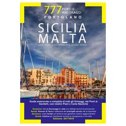
The Portolano 777 is far more than just a set of nautical charts. It's a comprehensive guide that integrates chart information with practical details crucial for yachtsmen and boaters: navigational aids, Notices to Mariners, restricted zones, and, most importantly, expert anchorage advice. Consider it your trusted companion for exploring the Italian coast with confidence.
Unlike navigation apps, the Portolano 777 doesn't rely on an internet connection and provides an immediate overview of the area. Ideal for pre-voyage route planning and a reliable backup in case of technical difficulties. These editions are periodically updated to reflect changes to the coastline and maritime regulations. Think of them as the best sea charts you can get.
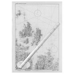
The pilot book uses internationally standardized symbols and abbreviations. It includes information on bathymetry, seabed types, navigational hazards (rocks, wrecks), maritime signals (buoys, lighthouses), and ports. Learn to recognize the symbols to correctly interpret the information on these navigation charts.
A nautical chart is a graphical representation of the coastline and seabed, while the pilot book is a guide that complements the chart with additional information such as port descriptions, anchorage recommendations, local regulations, and Notices to Mariners. The pilot book is an indispensable supplement to the nautical chart.
Modern pilot books often include GPS coordinates for the safest and most sheltered anchorages. Alternatively, you can derive the coordinates directly from the nautical chart using a ruler and compass. Remember to always verify the actual position of the anchorage before dropping anchor.
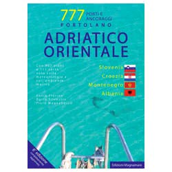
The 777 editions are considered among the most comprehensive and reliable for the Adriatic coast. Always check that the edition is recent to have up-to-date information on ports, anchorages, and navigational aids.
The pilot book uses internationally standardized symbols and abbreviations. It includes information on bathymetry, seabed types, navigational hazards (rocks, wrecks), maritime signals (buoys, lighthouses), and ports. Learn to recognize the symbols to correctly interpret the information.
A nautical chart is a graphical representation of the coastline and seabed, while the pilot book is a guide that complements the chart with additional information such as port descriptions, anchorage recommendations, local regulations, and Notices to Mariners. The pilot book is an indispensable supplement to the nautical chart.
Modern pilot books often include GPS coordinates for the safest and most sheltered anchorages. Alternatively, you can derive the coordinates directly from the nautical chart using a ruler and compass. Remember to always verify the actual position of the anchorage before dropping anchor.
The 777 editions are considered among the most comprehensive and reliable for the Adriatic coast. Always check that the edition is recent to have up-to-date information on ports, anchorages, and navigational aids.
90% of the orders are shipped within 24H. Have a look at the availability and shipment time in the product page
We work on boating since 1982. You will find experienced and polite staff
You can choose between Paypal, Credit Card, Postepay and Transfer
We only use packaging from recycled material within our own store
 Italiano
 English